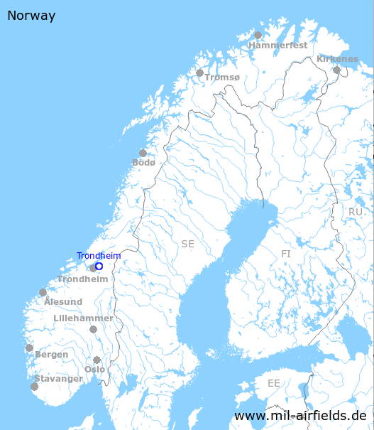
Trondheim Værnes Airport
Trondheim lufthavn, Værnes
Historical approach and aerodrome charts
For historical information only, do not use for navigation or aviation purposes!
| Coordinates | N632727 E0105505 (WGS84) Google Maps |
| Location indicator | ENVA |
In the 1950s
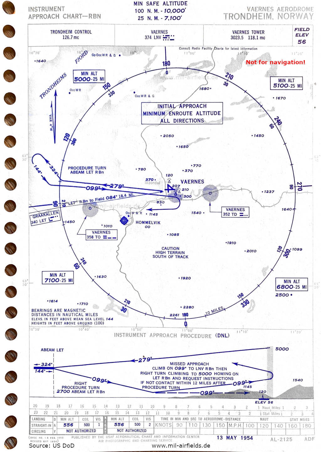
NDB approach runway 10 (May 1954) - In the bay of Hommelvik (Hommelvika) a seaplane base is shown. (Source: US DoD)
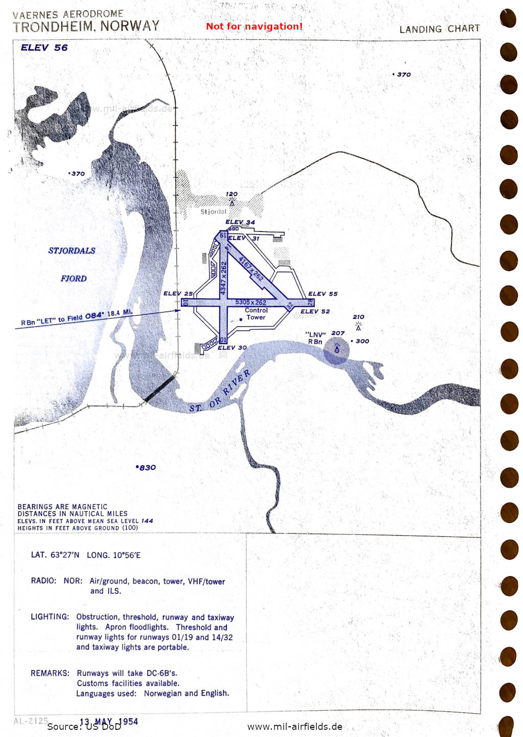
Airport map (May 1954) - There are three runways - 01/19: length 1294 m, width 80 m (4247 feet x 262 feet), 10/28: length 1617 m, width 80 m (5305 feet x 262 feet), 14/32: length 1270 m, width 80 m (4167 feet x 262 feet). (Source: US DoD)
In the 1960s
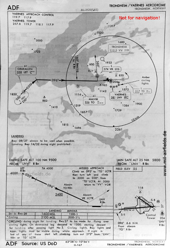
NDB approach runway 09 (May 1966) - There are two runways - 09/27: length 2365 m, width 45 m (7759 feet x 148 feet), 14/32: length 1270 m, width 80 m (4167 feet x 262 feet). Remarkable are the "circling lights" south-east of the airfield, which are used for orientation during circling approaches. (Source: US DoD)
Index to the objects shown on the maps
Aerodromes / Flyplasser:
- Hommelvik, Vaernes
Radio beacons with ident / Radiofyret:
- Grakallen NDB "LET"
- Malvik NDB "TO"
- Vaernes NDB "LNV", Locator "TD", "VK"
- Trondheim VOR "VV"
Air traffic control / Communications / Flygekontrolltjeneste:
- Trondheim Control
- Vaernes Approach Control, Vaernes Tower
Places:
- Hommelvik
- Stjørdal, Stjørdalsfjorden, Stordalselva
- Trondheimsfjorden
Source for all maps, if not marked otherwise: US Department of Defense (US DoD)
 mil-airfields.de at Facebook