Jönköping Old Airfield (Gamla flygfältet)
Historical approach and aerodrome charts
For historical information only, do not use for navigation or aviation purposes!
| Coordinates | N574546 E0141032 (WGS84) Google Maps |
The airport is closed since 1961 (?).
In the 1950s
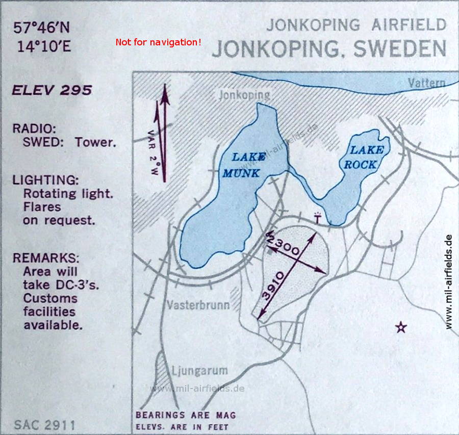
Airfield (October 1950)
The field has two unpaved runways, 1,192 m (3,910 feet) and 701 m (2,300 feet) long. A rotating light stands about 2 km west-southwest of the airfield.
(Source: US DoD)
The field has two unpaved runways, 1,192 m (3,910 feet) and 701 m (2,300 feet) long. A rotating light stands about 2 km west-southwest of the airfield.
(Source: US DoD)
Source for all maps, if not marked otherwise: US Department of Defense (US DoD)
Recommended


Image credits are shown on the respective target page, click on the preview to open it.
 mil-airfields.de at Facebook