Örebro Gustavsviksfältet Airfield
Örebro flygfält, Gustavsviksfältet
Historical approach and aerodrome charts
Örebro Gustavsviksfältet flygfält - Kartor
For historical information only, do not use for navigation or aviation purposes!
| Coordinates | N591519 E0151157 (WGS84) Google Maps |
Today, Gustavsvik airfield is closed, an airplane hangar still exists.
In the 1950s
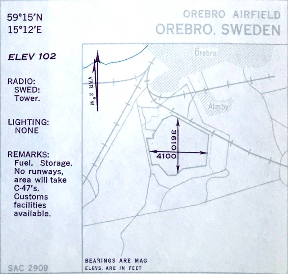
Airfield (October 1950)
The field extends in the indicated directions 1,250 m (4,100 feet) and 1,100 m (3,610 feet). North of the field is the narrow-gauge railway from Örebro to Hjortkvarn / Finspång / Kimstad, which no longer exists today.
(Source: US DoD)
The field extends in the indicated directions 1,250 m (4,100 feet) and 1,100 m (3,610 feet). North of the field is the narrow-gauge railway from Örebro to Hjortkvarn / Finspång / Kimstad, which no longer exists today.
(Source: US DoD)
Source for all maps, if not marked otherwise: US Department of Defense (US DoD)
Recommended

Image credits are shown on the respective target page, click on the preview to open it.
 mil-airfields.de at Facebook