Heston Aerodrome
Heston Air Park, Heston Airport
Historical approach and aerodrome charts
For historical information only, do not use for navigation or aviation purposes!
| Coordinates | N512927 W0002339 (WGS84) Google Maps |
| Region | London, Hounslow, Middlesex, Heston, Cranford |

In the 1930s
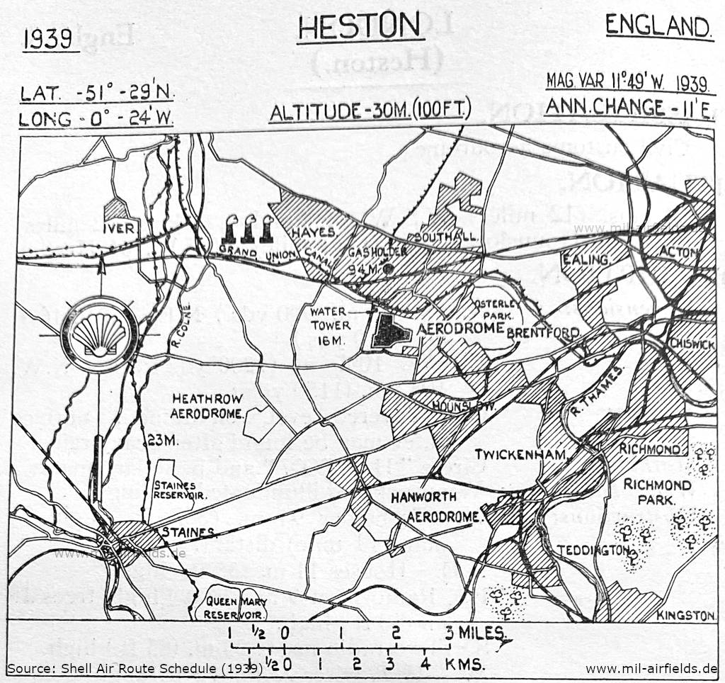
Map with location of Heston Airport (1939) (Source: Shell Air Route Schedule 1939)

Heston Aerodrome (1939) - Top right is the area of The Common, Wentworth Road, North Hyde Lane. The water tower is in the area of today's Navigator Park. The north-south road on the left is today's Southall Lane, and the east-west road at the bottom is Cranford Lane. The area below on the right is The Vale, Berkeley Waye, Somerset Waye, Blossom Waye, Meadow Waye, Heston Avenue. The area with the airfield buildings to the south are now the Parkway Industrial Estate and Aerodrome Way Industrial Estate. Today the former landing ground is bisected by the M4 motorway and forms the Airlinks Golf Course. (Source: Shell Air Route Schedule 1939)
Index to the objects shown on the maps
Aerodromes:
- Hanworth, Heathrow, Heston
Radio beacons with identifier:
- Inner Marker Beacon
Places
- Acton
- Brentford
- Chiswick
- Ealing
- Grand Union Canal
- Hayes
- Iver
- Kingston
- London
- Osterley Park
- Queen Mary Reservoir
- Richmond, Richmond Park, River Colne, River Thames
- Southall, Staines, Staines Reservoir
- Teddington, Twickenham
Source for all maps, if not marked otherwise: US Department of Defense (US DoD)
 mil-airfields.de at Facebook