UK: Historical airfields and airports

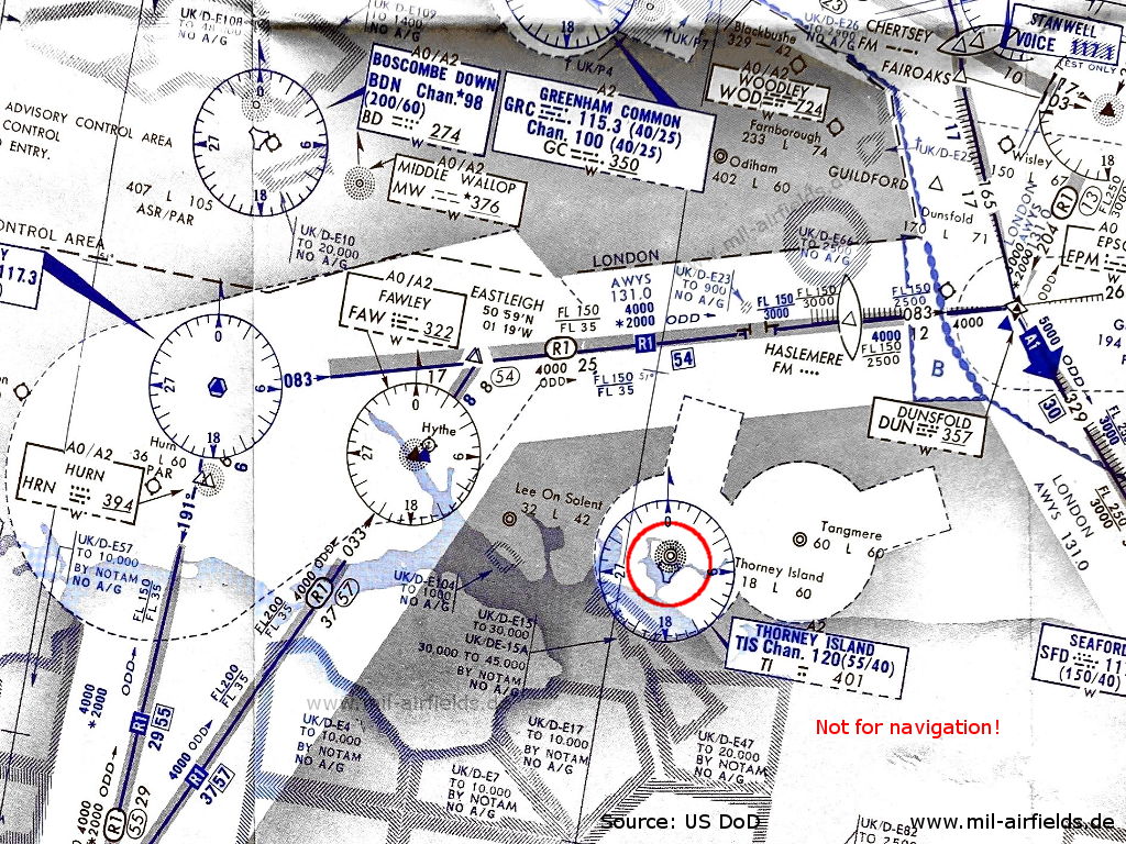
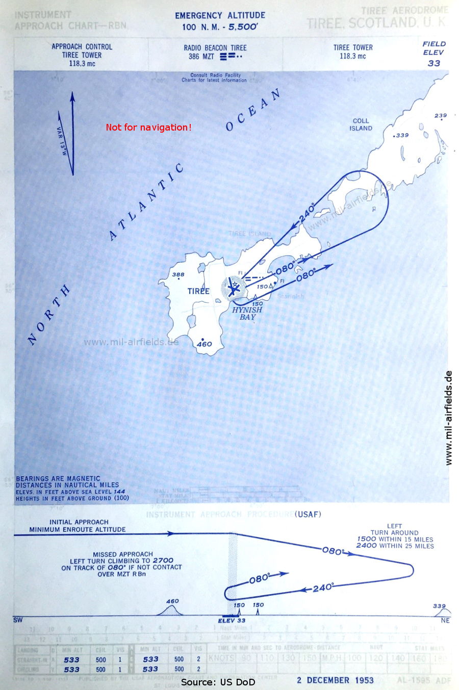
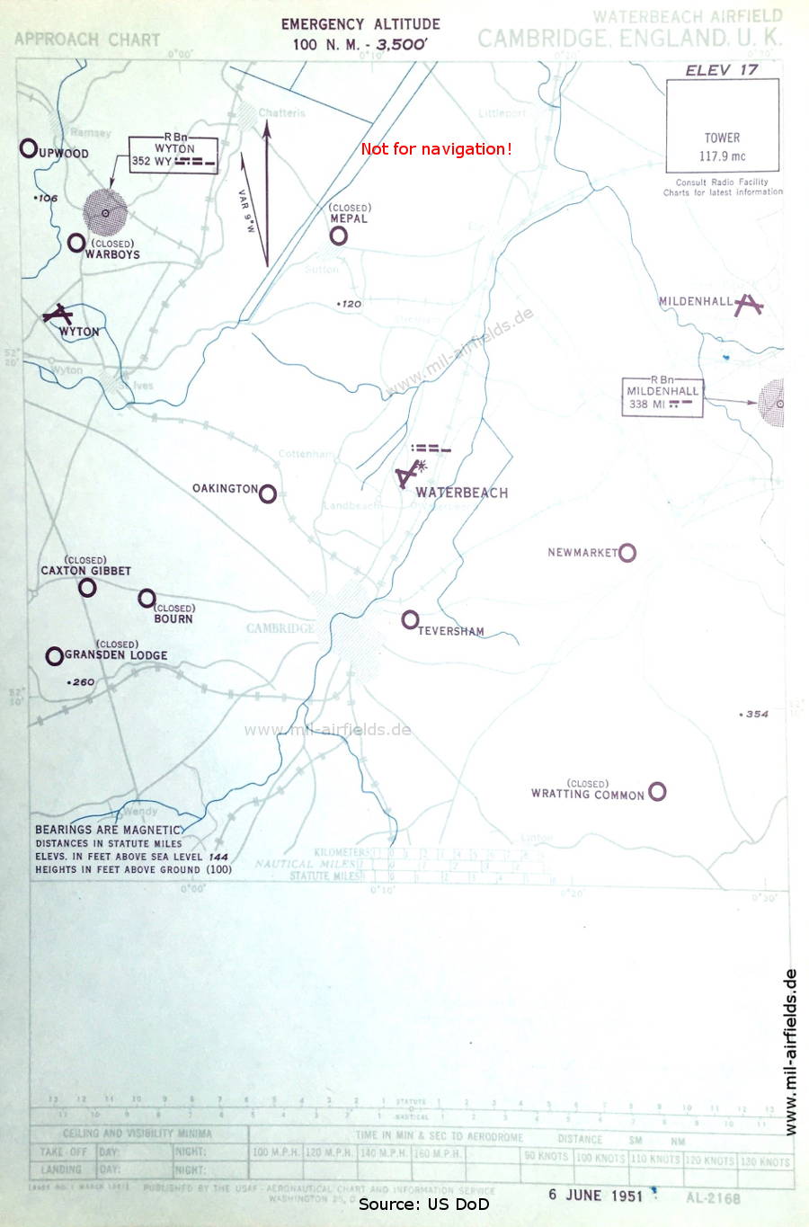
United Kingdom: Historical airfields and airports

Maps and approach charts

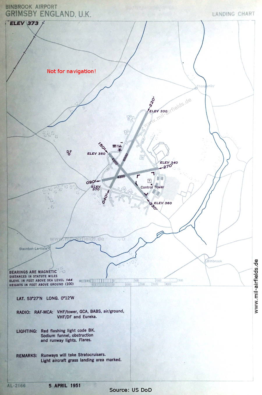
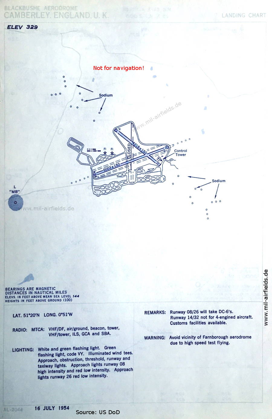
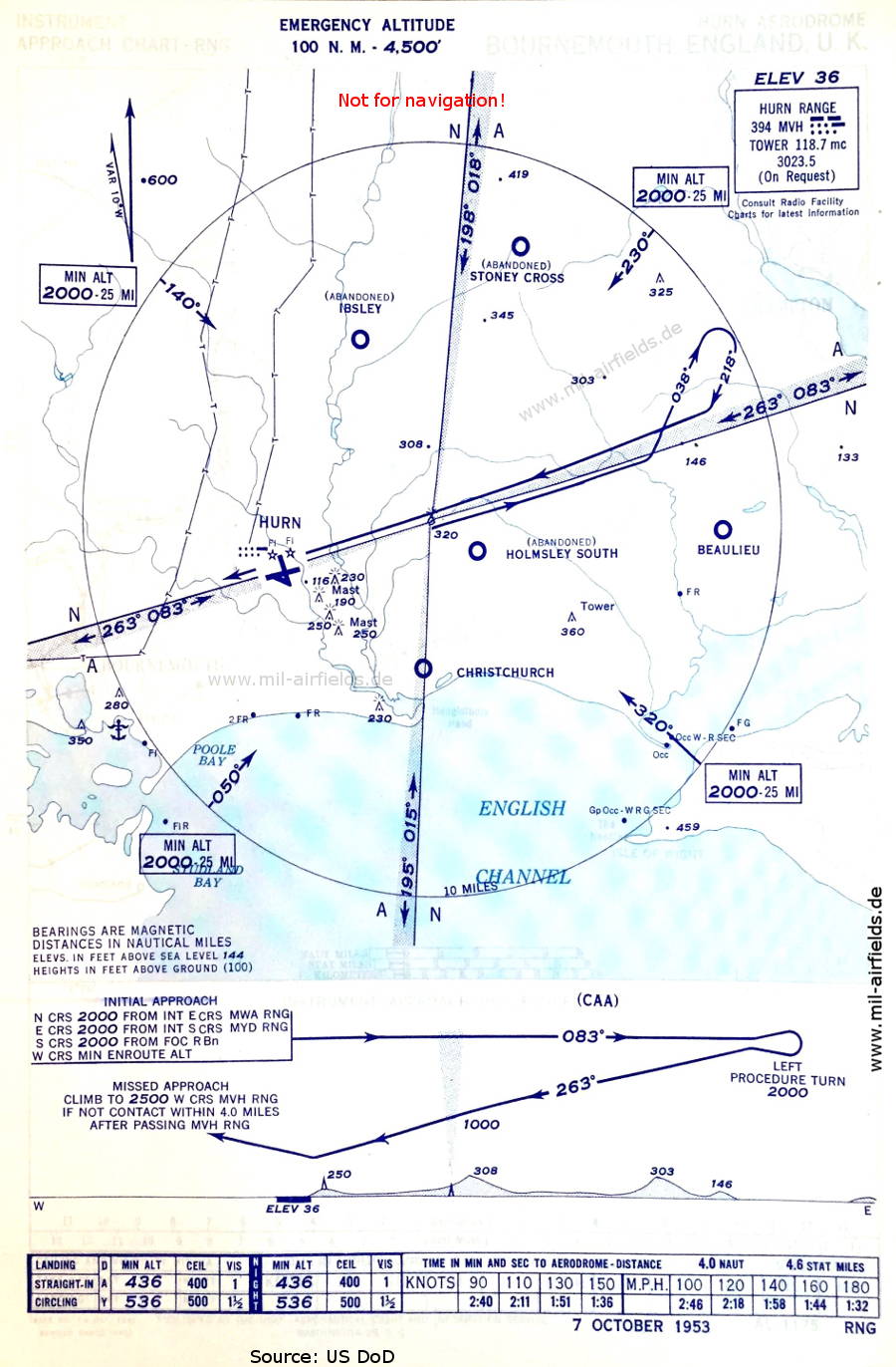
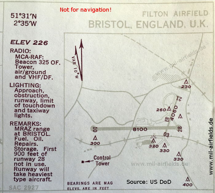
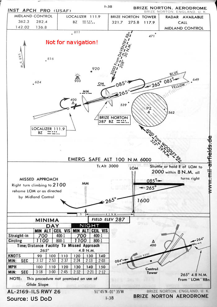
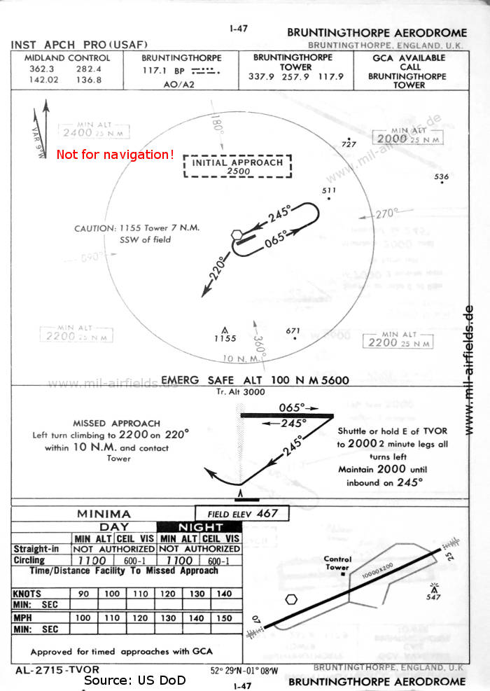
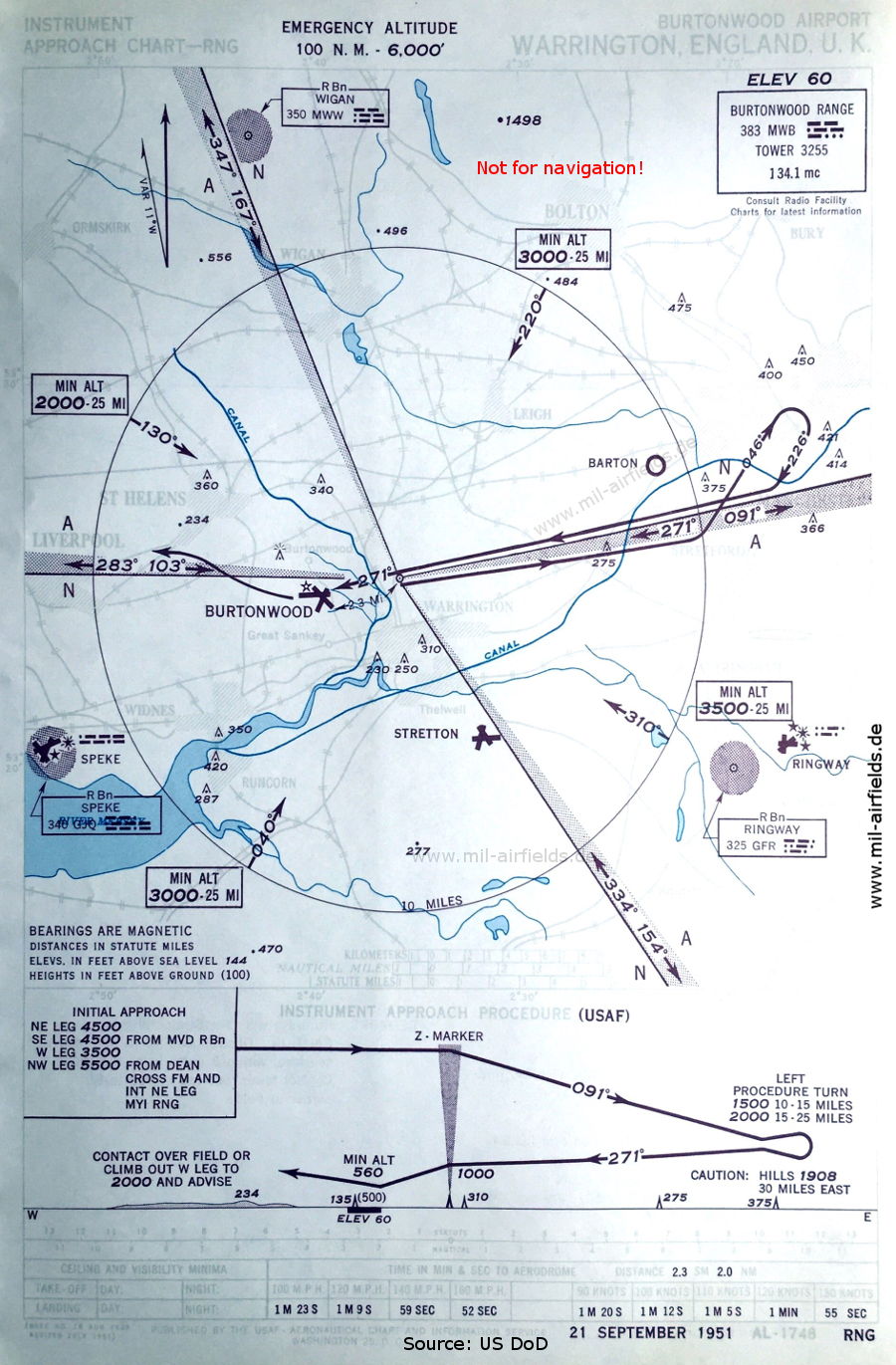
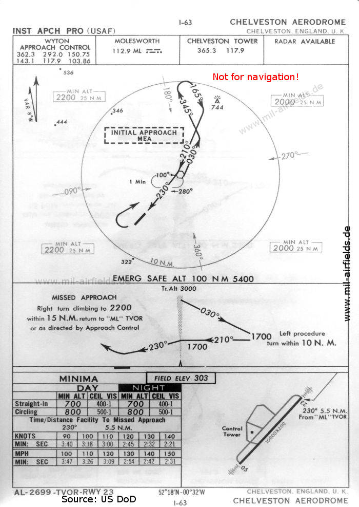
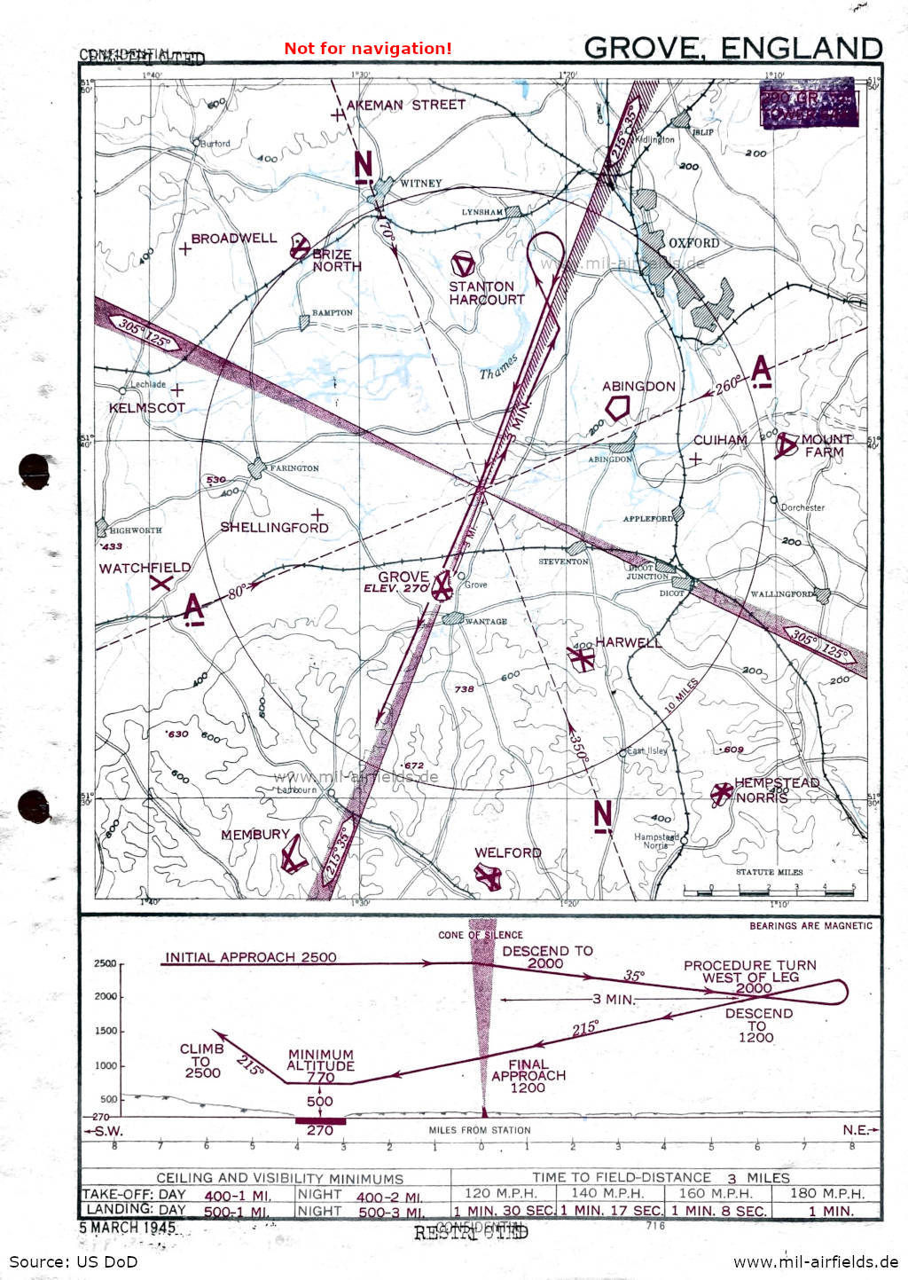
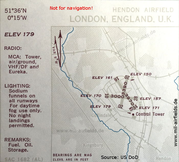
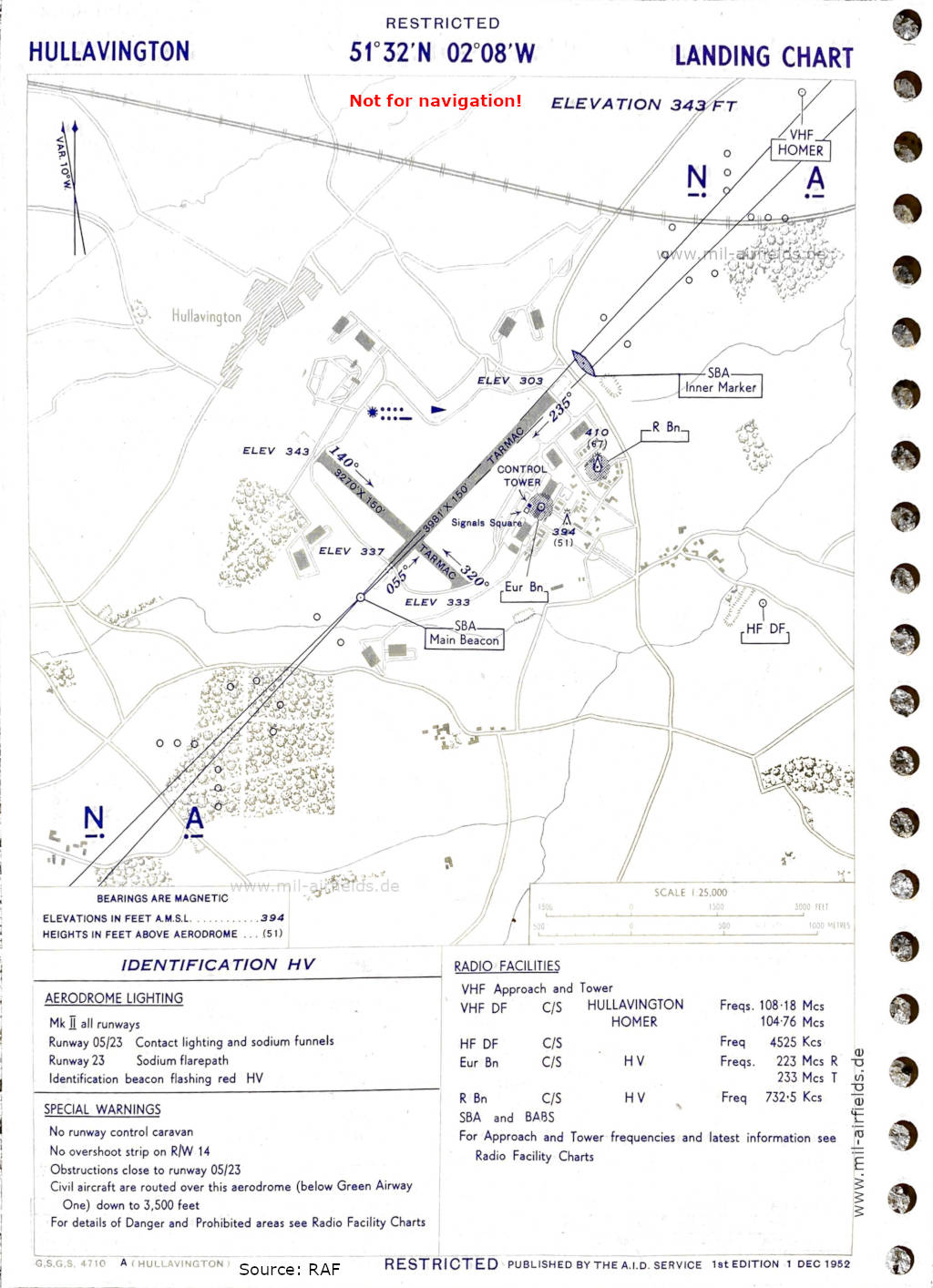
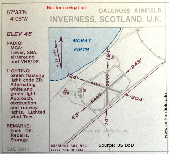
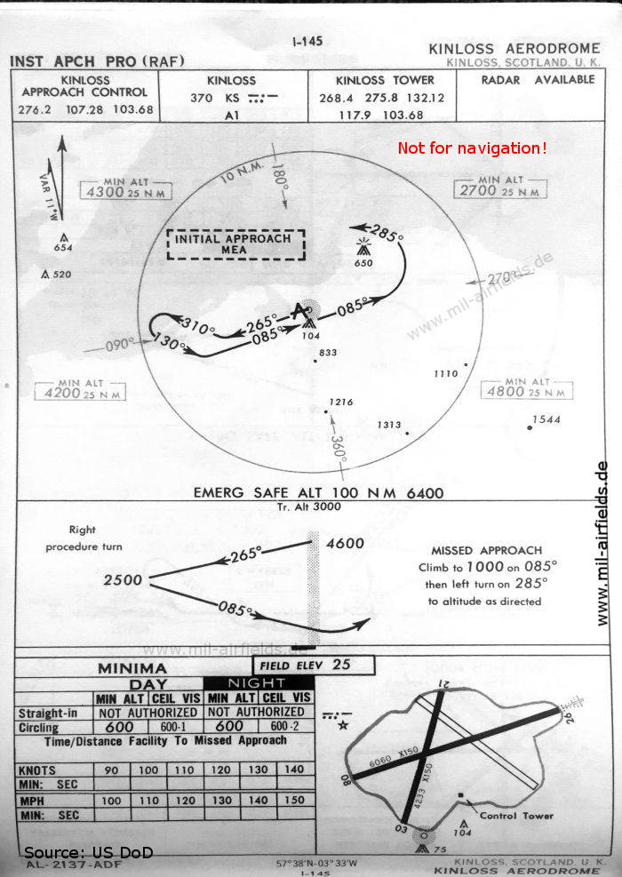
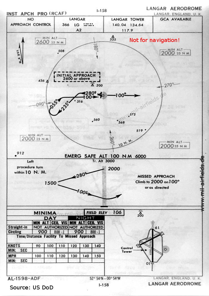
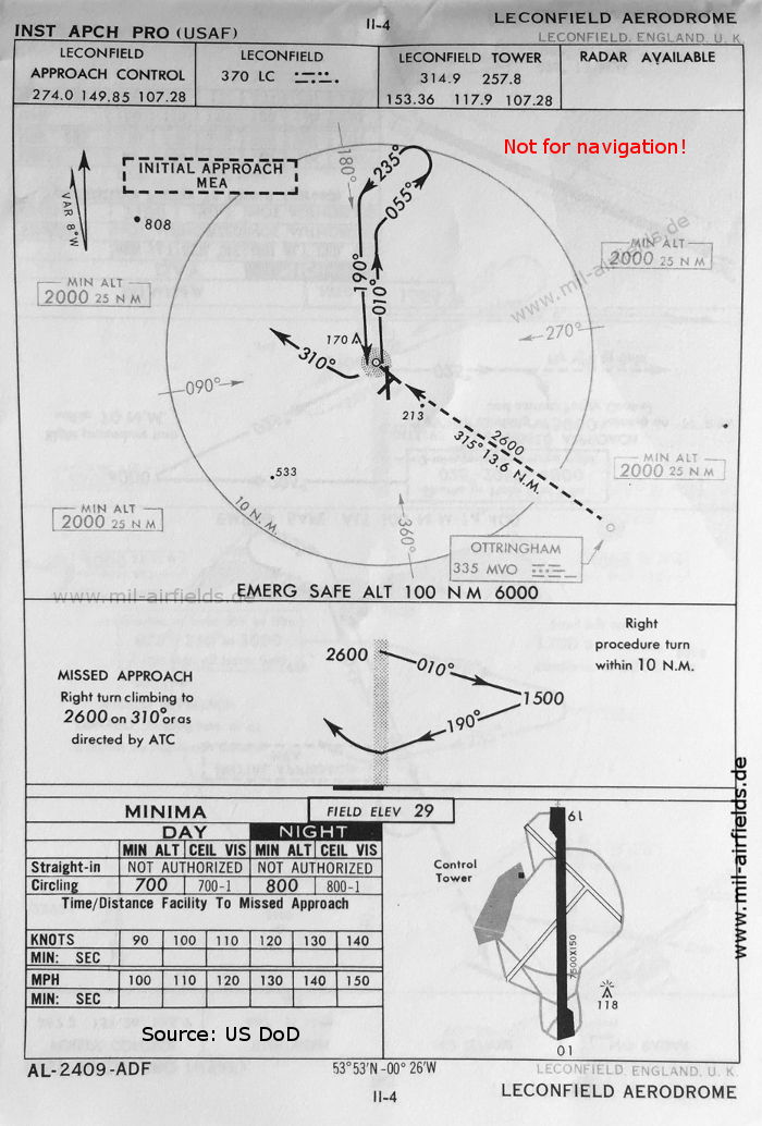
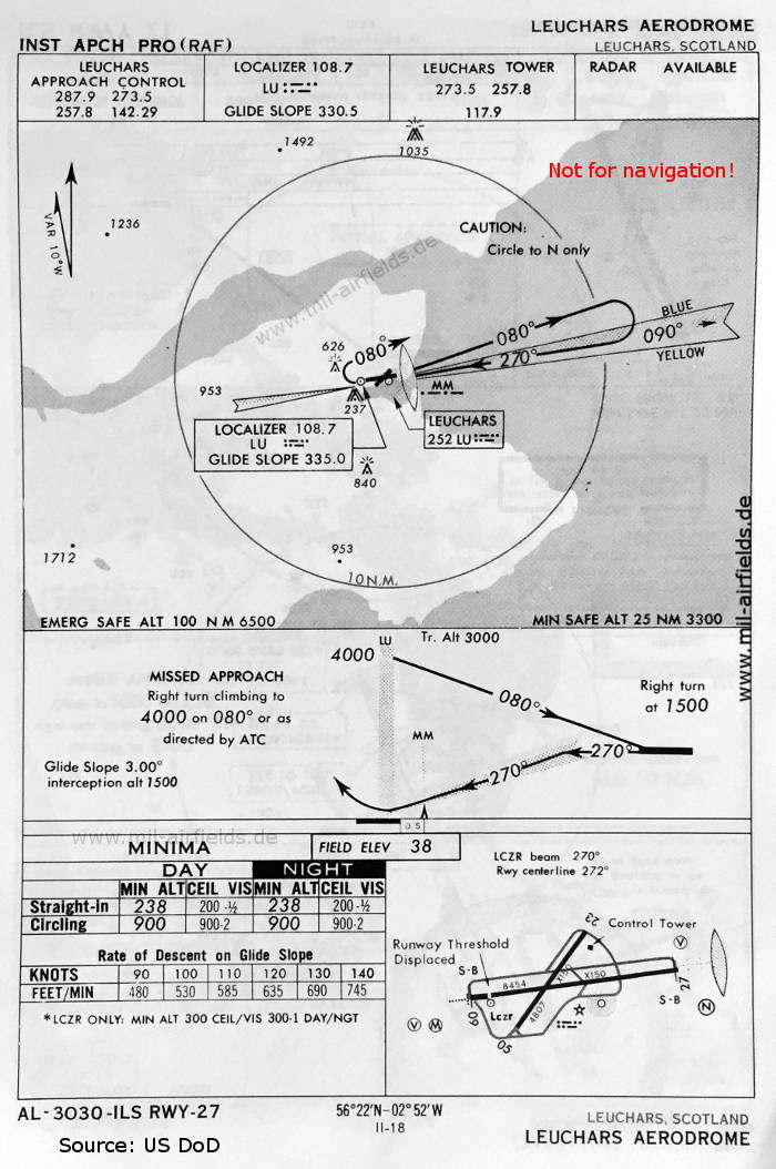
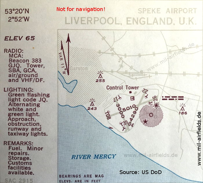
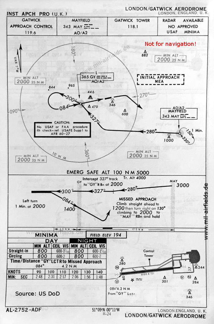
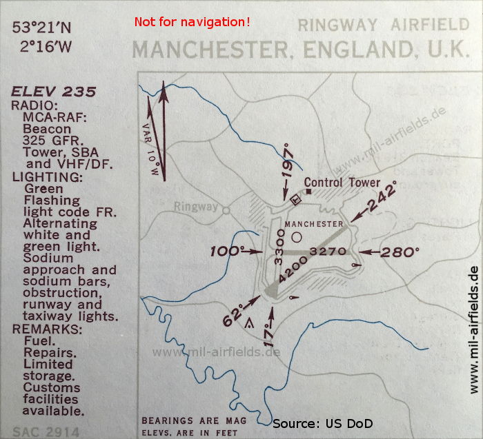
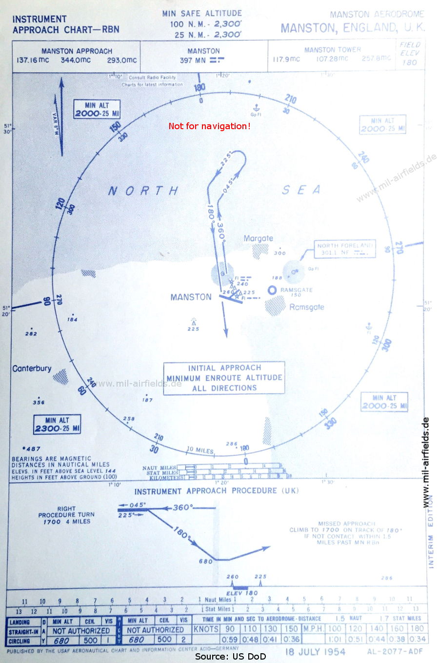
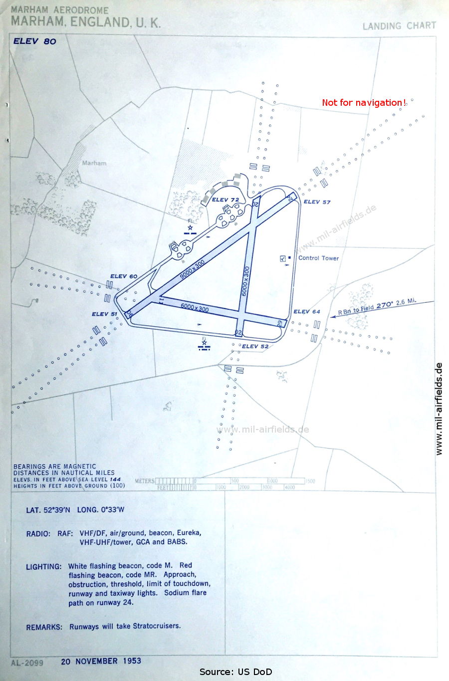
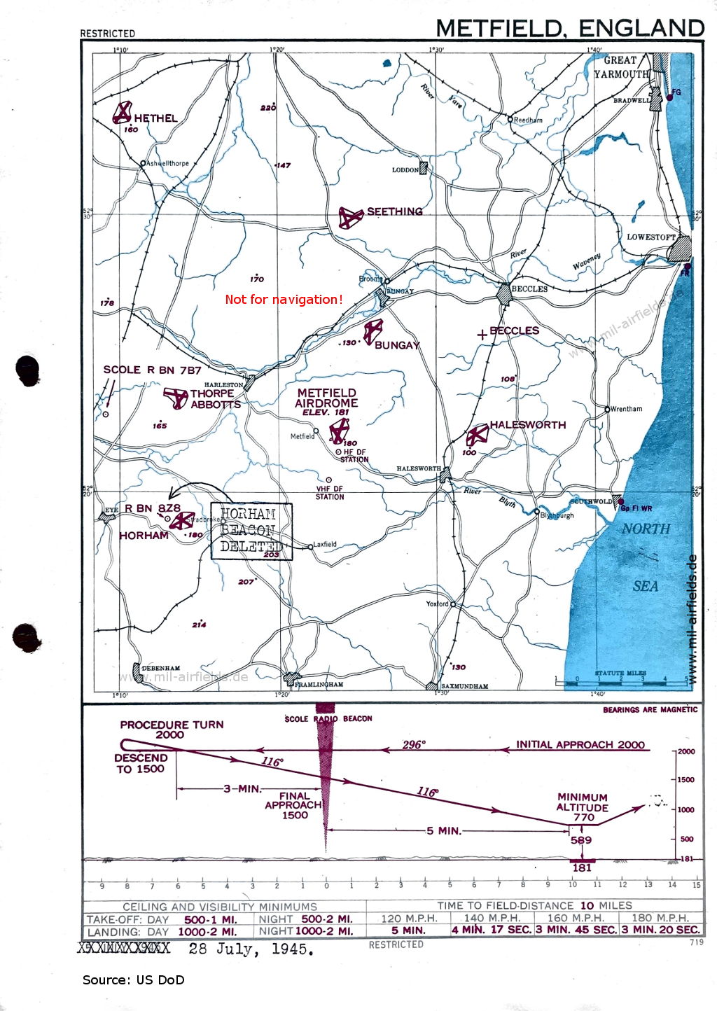
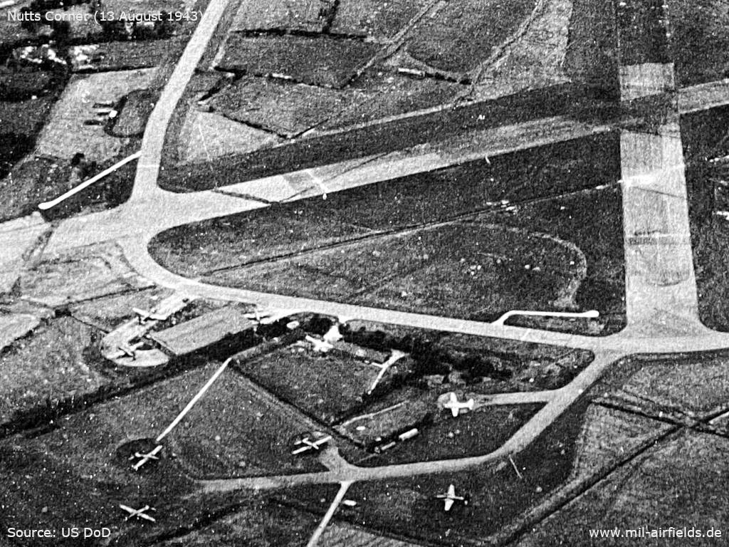
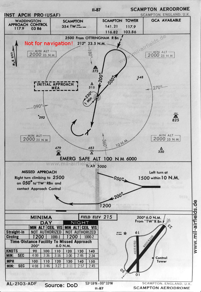
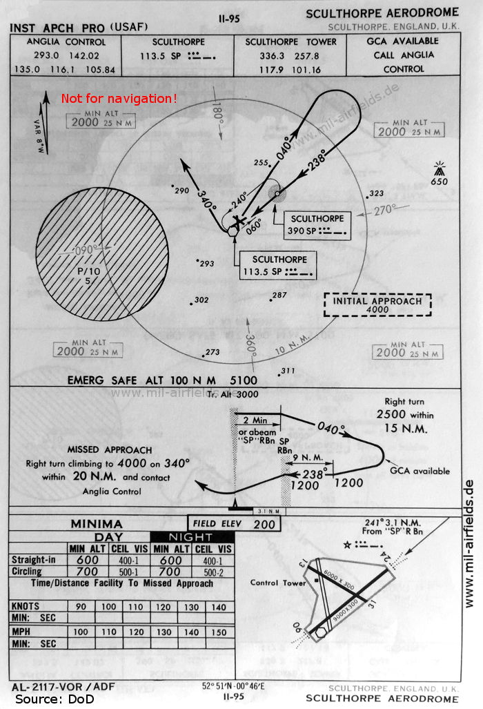
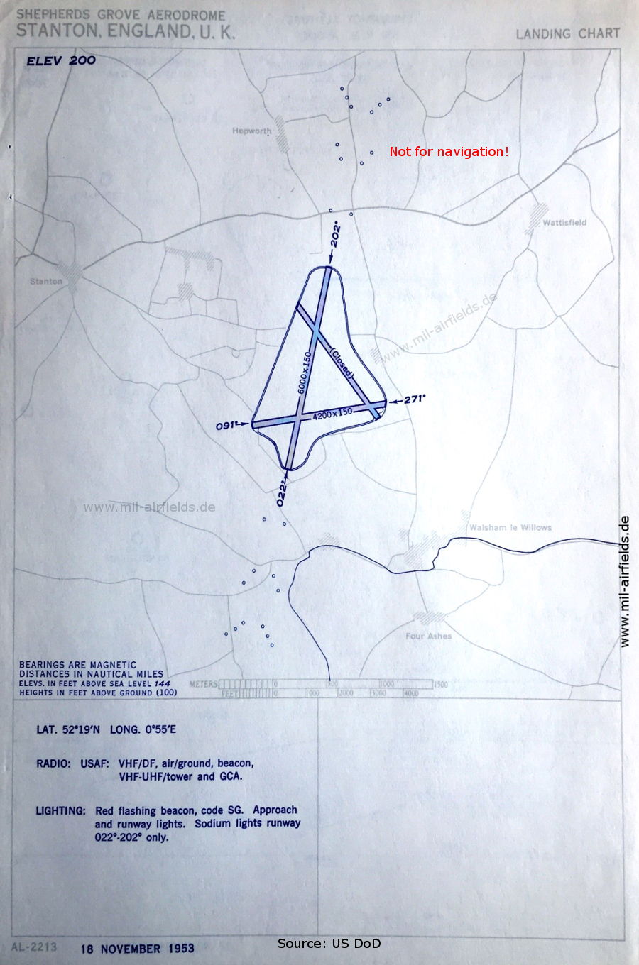
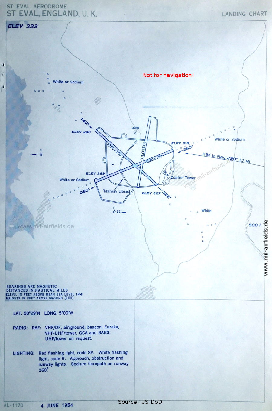
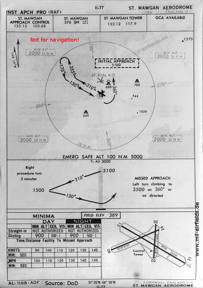
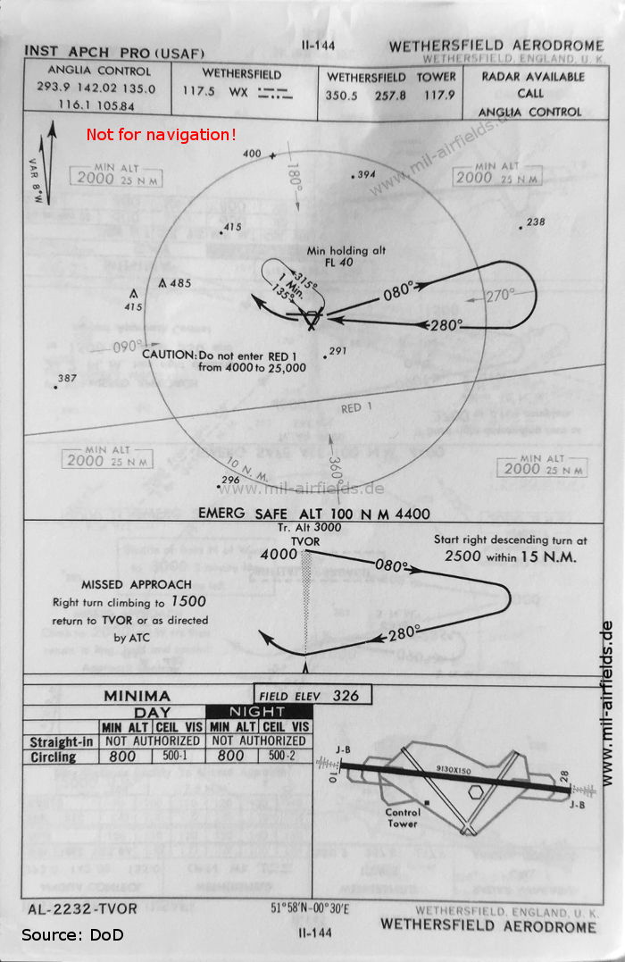
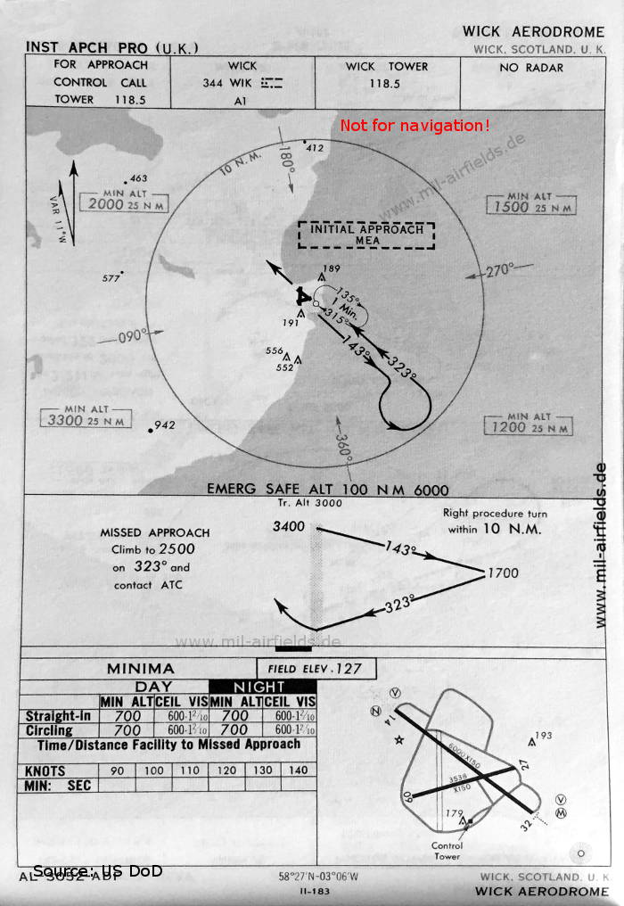
For historical information only, do not use for navigation or aviation purposes!

Map of Aberdeen Dyce Airport, 1950Aberdeen Dyce Airport
Lockheed TR-1 / U-2 at RAF Alconbury, 1983Alconbury RAF Station
Airfield map RAF Bassingbourn, United Kingdom 1951Bassingbourn RAF Station
TACAN approach map runway 26 RAF Bentwaters Air Base, United Kingdom 1960Bentwaters RAF Station
Aerodrome map RAF Binbrook, 1951Binbrook RAF Station
Map of Birmingham Elmdon Airport, 1950Birmingham Elmdon Airport
Landing chart Blackbushe Airport, 1954Blackbushe Airport
Bournemouth Hurn Airport, Range Approach, 1953Bournemouth Hurn Airport
RAF Bovingdon: Hangars and buildings 1945Bovingdon RAF Station
Map of Bristol Filton Airport, 1950Bristol Filton Airport
ILS approach chart runway 26 RAF Brize Norton, United Kingdom 1960Brize Norton RAF Station
VOR approach chart runway 25 RAF Bruntingthorpe, United Kingdom 1960Bruntingthorpe RAF Station
Range approach chart runway 27 RAF Burtonwood, United Kingdom 1951Burtonwood RAF Station
VOR approach chart runway 23 RAF Chelveston Air Base, UK 1960Chelveston RAF Station
NDB approach chart RAF station Dishforth, United Kingdom 1953Dishforth RAF Station
NDB approach chart Edinburgh Airport, United Kingdom 1960Edinburgh Turnhouse Airport
Aerodrome chart RAF Fairford, United Kingdom 1954Fairford RAF Station
Map of Glasgow Renfrew Airport, 1950Glasgow Renfrew Airport
ILS approach chart runway 29 RAF Greenham Common aerodrome, United Kingdom 1960Greenham Common RAF Station
Approach to RAF Grove, EnglandGrove RAF Station
Map of RAF Hendon airfield, 1950Hendon RAF Station
Map of Heston Aerodrome, London 1939Heston Aerodrome
Landing chart RAF Hullavington, United Kingdom 1952Hullavington - RAF Station
Map of Inverness Dalcross Airport, 1950Inverness Dalcross Airport
Map of Isle of Man Ronaldsway Airport, 1950Isle of Man Ronaldsway Airport
NDB approach chart RAF Kinloss, United Kingdom 1960Kinloss RAF Station
F-15E Strike Eagle, 48th Fighter Wing, RAF Lakenheath, 2001Lakenheath RAF Station
NDB approach chart RAF Langar, United Kingdom 1960Langar RAF Station
NDB approach chart runway 19 RAF Leconfield, United Kingdom 1960Leconfield RAF Station
ILS approach chart runway 27 RAF Leuchars, United Kingdom 1966Leuchars RAF Station
Map of Liverpool Speke Airport, 1950Liverpool Speke Airport
Aerial view / satellite view of RAF Llandow airfield, South Wales, 1978Llandow RAF Station
London Croydon Airport aerial viewLondon Croydon Airport
NDB approach chart runway 09 London Gatwick Airport, United Kingdom 1966London Gatwick Airport
London Heathrow Airport satellite image 1977London Heathrow Airport
NDB approach Lyneham aerodrome, United Kingdom 1966Lyneham RAF Station
Map of Manchester Ringway Airport, 1950Manchester Ringway Airport
NDB approach chart RAF Manston, United Kingdom 1954Manston RAF Station
Aerodrome chart RAF Marham, United Kingdom 1953Marham RAF Station
Approach chart RAF Metfield, United Kingdom 1945Metfield RAF Station
NDB approach chart runway 34 RAF Mildenhall, United Kingdom 1954Mildenhall RAF Station
Approach chart chart RAF Northolt, United Kingdom 1952Northolt RAF Station
Nutts Corner RAF Station: Aerial image southern partNutts Corner RAF Station
Prestwick Aerodrome: Aerial image of the northern part, 1943Prestwick Airport
NDB approach chart RAF Scampton runway 23, United Kingdom 1960Scampton RAF Station
VOR approach chart RAF Sculthorpe Air Base, runway 24, US Air Force, United Kingdom 1960Sculthorpe RAF Station
Aerodrome chart RAF Shepherds Grove, United Kingdom 1953Shepherds Grove RAF Station
Aerodrome chart RAF St. Eval, United Kingdom 1954St. Eval RAF Station
NDB approach chart RAF St. Mawgan, United Kingdom 1960St. Mawgan RAF Station
Stornoway Airport
English Electric Lightning XR753 at RAF Tangmere Museum, 2015Tangmere RAF Station
RAF Thorney Island airfield on an enroute chart 1963Thorney Island RAF Station
NDB approach chart runway 24 Tiree Airport, 1953Tiree Airport
RAF Upper Heyford Air Base, NDB Approach, 1954Upper Heyford RAF Station
Approach chart RAF Valley, United Kingdom 1954Valley RAF Station
Approach chart RAF Waterbeach, United Kingdom 1951Waterbeach RAF Station
VOR approach chart Wethersfield US Air Force, United Kingdom 1960Wethersfield RAF Station
NDB approach chart runway 32 Wick Airport, United Kingdom 1966Wick Airport
NDB approach chart RAF Woodbridge, 1954Woodbridge RAF Station

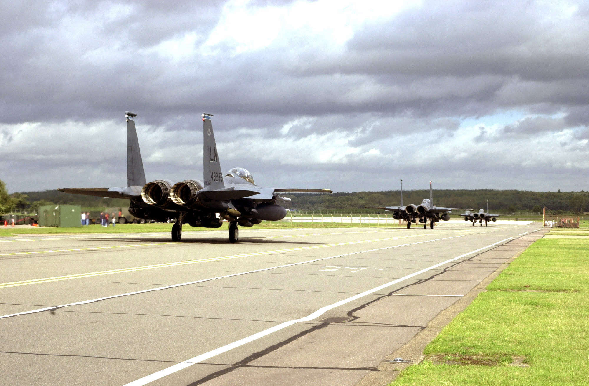
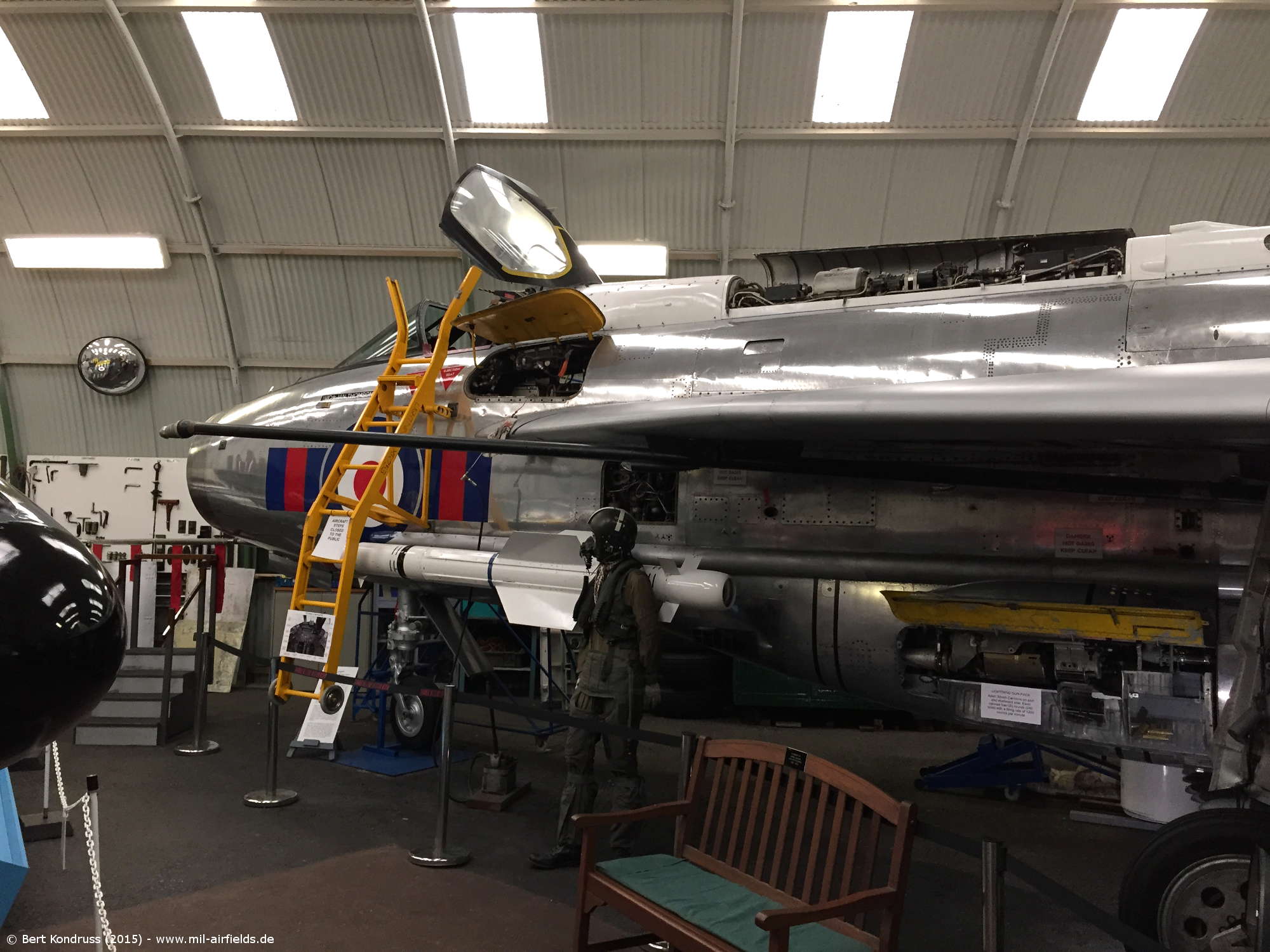
Title image: BOAC British Overseas Airline Cooperation Lockheed L-749A Constellation,G-ALAK. Source: ETH-Bibliothek Zürich, Bildarchiv/Stiftung Luftbild Schweiz / Fotograf: Swissair / LBS_SR03-04031, License: CC BY-SA 4.0


Links

https://atchistory.wordpress.com/2015/11/03/aerodr... - Aerodrome and approach charts - Interesting page about the history of air traffic control in the UK, also contains old charts
http://pdboyinsuffolk.blogspot.com/2013/04/militar... - Military Low Flying Mapping in the UK
http://pdboyinsuffolk.blogspot.com/2012/11/the-gre... - The Green 1
http://www.ais.org.uk/ - UK AIP
http://www.ukairfields.org.uk/ - UK Airfields
https://atchistory.wordpress.com/2017/06/12/uk-air... - UK Airways, AERAD and Low Flying Maps
https://www.aidu.mod.uk/aip/index.html - UK Mil AIP

Recommended

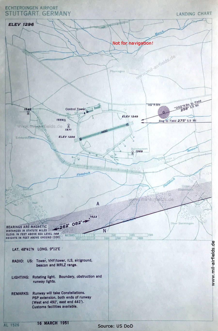
Image credits are shown on the respective target page, click on the preview to open it.

Navigation

Historical approach and airfield plates

Home