RAF Hullavington
RAF Hullavington
Historical approach and aerodrome charts
For historical information only, do not use for navigation or aviation purposes!
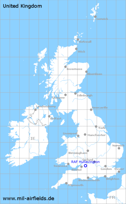
| Coordinates | N513146 W0020814 (WGS84) Google Maps |
| Region | Wiltshire |
| Location indicator | EGDV |
| Operator | Royal Air Force (RAF) |

In the 1950s
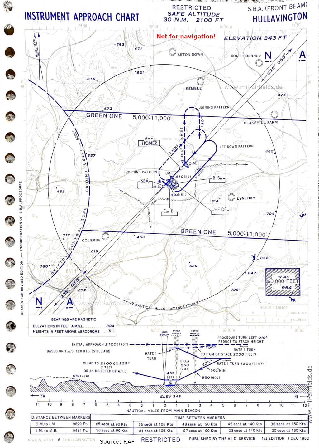
SBA approach (December 1952) - SBA = Standard Beam Approach (Source: RAF)
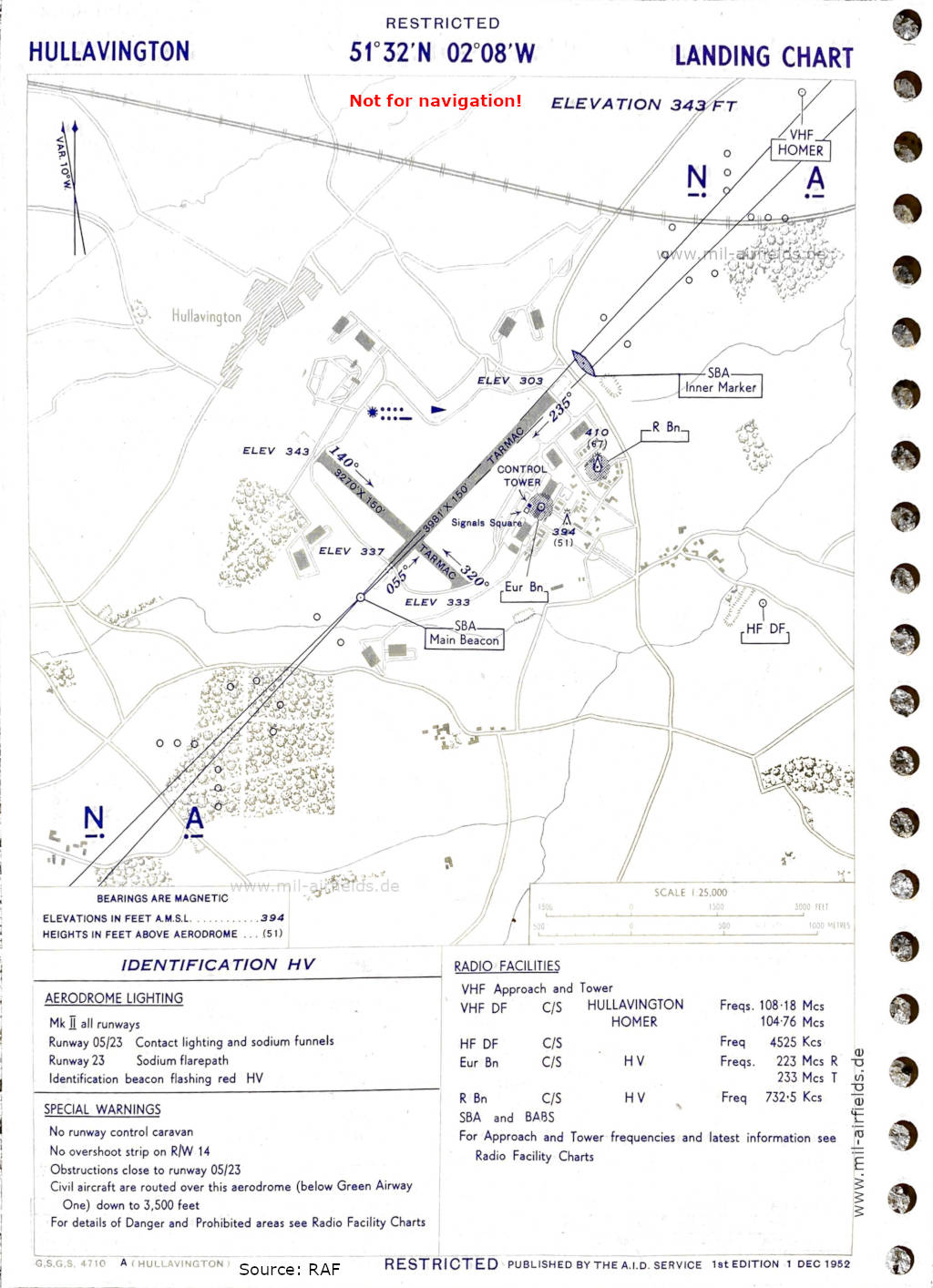
Landing (December 1952) - There are two runways - 055/235: length 1213 m, width 46 m (3981 feet x 150 feet), 140/320: length 997 m, width 46 m (3270 feet x 150 feet). (Source: RAF)
Index to the objects shown on the maps
Aerodromes:
- Aston Down
- Blakehill Farm
- Colerne
- Kemble
- Lyneham
- South Cerney
Airspace:
- Airway Green One
- Bristol Control Zone
Radio beacons with identifier:
- Hullavington NDB "HV", Eureka "HV", BABS, SBA, Outer Marker, Inner Marker
Air traffic control / Communications:
- Hullavington Approach, Tower, Homer
Recommended

Image credits are shown on the respective target page, click on the preview to open it.