For historical information only, do not use for navigation or aviation purposes!
| Coordinates | N521527 E0140100 ca. (WGS84) Google Maps |
| Former East Germany (GDR) | District of Frankfurt/O |
| Federal state | Brandenburg |
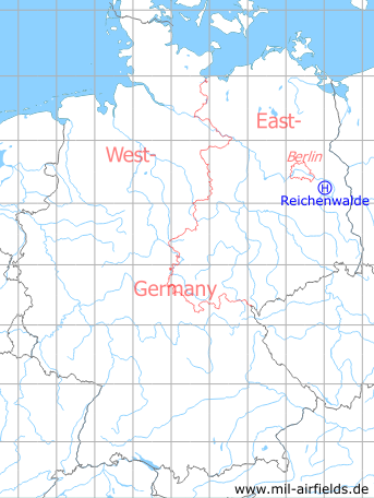
Germany during the Cold War Map
The history of the Cold War airfields: Reichenwalde
Location of airfield
1,6 km southeast of Reichenwalde.
Usage during the Cold War
Helipad 3120 for Anti-Aircraft Missile Unit 4134 (FRA-4134) of former East German Air Force (NVA LSK/LV).
Use today
Closed, area now used as golf course.
Runways, taxiways, aprons
Dimensions: 20 m x 20 m,
main takeoff and landing direction: 300°,
surface: concrete,
usable without crop damage,
capacity: 1 helicopter.
main takeoff and landing direction: 300°,
surface: concrete,
usable without crop damage,
capacity: 1 helicopter.
Communication
Stabsnetz S1 2734-838p
Airspace and procedures
Usable at day and good weather conditions.
Alert time: 60 minutes
Alert time: 60 minutes
Obstacles
Fence: distance 40 m, height 2 m;
Antennas: distance 60 m
Antennas: distance 60 m
Airfields in the vicinity
- 241°/5km Storkow: Helipad 1027 (HSLP 1027)
- 092°/8km Wilmersdorf: Helipad 3023 (HSLP / HLP 3023)
- 333°/8km Markgrafpieske: SA-2 Missile Site (Helipad 3110)
- 023°/9km Fürstenwalde: Helipad 3002 (HSLP / HLP 3002)
- 180°/11km Limsdorf: Helipad 3011 (HSLP 3011)
- 208°/11km Kehrigk: Helipad 3071 (HSLP / HLP 3071)
- 300°/11km Spreenhagen: Helipad 1013 (HSLP / HLP 1013)
- 298°/13km Spreenhagen: Highway Strip (Autobahnabschnitt ABA, Friedrichshof)
- 020°/16km Fürstenwalde: Airfield
- 114°/17km Beeskow: Agricultural Airfield
- 135°/19km Ranzig: Helipad 3003 (Beeskow)
 Follow mil-airfields on Facebook