For historical information only, do not use for navigation or aviation purposes!
| Coordinates | N521010 E0135627 (WGS84) Google Maps |
| Former East Germany (GDR) | District of Frankfurt/O |
| Federal state | Brandenburg |
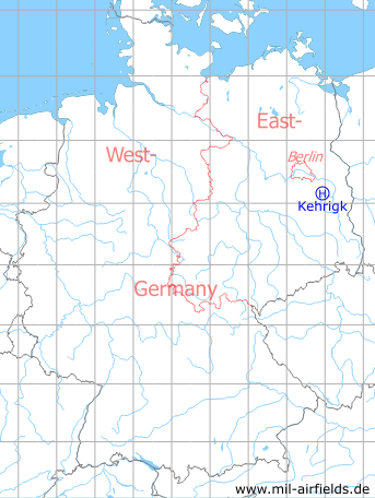
Germany during the Cold War Map
The history of the Cold War airfields: Kehrigk
Location of airfield
1.6 km northeast of Kehrigk.
Usage during the Cold War
Helipad 3071 for Chemical Training Ground of former East German National People's Army (NVA).
Use today
Closed.
Runways, taxiways, aprons
Dimensions: 150 m x 75 m,
main takeoff and landing direction: 110°,
surface: Bitumen/Concrete,
capacity: 2 helicopters.
main takeoff and landing direction: 110°,
surface: Bitumen/Concrete,
capacity: 2 helicopters.
Telephone
Sondernetz/Stabsnetz S1 2732-5993
Airspace and procedures
Usable at day during good weather conditions.
Alert time: 120 minutes.
Alert time: 120 minutes.
Obstacles
Trees: direction 90°, distance 200 m.
Airfields in the vicinity
- 102°/5km Limsdorf: Helipad 3011 (HSLP 3011)
- 005°/7km Storkow: Helipad 1027 (HSLP 1027)
- 028°/11km Reichenwalde: Helipad 3120 (HSLP 3120)
- 053°/16km Wilmersdorf: Helipad 3023 (HSLP / HLP 3023)
- 261°/16km Kleinköris / Löpten: Airfield (Löpten, Klein Köris)
- 345°/16km Spreenhagen: Helipad 1013 (HSLP / HLP 1013)
- 006°/17km Markgrafpieske: SA-2 Missile Site (Helipad 3110)
- 164°/17km Krugau: Helipad 3036 (HSLP / HLP 3036)
- 339°/17km Spreenhagen: Highway Strip (Autobahnabschnitt ABA, Friedrichshof)
- 100°/19km Ranzig: Helipad 3003 (Beeskow)
- 173°/19km Biebersdorf: Helipad 3022 (HSLP / HLP 3022)
- 026°/20km Fürstenwalde: Helipad 3002 (HSLP / HLP 3002)
- 222°/20km Brand: Air Base (Brand-Briesen, Аэродром Бранд)
- 082°/21km Beeskow: Agricultural Airfield
 Follow mil-airfields on Facebook