For historical information only, do not use for navigation or aviation purposes!
| Coordinates | N522958 E0143433 ca. (WGS84) Google Maps (approximate location) |
| Former East Germany (GDR) | District of Frankfurt/O |
| Federal state | Brandenburg |
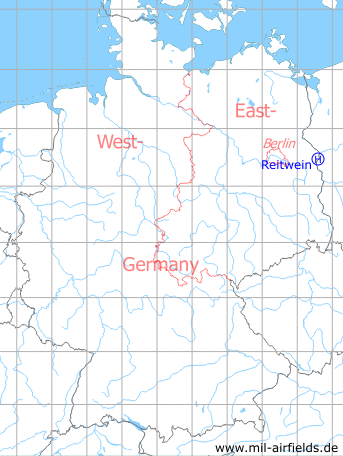
Germany during the Cold War Map
The history of the Cold War airfields: Reitwein
Location of airfield
Probably at the southwestern edge of Reitwein
Usage during the Cold War
Helipad 1019 for sub-depot 3 of Signals Depot 2 (TL-3/NGL-2) of former East German Ministry of National Defense (MfNV).
Use today
Closed.
Runways, taxiways, aprons
Dimensions: 100 m x 50 m,
main takeoff and landing direction: 005°,
surface: Meadow,
capacity: 2 helicopters.
main takeoff and landing direction: 005°,
surface: Meadow,
capacity: 2 helicopters.
Telephone
Landeplatz: Fe-Feldverbindung 500 m auf Vermittlung MSN 70 auf dieser HADP und Stabsnetz.
TL-3/NGL-2: Stabsnetz S1 Nummer 25880p, Tarnname Großlautsprecher 13
Airspace and procedures
Usable at day and night during good weather conditions.
Alert time: 60 minutes.
Alert time: 60 minutes.
Obstacles
None.
Units
Reitwein was home of the sub-depot 3 of Signals Depot 2 (NGL-2) Rechlin. NGL-2 was directly subordinated to the Ministry of Defense.
Sub-depot 3:
- Postal address: PO Box 26202, Reitwein.
- Installation: road Reitwein-Sonneck
- National People's Army installation ID: 05/115
- Area 2 ha, housing capacity 17
Sub-depot 3:
- Postal address: PO Box 26202, Reitwein.
- Installation: road Reitwein-Sonneck
- National People's Army installation ID: 05/115
- Area 2 ha, housing capacity 17
Airfields in the vicinity
- 204°/18km Frankfurt/O: Helipad 1015 (HSLP / HLP 1015)
- 260°/24km Heinersdorf: Helipad 3024 (HSLP / HLP 3024)
- 166°/26km Kunice: Airfield (Lotnisko Kunice)
- 299°/26km Neuhardenberg: Air Base (Marxwalde, Wriezen)
- 351°/28km Mieszkowice: Highway Strip (Drogowy odcinek lotniskowy (DOL))
- 299°/30km Altfriedland: Highway Strip planned
 Follow mil-airfields on Facebook