For historical information only, do not use for navigation or aviation purposes!
| Coordinates | N533159 E0133333 (WGS84) Google Maps |
| Former East Germany (GDR) | District of Neubrandenburg |
| Federal state | Mecklenburg-Vorpommern (Mecklenburg-Western Pomerania) |
Germany during the Cold War Map
The history of the Cold War airfields: Ulrichshof
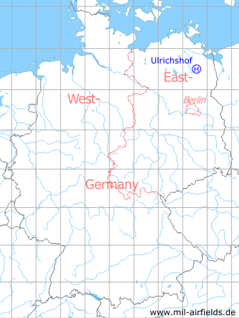
Location of airfield
Northeastern part of Ulrichshof.
Usage during the Cold War
Helipad 3014 for Radio Transmission Station 4 (FuSA-4) of former East German Air Force (NVA LSK/LV).
Use today
Closed.
Runways, taxiways, aprons
Dimensions: 150 m x 60 m,
main takeoff and landing direction: 180°,
surface: grass,
capacity: 1 helicopter.
main takeoff and landing direction: 180°,
surface: grass,
capacity: 1 helicopter.
Telephone
Stabsnetz S1 4323-341
Airspace and procedures
Usable at day during good weather conditions.
Alert time: 60 minutes.
Alert time: 60 minutes.
Obstacles
Cottonwood belt: direction 90°, distance 25 m.
Airfields in the vicinity
- 277°/6km Katzenhagen: Helipad 3302 (HSLP / HLP 3302)
- 253°/9km Cölpin: Helipad 3301 (HSLP / HLP 3301)
- 274°/11km Pragsdorf: Helipad 3350 (HSLP / HLP 3350)
- 262°/16km Burg Stargard: Agricultural Airfield, Helipad 3336 (HSLP / HLP 3336, Lindenhof)
- 199°/17km Wendorf: Helipad 3027 (HSLP / HLP 3027)
- 295°/18km Neubrandenburg: Air Base (Trollenhagen)
 Follow mil-airfields on Facebook