Kaufbeuren: Air Base
For historical information only, do not use for navigation or aviation purposes!
| Coordinates | N475146 E0103654 (WGS84) Google Maps |
| Elevation | 2391 ft |
| Federal state | Bayern (Bavaria) |
| Location indicator | EDSK (1990) |
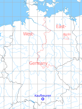
Germany during the Cold War Map
The history of the Cold War airfields: Kaufbeuren
Location of airfield
2 km south-southwest of Kaufbeuren.
During World War II
Use
Luftwaffe airbase.
Situation
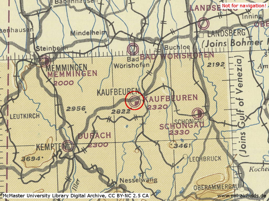
Kaufbeuren Air Base in World War II on a US map from 1945
Source: McMaster University Library Digital Archive, License: Creative Commons Attribution-NonCommercial 2.5 CC BY-NC 2.5 CA
During the Cold War
Use
Luftwaffe airfield.
In the 1950s
Overview
Kaufbeuren airfield in 1957
In the 1960s
Situation
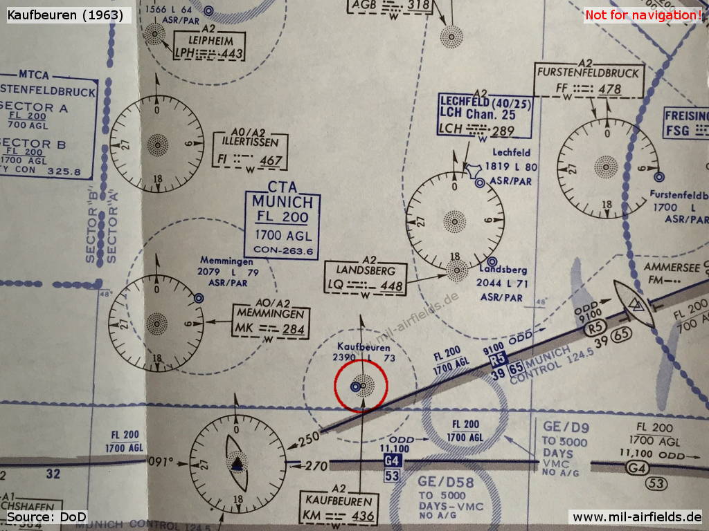
Map with Kaufbeuren airfield from 1963
In the 1970s
Overview
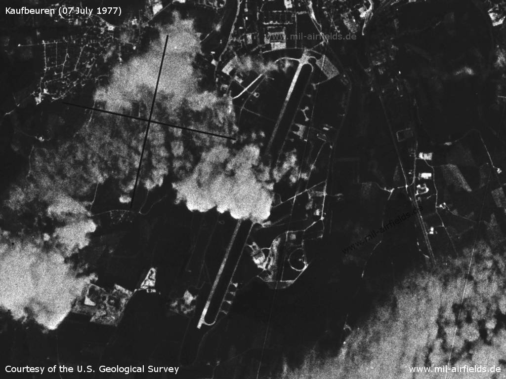
Kaufbeuren Air Base on a US satellite image from 07 July 1977 - The field is partly covered by clouds.
Source: U.S. Geological Survey
Radio beacons
Data for the year 1971:
- NDB: 436 "KUF", at field
Radar
ASR/PAR (1971)
In the 1980s and early 1990s
Situation
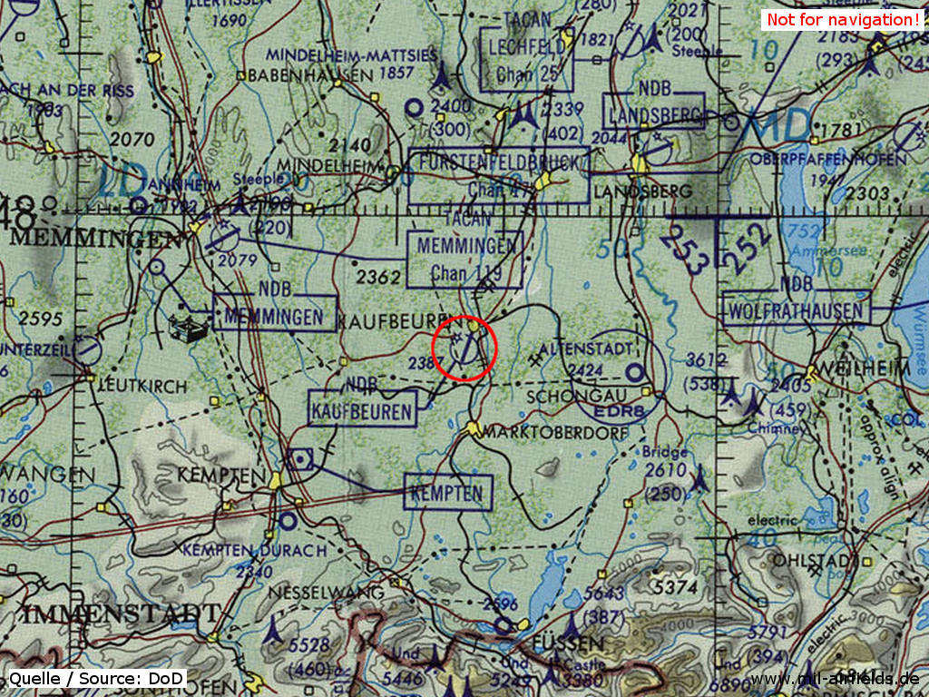
Kaufbeuren Air Base on a map of the US Department of Defense from 1981
Source: ONC F-2 (1981), Perry-Castañeda Library Map Collection, University of Texas at Austin
Overview
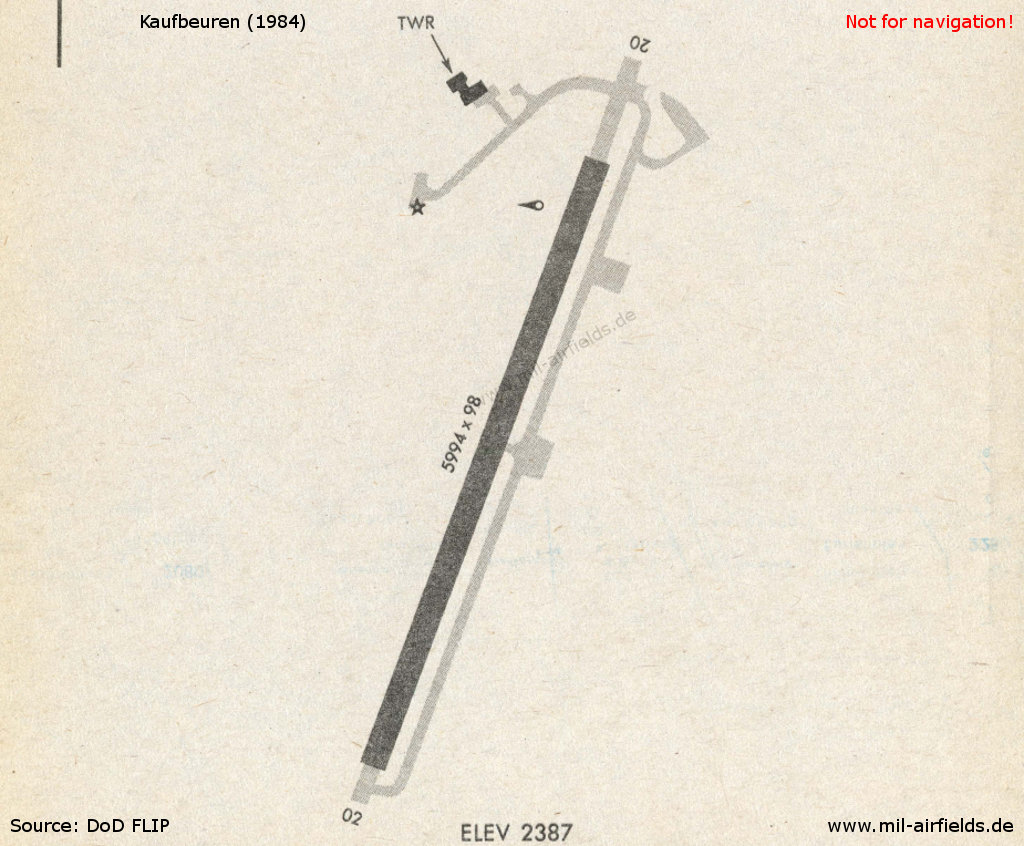
Map 1984
Source: US DoD
Runways
Data for the year 1990:
- 02/20: 1833 m x 30 m Concrete
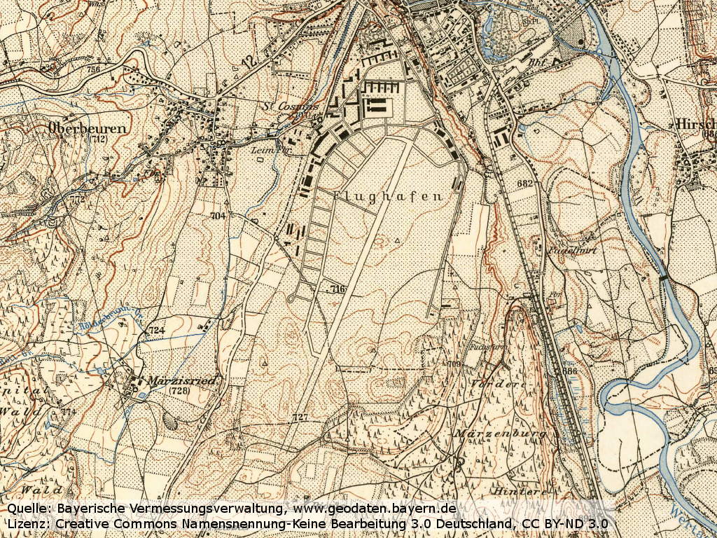
Today
Use
Reserve airfield; German Air Force technical school.
Overview
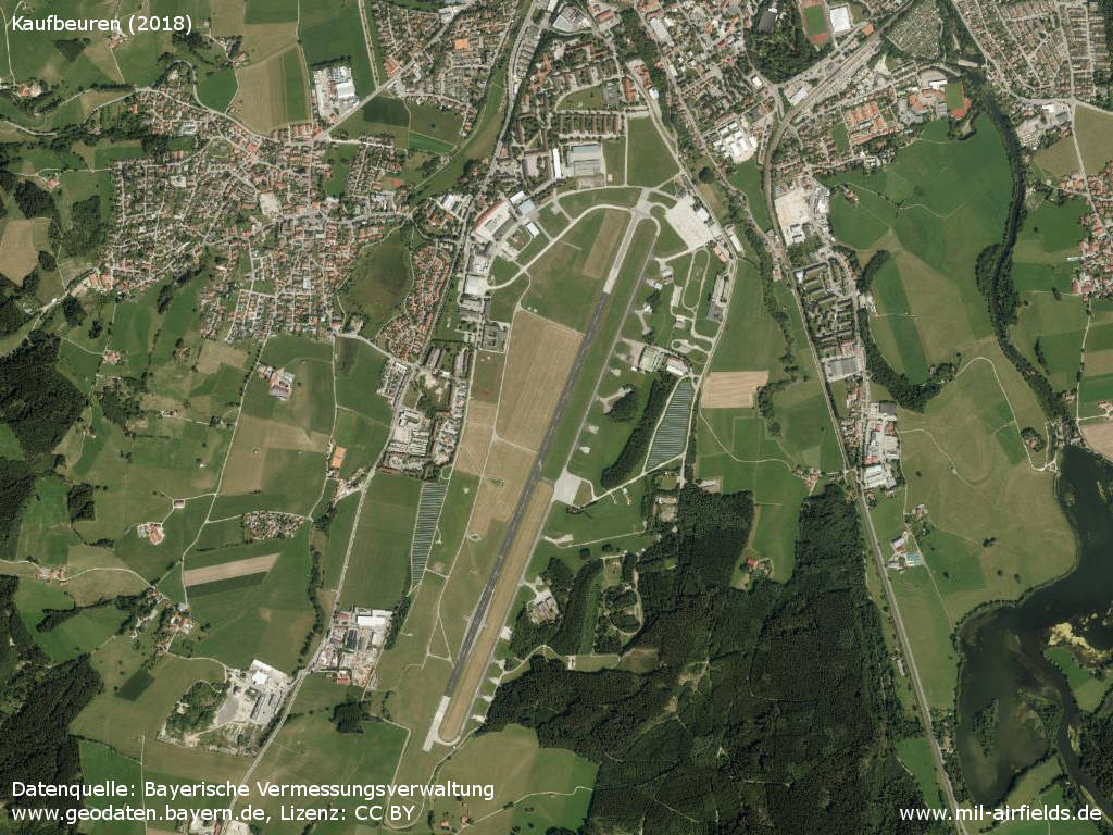
Aerial image (2018)
Source: Datenquelle: Bayerische Vermessungsverwaltung www.geodaten.bayern.de, License: Creative Commons Namensnennung 3.0 Deutschland (CC BY 3.0 DE)
Sources
- https://geoportal.bayern.de/ - Geoportal Bayern
Airfields in the vicinity
- 099°/19km Altenstadt: Airfield
- 297°/31km Memmingen: Air Base (Memmingerberg, Memmingen Airport, Allgäu Airport)
- 043°/32km Landsberg/Lech: Air Base (Penzing)
Categories
Military Airfields GermanyMilitary Airfields in former West GermanyGerman Air Force Air BasesRecommended
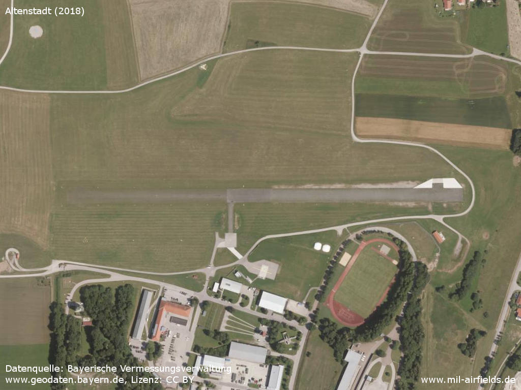
Image credits are shown on the respective target page, click on the preview to open it.
 Follow mil-airfields on Facebook