For historical information only, do not use for navigation or aviation purposes!
| Coordinates | N522241 E0133111 (WGS84) Google Maps |
| Elevation | 154 ft |
| Former East Germany (GDR) | District of Potsdam |
| Federal state | Brandenburg |
| Location indicator | EDXS (196x), ETBS (197x-199x), EDDB (199x-) |
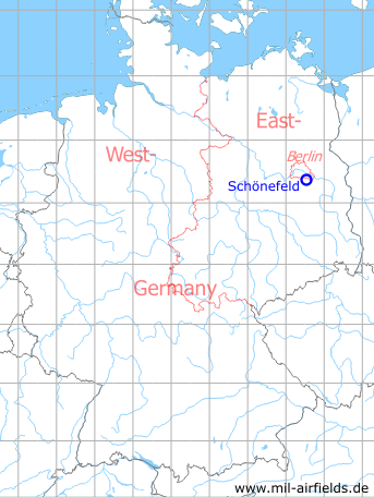
Germany during the Cold War Map
The history of the Cold War airfields: Schönefeld
Contents
Page 1: Schönefeld Airport ← you are here
Page 2: Berlin Brandenburg Airport (BER)
Page 5: Berlin Schönefeld Airport
General
In the mid-1930s, the Henschel-Flugzeugwerke (HFW) aircraft factory was looking for a suitable location for a new plant, as the facilities used at Johannisthal Airfield were no longer adequate. Subsequently, a new airfield was built south of Berlin between Schönefeld and Diepensee. Until 1945, aircraft of other manufacturers were manufactured here under licence and Henschel's own models were developed and produced.
At the end of the Second World War, Schoenefeld was occupied by Soviet troops, which stationed here transport aircraft. In the following years, the first air traffic to socialist countries developed. From the mid-1950s onwards, the airfield was used by the newly founded East German Lufthansa. The handling facilities for this were located at Diepensee in the southern part, while the northern part continued to be occupied by Soviet transport aircraft, which also decided about flight operations.
In order to gain full control of the field, the GDR had to create a replacement for the Soviet units. This was the newly built Sperenberg Airfield, which went into operation in the early 1960s. It allowed the East German Lufthansa and later the Interflug to use the entire facility as the "Berlin-Schönefeld Central Airport". During this time, a new runway 07/25 (later 07R/25L) with a length of 3000 m was built south of the existing runway 05/23. Passenger handling moved from south to north into the buildings of the former Henschel training workshop. Finally, a parallel staggered runway 07L/25R with a length of 2700 m was built, the so-called northern runway. Schoenefeld became the most important airport of the GDR and home base of the airline Interflug.
In the 1970s, the "New Passenger Terminal" (Neue Passagierabfertigung, NPA) was built, which went into operation in 1976 and served all international flights. It is the basis for today's Terminal A. The previous check-in in the Henschel training workshop was continued to be used for domestic flights until 1980. In the mid-1980s, the NPA was supplemented by the "Extended Passenger Terminal" (Erweiterte Passagierabfertigung, EPA).
Because of its location close to Berlin, Schoenefeld was often the starting and ending point for flights by the GDR's party and state leadership. The aircraft used for this purpose belonged to the Transport Aircraft Wing 44 (Transportfliegergeschwader 44, TG-44, designation in the 1980s), which was stationed at Marxwalde Airfield (now called Neuhardenberg again). These were usually military registered passenger aircraft of the types Il-18, Tu-124, Tu-134 or Tu-154. To disguise the identity, they used colours of the airline Interflug. At the beginning of the 1980s, the TG-44 received three long-range aircraft Il-62, which were stationed in Schoenefeld. A separate parking area was created for them in the southern part of the field, accessible via taxiway N.
The helicopter squadron of the East German People's Police and the aircrafts of the Ministry of State Security were also stationed at the airport. The latter operated two Tu-134 aircraft in the colors of Interflug in the 1980s, which were used, for example, to repatriate captured refugees from Hungary.
After the reunification, Interflug's flight operations were discontinued and numerous foreign airlines relocated to Tegel Airport. At first, it became quiet around Schoenefeld, until the airport was discovered by low-cost airlines. In 2006, construction work began on the south side of Schoenefeld Airport to build Berlin-Brandenburg BER Airport. It will use the existing southern runway as the north runway. The previous north runway 07L/25R was closed in 2007.
After several years of delays, passenger handling at the new Berlin Brandenburg BER airport began on 31 October 2020, which finally opened officially on 04 November 2020. Schönefeld thus became part of the new airport and the previous main terminal became BER's Terminal 5.
Nazi era and World War II
Use
Airfield of Henschel aircraft factory.
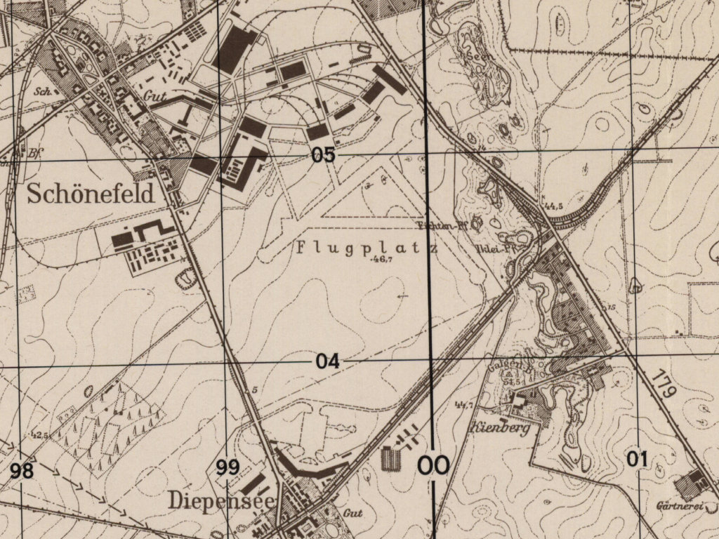
Situation
Schönefeld Airfield in World War II on a US map from 1943
Source: McMaster University Library Digital Archive, License: Creative Commons Attribution-NonCommercial 2.5 CC BY-NC 2.5 CA
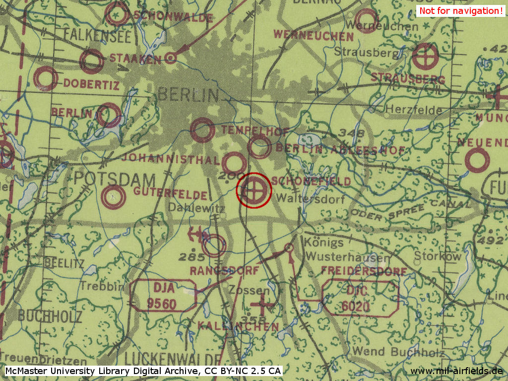
Overview
Schönefeld airfield with the installations of the Henschel Aircraft Factory (HFW) in the early 1940s on a US map from 1952
Source: AMS M841 GSGS 4414, Courtesy Harold B. Lee Library, Brigham Young University, https://contentdm.lib.byu.edu/digital/collection/GermanyMaps/id/851/rec/1
During the Cold War
Use
Used by Soviet forces. Later international airport for East Berlin and home base for East German Deutsche Lufthansa and Interflug respectivly. Base for Il-62 of Transport Wing 44 (TG-44 / TFG-44) of East German Air Force (LSK/LV) for VIP transport.
In the 1940s
Overview
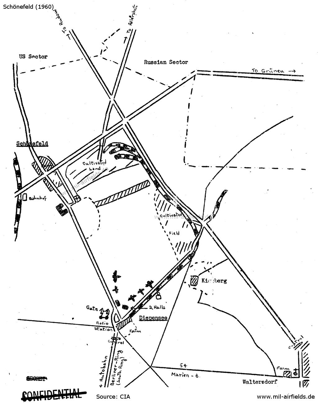
Sketch of the airfield from 1947 - The area of the former Henschel aircraft factories in the north is designated as cultivated land. The airfield is operated only in the south near Diepensee. Source: CIA
Additional information
Order No. 93 of the Soviet Military Administration of Brandenburg dated 21 May 1947 to expand Schoenefeld Airport.
1. Extension of the concrete runway and landing strip by 1,100 meters so that the total length of the strip will be brought to 2,000 meters, and the construction of a taxiway from the end of the runway to the aircraft parking site.
2. Lighting facilities for a take-off and landing strip required for night take-offs.
3. Leveling work on the site to be added to the field.
4. Construction of a radio transmitter and a DF station.
5. Enclosure of the airfield..
6. Construction of approach roads.
7. Reconstruction, re-equipment and repair of the buildings serving passenger traffic, of the hotel, restaurant, clubhouse, and of 120 housing units.
8. Clearing of the airfield area of debris after completion of the dismantling of objects.
9. Completion of projected work.
Source: CIA
Observations 1947
Agricultural land belonging to the communities of Diepensee and Schoenefeld was expropriated for the airport. Lieutenant Colonel Stolyarov has been appointed director of the airport.
Source: CIA
Observations in October 1947
a. ... All activity has been transfered from Adlershof to Schönefeld and the former field has been dismantled for the most part, although it is still being used by U-2 courier aircraft.
b. The field's chief entrance is at its southern extremity and is reached through Diepensee, where there is a Soviet control point. A sign at this entrance reads "Aeroport Berlin". Signs posted along the footpath between Diepensee and Waltersdorf read: "Trespassing forbidden under penalty of law and 500 marks fine. Soviet Army Unit No. 68061."
c. The field is grass covered, the ground is hard. The concrete runway, running southwest to northeast, is sixty meters wide and approximately 800 meters long. Apparently the runway is being extended by 100 to 150 meters as part of the improvements being made in the northwest area of the field.
d. The field contains a control tower, two hangars, a small building with direction finding equipment, and a radio station with two masts, each approximately thirty meters high.
e. The Siemens-Bauunion is reconstructing various buildings. FInal dismantling operations on the Henschel plant are controlled by the "Sonderbaubüro IV für Bauten der sowjetischen Besatzungsarmee bei der Stadtverwaltung Potsdam".
f. The field appears to be used at the moment only for transportation and mail services. Five PS-84 aircraft observed on 26 July bore camouflage paint minus the usual Soviet star; left side of fuselages and upper left side of wings were marked СССР; right side of fuselages and wings were marked Л 4076.
Source: CIA
Observations in November 1947
During the past month the Russian airfield at Schoenefeld (Z93) has undergone extensive enlargements, reportedly in connection with the recent increase in the amount of air traffic between Berlin and Moscow. This increase is due to the fact that the Russian-operated air lines, which formerly confined themselves almost exclusively to passenger service, are now carrying large amounts of freight, particularly watches, light metal products, and optical instruments, produced in the Russian Zone. The change-over, which has occasioned an almost six-fold expansion in flight capacity, was necessitated by the looting and robbery of Russian freight trains and trucks in Polish territory.
Source: CIA
Observations in August 1948
a. Except for the arrival of one transport, whose civilian and military passengers went to Berlin, there was no air traffic at Schönefeld airfield on 30 August. Four other transports were seen on the field, and there were eighteen tank cars on the railroad siding.
b. Two hangars and an operations tower are working. Field buildings on the Diepensee farm are being repaired, but former barracks near the airport are not in use.
c. The grass runway is in good shape. A concrete runway, running northeast-southwest, 30-40 meters wide and 1.8 to 2 kilometers long, has been finished; and a field ring is nearing completion.
d. There is a signal sender off the runway at the southwest end of the field. Behind the hangars are two radio stations, one fixed and one mobile.
e. A wire fence encloses the southern and northeastern side of the field; otherwise there are only signs against trespassing.
f. The Schönefeld-Diepensee road has been obliterated by the extension of airfield boundaries. A rail line is being laid down on the old main approach from the Rudow-Waltersdorf highway and a new street is being set out parallel to it.
Comment: Schönefeld flying hazards are represented by a large chimney still standing on the field and, possibly, the radio masts at Königs Wusterhausen.
Source: CIA
Hay shipment in March 1949
It was learned early in July 1949 that the unit ... stationed at the Schoenefeld airfield, had requested a shipment of hay from the Rangsdorf (N 53/Z 82) supply office in March 1949.
Source: CIA
Aircraft movements in June 1949
1. A four-engine plane ..., coming from the east landed at the Schoenefeld (N 53/Z 93) airfield about 5:00 p.m. on 7 June 1949. The plane was similar to the American Skymaster and was equipped with dual wheels and nose wheel ...
2. The plane was not at the field on 9 June 1949.
Comment: The plane mentioned probably was an Il-18. ... the plane was assigned to the "Aeroflot" Airlines. It is not known what route this plane was flying.
The two transport aircraft which formerly landed at the Schoenefeld (N 53/Z 93) airfield every evening did not arrive on 19 and 20 June 1949. * One four-engine plane of the same type as observed on 7 June 1949 landed on 21 June 1949. ** Quartering buildings at the airfield were still being improved.
* Comment: Since the exact landing times of the two transport aircraft which previously landed at the field every night, were not stated, it cannot be determined to which airlines these planes were assigned.
** Comment: According to the description given in a previous report, the four-engine plane which landed at the field on 21 June 1949, is an Il-18. The airline flown by this type is unknown ...
Source: CIA
Aircraft movements in August 1949
16 August 1949: A biplane took off at 9 am and a twin-engine biplane landed there at 12.45 pm.
The scheduled DC-3 arrived at 5:30 pm. Three other twin-eninge transport aircraft landed in succession about 11 pm.
17 August 1949: A single-engine plane landed at 1:35 pm. There was no other flying. A truck ... and a passenger car ... were observed.
No aircraft or soldiers were seen at the field. The hangars were closed.
18 August 1949: A biplane circled the field from late evening until after midnight. Red and green signals were fired from the biplane. Soon afterwards the report of a heavy gun was heard from the east.
19 August 1949: Three twin-engine aircraft took off from the field and headed east at 7:45 am. The lower sides of the planes were painted light blue, the upper sides dark green.
Construction work on the hangars and field buildings was still in progress.
Comment: Report shows that no air unit is located at the SCHOENEFELD airfield, which is used only by commercial aircraft and transport aircraft. The construction work at the northern section of the airfield is apperently not yet completed.
22 August 1949: Two Dakota type aircraft landed about 4 pm. One of these planes carried the number 4243. The construction work at the field continued.
25 August 1949: Seven commercial aircraft landed at the field in the morning. According to the porter at the field, Soviet delegations to attend the Goethe festivals in Germany had arrived in these planes. No air unit was stationed at the field.
Source: CIA
Observations in September 1949
19 September 1949: Seven twin-engine transport aircraft were parked on the south-western edge of the airfield. Another plane of the same type with silver paint and a light blue stripe on the rudder assembly landed at 12:15 pm. Motor vehicles ... were observed. Construction work was still being done. The field was guared by the "People's police".
28 September 1949: Four twin-engine transport planes, presumably DC-3s, were parked near the two hangars on the southern edge of the airfield. ... Construction work was being done on the spur track.
Source: CIA
Observations in November 1949
15 November 1949: Two passenger planes, probably DC-3s, landed at the field.
17 November 1949: A passenger plane of the same type ... landed at the field.
18 November 1949: No aircraft, Soviet Air Force soldier or military motor vehicles were observed at the airfield in the afternoon. The field was guarded by sentries and patrols of the Soviet Zone German police.
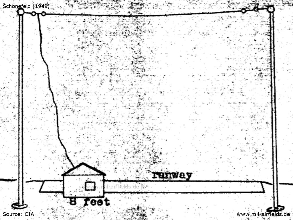
Some railroad tank cars were standing near the fuel dump on the southern edge of the field. A radio station stood beside the buildings on the southern edge (for antenna system see sketch 1). Another radio station stood north of the east end of the concrete runway (see sketch 2). A set of lamps was seen at the extension of the runway to the east. Boundary lights were ... available... Railroad spur track led to the buildings on the northwest edge. Signboards to the field had inscriptions such as "Airfield" and "To Intourist Hotel".
A twin-eninge passenger plane ... landed at and took off from the field between 21 and 27 November 1949.
Four or five of the described twin-engine passenger planes were parked in the hangar on the southern edge. The planes often made local flights, probably in connection with instrument approach flights, between 6 pm and midnight, sometimes in very hazy weather.
Colonel SKRIPNIK was the CO of the field. Soviet officers, some of them pilots with their dependants, were quartered in the dwelling houses at the field.
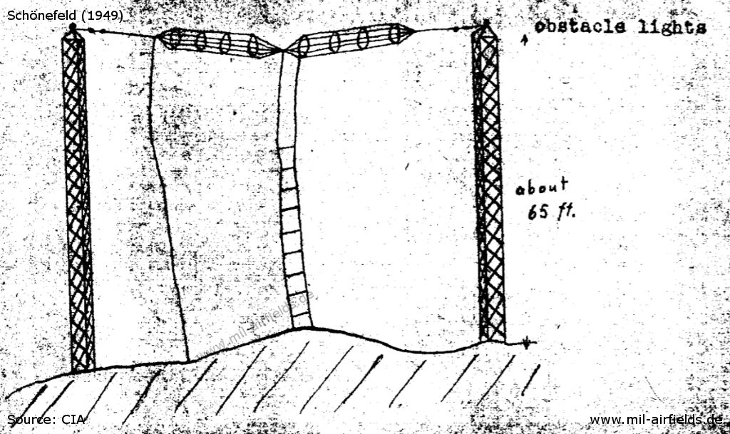
There were boundary lights on the eastern and western edges of the field in line with the runway. Obstacle lights were on the neighboring buildings. There was a DF station about 1,600 feet west of the runway surrounded by four radio masts which were interconnected by antenna wires. Another radio station was stood the flight control station. The entire airfield was serviceable for night flights and instruments landings.
It was rumored that the quarters at the field, now occupied by Soviet dependents, were soon to be used by air force troops.
Comment: The report confirms the previous assumption that the field is used by civilian airlines. No air unit was stationed there. Colonel SKRIPNIK, reportedly CO of the field, is possibly Maj SKRIPNIK, CO of the Alt Lönnewitz 345th ATB (formerly 67th ATB) (Avio Technical Battalion) from 1946 to 1948.
Sketch of the radio station observed beside the buildings on the southern egde of the field - Source: CIA
Sketch of the radio station north of the east end of the concrete runway. - Source: CIA
Source: CIA
Observations in December 1949
09 December 1949: No aircraft were parked outside the hangars. As it rained heavily the boundary lights, the runway lights and the row of lamps along the eastern expansion of the runway were switched on at 03:18 pm.
A twin-engine DC-3 with a vertical black stripe on the rudder assembly and a black marking on the nose glided in from the east and landed at the field at 03:20 pm. After it had been towed to the northern edge of the field at 03:25 pm, the lights were switched off again.
Railroad tank cars were near the fuel dump on the southern edge of the field.
There was intensive motor vehicle traffic between the field buildings.
The red obstacle lights were on in the evening. A beacon light in the approach flying lane, east of the mentioned row of lamps flashed alternately a dash and four points.
Source: CIA
In the 1950s
Situation
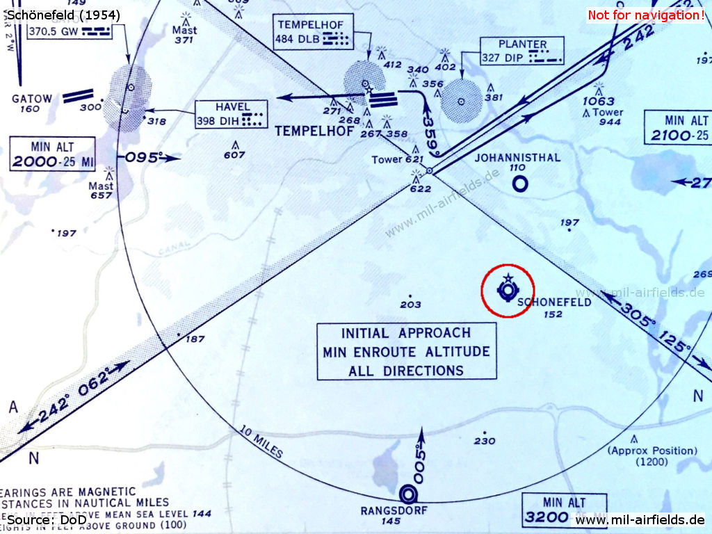
Schönefeld on a US Air Force map from 1954
Overview
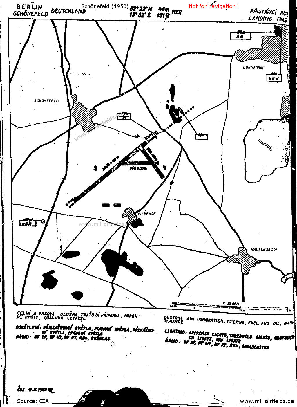
Map from the Czechoslovak aeronautical publication from 1950 - Runway 05/23 has been extended to the southwest /CIA RDP80S01540R003700010002-4/
Radio beacons
During the 1950s:
- NDB: 300 "AB", 044°/0,9 NM
Units
Units in 1954
- Soviet transport regiment (P. O. Box 62 322),
- Soviet transport regiment (P. O. Box 15 728),
Source: BND/Bundesarchiv B 206/3033
(For the P. O. Box numbers the digits 3 and 5 may be confused, because they are difficult to distinguish in the source document)
- Soviet transport regiment (P. O. Box 15 728),
Source: BND/Bundesarchiv B 206/3033
(For the P. O. Box numbers the digits 3 and 5 may be confused, because they are difficult to distinguish in the source document)
History
- 195x
Absturz eines sowjetischen Flugzeugs in der Nähe der Kirche von Berlin-Bohnsdorf. - August 1953
Die sowjetische Transportfliegereinheit mit Flugzeugen vom Typ Li-2 vom Flugplatz Berlin-Staaken wurde nach Schönefeld verlegt. Quelle: CIA - 06.12.1954
Auf dem Flugplatz werden 20 Li-2 und 2 Po-2 gezählt. Quelle: CIA
In the 1960s
Overview
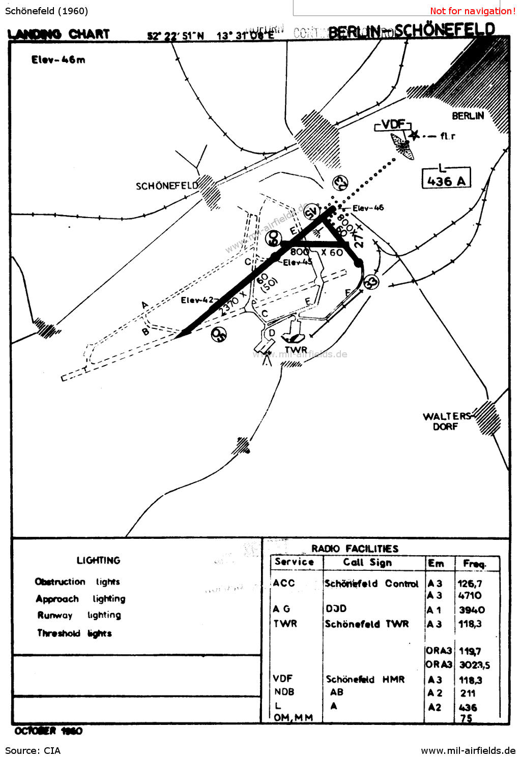
Map from 1960 - The new runway (later 07R/25L, Southern runway) and taxiways are either planned or under construction. /CIA RDP80T00246A059200030001-1/
Map
Aerial picture
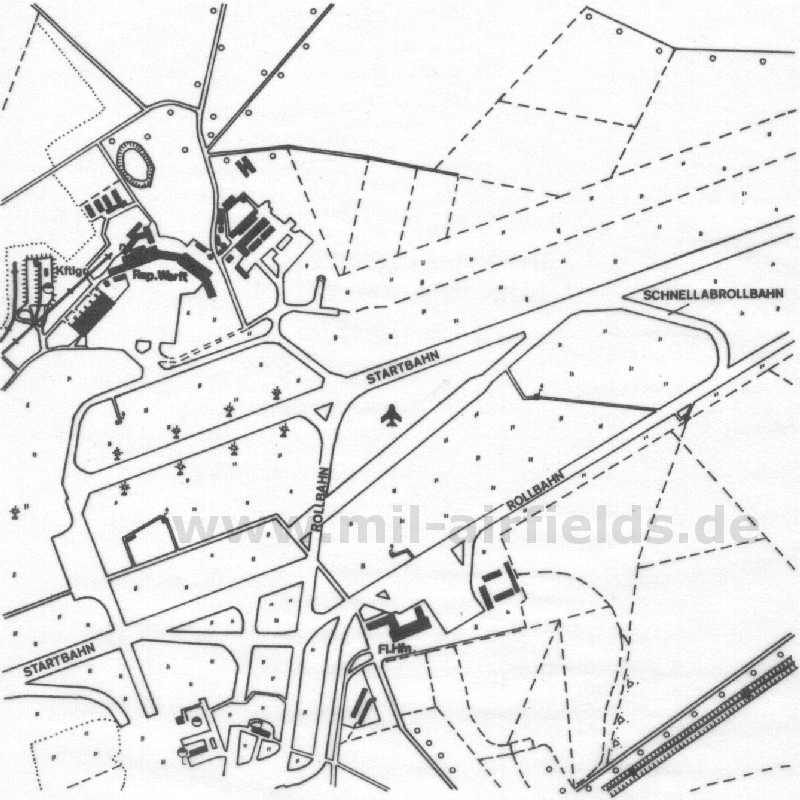
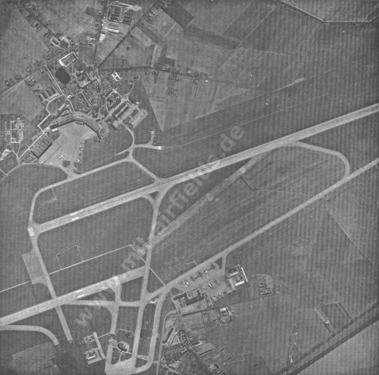
The map and the aerial picture from the East German field manual "A 042/1/003 Auswertung von Luftbildern" from 1973. Possibly for the purpose of disguise, they were printed upside down.
The former northern runway (top right) seems to be completed, so the picture is possibly taken after 1965. The parallel taxiway K does not exist yet. The remains of the old runway still show markings (center of the picture). On the northern apron some aircrafts can be seen: two Il-18 (?), one Il-14 (?), one An-24 (?) and two passenger jets with rear engines. On the southern apron (shown on top) two Il-18 (?), one An-24 (?) and 4 other aircrafts.
Runways
Data for the year 1960:
- 05/23: 2370 m x 60 m (50 m)
- 09/27: 800 m x 60 m
- 15/33: 800 m x 60 m
(Direction, runway length x width)
Lights
New lighting of runway 05/23 (1961):
Runway 23
The approach lighting system is left of the approach course consisting of 13 lights orange/red. 5 lights orange were placed across the runway to represent the artificial horizon. Intensity is 1000 W.
Up to the threshold lights the apron is marked by 4 red lights on either side. The touchdown point is marked by a white landing T. The threshold lights of runway 23 are 150 m inward the landing runway, green shining. The distance between the lights is 50 m on all runway.
Runway 05
There is neither an approach lighting nor a horizon on this landing direction. The apron is 363 m up to the threshold lights (green shining) and is marked by 6 red lights on the left side and 4 red lights on the right side of the runway.
The take-off point for jet or turboprop aircraft is at the red double lamps placed 200 m before the threshold lights. Near the red double lamps a cross-strip of 1 m is marked.
The landing T is marked by white lamps. The taxiway being in operation is marked by blue lights.
Source: NOTAM 01/61, /CIA RDP80T00246A059200030001-1/
History
- 1961
Inbetriebnahme der Südbahn 07R/25L (Start- und Landebahn I) - 1962
Die Start- und Landebahn I erhält eine Calvert-Anflugbefeuerung. - 1963
Inbetriebnahme neuer Hangar - 1963
Inbetriebnahme eines 10-cm-Weitbereichs-Radars - 1965
Inbetriebnahme der Nordbahn 07L/25R (Start- und Landebahn II), - 1965
Inbetriebnahme eines Wetterradars vom Typ BWR X-10
Images
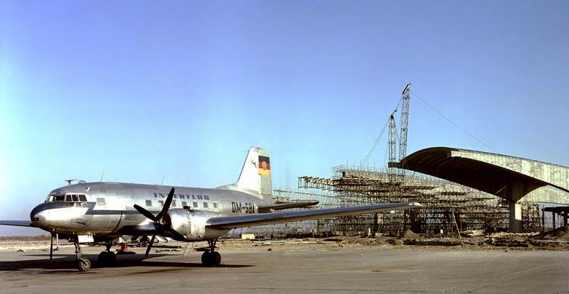
Interflug Il-14 DM-SBA at Schoenefeld Airport in January 1961. In the background hangar under construction.
Source: Bundesarchiv DH 2 Bild-F-04180, Fotograf: Wolter, CC BY-SA 3.0, via Wikimedia Commons, https://de.wikipedia.org/wiki/Datei:Bundesarchiv_DH_2_Bild-F-04180,_Berlin-Sch%C3%B6nefeld,_Flughafenbau,_Il14.jpg
In the 1970s
Overview
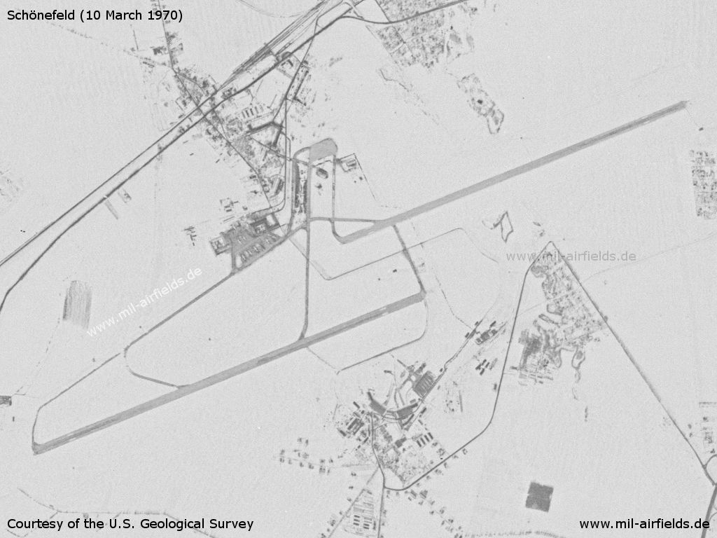
Schönefeld Airport on a US satellite image from 03 March 1970 - The landscape is covered with snow
Source: U.S. Geological Survey, https://www.usgs.gov/
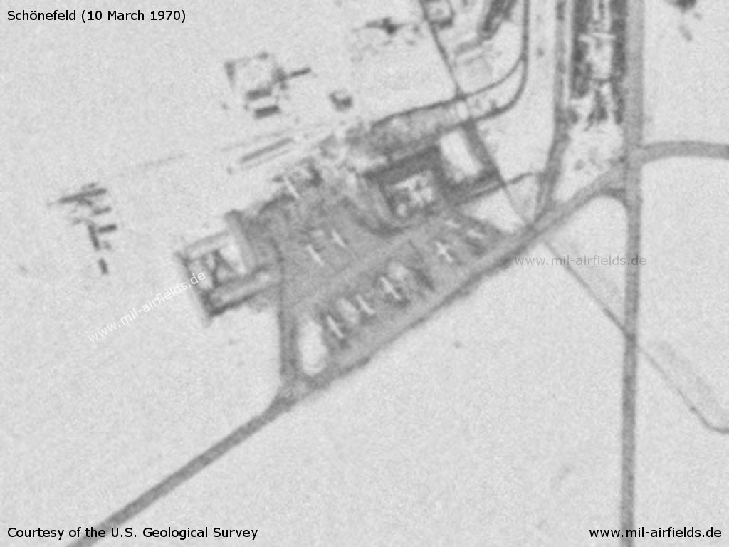
Enlargement: Former terminal
Source: U.S. Geological Survey
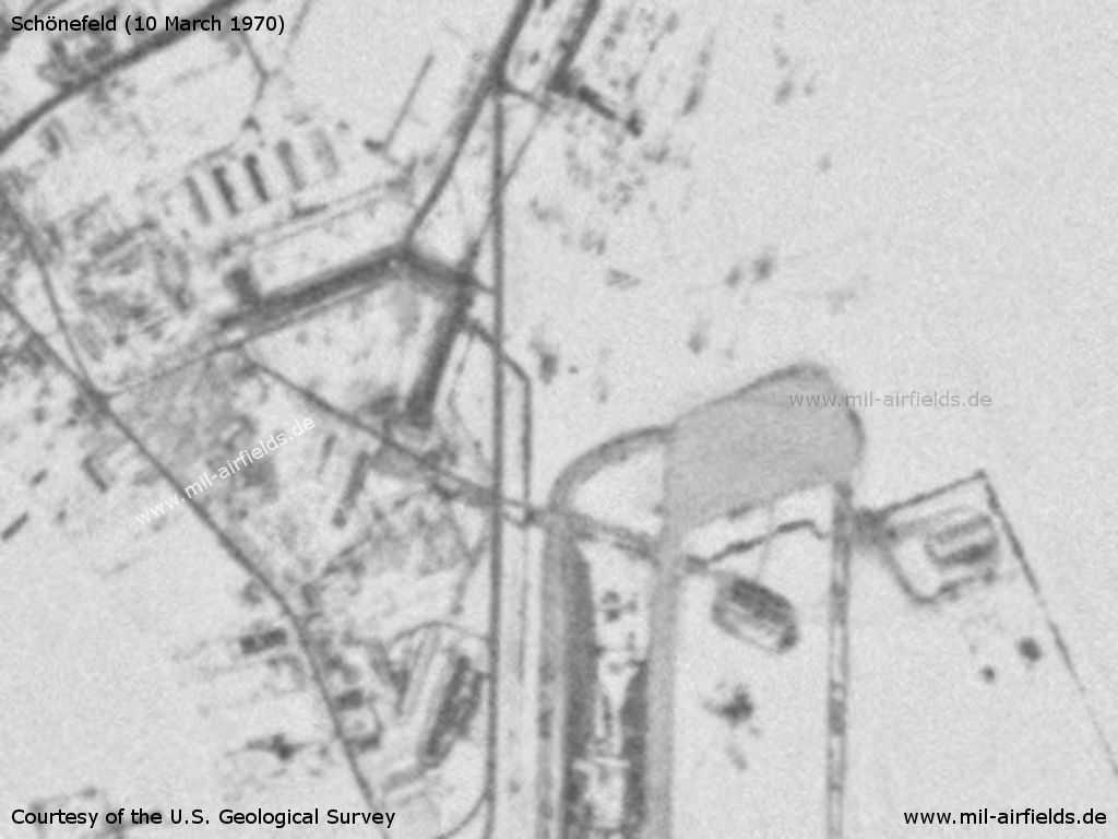
Enlargement: Schoenefeld special ramp
Source: U.S. Geological Survey
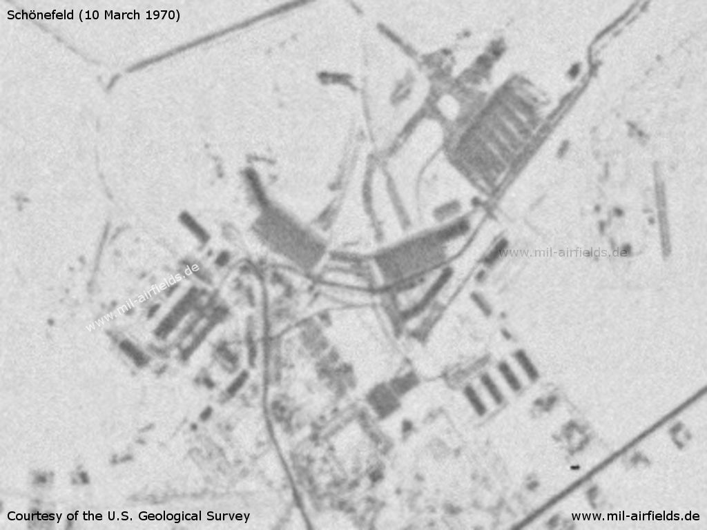
Enlargement: Maintenance area at Diepensee
Source: U.S. Geological Survey
Radar
During the 1970s:
En-Route Radar (RSR) and Aerodrome Surveillance Radar (ASR) in the western part of the field. Precision Approach Radar (PAR) for runways 07R/25L and 07L/25R.
History
- 1972
Commissioning of a new MRL-2 weather radar - August 14, 1972
Crash of the Il-62 DM-SEA of Interflug near Königs Wusterhausen. The aircraft departed from Schönefeld and was returning due to control problems. - 1973
Commissioning of a new engine workshop. - 1975
Comprehensive reconstruction of the approach control service - 1976
Commissioning of a new workshop for the maintenance and repair of technical equipment. - 1976
Inauguration of the "New Passenger Terminal" (Neuen Passagierabfertigung, NPA) - 1976
New construction of the fire station - Januar 28, 1977
At the nearby Schönefeld train station, 20 people are injured. At 09.55 a special plane lands in Schönefeld with the "General Secretary of the Communist Party of Chile", who is living in exile in the Soviet Union. The GDR party and state leadership had thousands of cheering statists set up at the airport and along the subsequent route to greet him; the next day, the East German press spoke of 50,000 people who had "greeted him enthusiastically." Between 11:20 and 11:30 a.m., a crowd formed on the pedestrian overpass at Schönefeld station as the cheering participants departed. As a result, people fall down the stairs and suffer rib fractures, bruises and injuries to their arms and legs. 11 people are taken to Köpenick Hospital for treatment, 9 to Königs Wusterhausen Hospital. While the East German press reported on the visit on many pages over the next few days, the incident at the station was not mentioned. - August 3, 1977
At 09.54 an Interflug Tu-134 crash-landed. Scheduled flight Moscow-Schönefeld with 5 crew members and 37 passengers. The main landing gear breaks, the aircraft comes to a halt on its fuselage. The fire department foams the aircraft. - October 1, 1977
At 16:36, a DC-9 from Zurich lands in Schoenefeld. It took a pressure chamber from Berlin (West) on board and took off for Malta at 17:54. There, a seriously injured diver from Berlin (West) was taken on board and flown to Schoenefeld, where the aircraft landed at 02.08 hrs on 02.10.1977. The diver was brought to Berlin via the Rudower Chaussee border crossing. The DC-9 took off back to Zurich at 04.50 hrs. - October 12, 1977
The European Group 3 World Cup qualifier between Austria and the GDR takes place in Leipzig. Due to bad weather conditions, charter planes with fans from Austria do not land in Leipzig, but in Schönefeld and Erfurt. Interflug organizes onward transport by bus. The match ends 1:1. - October 13, 1977
At 03.30 a plane lands in Schoenefeld that was supposed to bring Austrian soccer fans back from Leipzig to Vienna. However, no planes are accepted in Vienna due to bad weather, which is why the plane flies to Schoenefeld. The 144 fans are accommodated in a separate transit area and secured by the passport control unit (PKE) of the Stasi. Around 7 a.m., two planes take 72 fans each back to Vienna. - November 22, 1977
At 10:32 a.m., the Tu-134 DM-SCM of Interflug crashes while landing on runway 25R. Scheduled flight IF 601 from Moscow to Schönefeld, 5 crew members and 74 passengers, including 5 Interflug specialists. There were minor and moderate injuries. A fire engine approaching from outside with special signals collided with a Multicar at an intersection in Berlin-Grünau. One firefighter was slightly injured, the driver of the Multicar was seriously injured. - December 31, 1977
At 17:04, the right wing of an Interflug Tu-134 made contact with the ground during landing. This triggered the engine fire extinguishing system, but the engines did not catch fire. The 12 passengers and 5 crew members left the aircraft via emergency slides and were uninjured. - 1978
Installation of the 23 cm AVIA-D/KOREN radar system - January 16, 1978
At 14:35, an Interflug Il-62 with 6 crew members takes off on runway 07L for a training flight and takes off with only three engines. It drifts to the right and comes to rest on the grass. The aircraft is undamaged and there are no casualties. At 17:20, the aircraft is towed to the hangar. - March 4, 1978
Interflug receives an anonymous call that there will be an explosion on take-off of flight LO 067 of the Polish airline LOT at 12.55 pm. However, the aircraft is actually still in Warsaw because it was unable to take off due to fog. Another aircraft in Schoenefeld is secured. - May 5, 1978
The Interflug Il-62, which took off for Moscow at 08:55, returns to Schoenefeld due to engine problems. It lands at 09:25 without incident. The event nevertheless attracted increased attention because the landing of the Soviet Foreign Minister was scheduled for 10.00 am. - June 12, 1978
At 09:02 a deflagration occurs in the engine of an Aeroflot Tu-154. There were no passengers on board and no one was injured. The plane was due to take off for Moscow at 09:55. The departure took place at 10:13 a.m. after no damage could be detected. - July 4, 1978
Shortly before 8 a.m., Interflug receives two anonymous threatening calls: "Airport will be attacked", "Airport will be razed at 12.00 noon". The operational security office of the People's Police initiates measures, movements of people are taken under control, important objects are specially secured. - August 8, 1978
Due to heavy rainfall, there is a complete power failure at the airport at 17:55. From 18:07, there is an emergency power supply for the air traffic control systems, all other areas, including check-in, remain without power. The airport remained closed until 21:00 and 11 aircraft were diverted via Erfurt, Prague and Warsaw. The East German press reported on the disruption to air traffic caused by strong winds and water on the runways, but failed to mention the power failure. - August 15, 1978
At 13:11, the Interflug operations control center received an anonymous call: A 500-gram bomb had been placed in the Tu-134 DM-SCJ. The aircraft landed from Beirut at 12.32 p.m. with a stopover in Bucharest and is now at stand 3 for handling. It is pulled out and subjected to a foreign object check by Interflug. - August 30, 1978
The Tu-134 SP-LGC of the Polish airline LOT is forced to land at Berlin-Tempelhof Airport on the scheduled flight LO165 from Gdańsk to Schönefeld. - October 9, 1978
Train D 373 to Bucharest is waiting at Schönefeld station and can not depart as planned at 00:37 due to overcrowding. Interflug had directed several groups of passengers to this train. The Deutsche Reichsbahn asked the transport police to get passengers off the train. The train was finally able to depart at 03:49. - January 23, 1979
At 18:34, the right wing of a Tu-154 of the Romanian airline Tarom comes into contact with a snow bank during landing. The tip of the wing was torn off. The pilot had previously reported difficulties during the landing approach. The aircraft taxied out normally and the 45 passengers and 8 crew members were not injured. The aircraft is unfit to fly. - Summer 1979
Installation of a 60 m high mast for wind shear measuring, 500 south of the runway. The installation was carried out using an Mi-8 helicopter.
Additional information
1972: Keine Verlegung des TG-44 von Marxwalde nach Schönefeld bis 1980
Aus dem Protokoll des Nationalen Verteidigungsrates vom 14.07.1972:
- Zurückstellung des Generalbebauungsplanes für Berlin-Schönefeld
- Daher keine Umbasierung der Transportfliegerstaffel aus Marxwalde nach Schönefeld bis 1980
- Sicherstellung der Flüge ab Marxwalde und Schönefeld
- 01.01.1973 Übergang der Transportfliegerstaffel 44 in das Transportfliegergeschwader 44
- Keine Aufnahme von Il-62 in den Bestand. Bei Bedarf werden Flüge von der Interflug durchgeführt.
(Quelle: Bundesarchiv)
Images
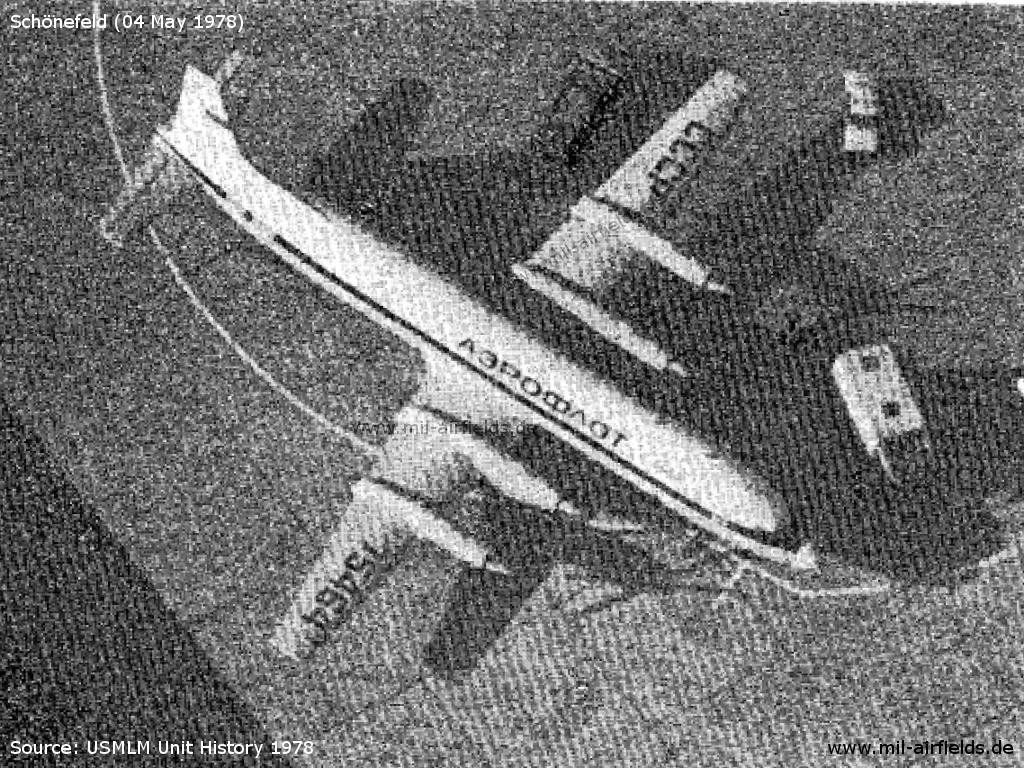
An Il-18 in Aeroflot colors on 04.05.1978 at Schoenefeld Airport, presumably used as a telecommunications center.
In the 1980s and early 1990s
Runways
Data for the 1970s and 1980s:
- 07R/25L: 3000 m x 60 m Concrete
- 07L/25R: 2700 m x 60 m Concrete
(Direction, runway length x width, surface)
The former main runway 05/23 was put out of operation ca. in 1964. A part of it was still available as taxiway C and was used to park aircrafts.
Runway 25L was equipped for category II operations from approximately the end of the 1970s.
The take-off positions for 07R and 25L were displaced for about 200 m. The full length could be used on request.
Taxiways, aprons
During the 1970s and 1980s:
Taxiway K to runway 25R was closed for aircraft with a wingspan exceeding 50 m, except for DC-10 and Il-76.
Radio beacons
During the 1980s:
- ILS25R: 110.3 "SLR"
- ILS25L: 109.9 "SLL"
- LOM: 299 "SL"
- LMM: 430 "S"
- ILS07R: 110.7 "MWR"
- LOM: 309 "MW"
- LMM: 430 "M"
Radar
During the 1980s:
ASR south of the field, PAR for runway 07L/25R.
Radio communication
Data for the 1950s:
The Soviet radio post was working on 4150 kcs with the call sign BELKA.
During the 1980s:
- Schönefeld ATIS 125.9
- Schönefeld Approach 119.5
- Schönefeld Radar 135.65 Westrichtung
- Schönefeld Director 121.3
- Schönefeld Precision 118.3 PAR-Anflüge 07L/25R
- Schönefeld Tower 121.3
- Schönefeld Taxi 121.6
- Schönefeld VOLMET 128.4
- Interflug Berlin 131.7
- Interflug Berlin HF 4745, 6753, 8984, 11237, 13225, 15046, 17975, 23225
The HF radio station "Interflug Berlin" was also used by aircrafts of the military transport wing TG-44 for phone patches to their command post.
Telephone
During the 1980s:
| Verkehrsflug | Operativzentrum | 672-4001 |
| Agrarflug | Operativzentrum | 678-8221 (Fluggespräche), -8262 |
| Interflug Betrieb Fernerkundung, Industrie- und Forschungsflug | 672-7881, -7817 | |
| Approach Control | 672-7531 | |
| Control Tower | 672-7536 | |
| ATCC | 678-8265 (Fluggespräche), 672-4187, -7522 | |
| Met office | 672-3855, 678-8288 | |
| MdI / Volkspolizei | Diensthabender Flugleiter der Hubschrauberstaffel / Helicopter unit (Hubschraubereinheit, HSE) call sign "Ida 201" | Sondernetz / Stabsnetz S1 2432-4102 (Anschluss MdI Hauptnachrichtenzentrale) |
| Betriebsschutz Schönefeld, call sign "Toni 26" | über PdVP Berlin 50 | |
| NVA | Teile TG-44 | Sondernetz / Stabsnetz S1 24401 |
| Gästehaus Flughafen Schönefeld | Ministeranlage des MfNV Apparat 310 |
Connections between visual approach and departure routes and local flying routes
Angaben für das Jahr 1982
Mittenwalde, Zossen, örtliche Flugline Punkt Zossen
Bestensee, örtliche Fluglinie in Richtung Golssen
Beeskow, kürzester Flugweg nach der örtlichen Flugline Nr. 42 (Streckenabschnitt Frankfurt/Oder - Straupitz)
Grünheide, Punkt Hoppegarten örtliche Flugline Nr. 31, Prötzel, Fürstenwalde oder Grünheide, Punkt Autobahnauffahrt Fürstenwalde
(Quelle: VFR-Handbuch für den Agrarflug, Nur für den Dienstgebrauch)
History
- 1980
Inbetriebnahme des Flugsimulators Tu-134 an der Betriebsschule der Interflug. - 15. April 1980
Aufnahme des Dauerbetriebs der Radardatenverarbeitung GAMMA-1. Mit dem Rechnersystem ODRA 1305 werden die Daten des Sekundärradars KOREN verarbeitet und auf Sichtgeräten WPS-10 dargestellt. In den Anfangsjahren gab es Probleme mit der Stabilität des Rechners und mit der Zielverfolgung. - 1981
Inbetriebnahme des Antihavarietrainingskabinetts an der Betriebsschule der Interflug. - 1981
Inbetriebnahme eines Werksrestaurants - August 1982
Inbetriebnahme der rechnergestützten automatischen Fernschreibspeichervermittlung im festen Flugfernmeldenetz (AFTN) eines franzöischen Herstellers. - 1984
Inbetriebnahme des Funktionsgebäudes für den Betrieb Fernerkundung, Industrie- und Forschungsflug der Interflug. - November 1984
Inbetriebnahme einer neuen NOTAM-Datenbank - 1985
Inbetriebnahme der "Erweiterten Passagierabfertigung" (EPA) - 1985
Demontage des Wetterradars MRL-2 und Montage eines neuen Wetterradars MRL-5 jeweils mit Hilfe eines Hubschraubers Mi-8 - Dezember 1985 - März 1986
Modernisierung des Radarkomplexes AVIA-D/KOREN. Einrüstung eines Wetterkanals. - 1986
Grundsteinlegung für das Fliegertrainingszentrum der Interflug. - Januar 1986
Inbetriebnahme des neuen Wetterradars MRL-5 - 1986
Die Flughafenfeuerwehr erhält neue Tanklöschfahrzeuge auf Tatra 815 - 12.12.1986
Absturz der Tu-134 CCCP-65795 der Aeroflot im Anflug südlich von Bohnsdorf. - 1988
Beginn der Ausbildung im Fliegertrainingszentrum der Interflug. - 1988
Einrichtung eines Feuerwehr-Übungsfeldes für die praxisnahe Ausbildung. - 1988
Großflächige Löschversuche zur Erprobung von Methoden der Flugzeugbrandbekämpfung. - 17.06.1989
Probleme zwingen die Il-62 DDR-SEW der Interflug zum Startabbruch. Flugzeug rollte über das Ende der Bahn hinaus und geriet in Brand. - 26.06.1989
Ankunft des ersten Airbus A 310-300 DDR-ABA der Interflug.
Additional information
Flugzeugabsturz am 12.12.1986
Am 12.12.1986 stürzte eine Tu-134 der Aeroflot beim Landeanflug südlich von Bohnsdorf ab. An Bord befanden sich 82 Personen, von denen 72 starben. Mario Wünsche war damals Krankentransporteur beim Rettungsamt Berlin, Marienburger Str. Er berichtet über seine Erlebnisse:
"Ich hatte Spätdienst (14:00-22:00) und seit einigen Tagen einen neuen Mitarbeiter zum Anlernen an Bord. Mit unserem Sankra 2009 hatten wir gegen 17:00 Uhr einen Patienten in Adlershof nach Hause gefahren und meldeten uns anschließend gegen 17: 20 Uhr bei unserer Leitstelle mit „Hunger“. Nun war gerade unserer Sankra 9 dafür bekannt, dass man uns besser in die Pause entlässt wenn er sich mit „Hunger“ meldet - sonst hatten wir nur schlechte Laune und waren zu nichts mehr zu gebrauchen (etwas übertrieben gesehen). Anstelle einer Bestätigung kam die Meldung: "Signalfahrt über Adlergestell auf die Autobahn! Flugzeugabsturz bei Bohnsdorf. Bahn sei gesperrt und Polizei weist uns ein." Ich fragte noch ob das ein Scherz sei, aber da wir keine Antwort darauf erhielten wurde uns mulmig. Mit Fernlicht und Sondersignal rasten wir über das Adlergestell in Richtung Absturzstelle. Das erste Mal in meiner ganzen Zeit als Fahrzeugführer sah ich Polizisten, die sich im fließenden Verkehr vor die Autos stellten, um uns die ungehinderte Durchfahrt zu ermöglichen.
Am Unglücksort angekommen, war erst mal nichts zu sehen außer Rauch in einem Waldgebiet rechts neben der Autobahn. Von der Polizei wurden wir jedenfalls nicht eingewiesen. Ich sagte noch zu meinem Kollegen: „Lass uns die Trage mitnehmen, wer weiß was uns da erwartet!“
Wir rannten also durch den schon dunklen Wald in Richtung Feuerschein. Das Bild dieser Unglücksmaschine hat sich bei mir eingebrannt und selbst nach gut 24 Jahren habe ich sie vor Augen. Tote und Verstümmelte vor und in der Nähe des Wracks... Film und die Wirklichkeit sind jedenfalls nicht vergleichbar! Überlebende oder Verletzte hatten wir keine mehr gefunden. Die überlebt hatten, wurden von der Feuerwehr und anderen Rettungswagen schon abtransportiert.
Auf der Autobahn zurück, fand ein heilloses Durcheinander statt. Polizei, Feuerwehr und Rettungsdienst – jeder machte seins. Eine Koordinierung der Einsatzkräfte hat anfangs nicht stattgefunden.
Auf der Autobahn zurück, fand ein heilloses Durcheinander statt. Polizei, Feuerwehr und Rettungsdienst – jeder machte seins. Eine Koordinierung der Einsatzkräfte hat anfangs nicht stattgefunden.
Unser Chef vom Rettungsamt hat sich für eine Koordinierung eingesetzt und ich hatte das Gefühl, dass er es auch ganz gut gepackt hat. Ihm hatten wir es auch zu verdanken, dass wir Stunden später einen großen Kübel Tee geliefert bekommen haben. Der Einsatz vor Ort zog sich bis in die frühen Morgenstunden hin. Zur Absicherung und weil wir immer noch hofften, dass die Feuerwehr Überlebende finden...
Für unsere Einsatzbereitschaft erhielten alle Beteiligten ein Dankesschreiben."
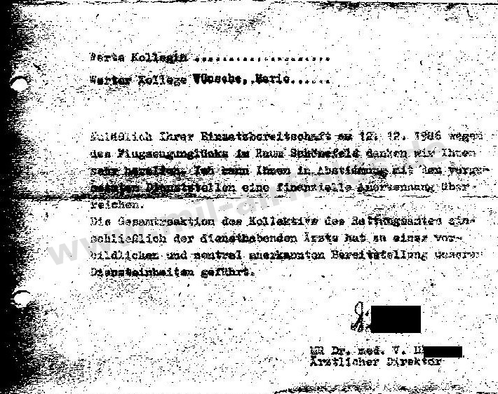
Text "Werte Kollegin / Werter Kollege ... Anläßlich Ihrer Einsatzbereitschaft am 12.12.1986 wegen des Flugzeugunglücks im Raum Schönefeld danken wir Ihnen sehr herzlich. Ich kann Ihnen in Abstimmung mit den vorgesetzten Dienststellen eine finanzielle Anerkennung überreichen. Die Gesamtreaktion des Kollektivs des Rettungsamtes einschließlich der diensthabenden Ärzte hat zu einer vorbildlichen und zentral anerkannten Bereitstellung unserer Diensteinheiten geführt. MR Dr. med. V. H. Ärztlicher Direktor"
Mario, danke für diesen bewegenden Bericht!
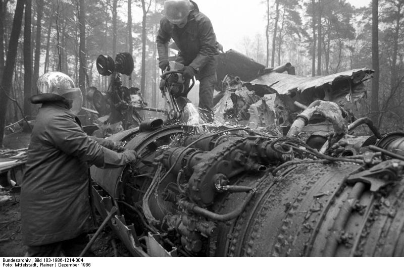
Clean-up work at the crash site near Berlin-Bohnsdorf in December 1986
Source: Bundesarchiv Bild 183-1986-1214-004, Fotograf: Mittelstädt, CC BY-SA 3.0, via Wikimedia Commons, https://de.wikipedia.org/wiki/Datei:Bundesarchiv_Bild_183-1986-1214-004,_Berlin,_Flugzeugungl%C3%BCck.jpg
Einsätze der Tu-134 des Transportfliegergeschwaders 44 ab Schönefeld
Einsätze des TG-44 der Nationalen Volksarmee (NVA) waren Flüge im Auftrag der Partei- und Staatsführung und begannen häufig in Schönefeld. Die Tu-134 - überwiegend in den Farben der Interflug - starteten von ihrem Stationierungsort Marxwalde (heute wieder Neuhardenberg) und flogen die kurze Strecke nach Schönefeld, um von hier aus den eigentlichen Einsatz zu beginnen. Analog flogen sie auf dem Rückweg zunächst nach Schönefeld und dann zurück nach Marxwalde. Übergabepunkt zwischen Schönefeld und Marxwalde war jeweils das Funkfeuer Fürstenwalde (FWE). Ende der 1980er Jahre wurde dafür eine eigene Abflugroute eingerichtet, die jedoch nicht international veröffentlicht wurde.
Il-62 des Transportfliegergeschwaders 44
Für Langstreckenflüge im Auftrag der Partei- und Staatsführung der DDR wurden drei Il-62 beschafft, die im TG-44 der NVA eingesetzt wurden, aber in den Farben der Fluggesellschaft Interflug verkehrten. Für diese Flugzeuge wurde Anfang der 1980er Jahre auf dem Südteil des Flugplatzes eine eigene Abstellfläche errichtet und über den Rollweg N angebunden.
Das Protokoll des Nationalen Verteidigungsrates vom 16.06.1978 schreibt dazu:
- Einführung von drei Flugzeugen des Typs Il-62 (1978, 1979/80, 1982/85)
- Stationierung in Marxwalde unmöglich ohne Ausbau der Start- und Landebahn, der Rollwege und Abstellflächen, Ausbau des Landesystems und Neubau eines Reparaturdocks
- Daher Stationierung in Berlin-Schönefeld notwendig
- Aufstellung einer selbständigen Transportfliegerkette Il-62 im TG-44 mit Standort Berlin-Schönefeld
- Erhöhung um 168 Planstellen im TG-44 und FTB-44
(Quelle: Bundesarchiv)
Geplante Verlegung des TG-44 von Marxwalde nach Schönefeld 1987
Im Protokoll des Nationalen Verteidigungsrates vom 16.06.1978 ist zu lesen:
- Viele Flüge für das Politbüro und für den Ministerrat beginnen in Schönefeld
- Stationierung der Flugzeuge in Marxwalde unzweckmäßig; Flugzeuge und Reserve- und Sicherstellungstechnik müssen bereits am Vortag überführt werden, was großen Aufwand bedeutet.
- Daher ab 1987 Dislozierung des TG-44 (mit Ausnahme der Hubschrauberstaffel) in Schönefeld
- Geplante Bauinvestitionen in Schönefeld 263 Mio M (55 Mio Unterkunftszone, 117 Mio Dienstzone, 43 Mio Flugzone, 48 Mio Wohnzone)
- Geplanter Standort: südlich der Bahn 07R/25L, westlich von Diepensee (Flugzone, Dienstzone, Unterkunftszone) sowie nordöstlich des Flugplatzes (Wohnzone)
(Quelle: Bundesarchiv)
Flüge zur Erdgastrasse in den 1980er Jahren
Zur Versorgung der Arbeiter an der Erdgastrasse gab es in den 1980er Jahren mehrmals pro Woche Flüge von Schönefeld nach Lvov. Dazu flogen am Morgen z.B. drei An-26 der TS-24 von Dresden und eine Tu-134 des TG-44 von Marxwalde nach Schönefeld. Von hier starteten sie in Richtung Erdgastrasse und kehrten am Abend nach Schönefeld zurück. Dann ging es wieder zurück nach Dresden bzw. Marxwalde.
Aufbau des Amts für Luftraumkoordinierung Ende der 1980er Jahre
Das Protokoll des Nationalen Verteidigungsrates vom 25.11.1988 nennt die folgenden Maßnahmen zum Aufbau eines Amts für Luftraumkoordinierung:
- Arbeitsbereitschaft für Teilaufgaben ab Mitte 1989 in den Räumen der ehemaligen Flughafenabfertigung (Ausbau- und Ausrüstungskosten ca. 500 TM).
- Herstellung der vollständigen Arbeitsfähigkeit nach Umzug in das gemeinsame Flugleitzentrum Berlin-Schönefeld ab 1991/92
(Quelle: Bundesarchiv)
- Arbeitsbereitschaft für Teilaufgaben ab Mitte 1989 in den Räumen der ehemaligen Flughafenabfertigung (Ausbau- und Ausrüstungskosten ca. 500 TM).
- Herstellung der vollständigen Arbeitsfähigkeit nach Umzug in das gemeinsame Flugleitzentrum Berlin-Schönefeld ab 1991/92
(Quelle: Bundesarchiv)
Today
Use
One of 2 airports for Berlin. Reconstruction of a new airport Berlin-Brandenburg International (BER).
Images
Pictures 2005
Buildings (2005)
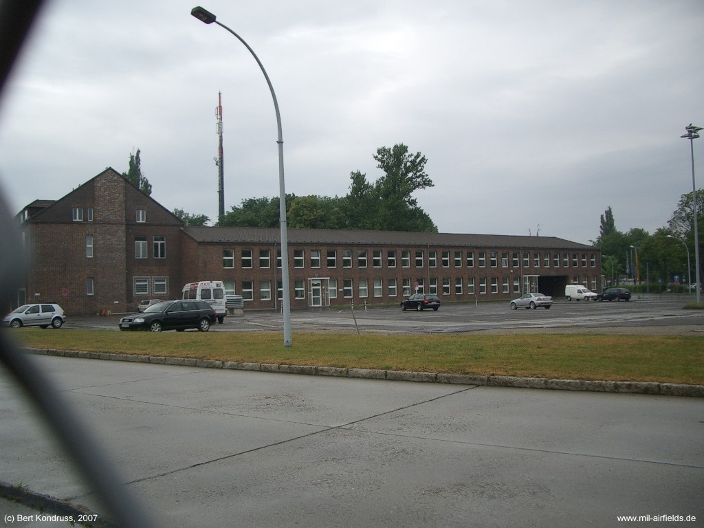
Buildings (2005)
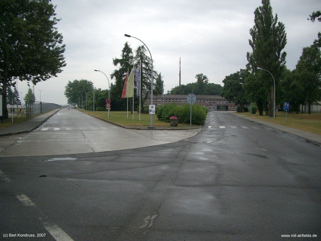
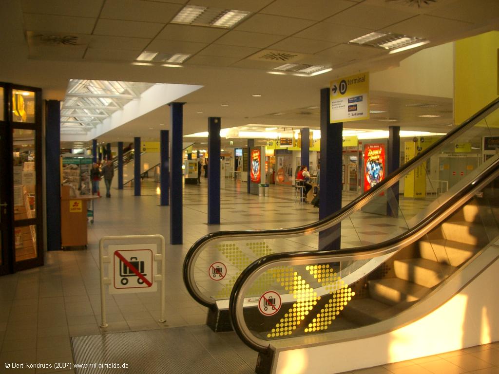
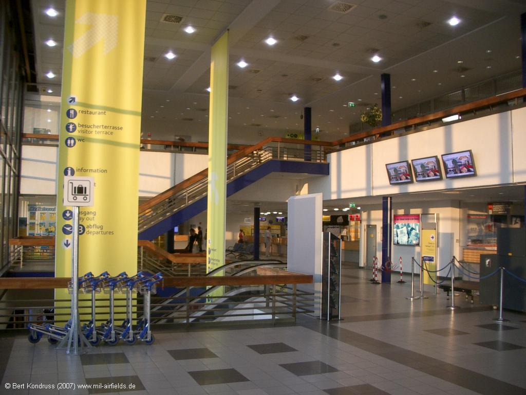
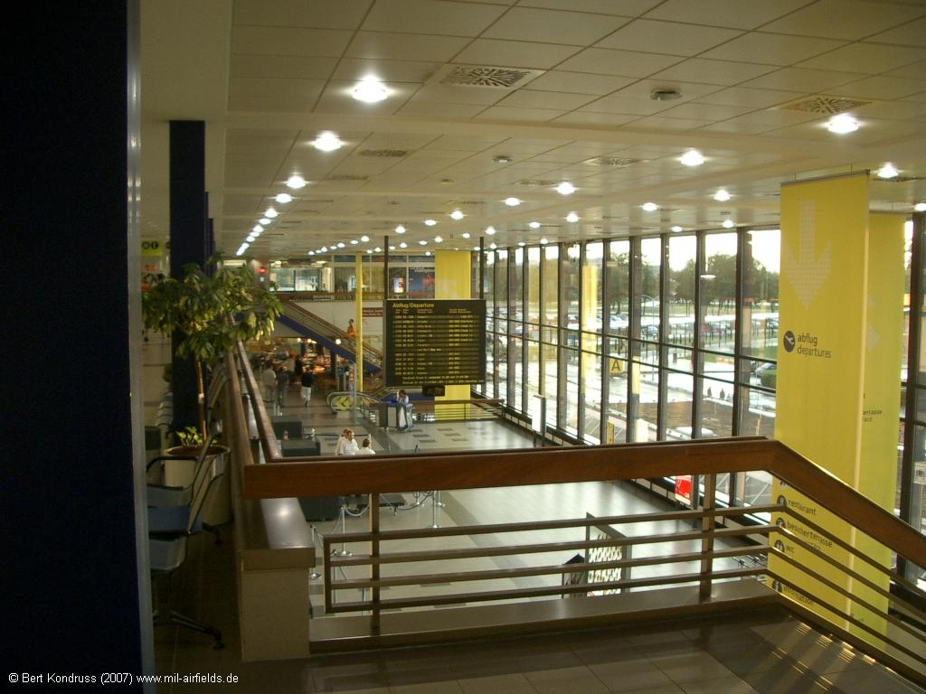
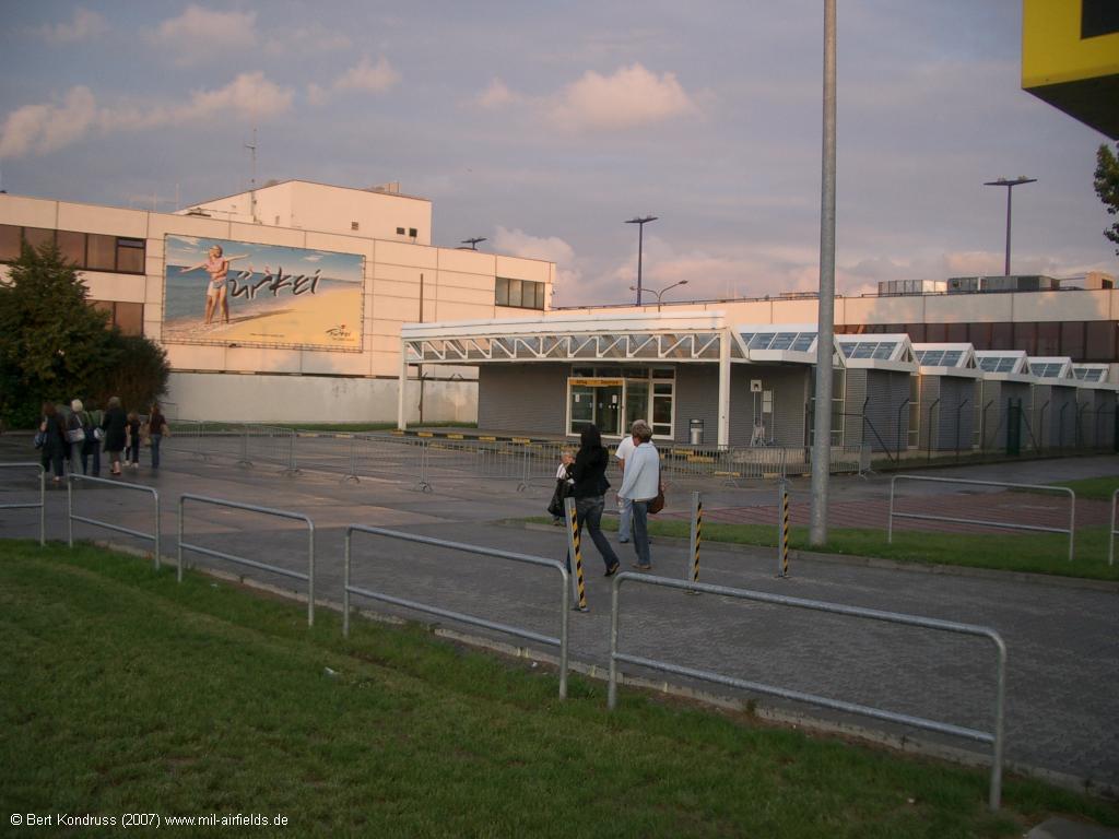
2007: Old airport, pictures of the terminal
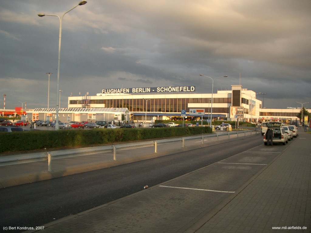
Terminal A
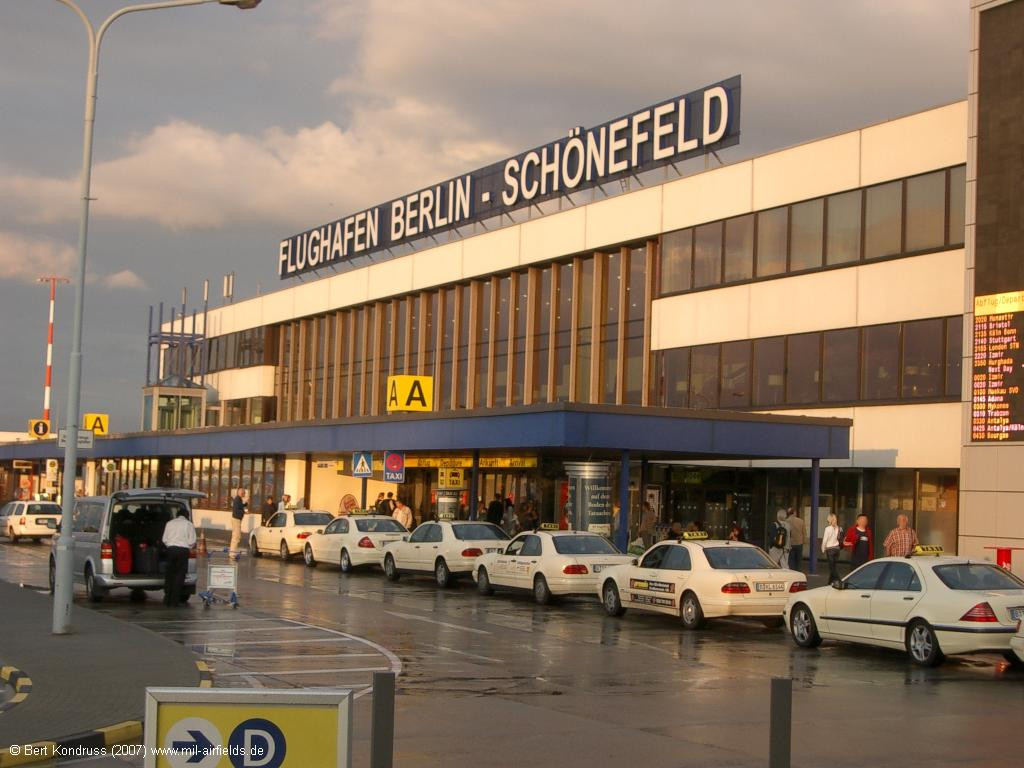
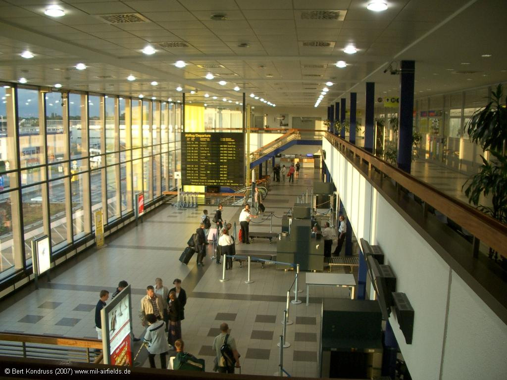
Checkin area
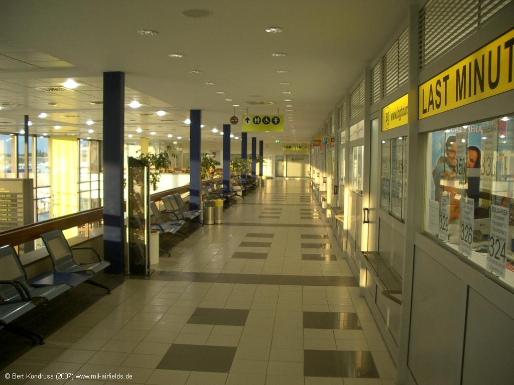
3rd floor
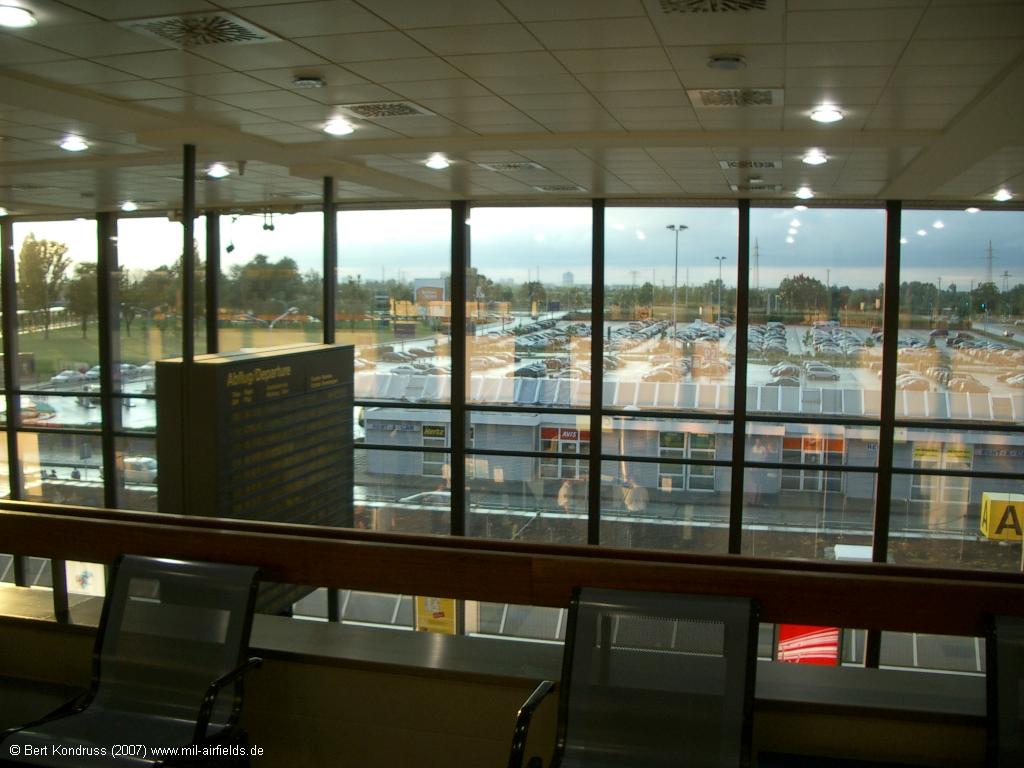
Parking
View of the departure area
Terminal C
2007: Ramp
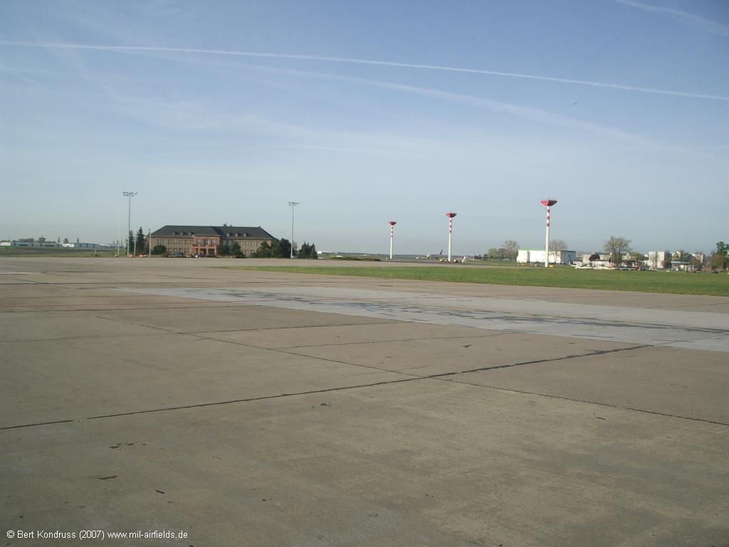
Apron with Generalshotel
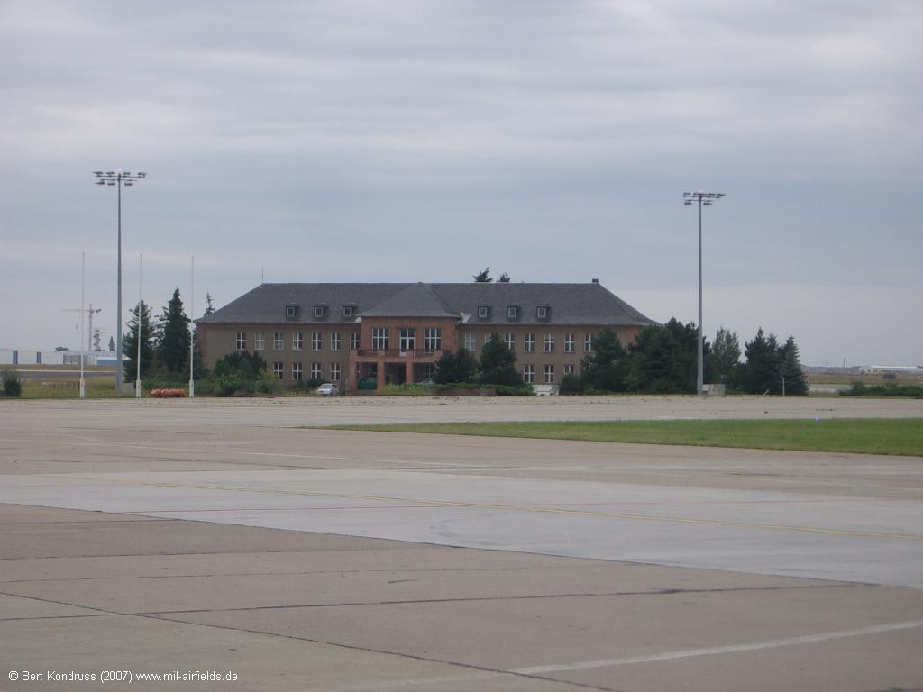
The "Generalshotel" (General's Hotel) served the greet state guests during the GDR era. In front of it was the so-called Special Ramp
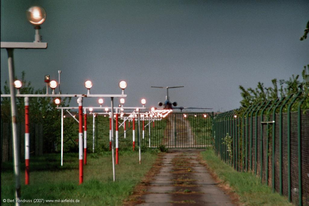
2007: Former northern runway
In 2007, the so-called northern runway 07L/25R was taken out of service. The following pictures were taken a few days before closing.
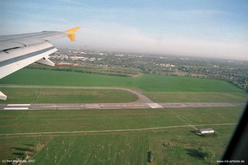
The beginning of the former northern runway 25R shortly before going out of operation in 2007.
An aircraft approaching the northern runway 25R
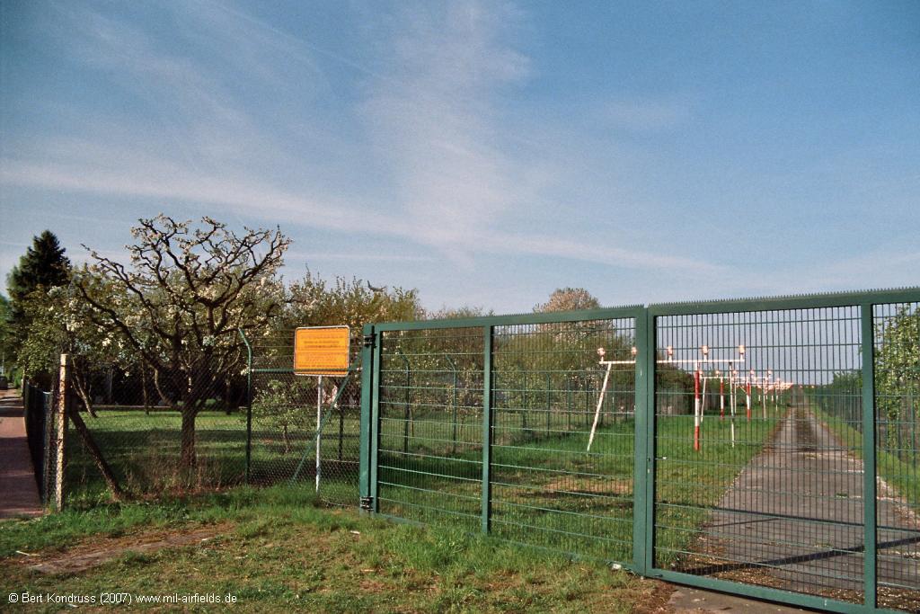
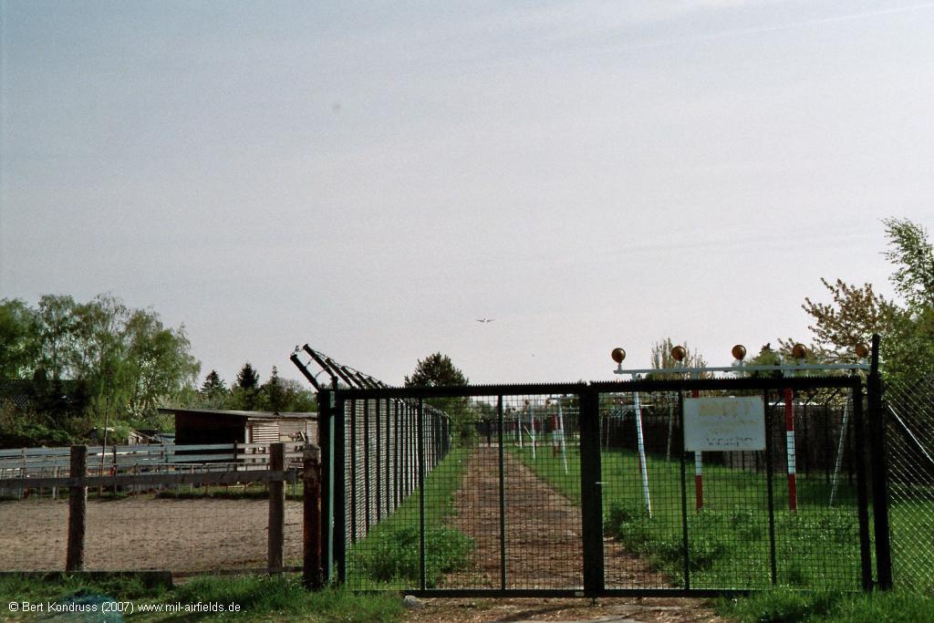
Approach lights of the former northern runway 25R in Berlin-Bohnsdorf Fliegenpilzstraße
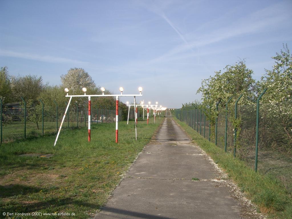
Approach lights
Aircraft before take-off on former runway 25R
Dismantled approach lights
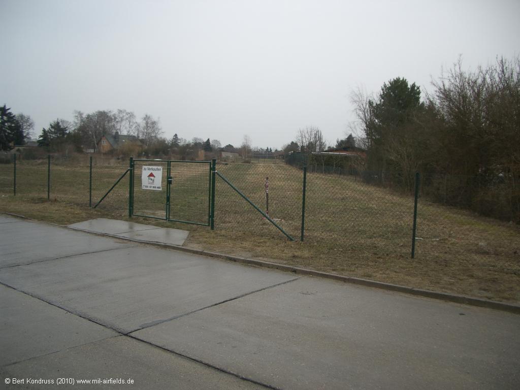
After closure of the northern runway, approach lighting has been dismantled - Berlin-Bohnsdorf, Fliegenpilzstraße, looking northeast
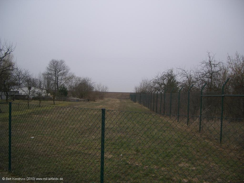
View towards the former threshold 25R
Contents
Page 1: Schönefeld Airport ← you are here
Page 2: Berlin Brandenburg Airport (BER)
Page 5: Berlin Schönefeld Airport
 Follow mil-airfields on Facebook