Linz Hörsching Airport
Vogler Air Base
Historical approach and aerodrome charts
For historical information only, do not use for navigation or aviation purposes!
| Coordinates | N481400 E0141115 (WGS84) Google Maps |
| Elevation | 978' |
| Location indicator | LOWL, LOXL |
In the 1950s
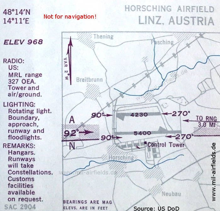
Airport (October 1950) - At this time, the airfield is operated by the US Air Force (USAF) (Source: US DoD)
Source for all maps, if not marked otherwise: US Department of Defense (US DoD)
Recommended
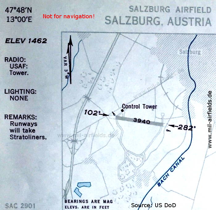
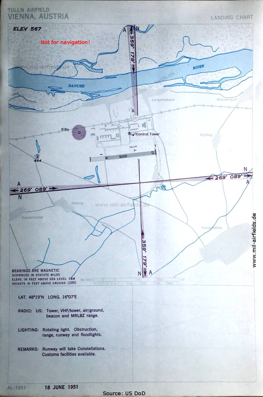
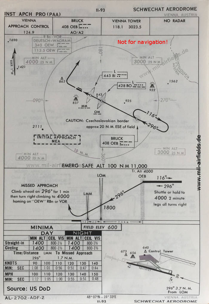
Image credits are shown on the respective target page, click on the preview to open it.
Navigation
Historical approach and aerodrome charts - Austria