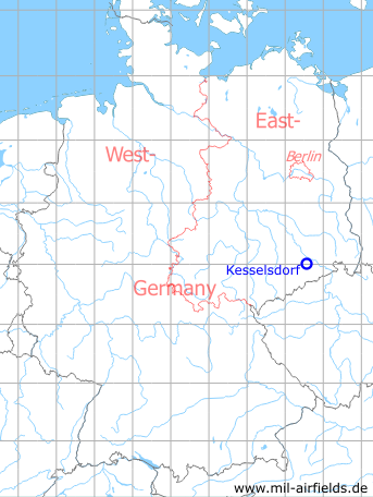
Kesselsdorf Agricultural Airfield
Historical approach and aerodrome charts East Germany
For historical information only, do not use for navigation or aviation purposes!
| Coordinates | N510156 E0133416 (WGS84) Google Maps |
| Former East Germany (GDR) | District of Dresden |
| Federal state | Sachsen (Saxony) |
| Region | Dresden, Wilsdruff |
User: Interflug Agricultural Aviation, Agrochemisches Zentrum ACZ
In the 1980s
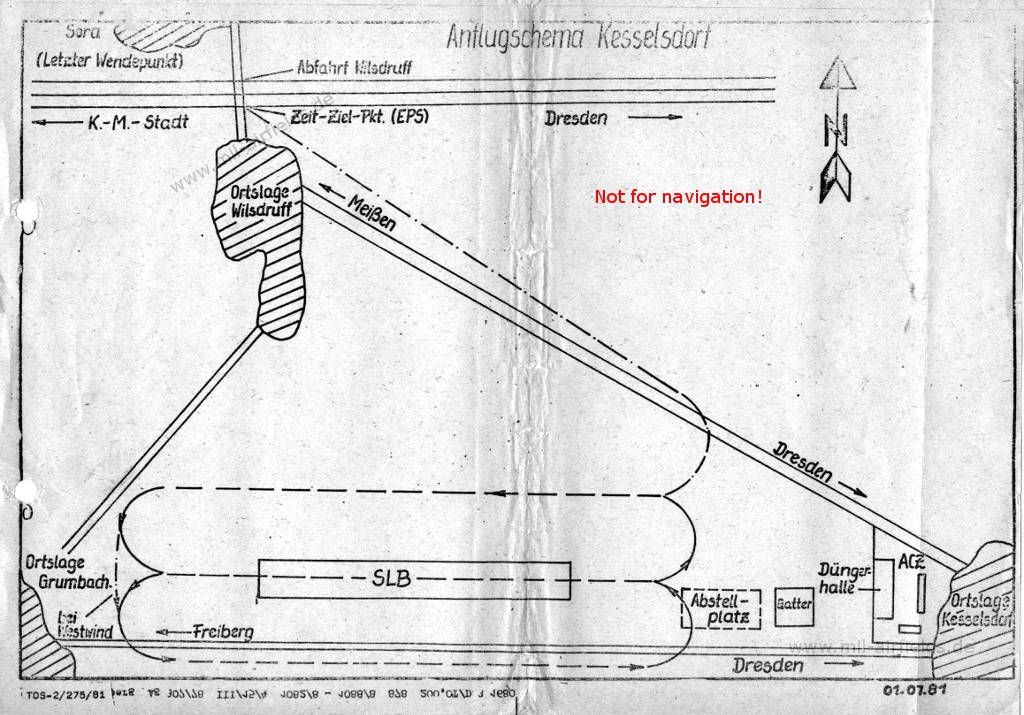
Approach chart (July 1981) - The runway shown here (SLB = Start- und Landebahn) is today crossed by the federal road 173. In the eastern part there is a helipad today. (Source: US DoD)
Index to the objects shown on the maps
Places:
- Grumbach, Kesselsdorf, Sora, Wilsdruff
Recommended
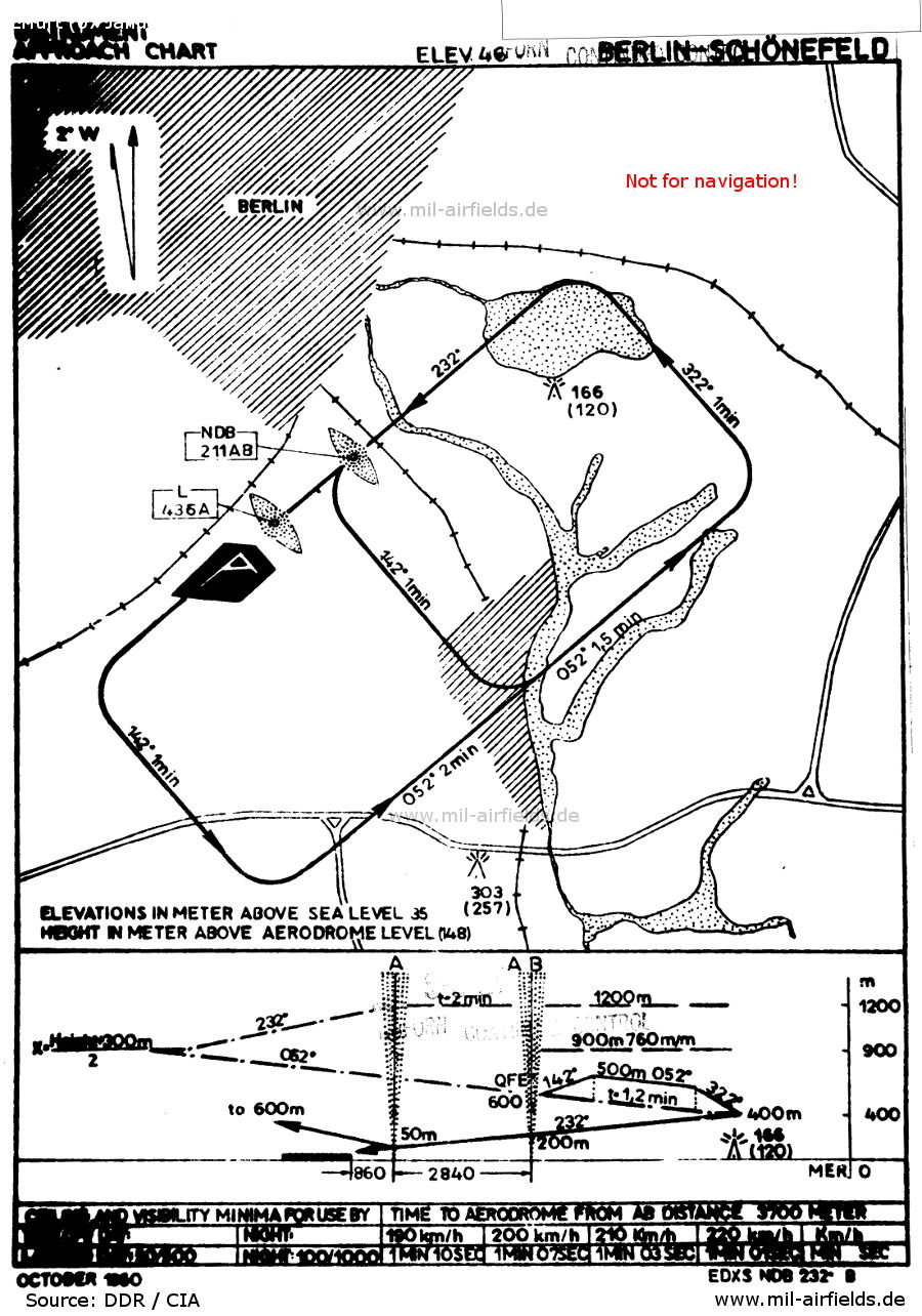

Image credits are shown on the respective target page, click on the preview to open it.
 mil-airfields.de at Facebook