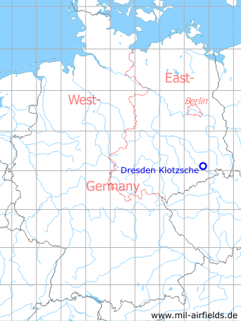
Dresden Klotzsche Airport
Dresden Airport, DRS
Historical approach and aerodrome charts East Germany
For historical information only, do not use for navigation or aviation purposes!
| Coordinates | N510804 E0134605 (WGS84) Google Maps |
| Elevation | 230 m |
| Former East Germany (GDR) | District of Dresden |
| Federal state | Sachsen (Saxony) |
| Region | Elbe |
| Location indicator | EDXD (196x), ETDN (-199x), EDDC (199x-) |
User: East German Lufthansa, Interflug, East German National People's Army
Dresden was an airport and military airfield. The largely incompatible civil and military air traffic control systems and the excessive military secrecy resulted in unusual constellations.
In the 1960s
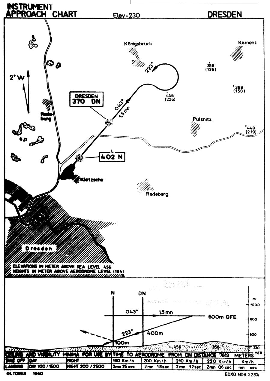
Standard NDB approach runway 22 (October 1960) - The approach leads over the two non-directional radio beacons "DN" and "N". (Source: DDR / CIA)
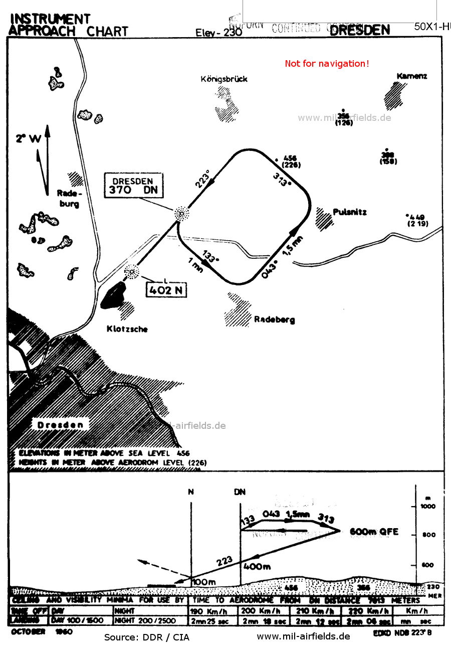
NDB approach runway 22 (October 1960) - Approach with a "small box". (Source: DDR / CIA)
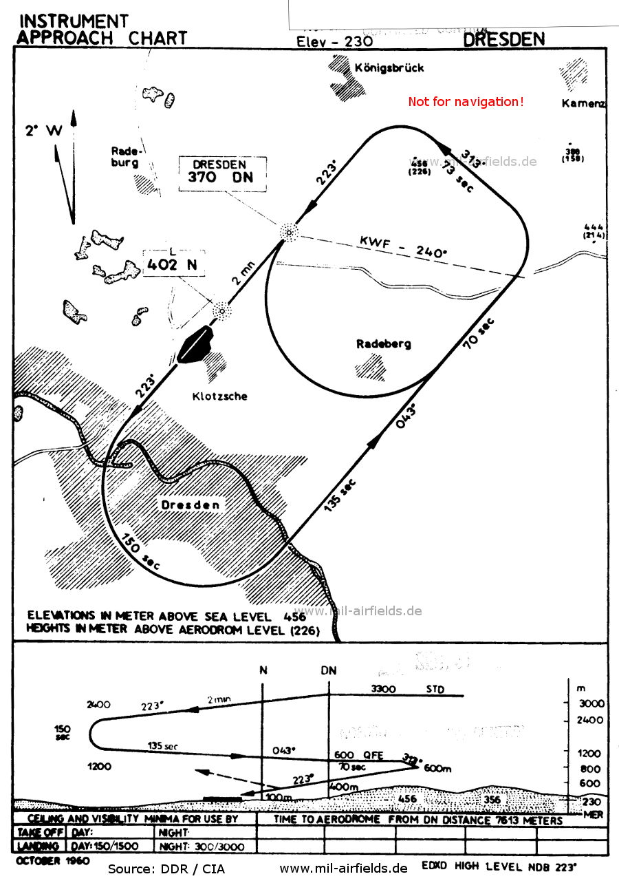
High NDB approach runway 22 (October 1960) - The approach starts at Flight Level 3300 m (3300 STD) and leads first in the large loop down to a height of 600 m above the airfield (600 QFE). (Source: DDR / CIA)
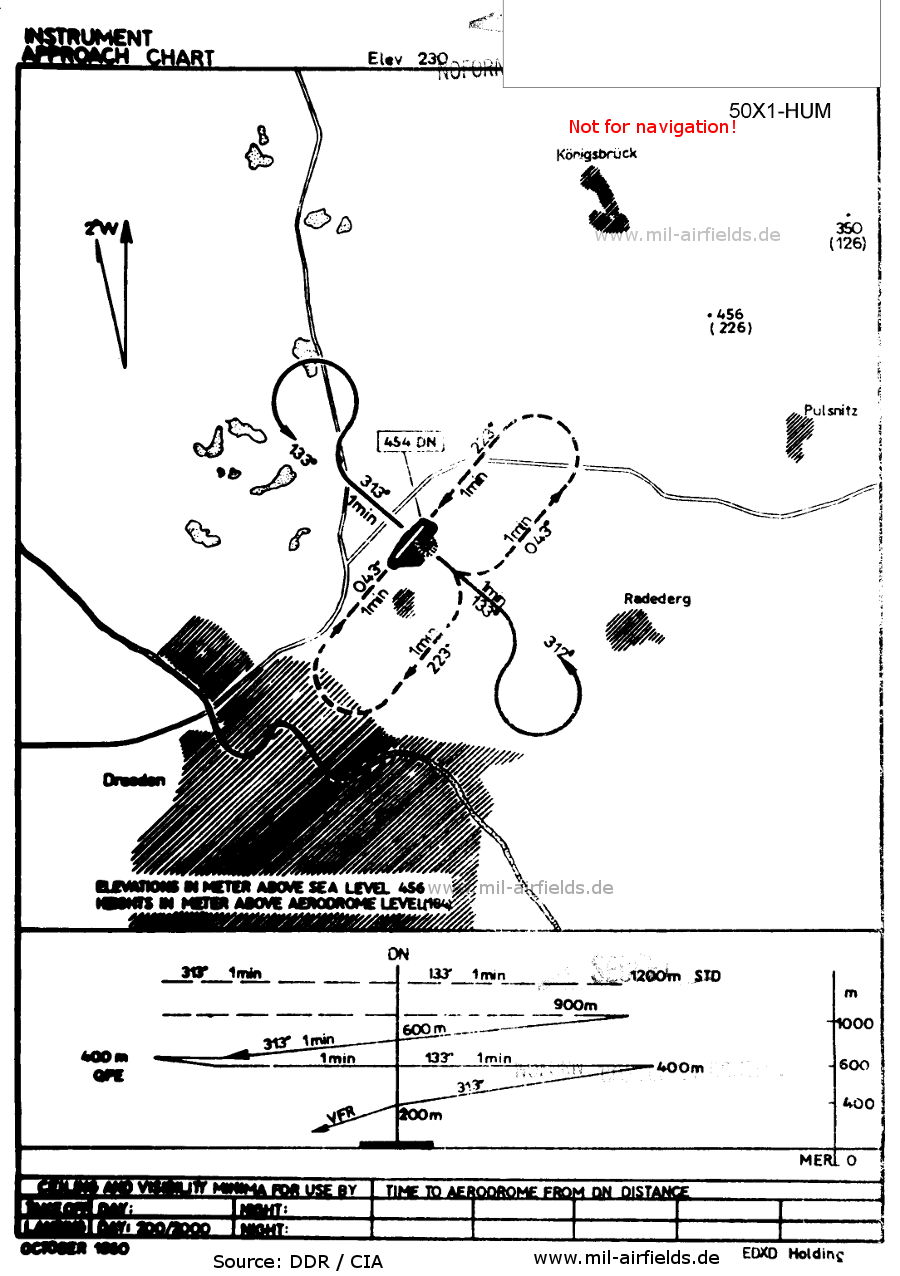
Holding pattern (October 1960) - Over the airfield beacon, which also has the ident "DN". (Source: DDR / CIA)
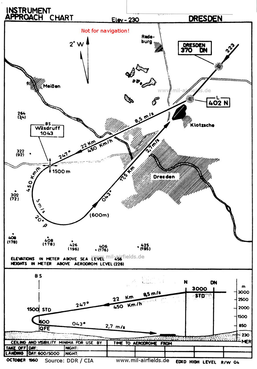
High NDB approach runway 04 (October 1960) - The approach starts at Flight Level 3000 m (3000 STD) and continues via the Wilsdruff broadcasting station (BS). (Source: DDR / CIA)
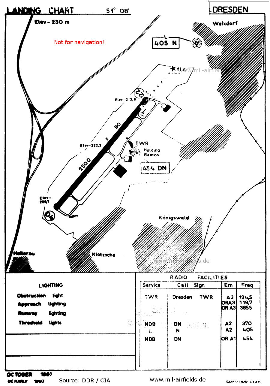
Airport (October 1960) - The runway is unusually wide at 80 metres. At the beginning of the approach lighting in the northeast is a red beacon. (Source: DDR / CIA)
1989/1990
Maps from the "Directory 012" (Verzeichnis 012), containing aeronautical information about military airfields of the former East Germany National People's Army (NVA) and Border Troops (GT). The document was classified as "Secret".
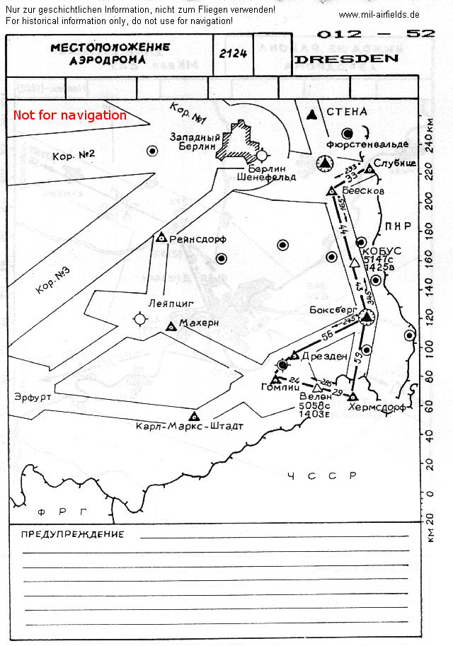
Location of the airfield within East Germany - Shown on the left and top are the three corridors to and from Berlin and the Berlin Control Zone as a circle. On the right and bottom is the system of airways in the southern part of the GDR. (Source: NVA)
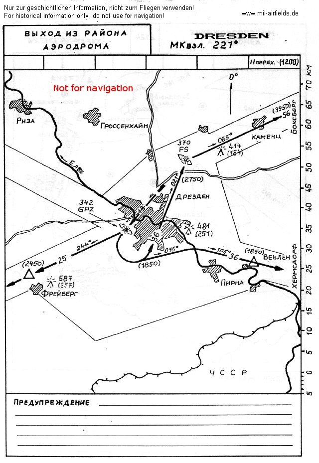
Departure routes in take-off direction 22 - Take-off to the southwest, en route to airways B52 and B51, but not towards Leipzig. (Source: NVA)
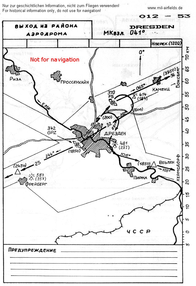
Departure routes in take-off direction 04 - Take-off to the northeast, en route to airways B52 and B51, but not towards Leipzig. (Source: NVA)
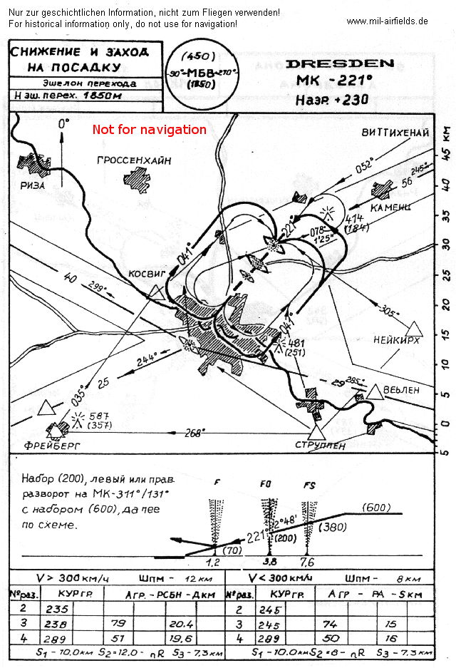
Approach in primary landing direction 22 - Approaching from the northeast there are three non-directional beacons, which result from overlapping of the civil system (beacons FS and F) and the military system (beacons FO and F). In addition, fine lines show the visual approaches from the local flying routes via the points Freiberg, Struppen, Neukirch and Coswig. (Source: NVA)
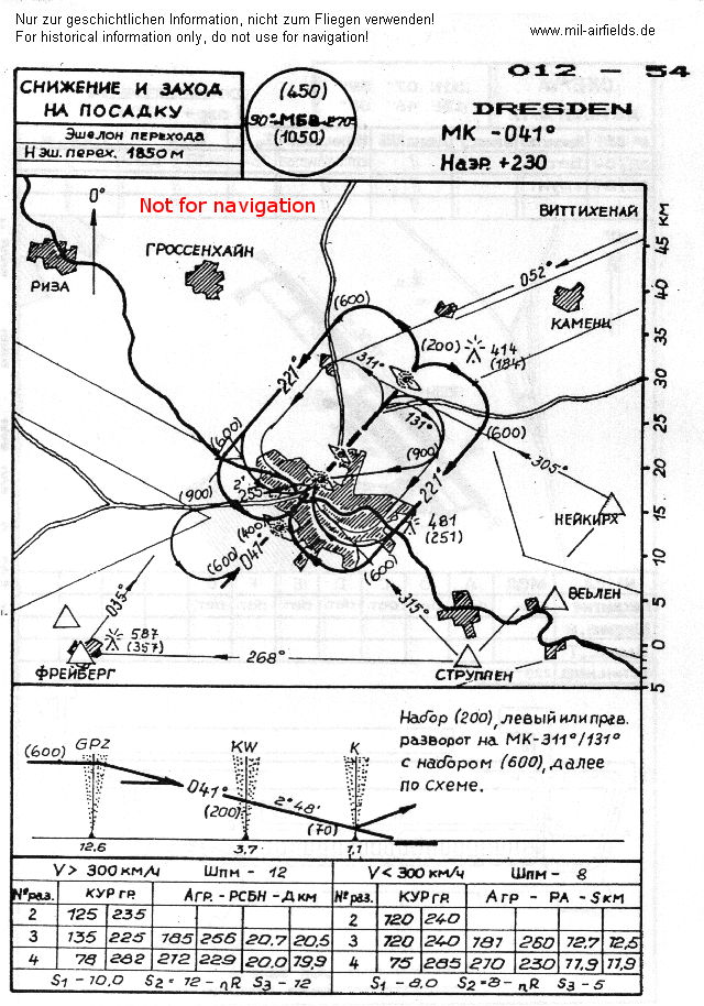
Approach in secondary landing direction 04 - Approaching from southwest there are also three beacons: civil (GPZ and K) and military (KW and K). The airways B51, B52 and approach 04 meet at the Gompitz GPZ radio beacon. (Source: NVA)
Index to the objects shown on the maps
Radio beacons:
- Dresden Locator "DN", "F", "FO", "FS", "K", "KW", "N"
- Dresden Fernfunkfeuer "FO", "KW", Nahfunkfeuer "F", "K"
- Dresden RSBN "FO"
- Gompitz NDB "GPZ"
Air traffic control:
- Dresden Approach, Dresden Tower
- Figaro Start
Places:
- Dresden, Hellerau, Kamenz, Klotzsche, Königsbrück, Königswald, Meißen, Pulsnitz, Radeberg, Radeburg, Weixdorf, Wilsdruff
Recommended
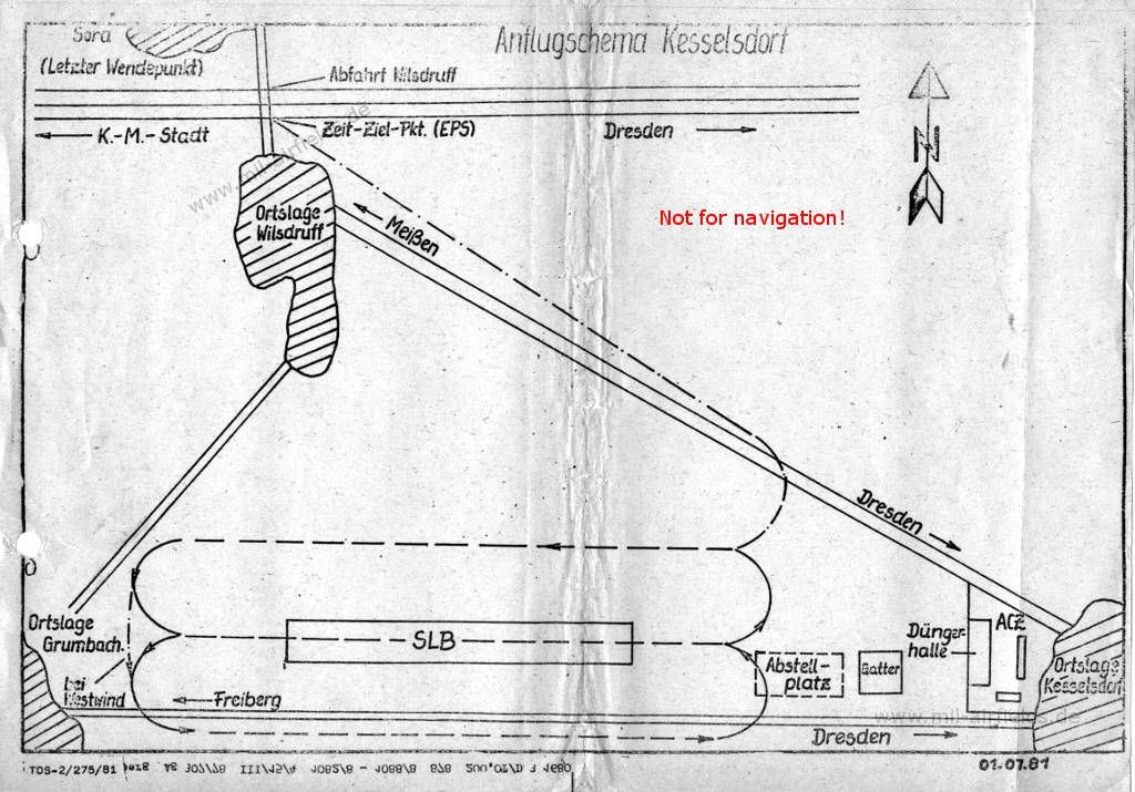
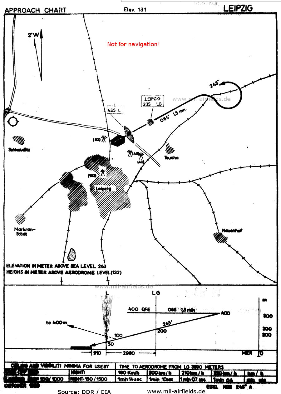


Image credits are shown on the respective target page, click on the preview to open it.
 mil-airfields.de at Facebook