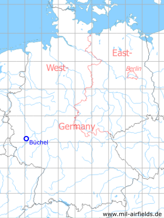
Büchel Air Base, Germany
Historical approach and aerodrome charts
For historical information only, do not use for navigation or aviation purposes!
| Coordinates | N501027 E0070349 (WGS84) Google Maps |
| Elevation | 1568 ft |
| Federal state | Rheinland-Pfalz (Rhineland-Palatinate) |
| Region | Eifel |
| Location indicator | EDSB (196x-1995), ETSB (1995-) |
| Operator | Luftwaffe / German Air Force (GAF) |
In the 1960s
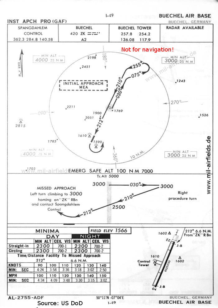
NDB approach runway 22 (October 1960) (Source: US DoD)
Index to the objects shown on the maps
Radio beacons with identifier:
- Büchel NDB "ZK"
Air traffic control / Communications:
- Buechel Tower
- Spangdahlem Control
Source for all maps, if not marked otherwise: US Department of Defense (US DoD)
Recommended
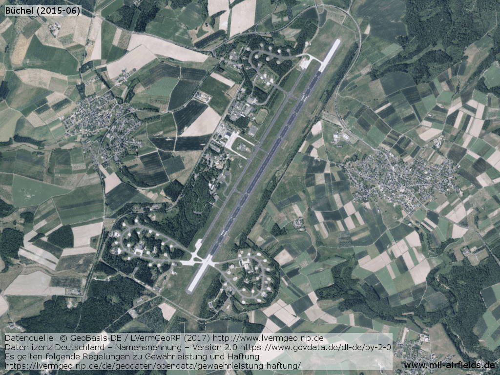
Image credits are shown on the respective target page, click on the preview to open it.
Navigation
Approach and airfield charts - Federal Republic of Germany