Fürstenfeldbruck Air Base / Airfield
Fürstenfeldbruck Airfield
Historical approach charts and maps
For historical information only, do not use for navigation or aviation purposes!
| Coordinates | N481220 E0111605 (WGS84) Google Maps |
| Elevation | 1703 ft |
| Federal state | Bayern (Bavaria) |
| Location indicator | DEFF (195x), EDSF (196x-1995), ETSF (1995-) |
Location Indicator: DBFF (USAF); DEFF, EDSF, ETSF (GAF)
User: US Air Force (USAF), German Air Force (GAF)
In the 1950s
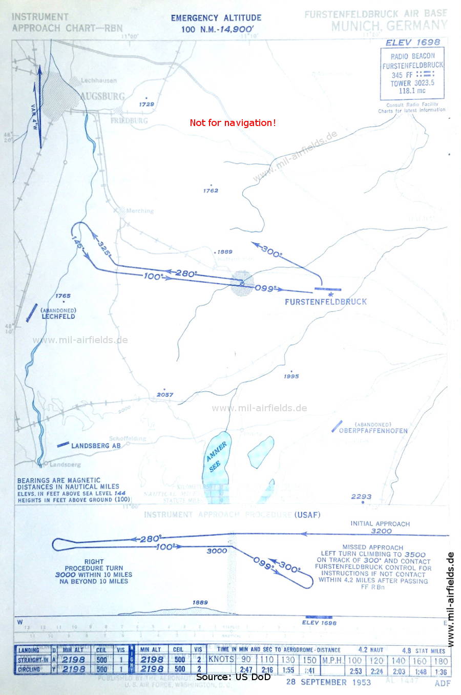
NDB approach chart (September 1953) - Airfields in the vicinity: Landsberg, Lechfeld (closed), Oberpfaffenhofen (closed). (Source: US DoD / USAF)
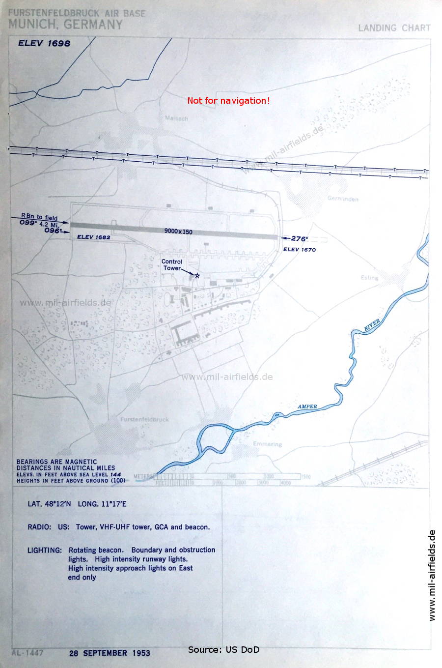
Aerodrome map (September 1953) - At this time, the field is operated by US troops. The runway length is shown with 2,743 m (9,000 feet). (Source: US DoD / USAF)
In the 1960s
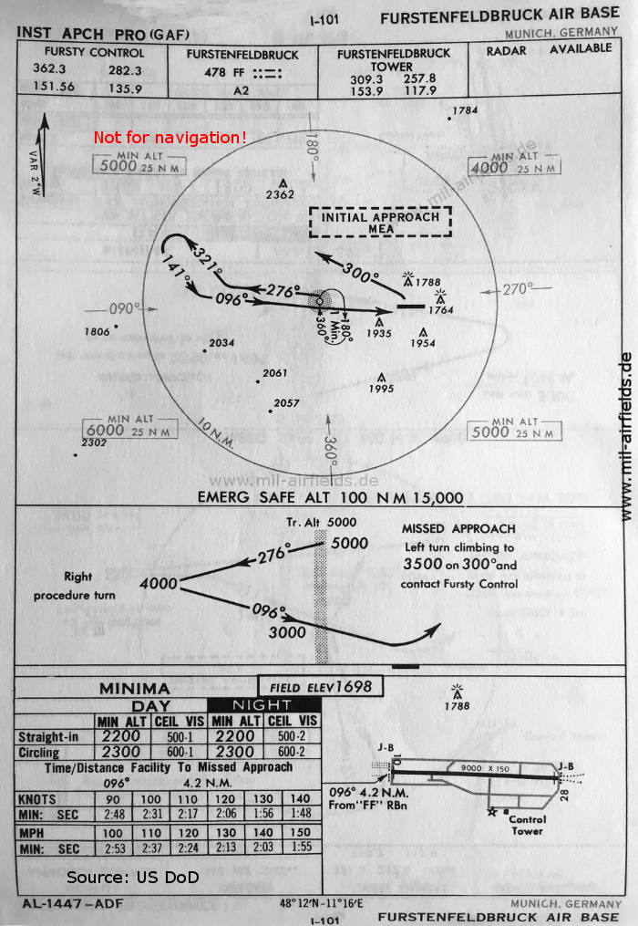
NDB approach runway 10 (October 1960) (Source: US DoD)
Source for all maps, if not marked otherwise: US Department of Defense (US DoD)
Recommended
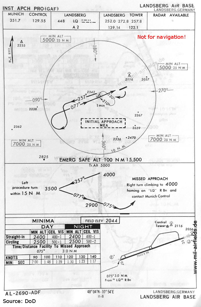

Image credits are shown on the respective target page, click on the preview to open it.