Landsberg Air Base, Germany
Penzing
Historical approach and aerodrome charts
For historical information only, do not use for navigation or aviation purposes!
| Coordinates | N480414 E0105422 (WGS84) Google Maps |
| Federal state | Bayern (Bavaria) |
| Location indicator | DELB (195x), EDSA (196x-199x), ETSA (199x-) |
Airfield
Region:
Bayern (Bavaria)
Location Indicator:
DBLB (USAF); DELB, EDSA, ETSA (GAF)
User:
US Air Force (USAF), German Air Force (GAF)
In the 1950s
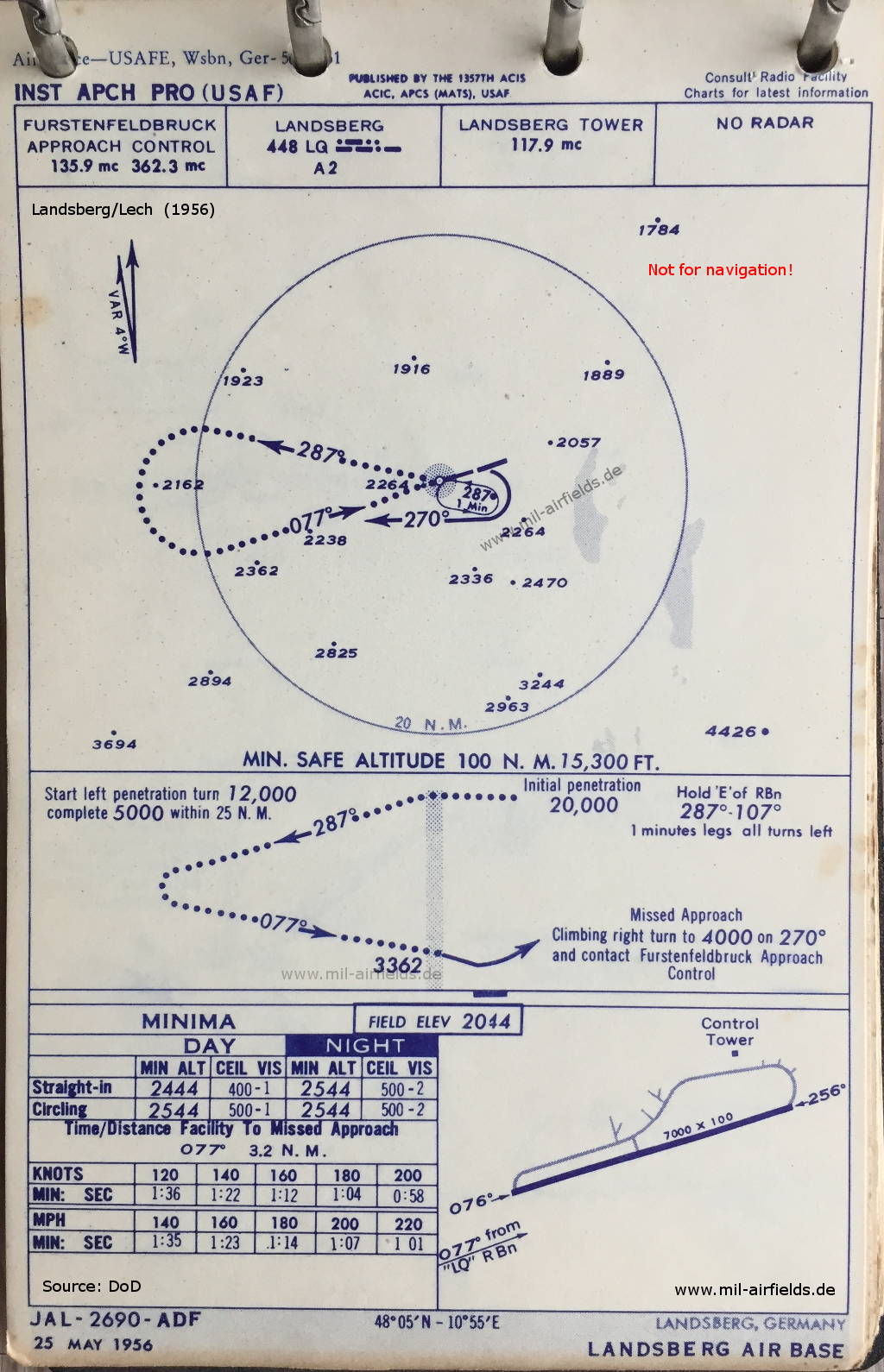
Instrument Approach Procedure, US Air Force (May 1956) - This is a jet approach that starts at a high altitude (20000 feet). There is one runway - 076/256: length 2133 m, width 30 m (7000 feet x 100 feet). (Source: DoD)
In the 1960s
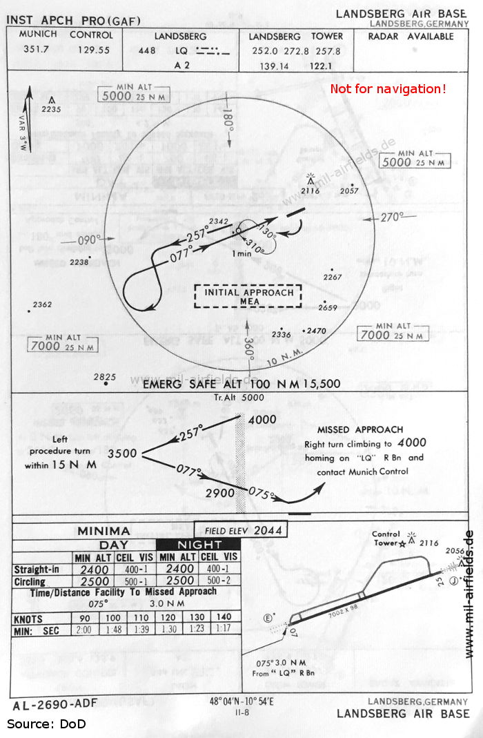
NDB approach runway 07 (May 1966) - Now the runway is shown as - 07/25: length 2134 m, width 30 m (7002 feet x 98 feet). (Source: DoD)
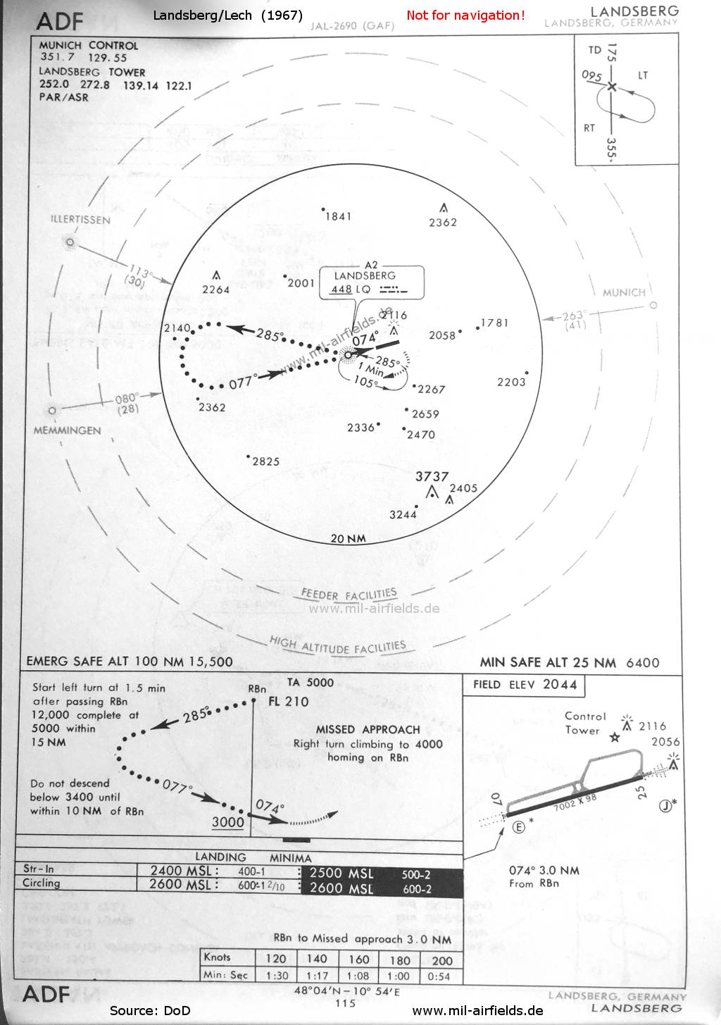
HI NDB Approach runway 07 (1967) - Jet approach that starts at high altitude (FL 210 = Flight Level 210 = 21000 feet) (Source: DoD)
Index to the objects shown on the maps
Radio beacons:
- Landsberg NDB "LQ"
Air traffic control
- Fürstenfeldbruck Approach Control
- Landsberg Tower
- Munich Control
Source for all maps, if not marked otherwise: US Department of Defense (US DoD)
Recommended
Image credits are shown on the respective target page, click on the preview to open it.
Navigation
Approach and airfield charts - Federal Republic of Germany