Ingolstadt/Manching Air Base
Historical approach and aerodrome charts
For historical information only, do not use for navigation or aviation purposes!
Airfield
Region: Bayern, Oberbayern, Donau
Location indicator: EDSI, ETSI
User: German Air Force
In the 1960s
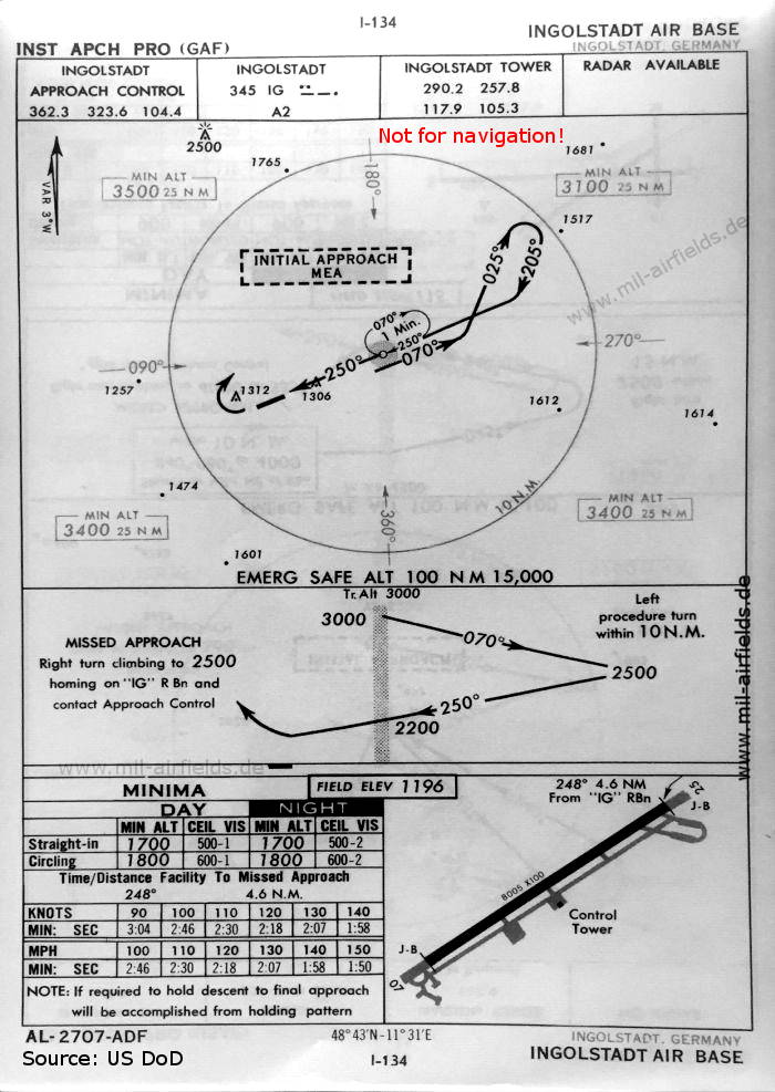
NDB approach runway 25 (October 1960) - There is one runway - 07/25: length 2440 m, width 30 m (8005 feet x 100 feet). (Source: US DoD)
Index to the objects shown on the maps
Radio beacons:
- Ingolstadt NDB "IG"
Air traffic control
- Ingolstadt Approach Control, Ingolstadt Tower
Source for all maps, if not marked otherwise: US Department of Defense (US DoD)
Recommended


Image credits are shown on the respective target page, click on the preview to open it.
 mil-airfields.de at Facebook