Palma de Mallorca Son Sant Joan Airport
Son San Juan
Historical approach and aerodrome charts
Aeroport de Son Sant Joan / Son San Juan - Cartas de aproximación históricos
For historical information only, do not use for navigation or aviation purposes!
| Coordinates | N393302 E0024410 (WGS84) Google Maps |
Airfield
Location Indicator: LEPA
In the 1950s
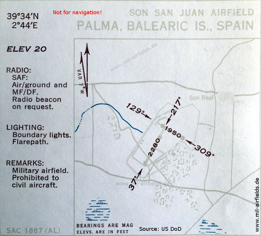
Airfield map (October 1950)
Two paved runways are shown: 594 m (1,950 feet) and 695 m (2,280 feet) long.
(Source: US DoD)
Two paved runways are shown: 594 m (1,950 feet) and 695 m (2,280 feet) long.
(Source: US DoD)
In the 1960s
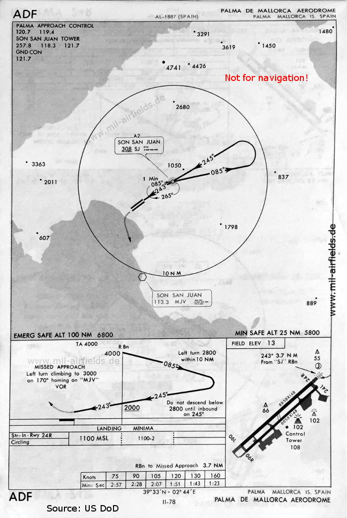
NDB approach runway 24 (May 1966)
Were there really two locator beacons close together? ('SJ' 3.7 nautical miles and LOM 'PA' 4.2 nautical miles from the runway threshold?)
(Source: US DoD)
Were there really two locator beacons close together? ('SJ' 3.7 nautical miles and LOM 'PA' 4.2 nautical miles from the runway threshold?)
(Source: US DoD)
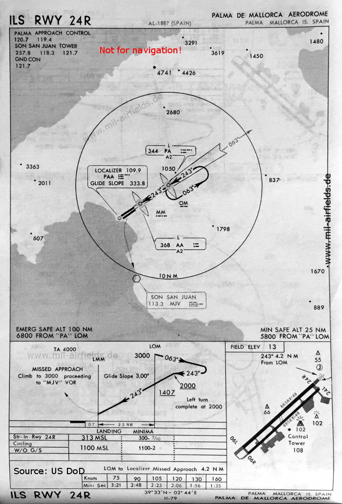
ILS approach runway 24R (May 1966)
There are two parallel runways 06L/24R and 06R/24L, each with 2700 m x 45 m (8858 feet x 148 feet)
(Source: US DoD)
There are two parallel runways 06L/24R and 06R/24L, each with 2700 m x 45 m (8858 feet x 148 feet)
(Source: US DoD)
Index to the objects shown on the maps
Aerodromes / Aeropuertos
- Palma de Mallorca
Radio beacons / Radiofaro:
- Son San Juan VOR "MJV", Locator "SJ", "PA", "AA", ILS "PAA", Outer Marker, Middle Marker
Air traffic control / Control del tráfico aéreo:
- Palma Approach Control, Son San Juan Tower, Ground Control
Source for all maps, if not marked otherwise: US Department of Defense (US DoD)
Recommended

Image credits are shown on the respective target page, click on the preview to open it.
 mil-airfields.de at Facebook