Erding Air Base, Germany
Erding Air Depot
Historical approach charts
For historical information only, do not use for navigation or aviation purposes!
| Coordinates | N481920 E0115655 (WGS84) Google Maps |
| Elevation | 1514 ft |
| Federal state | Bayern (Bavaria) |
| Location indicator | DBED (USAF); DEED, EDSE, ETSE (Luftwaffe) |
| Operator | US Air Force (USAF), Deutsche Luftwaffe |
Erding is a former air base in Bavaria, Germany. After World War II it was used by the US Air Force, later by the German Air Force. Today the field is closed.
In the 1950s
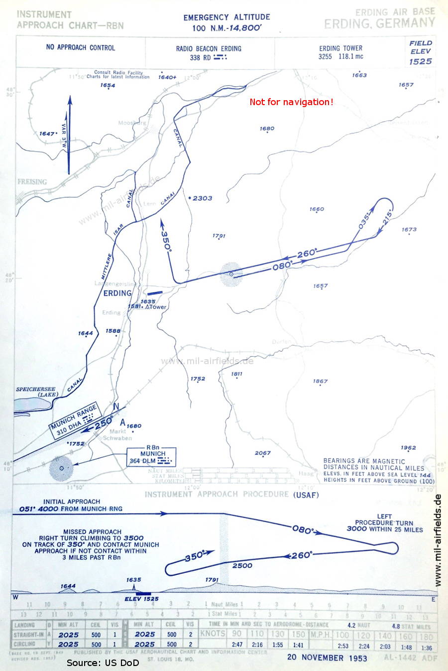
NDB approach runway 26 (November 1953) (Source: US DoD)
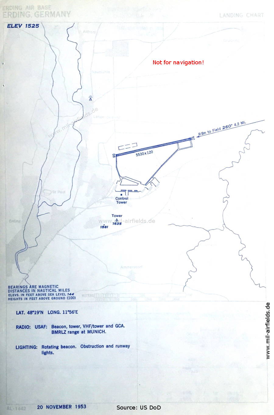
Aerodrome chart (November 1953) - At this time, the airfield is operated by the US Air Force (USAF) There is one runway - 08/26: length 1685 m, width 37 m (5530 feet x 120 feet). (Source: US DoD)
In the 1960s
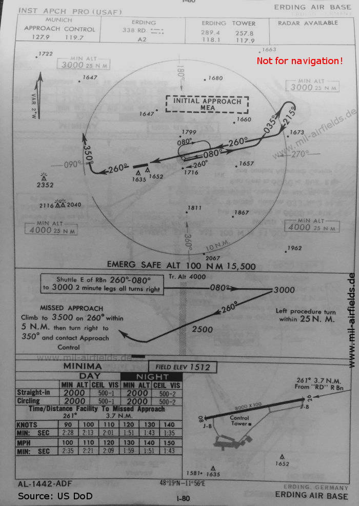
NDB approach runway 26 (October 1960) (Source: US DoD)
Index to the objects shown on the maps
Radio beacons:
- Erding NDB "RD"
- München NDB "DLM"
Air traffic control:
- Erding Tower
- Munich Approach Control
Places:
- Altham, Dorfen, Freising, Haag, Langengeisling, Lern, Markt Schwaben, Moosburg an der Isar, St. Paul
Source for all maps, if not marked otherwise: US Department of Defense (US DoD)
Recommended

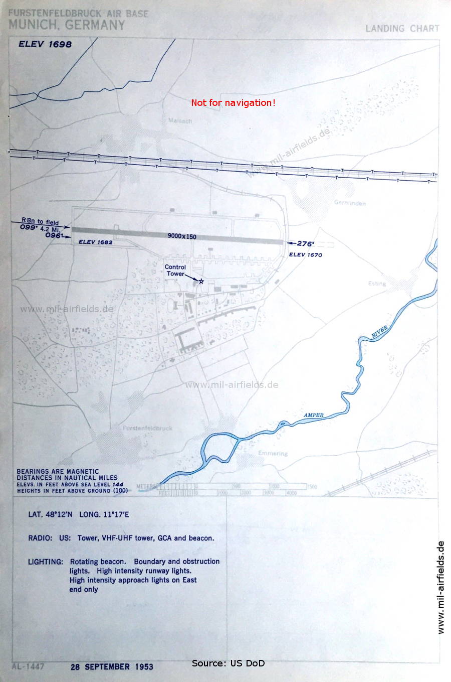
Image credits are shown on the respective target page, click on the preview to open it.
Navigation
Approach and airfield charts - Federal Republic of Germany