Memmingen Air Base
Memmingerberg, Memmingen Airport, Allgäu Airport
Historical approach and aerodrome charts
For historical information only, do not use for navigation or aviation purposes!
| Coordinates | N475920 E0101421 (WGS84) Google Maps |
| Elevation | 2079 ft |
| Federal state | Bayern (Bavaria) |
| Location indicator | EDSM (-1995), ETSM (1995-2002), EDJA |
Location Indicator: DEMM, EDSM, ETSM (GAF), EDJA (civ, Memmingen Allgäu Airport)
User: German Air Force (GAF), civil
In the 1960s
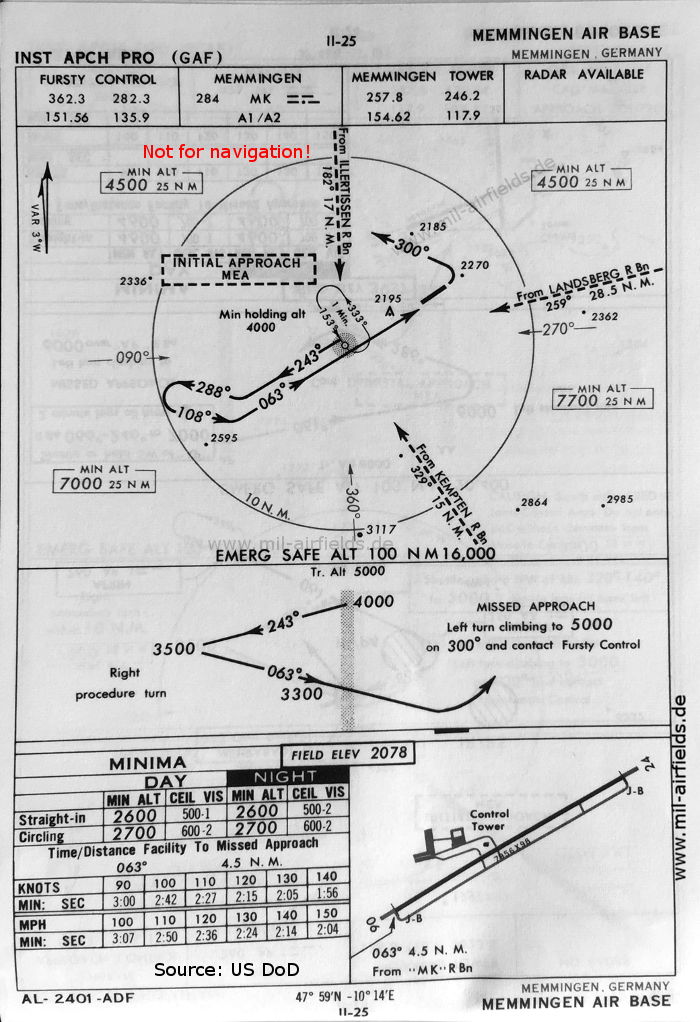
NDB approach (October 1960) - Approach control is provided by "Fursty Control". (Source: US DoD)
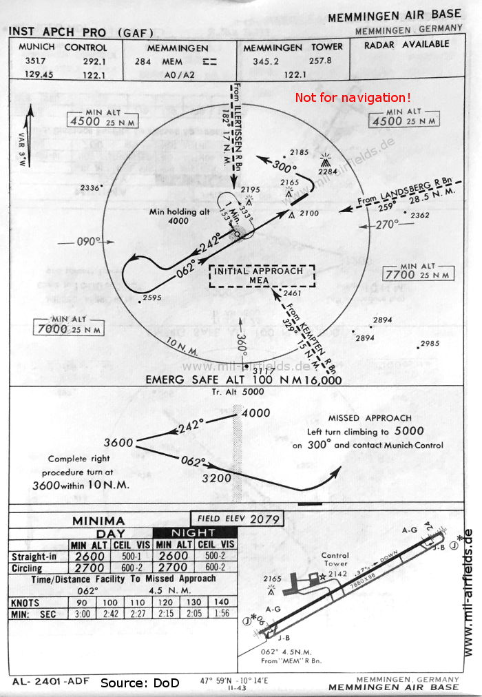
NDB approach runway 06 (May 1966) - Approach control is now provided by Munich. (Source: DoD)
Source for all maps, if not marked otherwise: US Department of Defense (US DoD)
Recommended
Image credits are shown on the respective target page, click on the preview to open it.
Navigation
Approach and airfield charts - Federal Republic of Germany