Sembach Air Base
Sembach Air Base
Historical approach charts
For historical information only, do not use for navigation or aviation purposes!
| Coordinates | N493023 E0075150 (WGS84) Google Maps |
| Elevation | 1052 ft |
| Federal state | Rheinland-Pfalz (Rhineland-Palatinate) |
| Location indicator | EDAS (1990) |
Location Indicator: DBSB, EDAS
User: US Air Force (USAF)
In the 1950s
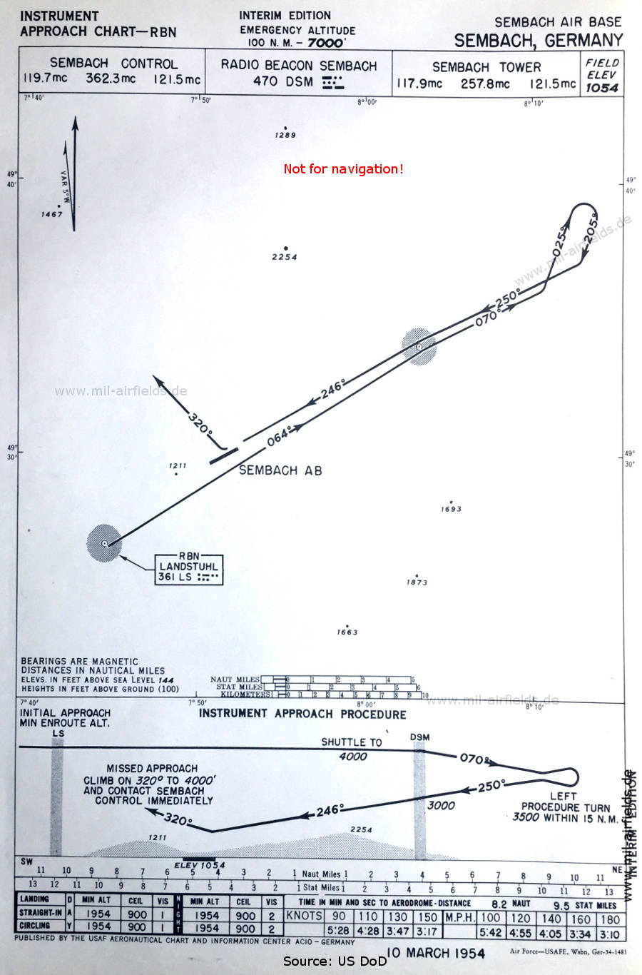
NDB approach (March 1954) - Interim edition (Source: US DoD)
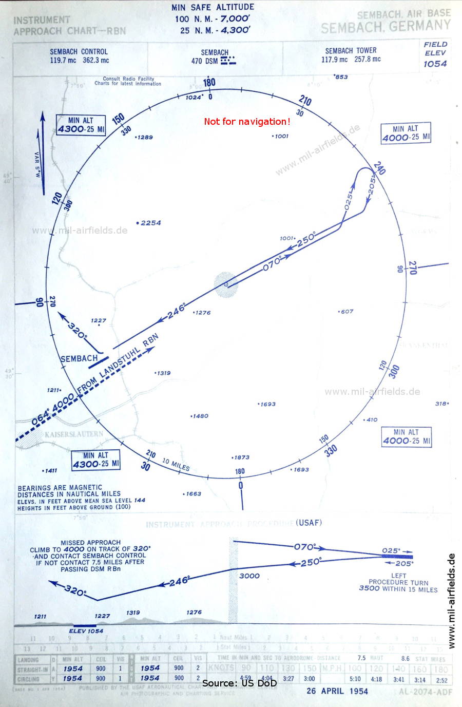
NDB approach (April 1954) (Source: US DoD / USAF)
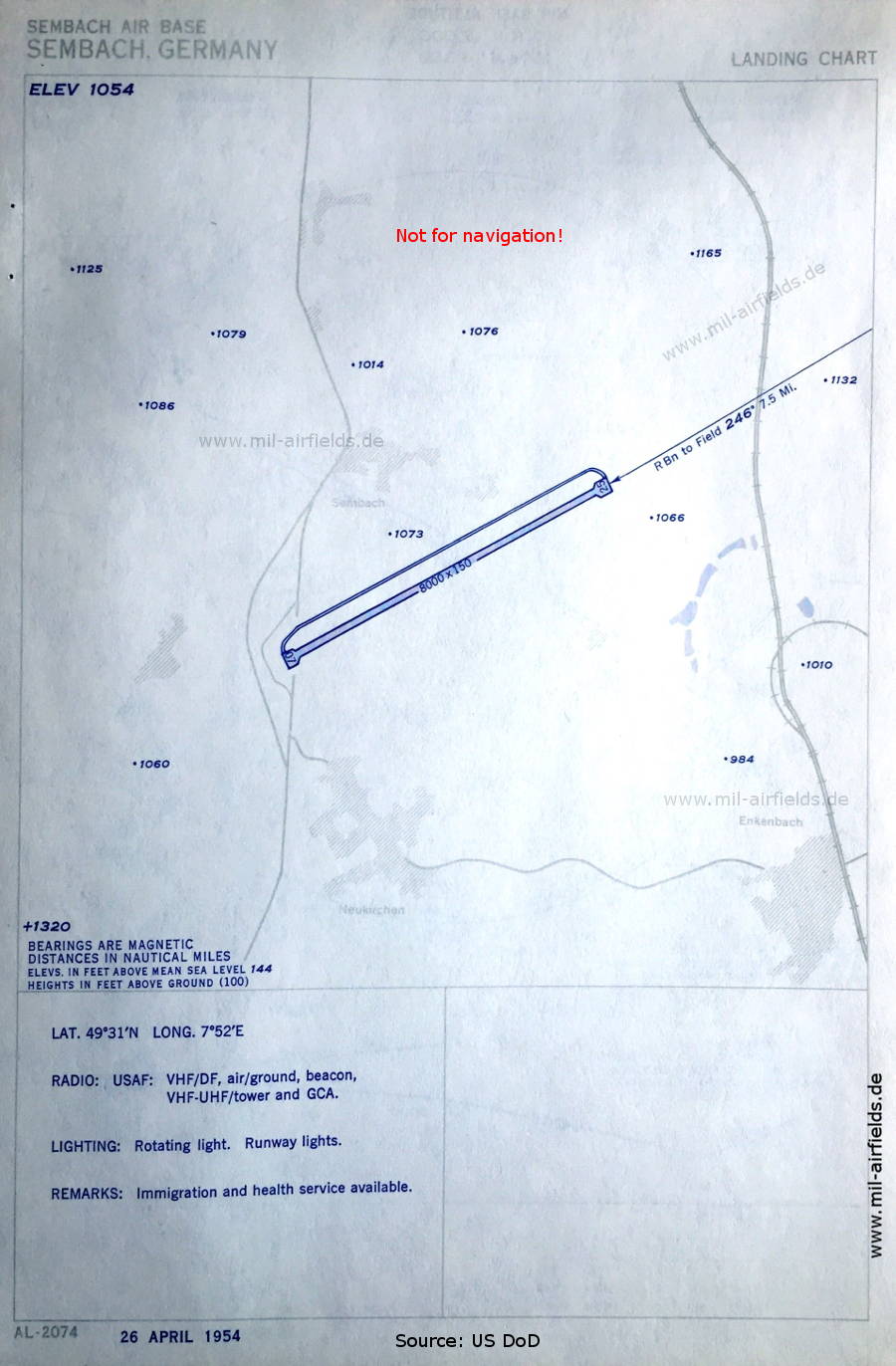
Aerodrome chart (April 1954) (Source: US DoD / USAF)
In the 1960s
NDB approach runway 25 (October 1960) (Source: US DoD)
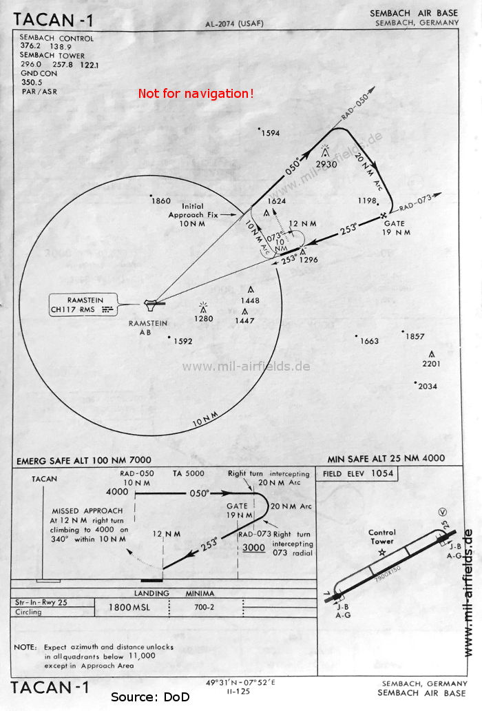
TACAN approach runway 25 (May 1966) - The procedure uses the Ramstein TACAN. (Source: US DoD)
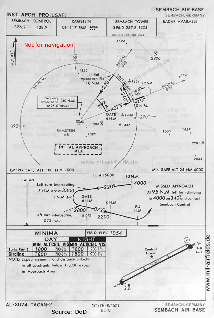
TACAN approach runway 07 (May 1966) - The procedure uses the Ramstein TACAN. (Source: US DoD)
Source for all maps, if not marked otherwise: US Department of Defense (US DoD)
Recommended
Image credits are shown on the respective target page, click on the preview to open it.
Navigation
Approach and airfield charts - Federal Republic of Germany