Zweibrücken Air Base
Historical approach charts
For historical information only, do not use for navigation or aviation purposes!
| Coordinates | N491234 E0072402 (WGS84) Google Maps |
| Elevation | 1133 ft |
| Location indicator | EDAM (1990), EDRZ (2000) |
Location Indicator: DFZB (RCAF), EDAM (RCAF/CF, USAF), EDRZ (civ)
Users: Royal Canadian Air Force (RCAF), Canadian Forces (CF), US Air Force (USAF), civil airport / airfield.
In the 1960s
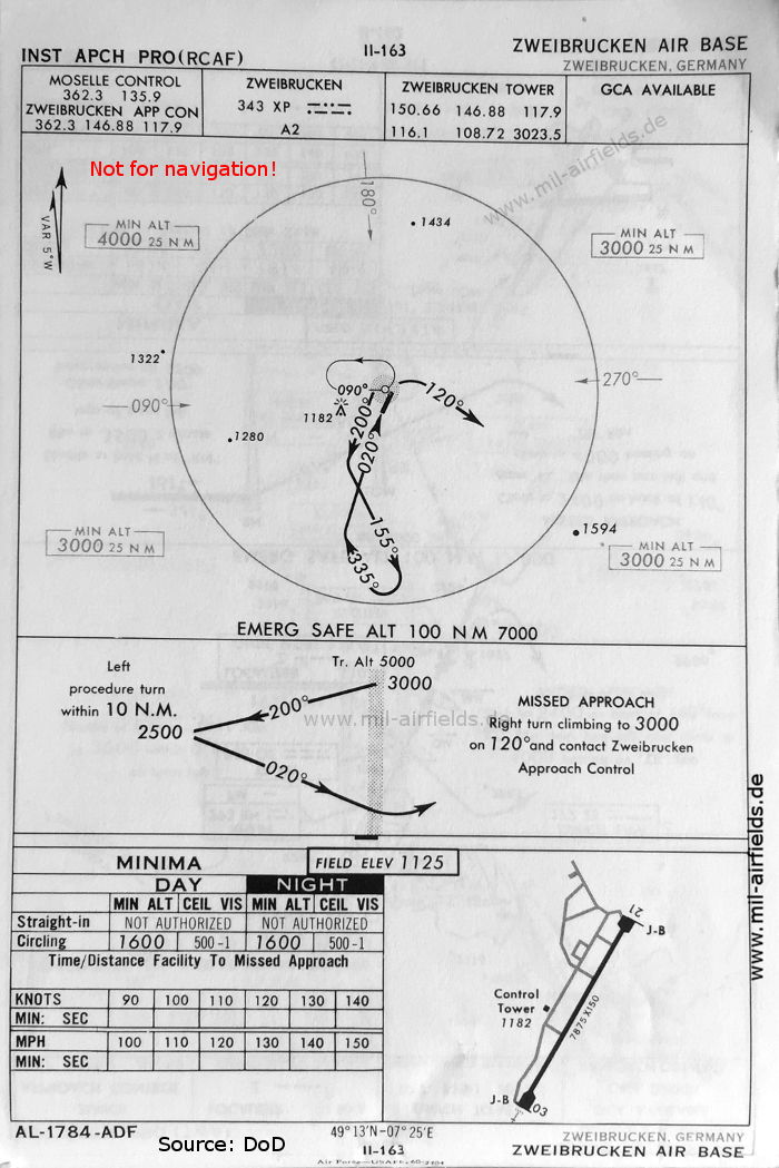
NDB approach runway 03 (October 1960) - Procedure of the Royal Canadian Air Force (RCAF), which was stationed on the field at the time. Zweibrücken had its own approach control, but also Moselle Control is listed, the joint control center of the French, Canadians and Americans in Metz, France. For Zweibrücken Tower, the shortwave frequency 3023.5 is still shown here. (Source: DoD)
Source for all maps, if not marked otherwise: US Department of Defense (DoD)
Recommended
Image credits are shown on the respective target page, click on the preview to open it.
 mil-airfields.de at Facebook