Wiesbaden Air Base
Erbenheim
Historical approach charts
For historical information only, do not use for navigation or aviation purposes!
| Coordinates | N500260 E0081932 (WGS84) Google Maps |
| Elevation | 461 ft |
| Location indicator | DBWB, EDAW, EDOU, ETOU |
Airfield
Region: Hessen, Taunus, Rhein
Location indicator: DBWB, EDAW, EDOU, ETOU
User: US Air Force (USAF), US Army
In the 1940s

Range approach (December 1948) - The Range beacon "Frankfurt Radio FT" is located southeast of Rüsselsheim. (Source: US DoD)
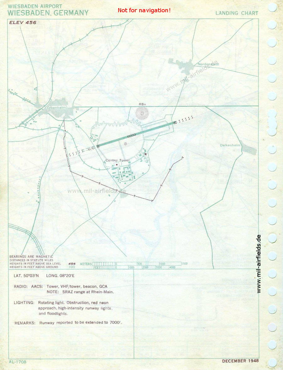
Airfield map (December 1948) - There is one runway - 08/26: length 1829 m (6000 feet). It is reported to be extended to 7000 feet (U/C = under construction) (Source: US DoD)
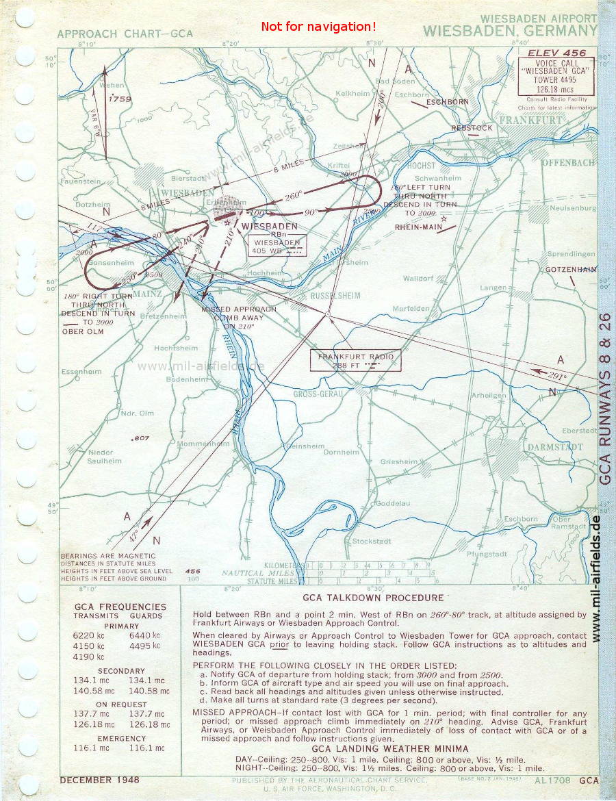
Ground Controlled Approach GCA (December 1948) (Source: US DoD)
In the 1950s
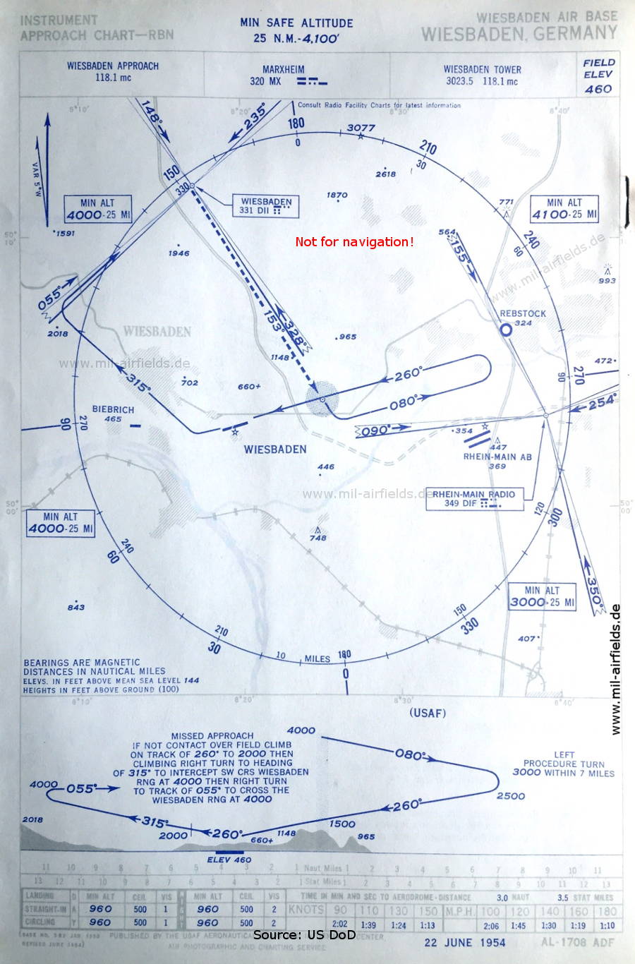
NDB approach (January 1954) - The Range beacon "DII" is located southeast of Idstein / northwest of Dasbach. (Source: US DoD / USAF)
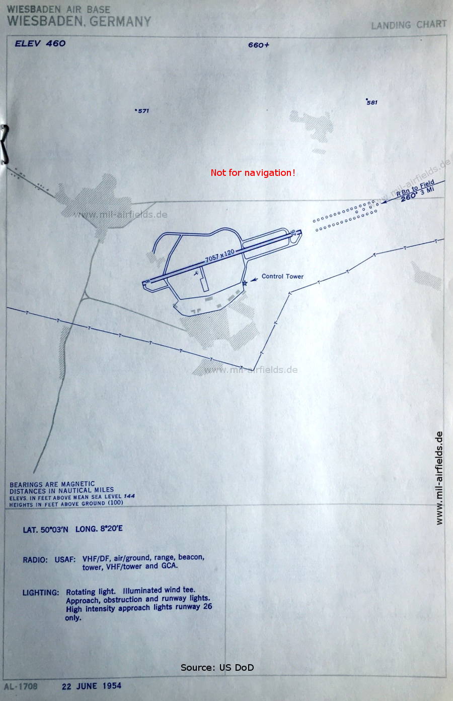
Aerodrome chart (January 1954) - There is one runway - 08/26: length 2151 m, width 37 m (7057 feet x 120 feet). (Source: US DoD / USAF)
In the 1960s
NDB approach (October 1960) - North of the field is the Range beacon "WBD" with its four beams (Source: US DoD / USAF)

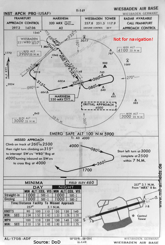
NDB approach runway 26 (May 1966) - Meanwhile, the Range "WBD" has been converted to an NDB. (Source: US DoD)
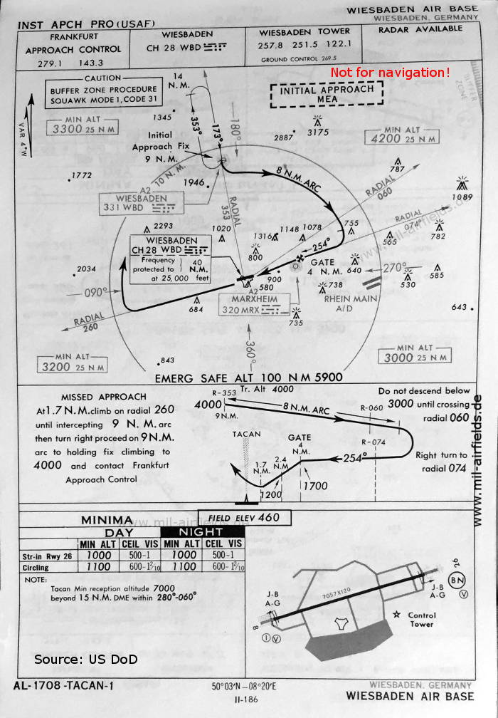
TACAN approach runway 26 (May 1966) (Source: US DoD)
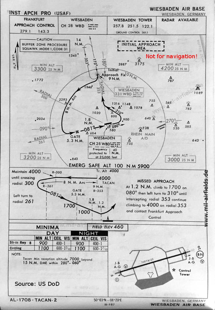
TACAN approach runway 08 (May 1966) (Source: US DoD)
Index to the objects shown on the maps
Aerodromes:
- Biebrich, Eschborn, Götzenhain, Ober-Olm (Main Finthen), Rebstock, Rhein-Main Air Base, Wiesbaden
Radio beacons:
- Frankfurt Radio Range "FT"
- Marxheim NDB "MRX", "MX"
- Rhein-Main Radio Range "DIF", "RM"
- Wiesbaden Range "DII", "WBD", NDB "WN", "WR"
Air traffic control
- Darmstadt Cornbeef Homer
- Frankfurt Approach Control
- Wiesbaden Approach, Wiesbaden Tower
Source for all maps, if not marked otherwise: US Department of Defense (US DoD)
Recommended


Image credits are shown on the respective target page, click on the preview to open it.
 mil-airfields.de at Facebook