Bordeaux Mérignac Airport
Base aérienne 106 Bordeaux-Mérignac
Historical approach and aerodrome charts
Base aérienne 106 Bordeaux-Mérignac - Cartes d'approche historiques
For historical information only, do not use for navigation or aviation purposes!
| Coordinates | N444943 W0004256 (WGS84) Google Maps |
| Location indicator | LFBD |

In the 1940s
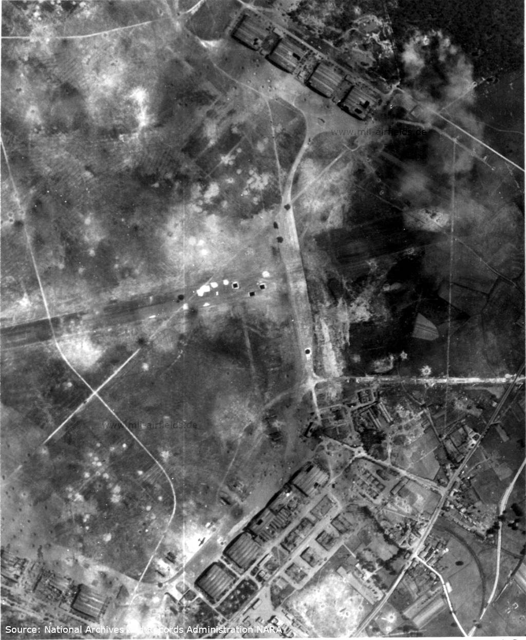
Aerial view from World War II - The picture shows the southeastern corner of the field, the top is approx. northeast, see the following map from 1945. Original image caption: "Three large hangars at the Bordeaux/Merignac airfield in France were partially destroyed by the 15 June 1944 attack of U.S. 8th AAF heavy bombers. One large workshop is completely destroyed and the other has been damaged. Numerous craters cover the dispersal areas and landing strips" (Source: National Archives 193755273)
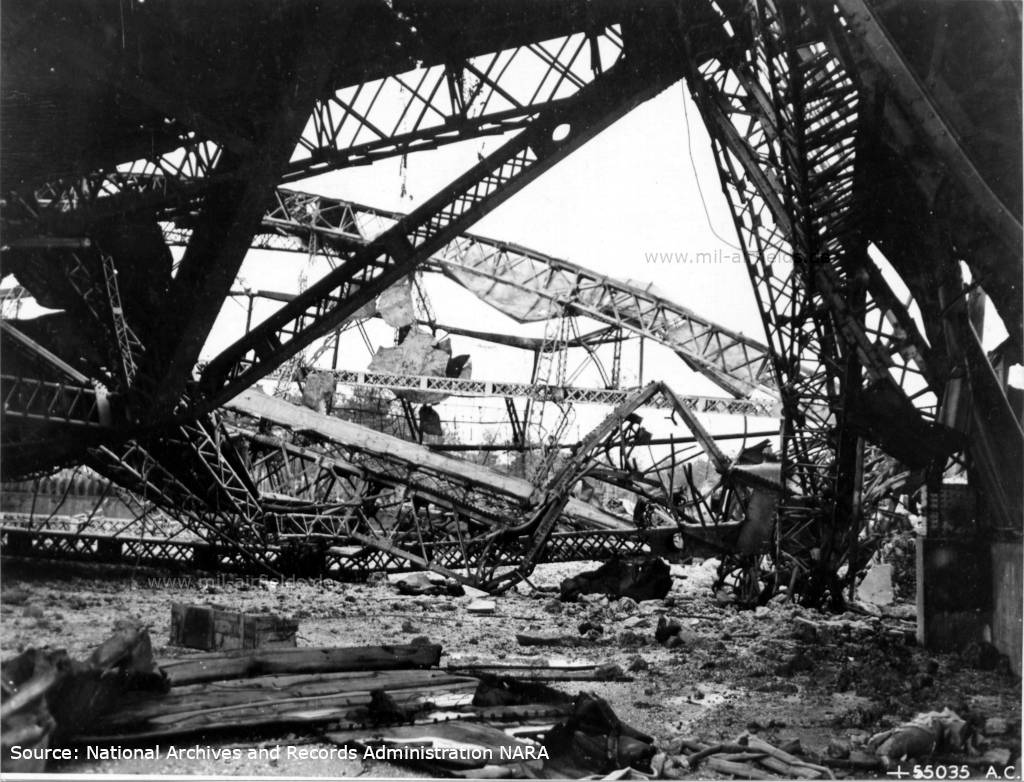
Destroyed aircraft hangars in the Second World War - Original image caption: "UNDERGROUND AIRCRAFT PLANT-These twisted steel girders once supported a big hangar at Merignac Airdrome, near Bordeaux, which U.S. Army 8th Air force heavies bombed out of commission as an important Nazi operational field as the site of an FW-190 assembly plant. This is the kind of destruction which drove the plant underground." (Source: National Archives 193749636)
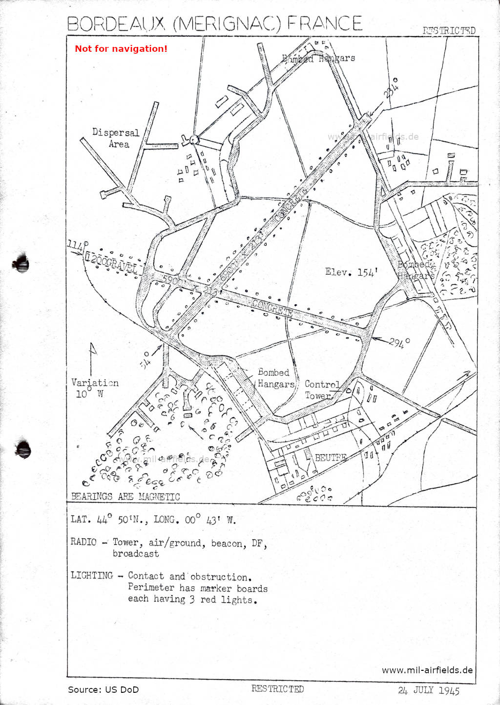
Map from 25 July 1945 - There are two runways - 054/234: length 2103 m, width 65 m (6900 feet x 213 feet), concrete; 114/294: length 1798 m concrete + 366 m gravel, width 65 m (5900 feet x 213 feet). (Source: US DoD)
In the 1950s
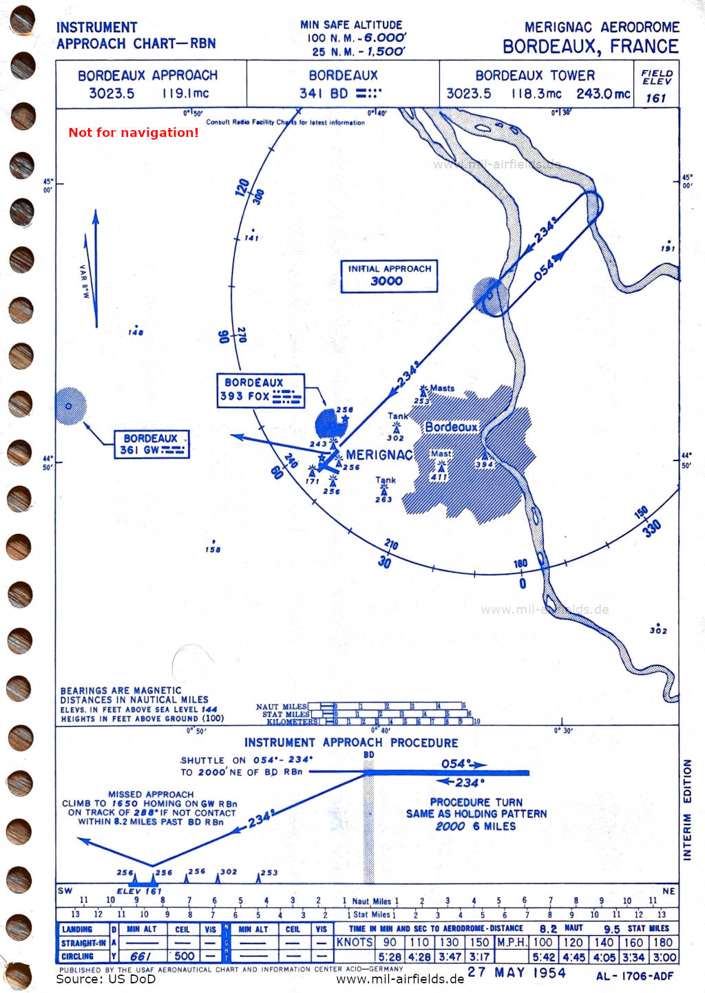
NDB approach runway 23 (May 1954) (Source: US DoD)
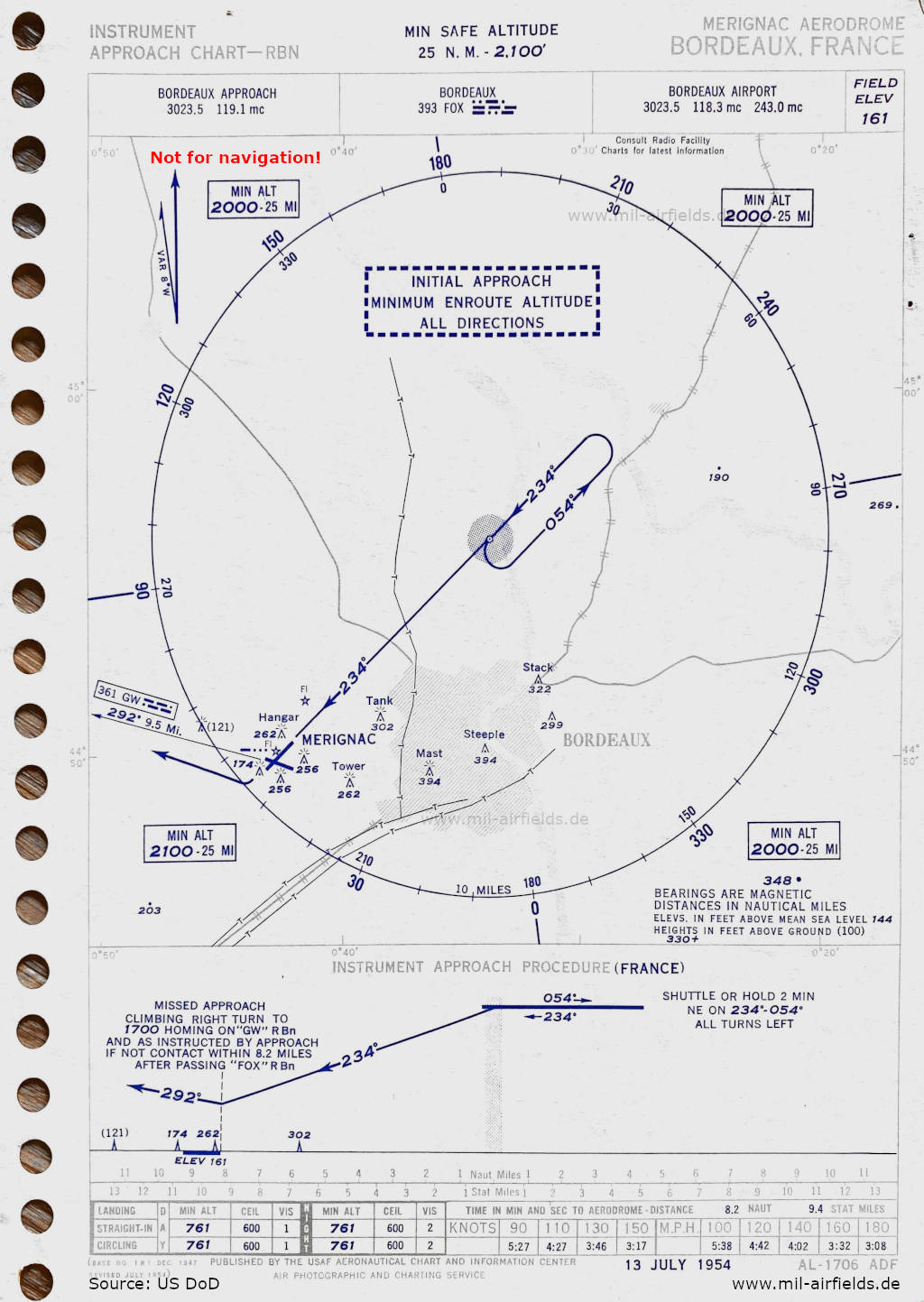
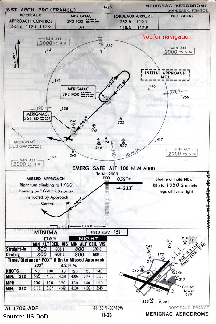
NDB approach runway 23 (July 1954) (Source: US DoD)
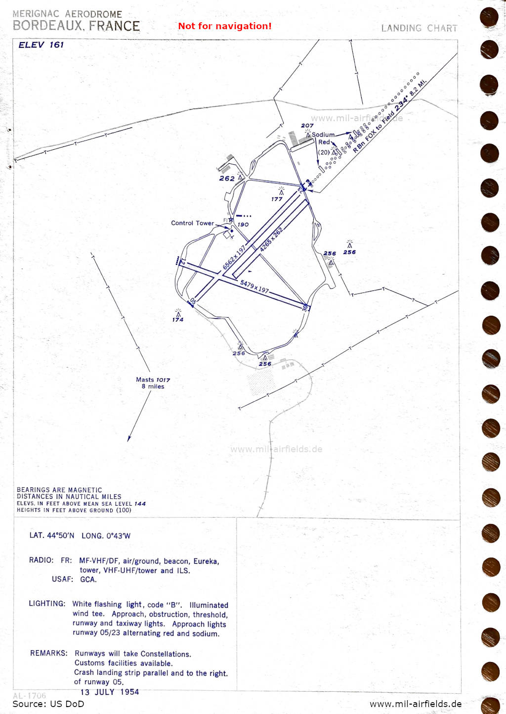
Airport map (July 1954) - There are three runways - 05/23: length 2000 m, width 60 m (6562 feet x 197 feet), 05/23: length 1300 m, width 80 m (4265 feet x 262 feet), 12/30: length 1670 m, width 60 m (5479 feet x 197 feet). (Source: US DoD)
In the 1960s
NDB approach runway 23 (October 1960) - There are two runways - 05/23: length 2025 m, width 60 m (6644 feet x 197 feet), 11/29: length 2400 m, width 60 m (7874 feet x 197 feet), In addition, there is an unpaved strip - 05/23: length 1000 m (3280 feet). (Source: US DoD)
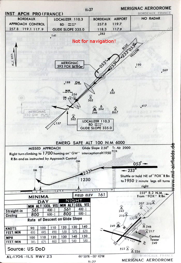
ILS approach runway 23 (October 1960) (Source: US DoD)
Index to the objects shown on the maps
Radio beacons / Radiophares aéronautiques:
- Bordeaux Merignac NDB "FOX", "BD", Eureka, ILS "BD", Outer Marker, Middle Marker, Inner Marker
Air traffic control / Contrôle de la circulation aérienne:
- Bordeaux Approach Control, Bordeaux Tower
Source for all maps, if not marked otherwise: US Department of Defense (US DoD)
 mil-airfields.de at Facebook