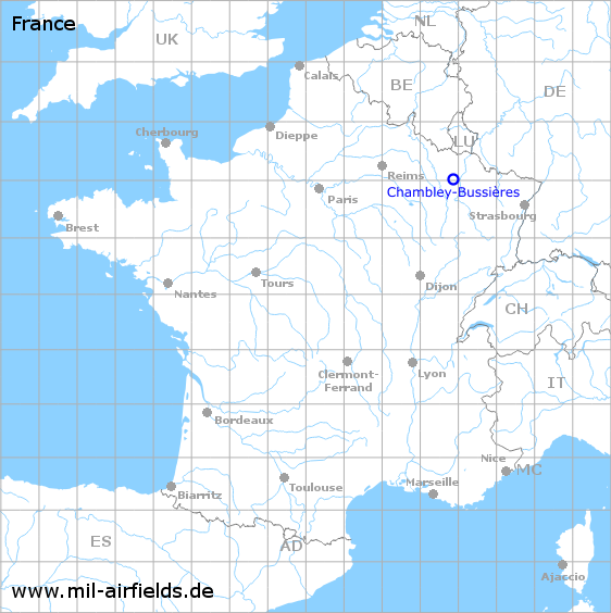
Chambley-Bussières Air Base
Historical approach and aerodrome charts
Base aérienne de Chambley-Bussières - Cartes d'approche / d'atterrissage historiques
For historical information only, do not use for navigation or aviation purposes!
| Coordinates | N490133 E0055236 (WGS84) Google Maps |
| Region | Grand Est, Meurthe-et-Moselle |
| Location indicator | LFQY, LFJY |
Use
- Short-term use during the 2nd world war
- 1952: Start of construction of the new air base as NATO airfield (LFQY)
- 1953 - 1967: Used by the US Air Force (USAF)
- Afterwards airfield of l'Armée de l'Air (French Air Force)
- Since 2009 also general aviation (LFJY)
In the 1960s
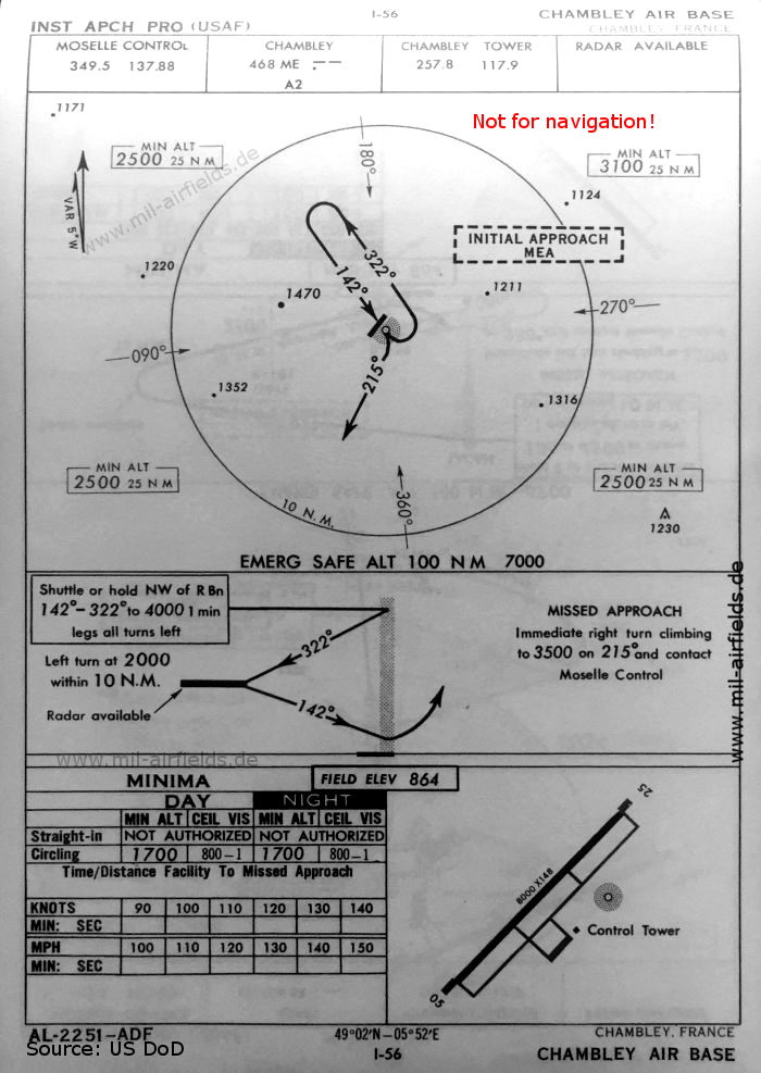
NDB approach (October 1960) - There is one runway - 05/23: length 2438 m, width 45 m (8000 feet x 148 feet). (Source: US DoD)
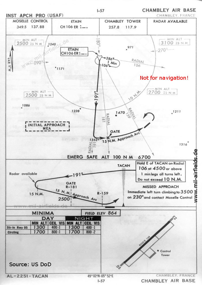
TACAN approach runway 05 (October 1960) (Source: US DoD)
In the 1970s
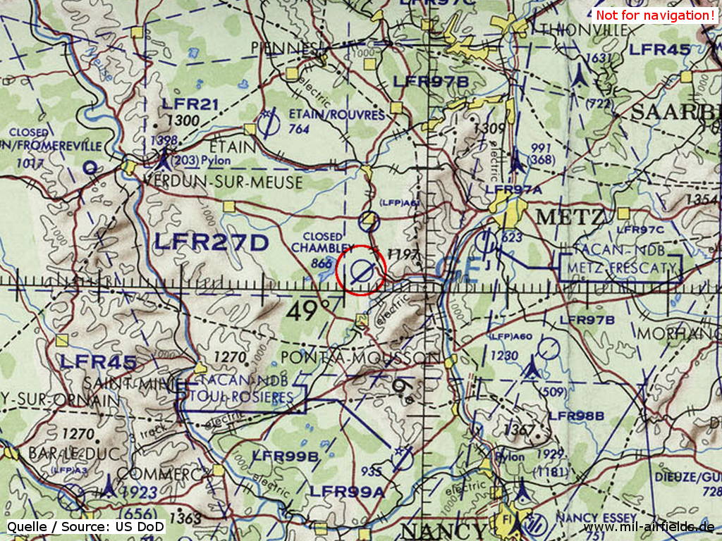
Chambley-Bussières Air Base on a map of the US Department of Defense from 1972 - The field is shown as closed. (Source: ONC E-2 (1972), Perry-Castañeda Library Map Collection, University of Texas at Austin)
Index to the objects shown on the maps
Radio beacons / Radiophares aéronautiques:
- Chambley NDB "ME"
- Etain TACAN "ER"
Air traffic control / Contrôle de la circulation aérienne:
- Chambley Tower
- Moselle Control
Source for all maps, if not marked otherwise: US Department of Defense (US DoD)
Links
https://en.wikipedia.org/wiki/Chambley-Bussi%C3%A8... - Chambley-Bussières Air Base
Recommended
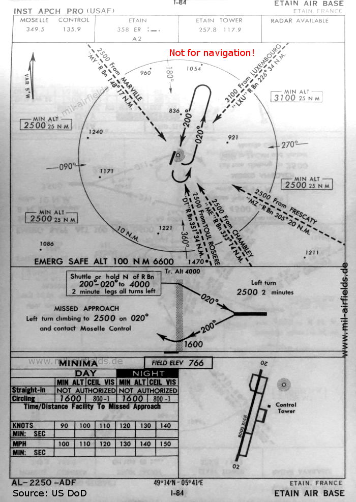

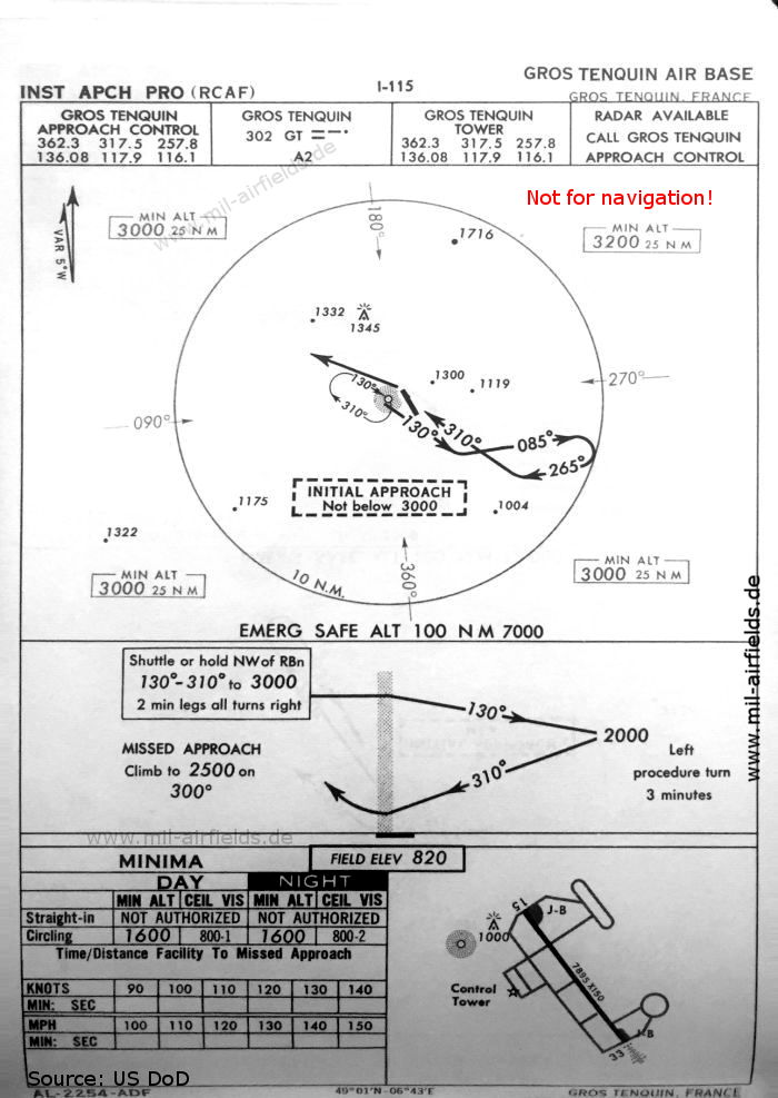
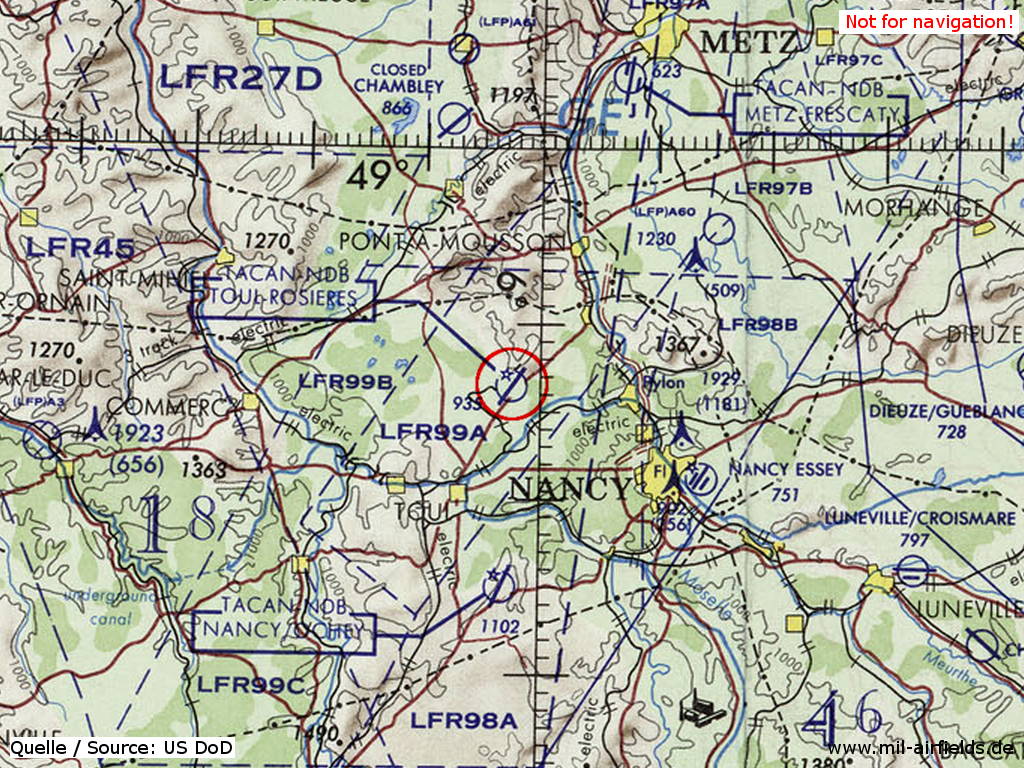
Image credits are shown on the respective target page, click on the preview to open it.
 mil-airfields.de at Facebook