Dreux Vernouillet Airfield
Aérodrome de Dreux-Vernouillet
Historical approach and aerodrome charts
Aérodrome de Dreux
For historical information only, do not use for navigation or aviation purposes!
| Coordinates | N484220 E0012141 (WGS84) Google Maps |
| Region | Eure-et-Loir |
| Location indicator | LFON |
In the 1940s

Range approach (July 1945) (Source: US DoD)
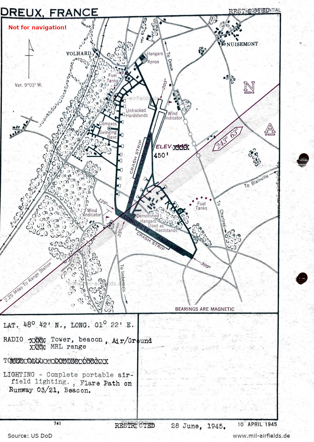
Aerodrome (June 1945) - There are two runways - 025/205: length 1829 m, width 61 m (6000 feet x 200 feet) concrete, 129/309: length 1341 m, width 61 m (4400 feet x 200 feet) concrete. (Source: US DoD)
Index to the objects shown on the maps
Aerodromes / Aérodromes:
- Dreux Vernouillet
- Illiers L'Everque
- Le Hamel
- Nogent-le-Roi
Radio beacons / Radiophares aéronautiques:
- Dreux Range
Air traffic control / Contrôle de la circulation aérienne:
- Tower: call sign "Domina"
Places:
- Anet, Berchères-Saint-Germain, Blainville, Blévy, Boutigny-Prouais, Brezolles, Chartres, Châteauneuf-en-Thymerais, Chêne-Chenu, Clévilliers, Digny, Ézy-sur-Eure, Faverolles, Germainville, Houdan, Imberbais, La Madeleine, Laons, Maintenon, Nogent-le-Roi, Nonancourt, Nuisement, Oulins, Saint-Georges-Motel, Saint-Lubin-de-la-Haye, Senonches, Theuvy, Tillières-sur-Avre
Source for all maps, if not marked otherwise: US Department of Defense (US DoD)
Recommended


Image credits are shown on the respective target page, click on the preview to open it.
 mil-airfields.de at Facebook