Évreux Fauville Air Base
Base aérienne 105, B.A. 105
Historical approach and aerodrome charts
Base aérienne 105 Évreux-Fauville (B.A. 105) - Cartes d'approche historiques
For historical information only, do not use for navigation or aviation purposes!
| Coordinates | N490144 E0011312 (WGS84) Google Maps |
| Region | Normandie, Département Eure |
| Location indicator | LFOE |
Use
- Military airfield since the 1930s
- 1952-1966: Expansion and use by NATO and the US Air Force (USAF)
- Since 1967 Airfield of the French Air Force (Armée de l'air)
In the 1960s
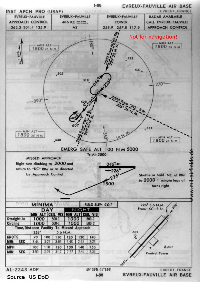
NDB approach runway 23 (October 1960, USAF) - The runway length is not shown. (Source: US DoD)
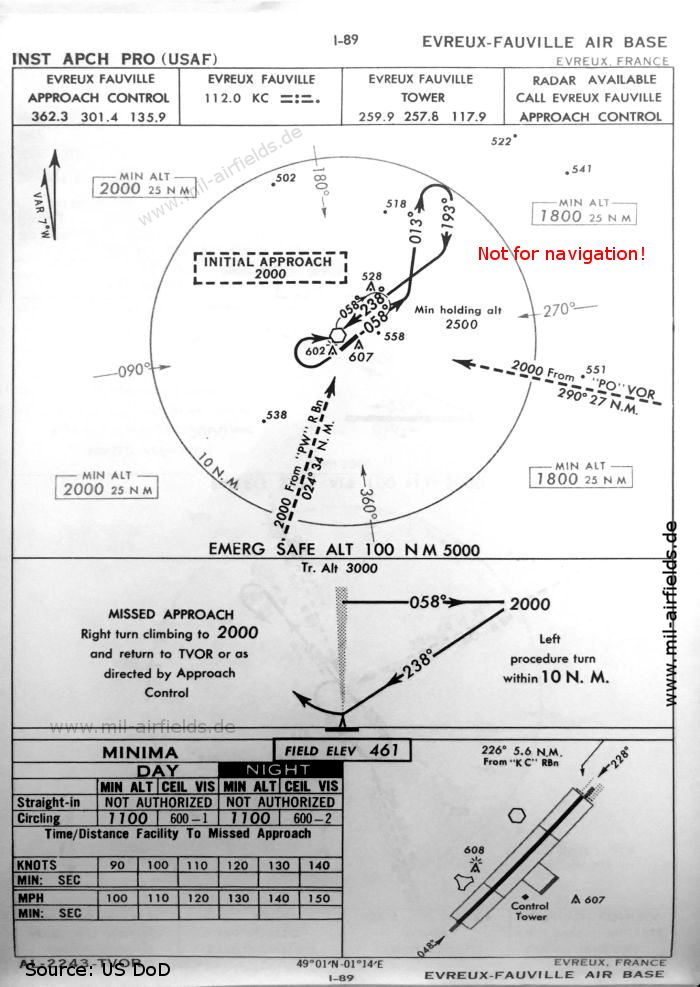
VOR approach runway 23 (October 1960, USAF) (Source: US DoD)

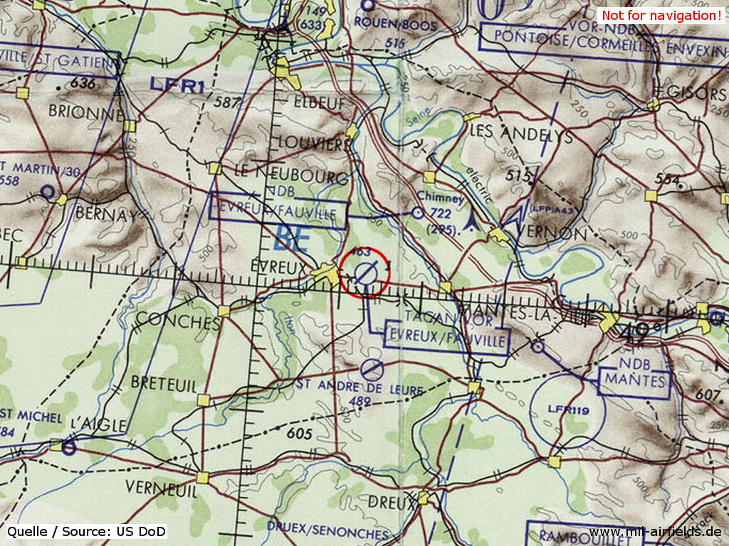
VOR/NDB approach runway 23 (October 1960, USAF) - On this chart the runway lenght is shown - 048/228: length 2400 m, width 46 m (7874 feet x 150 feet). (Source: US DoD)
In the 1970s
Évreux Fauville Air Base on a map of the US Department of Defense from 1972 (Source: ONC E-2 (1972), Perry-Castañeda Library Map Collection, University of Texas at Austin)
Index to the objects shown on the maps
Radio beacons / Radiophares aéronautiques:
- Evreux-Fauville NDB "KC", VOR "KC"
Air traffic control / Contrôle de la circulation aérienne:
- Evreux-Fauville Approach Control, Evreux-Fauville Tower
Source for all maps, if not marked otherwise: US Department of Defense (US DoD)
 mil-airfields.de at Facebook