Étain Rouvres Air Base
Historical approach and aerodrome charts
Base Lieutenant Étienne Mantoux - Cartes d'approche historiques
For historical information only, do not use for navigation or aviation purposes!
| Coordinates | N491336 E0054020 (WGS84) Google Maps |
| Region | Grand Est, Département Meuse, Lorraine, Rouvres-en-Woëvre |
| Location indicator | LFQE |
Use
- Military airfield since the 1930s
- 1953-1967: Expansion and use by the US Air Force (USAF)
- Today airfield of the French army aviation (Aviation légère de l’armée de terre)
In the 1940s
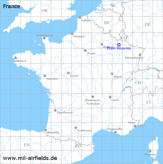
GCA approach radar of the US forces at Étain in Spring 1945 (Source: National Archives, 6922417)
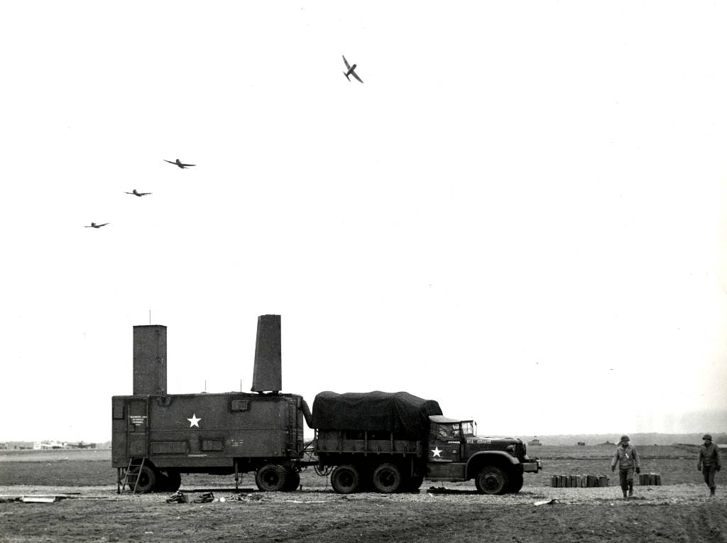
Enlargement: Truck (Source: National Archives, 6922417)
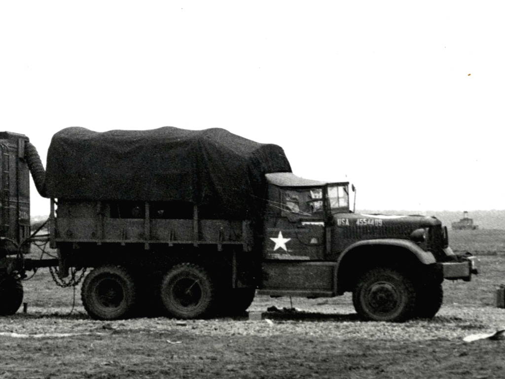
Enlargement: trailer with GCA approach radar (Source: National Archives, 6922417)
In the 1960s
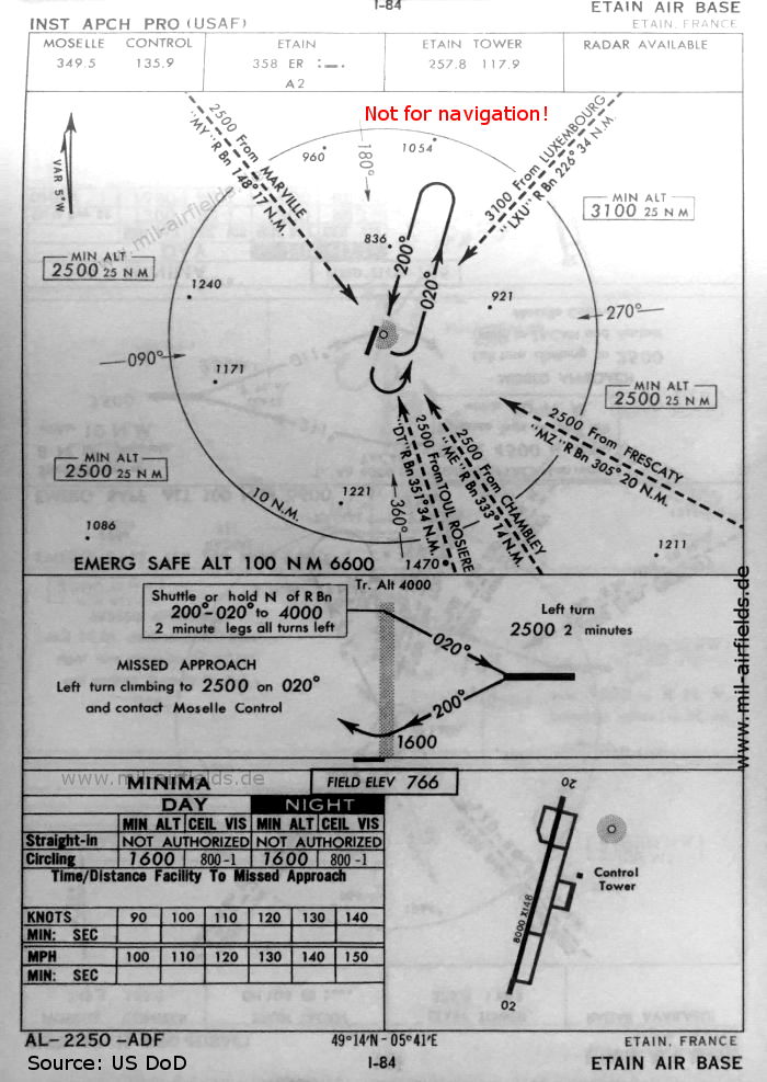
NDB approach runway 20 (October 1960, USAF) - There is one runway - 02/20: length 2438 m, width 45 m (8000 feet x 148 feet). (Source: US DoD)
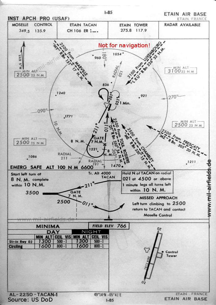
TACAN approach runway 02 (October 1960, USAF) - On this chart the runway is shown as - 02/20: length 2399 m, width 46 m (7872 feet x 150 feet). (Source: US DoD)
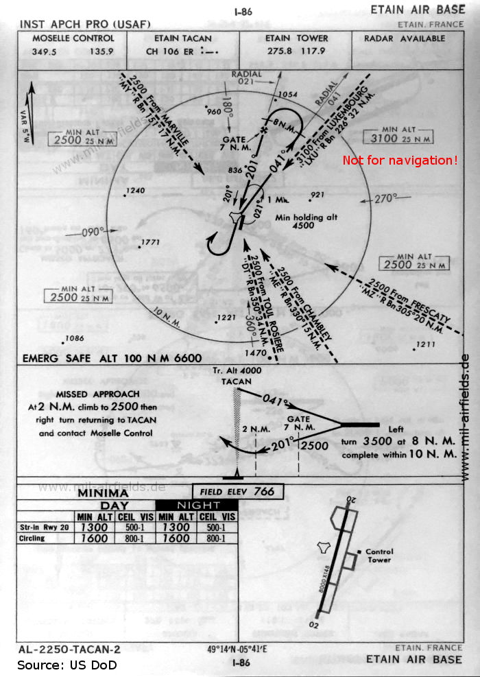
TACAN approach runway 20 (October 1960, USAF) (Source: US DoD)
In the 1970s
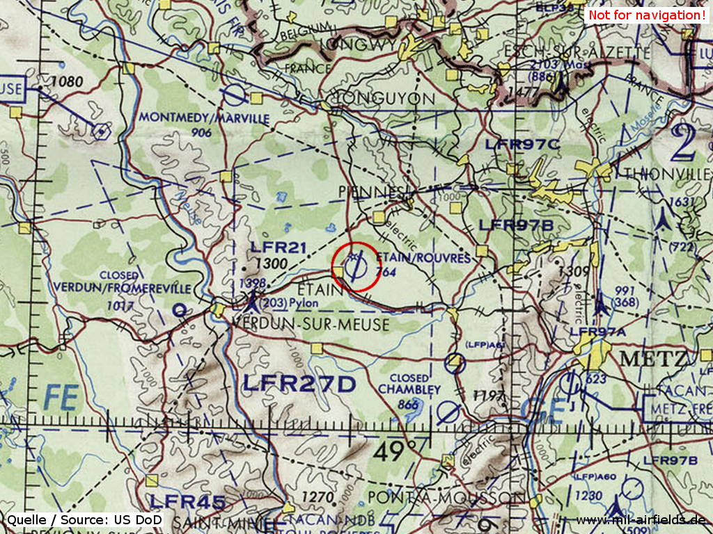
Étain Rouvres Air Base on a map of the US Department of Defense from 1972 (Source: ONC E-2 (1972), Perry-Castañeda Library Map Collection, University of Texas at Austin)
Index to the objects shown on the maps
Radio beacons / Radiophares aéronautiques:
- Etain NDB "ER", TACAN "ER"
Air traffic control / Contrôle de la circulation aérienne:
- Etain Tower
- Moselle Control
Source for all maps, if not marked otherwise: US Department of Defense (US DoD)
Links
https://www.archives.gov/ - National Archives
Recommended

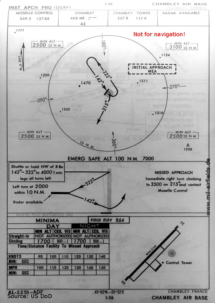

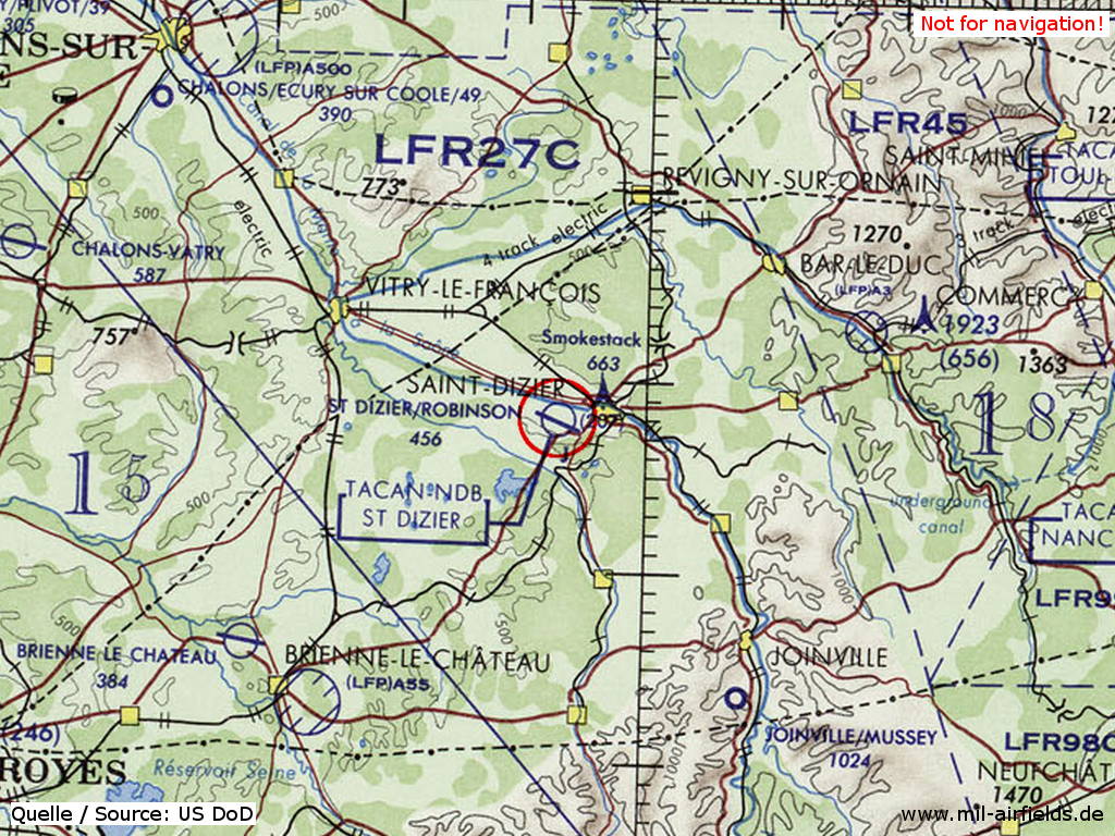
Image credits are shown on the respective target page, click on the preview to open it.
 mil-airfields.de at Facebook