Marseille Marignane Airport
Aéroport Marseille Provence
Historical approach and aerodrome charts
Aéroport Marseille Provence - Cartes d'approche historiques
For historical information only, do not use for navigation or aviation purposes!
| Coordinates | N432616 E0051247 (WGS84) Google Maps |
| Location indicator | LFML |
In the 1930s
Map from 1931 (Source: Internationales Flughandbuch 1931)
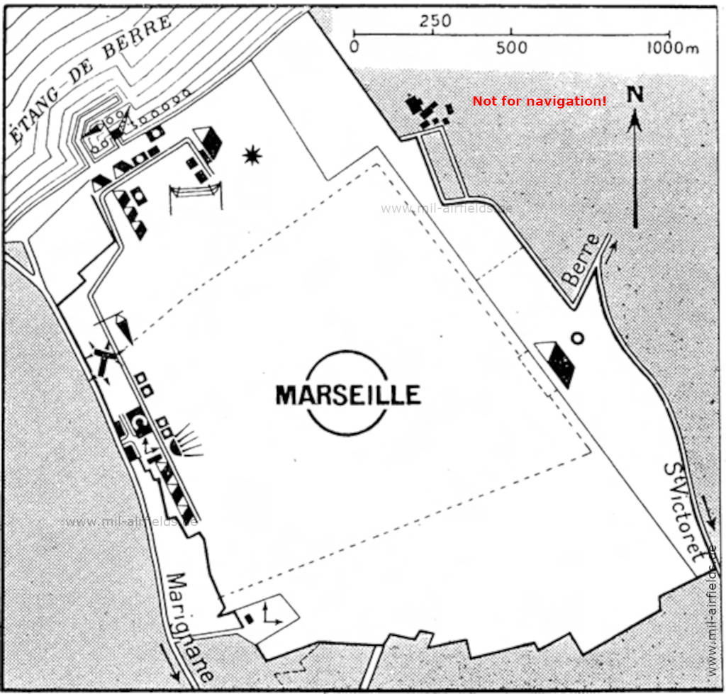
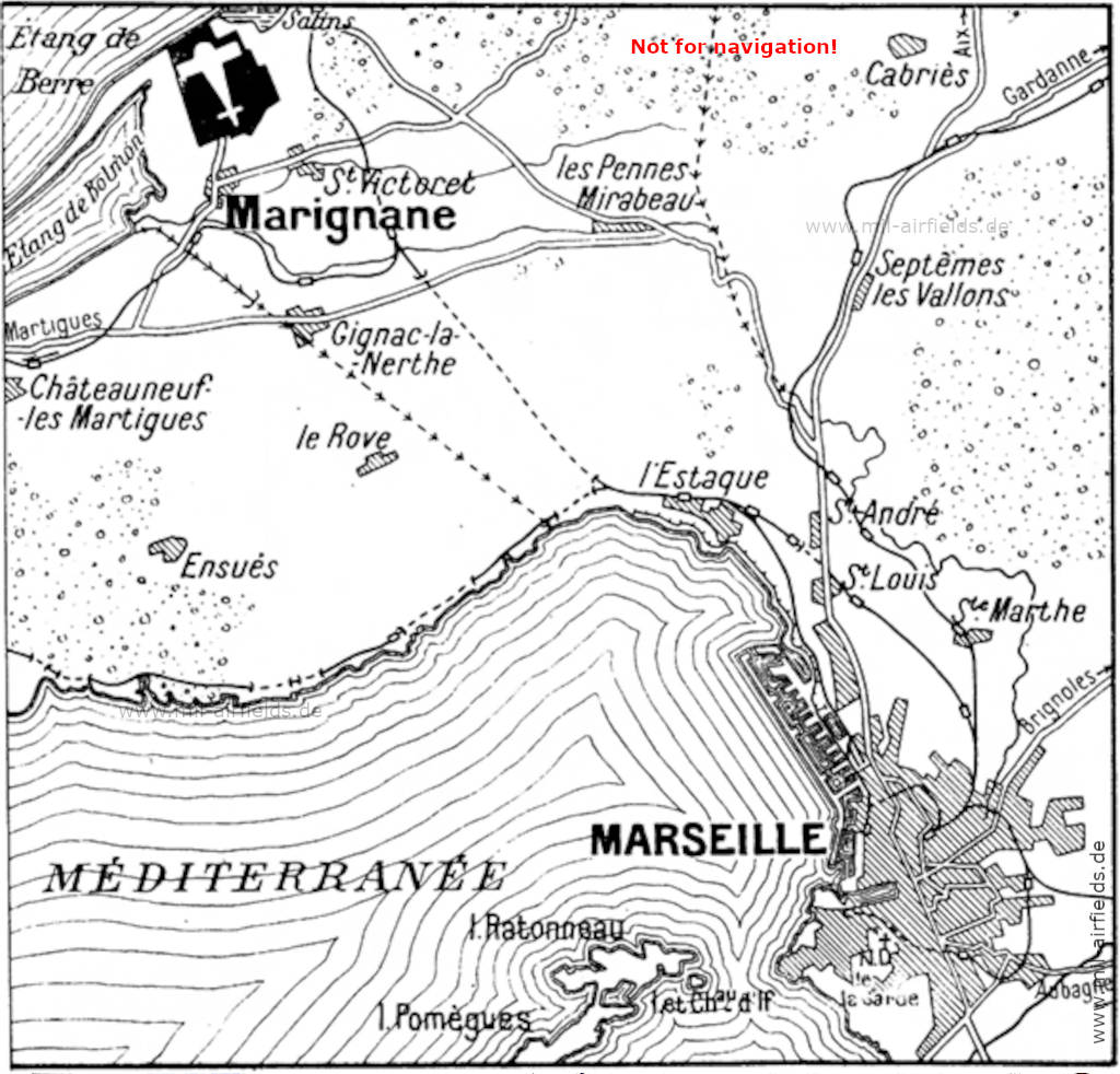
Marseille Airfield in 1931 (Source: Internationales Flughandbuch 1931)
In the 1940s
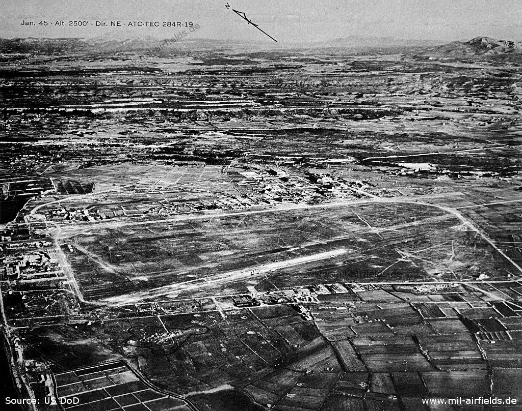
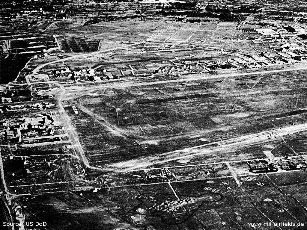
Aerial image (January 1945) - Viewing direction is northeast. On the left edge is the sea plane base at the Étang de Berre lagoon. The image was classified as "Restricted". (Source: US DoD)
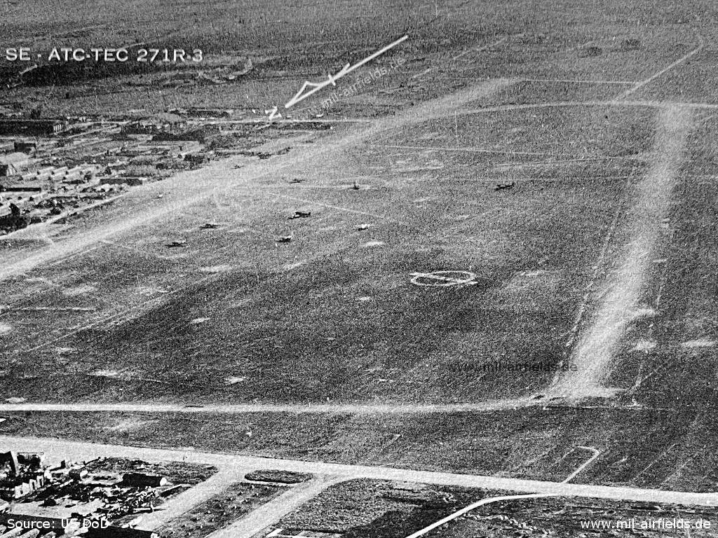
Enlargement - In the right half of the picture some airplanes are visible. (Source: US DoD)
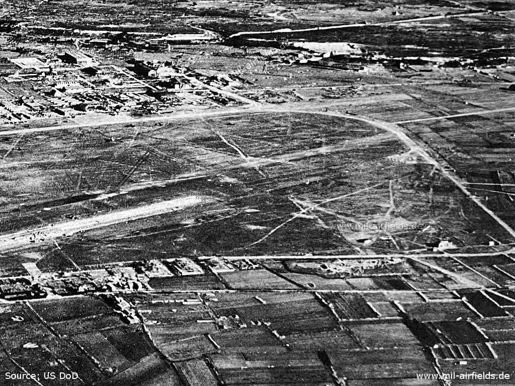
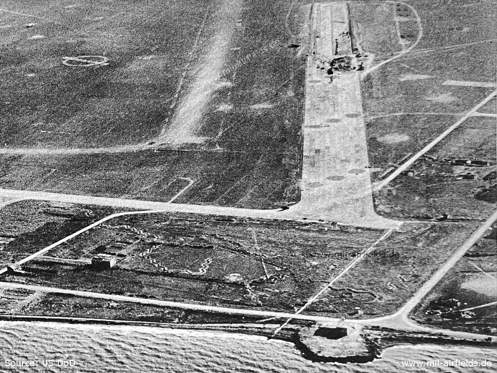
Enlargement - Southeastern part. (Source: US DoD)
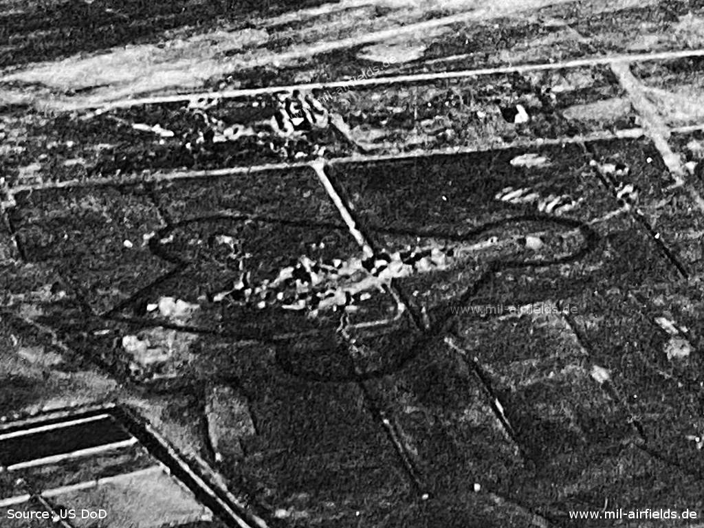
Enlargement: Area with a noticeable shape - In the southwestern part. (Source: US DoD)
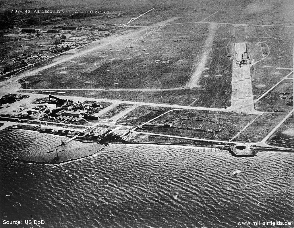
Aerial view 07 January 1945 - Viewing direction southwest. (Source: US DoD)
Enlargement: Movement area - On the right edge of the picture there is an unpaved runway. The circle to the right of the centre of the picture contains the inscription "Marseille". (Source: US DoD)
Enlargement: Runways - On the left the unpaved runway, on the right the paved one, on which obviously construction work is taking place. (Source: US DoD)
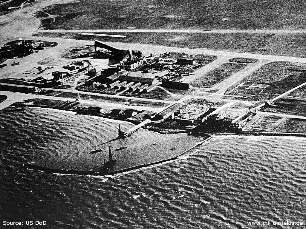
Enlargement: Seaplane base (Source: US DoD)
In the 1950s
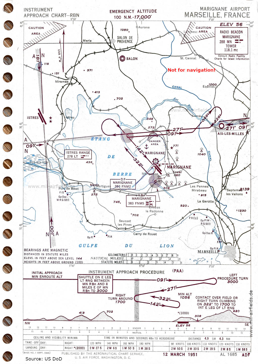
NDB approach runway 14R (March 1951) - With anchor symbols, the map shows two seaplane bases in the Étang de Berre: one immediately north of the Marignane airfield, the second northwest of it. (Source: US DoD)
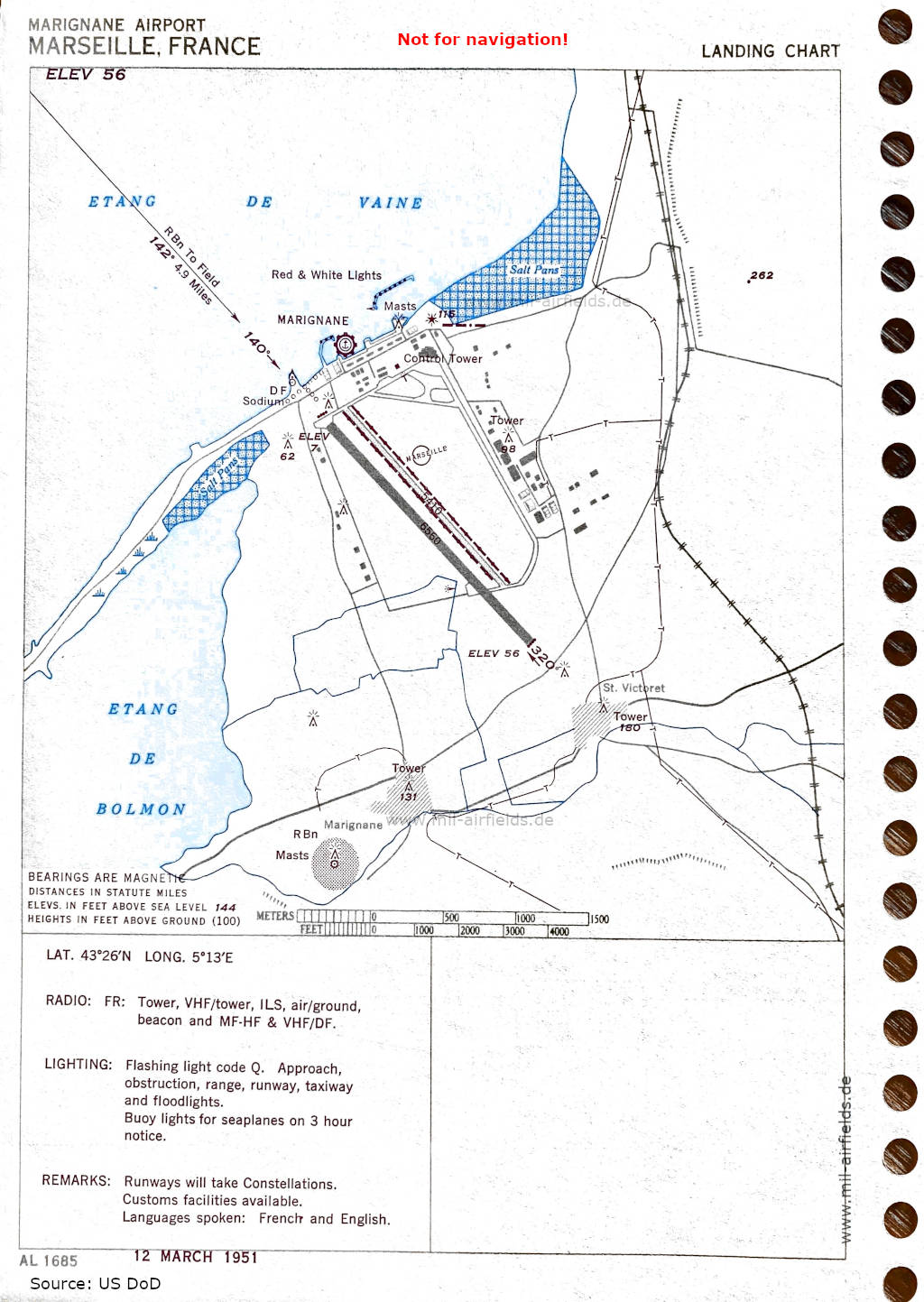
Airport map (March 1951) - There are two runways - 140/320: length 1996 m (6550 feet), 140/320: length 1649 m (5410 feet). (Source: US DoD)
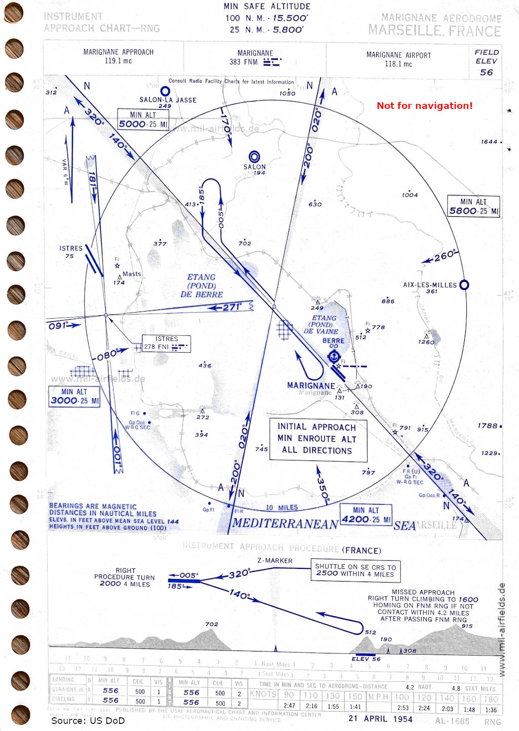
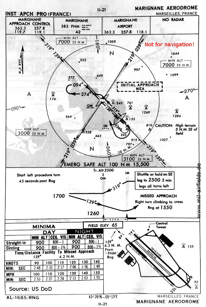
Range approach runway 14 (April 1954) (Source: US DoD)
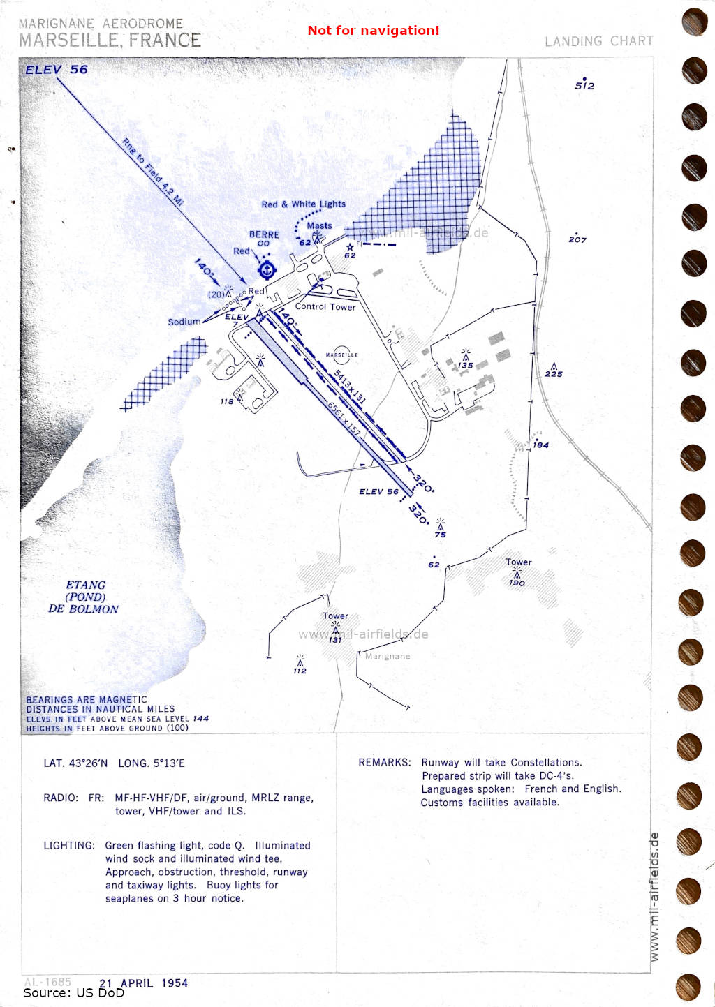
Aerodrome (April 1954) - Now these two runways are shown - 140/320: length 2000 m, width 48 m (6561 feet x 157 feet), 140/320: length 1650 m, width 40 m (5413 feet x 131 feet). (Source: US DoD)
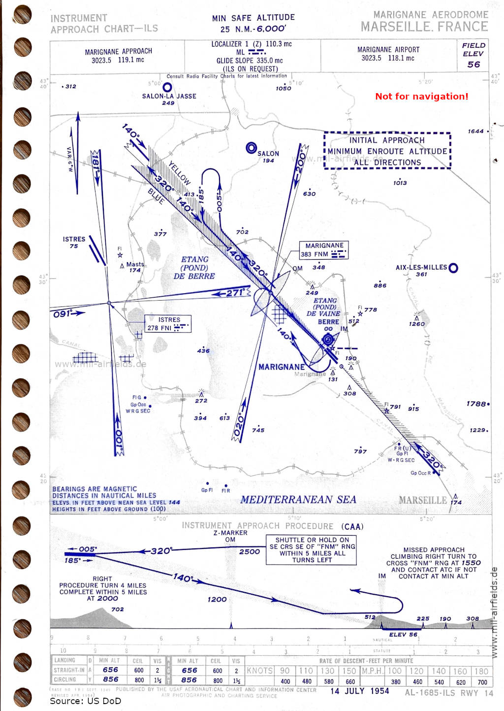
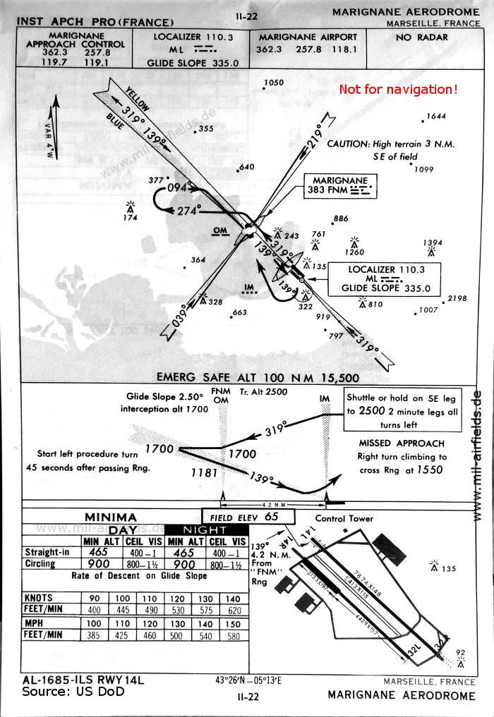
ILS approach runway 14R (July 1954) (Source: US DoD)
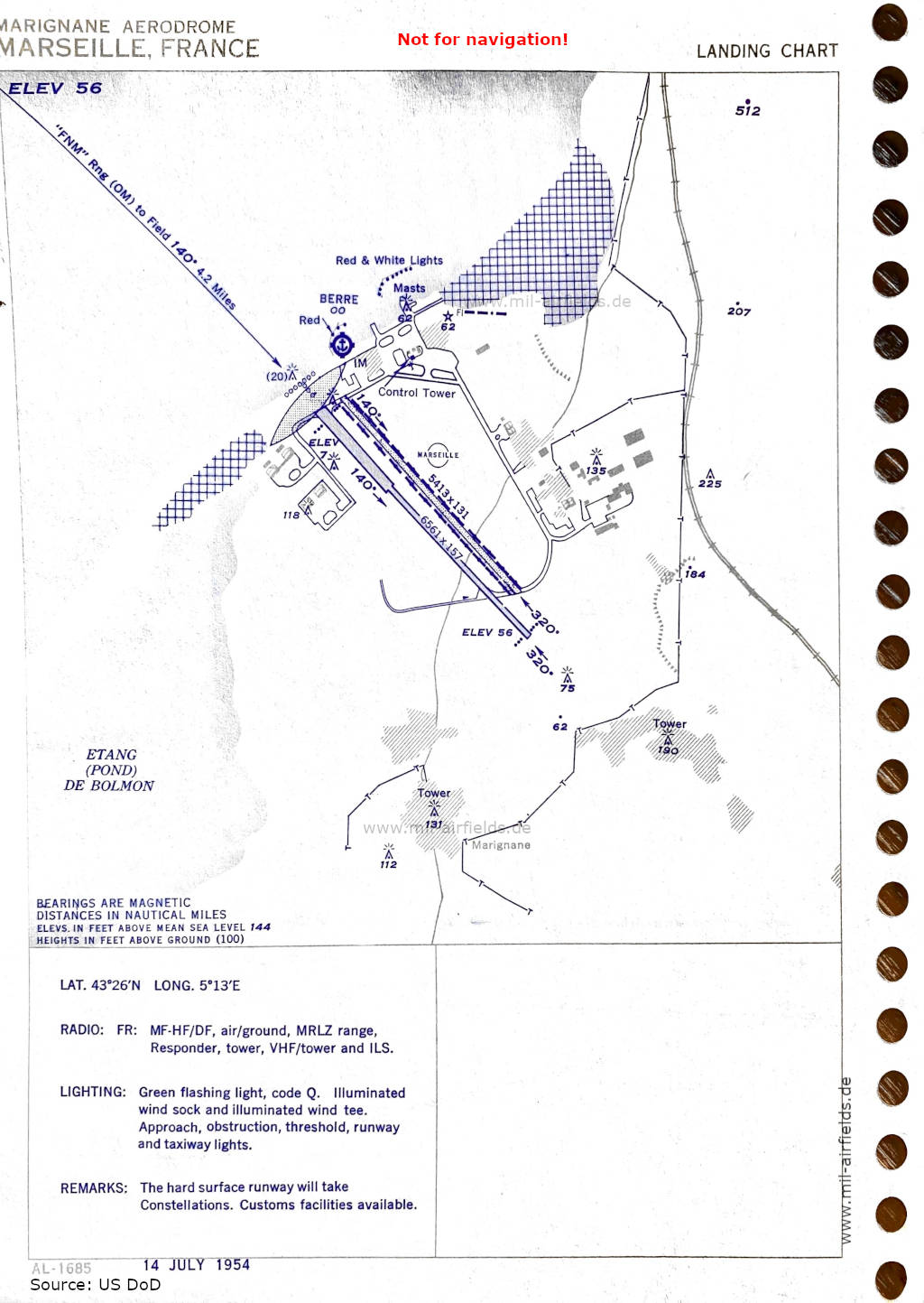
Airport map (July 1954) (Source: US DoD)
In the 1960s
Range approach runway 14R (October 1960) - The Range beacon has the ident "FNM" and emits the four displayed guiding beams. (Source: US DoD)
ILS approach runway 14L (October 1960) - There are three runways - 14L/32R: length 2400 m, width 45 m (7874 feet x 148 feet), 14R/32L: length 2000 m, over a length of 650 m (2133 feet) the width is 60 m (197 feet), over a length of 1350 m (4429 feet), the width is 48 m (157 feet). Between both, there is an unpaved runway: length 1650 m, width 35 m (5413 feet x 115 feet). (Source: US DoD)
In the 1970s
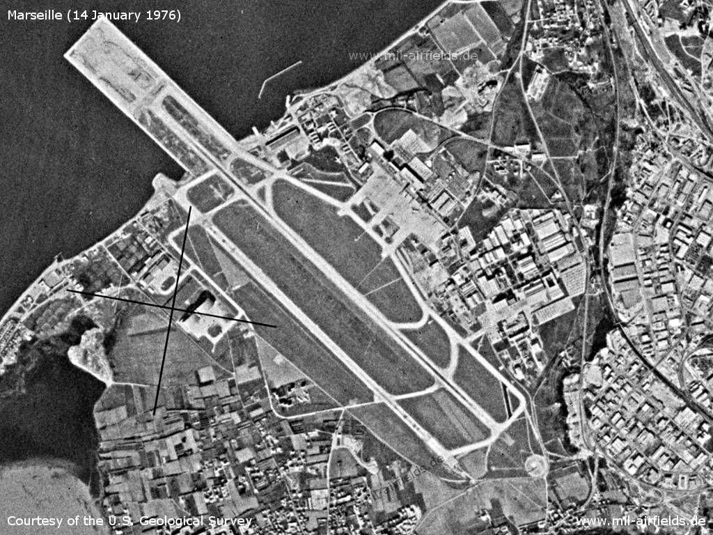
Satellite image from 14 January 1976 - The image was taken from a US reconnaissance satellite and was previously subject to strict secrecy. (Source: U.S. Geological Survey)
In the 1980s
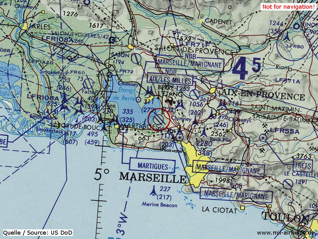
Marseille Marignane Airport on a map of the US Department of Defense from 1981 (Source: ONC F-2 (1981), Perry-Castañeda Library Map Collection, University of Texas at Austin)
Index to the objects shown on the maps
Aerodromes / Aérodromes:
- Aix Les Milles
- Berre
- Istres Le Tube
- Le Castellet
- Marseille Marignane
- Salon-de-Provence, Salon Eyguières, Salon-La Jasse
Radio beacons / Radiophares aéronautiques:
- Aix Les Milles NDB
- Istres Range "FNI", "LT"
- Marignane Range "FNM", NDB "MN", "FNM5", ILS "ML", Outer Marker, Inner Marker
- Martigues VORDME
- Trets VOR
Air traffic control / Contrôle de la circulation aérienne / Communications:
- Marignane Approach Control, Marignane Airport, Marignane DF "FNM2"
Places:
- Aurons
- Cabriès, Carry-le-Rouet, Châteauneuf-les-Martigues
- Éguilles, Ensuès-la-Redonne, Étang de Berre, Étang de Bolmon
- Fos-sur-Mer
- Gignac-la-Nerthe, Golfe du Lion
- Île Ratonneau, Île Pomègues, Istres
- L'Arc, La Garotte, Lambesc, Le-Rove, Les-Pennes-Mirabeau
- Marseille, Marignane, Martigues, Merle, Miramas
- Port-de-Bouc
- Salon de Provence, Saint-André, Saint-Cannat, Saint-Louis, Saint-Marthe, Saint-Victoret, Septèmes-les-Vallons, Sausset-les-Pins
Source for all maps, if not marked otherwise: US Department of Defense (US DoD)
Links
https://en.wikipedia.org/wiki/Marseille_Provence_A... - Marseille Provence Airport
Recommended
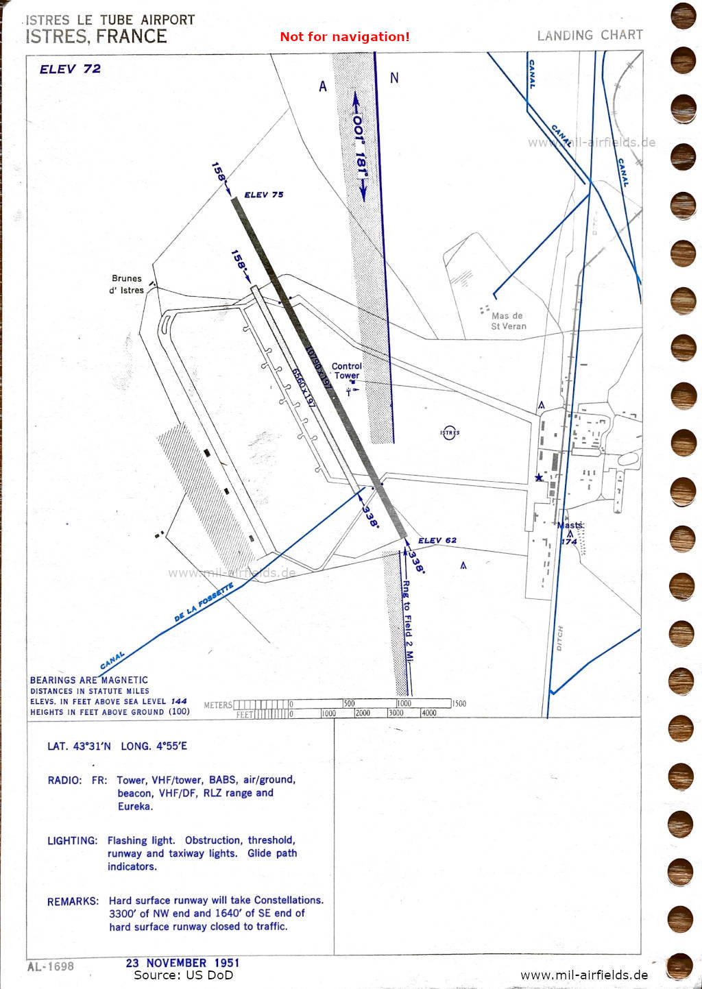


Image credits are shown on the respective target page, click on the preview to open it.
 mil-airfields.de at Facebook