Saint-Dizier Robinson Air Base
Historical approach and aerodrome charts
Base aérienne 113 Saint-Dizier-Robinson (B.A. 113) - Cartes d'approche historiques
For historical information only, do not use for navigation or aviation purposes!
| Coordinates | N483809 E0045358 (WGS84) Google Maps |
| Region | Champagne-Ardenne / Grand Est, Département Haute-Marne |
| Location indicator | LFSI |
| Operator | Armée de l’air |
In the 1960s
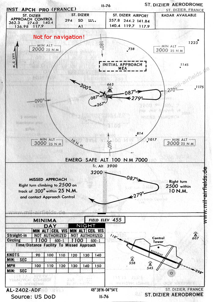
NDB approach runway 30 (October 1960) - There is one runway - 12/30: length 2440 m, width 45 m (8005 feet x 148 feet). (Source: US DoD)
In the 1970s
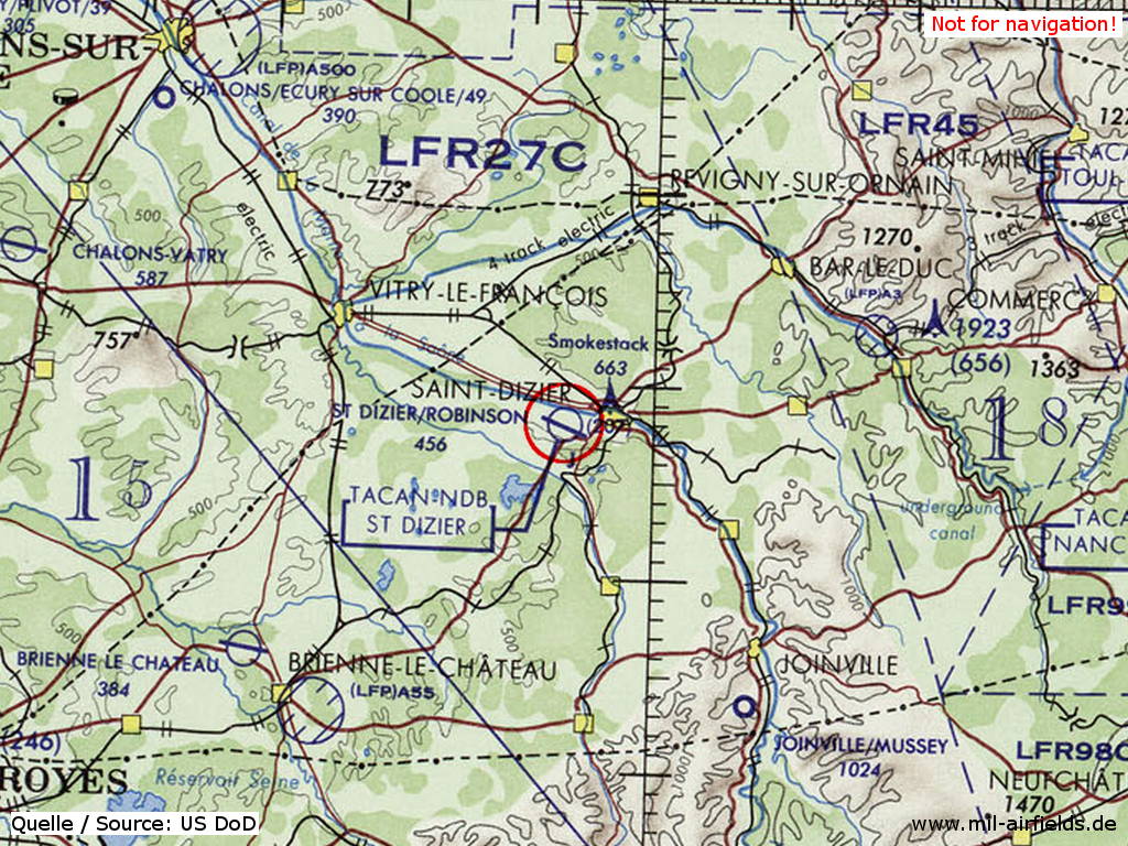
Saint-Dizier Robinson Air Base on a map of the US Department of Defense from 1972 (Source: ONC E-2 (1972), Perry-Castañeda Library Map Collection, University of Texas at Austin)
Index to the objects shown on the maps
Radio beacons / Radiophares aéronautiques:
- St. Dizier NDB "SD"
Air traffic control / Contrôle de la circulation aérienne:
- St. Dizier Approach Control, St. Dizier Airport
Source for all maps, if not marked otherwise: US Department of Defense (US DoD)
 mil-airfields.de at Facebook