Florence Peretola Airport
Aeroporto di Firenze-Peretola "Amerigo Vespucci"
Historical approach and aerodrome charts
Carte di avvicinamento
For historical information only, do not use for navigation or aviation purposes!
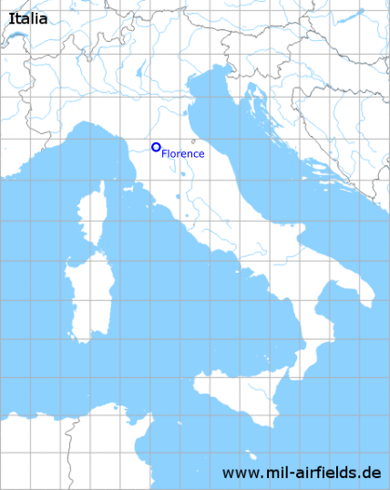
| Coordinates | N434837 E0111219 (WGS84) Google Maps |
| Region | Tuscany |
| Location indicator | LIRQ |
In the 1940s
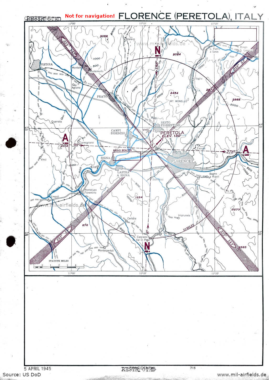
Approach (April 1945) - A Range beacon (the 4 beams) and a non-directional beacon ("RADIO BEACON") are located in the southeast of the runway. The map was initially classified as "Confidential" and was then downgraded to "Restricted". (Source: US DoD)
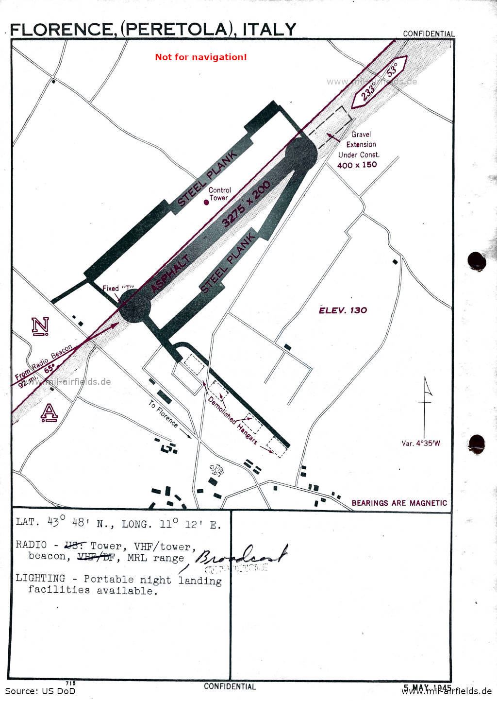
Aerodrome (May 1945) - There is one runway - length 998 m, width 61 m (3275 feet x 200 feet); an extension with gravel is under construction in the northeast: length 122 m, width 46 m (400 feet x 150 feet). Parking platforms on the sides are made of steel planks. In the south there are four demolished aircraft hangars. (Source: US DoD)
Index to the objects shown on the maps
Radio beacons / Radiofaro:
- Range, Radio beacon
Air traffic control / Controllo del traffico aereo:
- Tower
Places:
- Agliana, Bagno a Ripoli, Bisenzio, Borgo san Lorenzo, Campi Bisenzio, Carmignano, Cerbaia in Val di Pesa, Empoli, Fiesole, Firenze, Fiume Arno, Fiume Ombrone Pistoiese, Impruneta, Lastra a Signa, Montale, Montelupo Fiorentino, Montemurlo, Montespertoli, Pistoia, Prato, Quarrata, San Casciano in Val di Pesa, San Piero a Sieve, Sandicci, Sesto Fiorentino, Signa, Vaglia, Vaiano, Vinci
Source for all maps, if not marked otherwise: US Department of Defense (US DoD)
Recommended

Image credits are shown on the respective target page, click on the preview to open it.
 mil-airfields.de at Facebook