Lesina Airfield
Historical approach and aerodrome charts
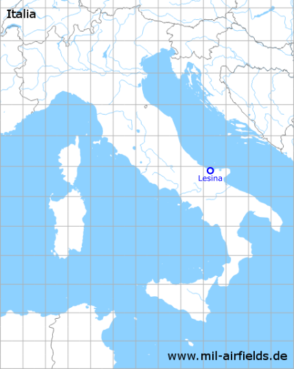
Aeroporto di Lesina
For historical information only, do not use for navigation or aviation purposes!
| Coordinates | N415151 E0151836 (WGS84) Google Maps |
| Region | Apulia, Province of Foggia (Provincia di Foggia) |
| Operator | United States Army Air Force |

In the 1940s
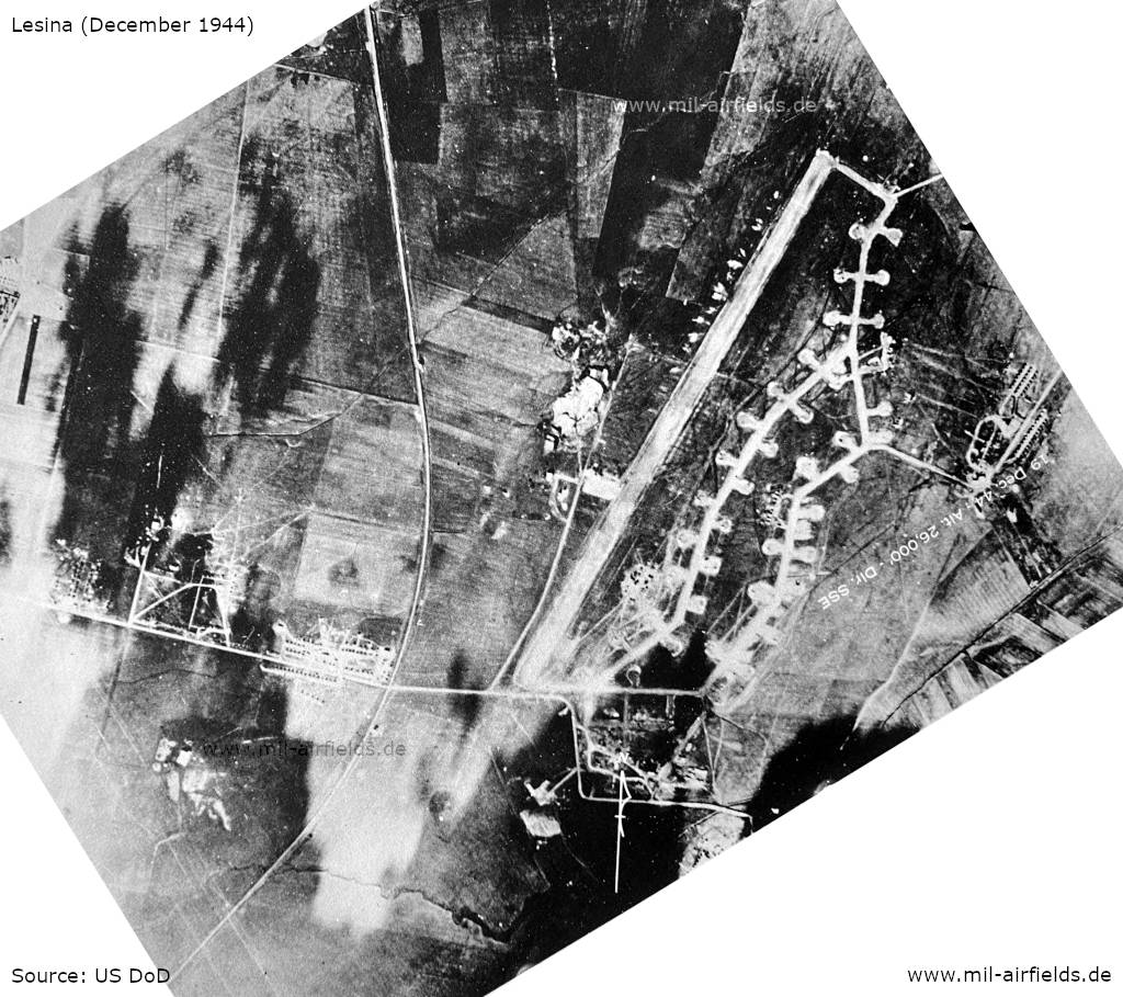
Aerial image (December 1944) (Source: US DoD)
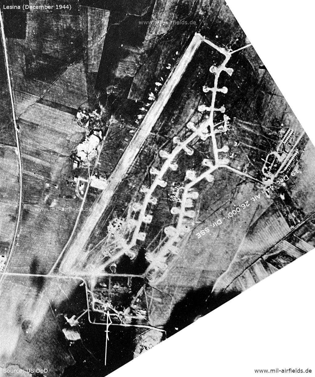
Enlargement with runway (Source: US DoD)
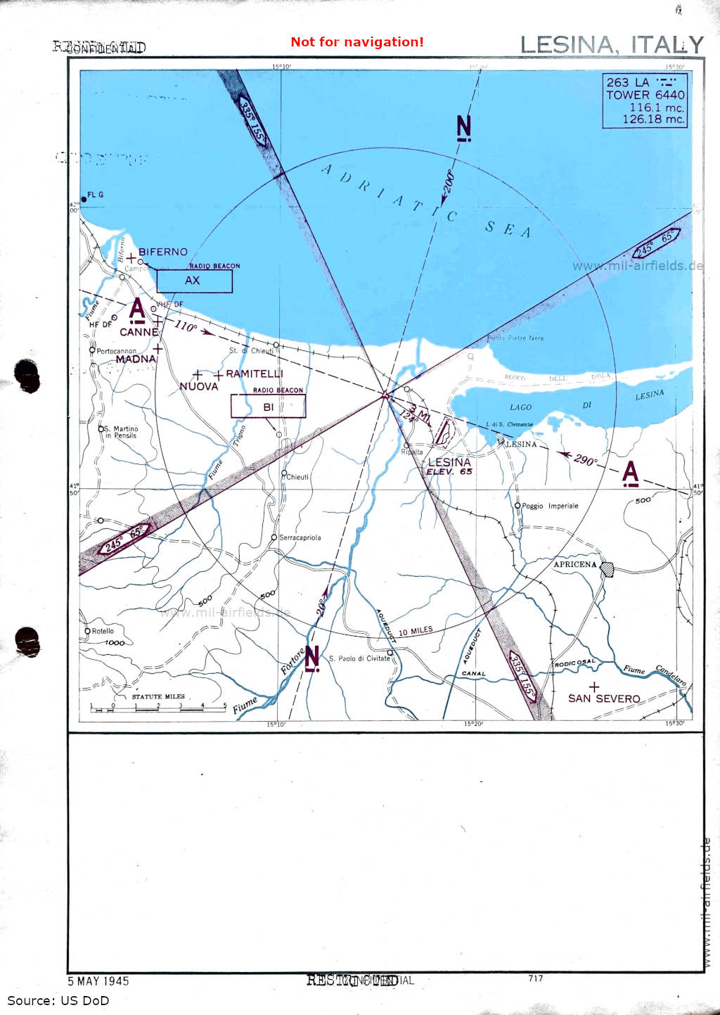
Approach (May 1945) (Source: US DoD)
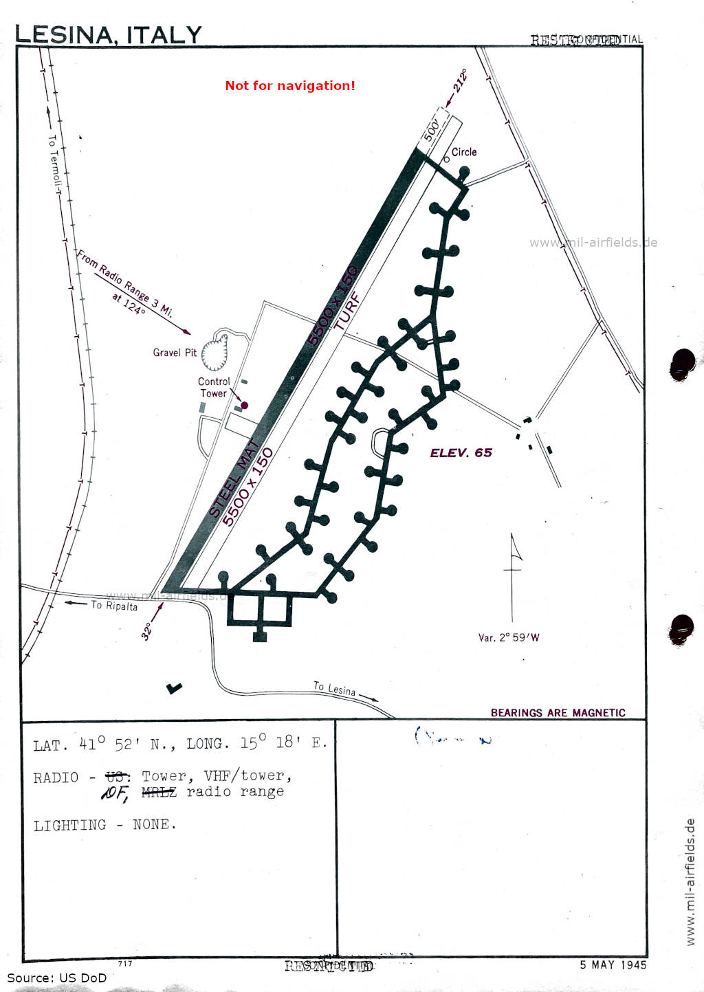
Airfield map (May 1945) - There are two runways - 032/212: length 1676 m, width 46 m (5500 feet x 150 feet) steel mat, 032/212: length 1676 m, width 46 m (5500 feet x 150 feet) turf. (Source: US DoD)
Index to the objects shown on the maps
Aerodromes / Aeroporti:
- Biferno
- Canne
- Madna
- Nuova
- Ramitelli
- San Severo
Radio beacons / Radiofaro:
- Lesina Range "LA",
- Radio beacon "AX", "BI"
Air traffic control / Controllo del traffico aereo:
- Lesina Tower
Places
- Adriatic Sea, Apricena
- Canal Rodicosal, Chieuti
- Fiume Biferno, Fiume Candelaro, Fiume Fortore, Fiume Trigno
- Lago di Lesina, Lesina
- Poggio Imperiale, Portocannon, Punta Pietre Nere
- Ripalta, Rotello
- S. Martino in Pensils, St. di Chieuti, Serracapriola
Source for all maps, if not marked otherwise: US Department of Defense (US DoD)
Recommended
Image credits are shown on the respective target page, click on the preview to open it.