San Giovanni Airfield
Historical approach and aerodrome charts
For historical information only, do not use for navigation or aviation purposes!
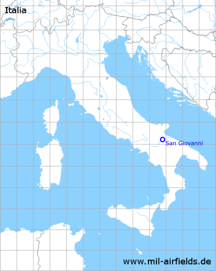
| Coordinates | N411360 E0154811 (WGS84) Google Maps |
| Region | Apulia, Province of Foggia (Provincia di Foggia) |
| Operator | US Army Air Force |

In the 1940s
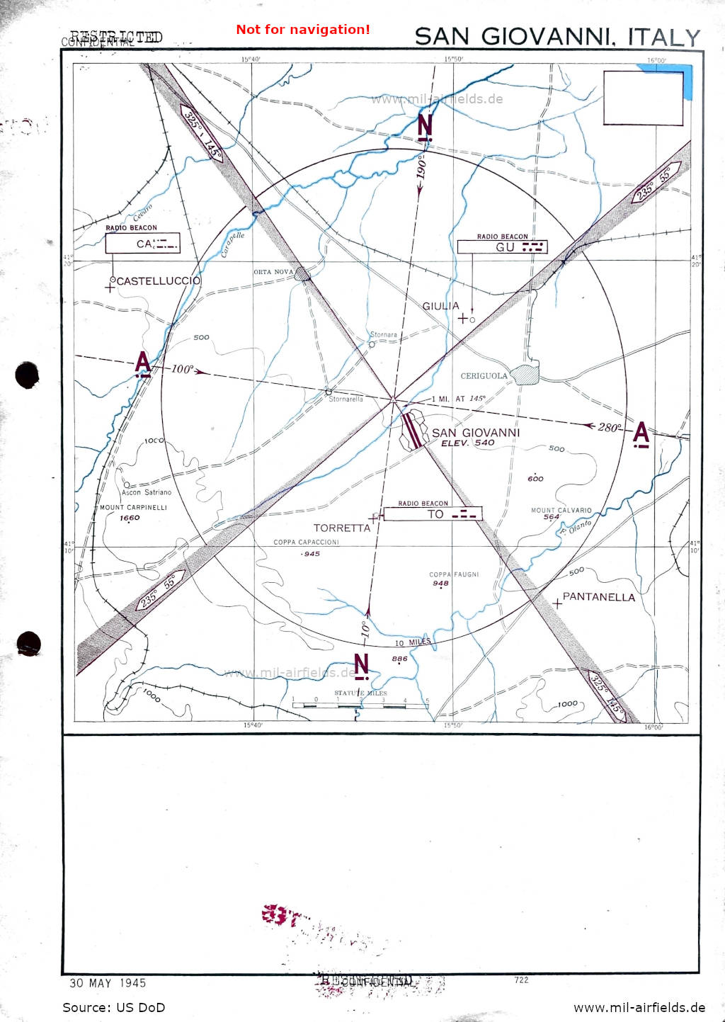
Approach chart (May 1945) (Source: US DoD)
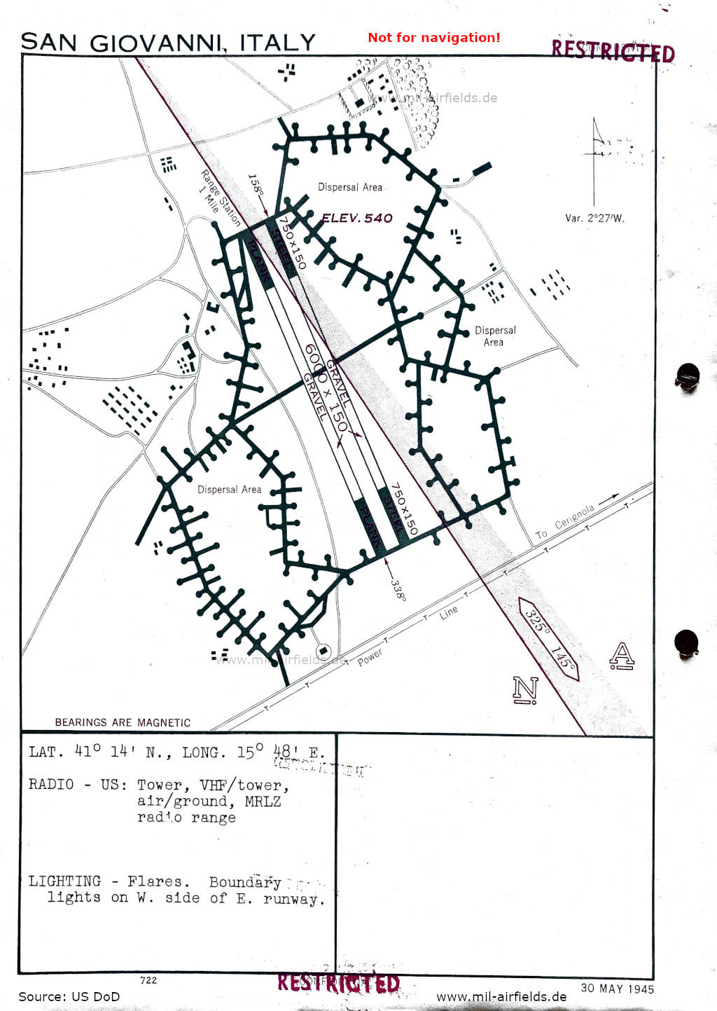
Airfield map (May 1945) - There are two parallel runways shown, each with a pavement of 750 feet (229 m) of steel plates, 6000 feet (1829 m) of gravel, and 750 feet (229 m) of steel plates. (Source: US DoD)
Index to the objects shown on the maps
Aerodromes / Aeroporti:
- Castelluccio
- Giulia
- Pantanella
- San Giovanni
- Torretta
Radio beacons / Radiofaro:
- Castelluccio NDB "CA"
- Guilia NDB "GU"
- San Giovanni Range
- Torretta NDB "TO"
Air traffic control / Controllo del traffico aereo:
- Tower
Places
- Ascon Satriano
- Ceriguola, Coppa Capaccioni, Coppy Faugni
- Mount Calvario, Mount Carpinelli
- Orta Nova
- Stornara, Stornarella
Source for all maps, if not marked otherwise: US Department of Defense (US DoD)
Recommended
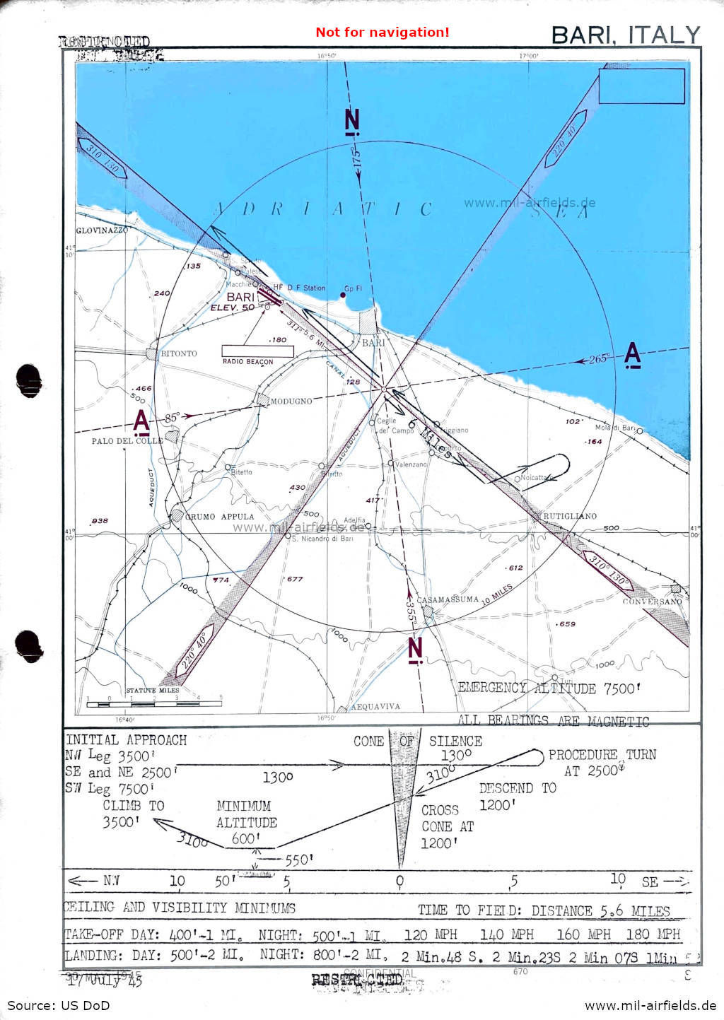
Image credits are shown on the respective target page, click on the preview to open it.