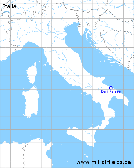
Bari Palese Airport
Palese Macchie, Aeroporto di Bari-Palese "Karol Wojtyla"
Historical approach and aerodrome charts
Aeroporto di Bari-Palese: Carte di avvicinamento
For historical information only, do not use for navigation or aviation purposes!
| Coordinates | N410816 E0164528 (WGS84) Google Maps |
| Location indicator | LIBD |
In the 1940s
The maps show the old installations, which are out of operation today. The new facilities were built later east of it.
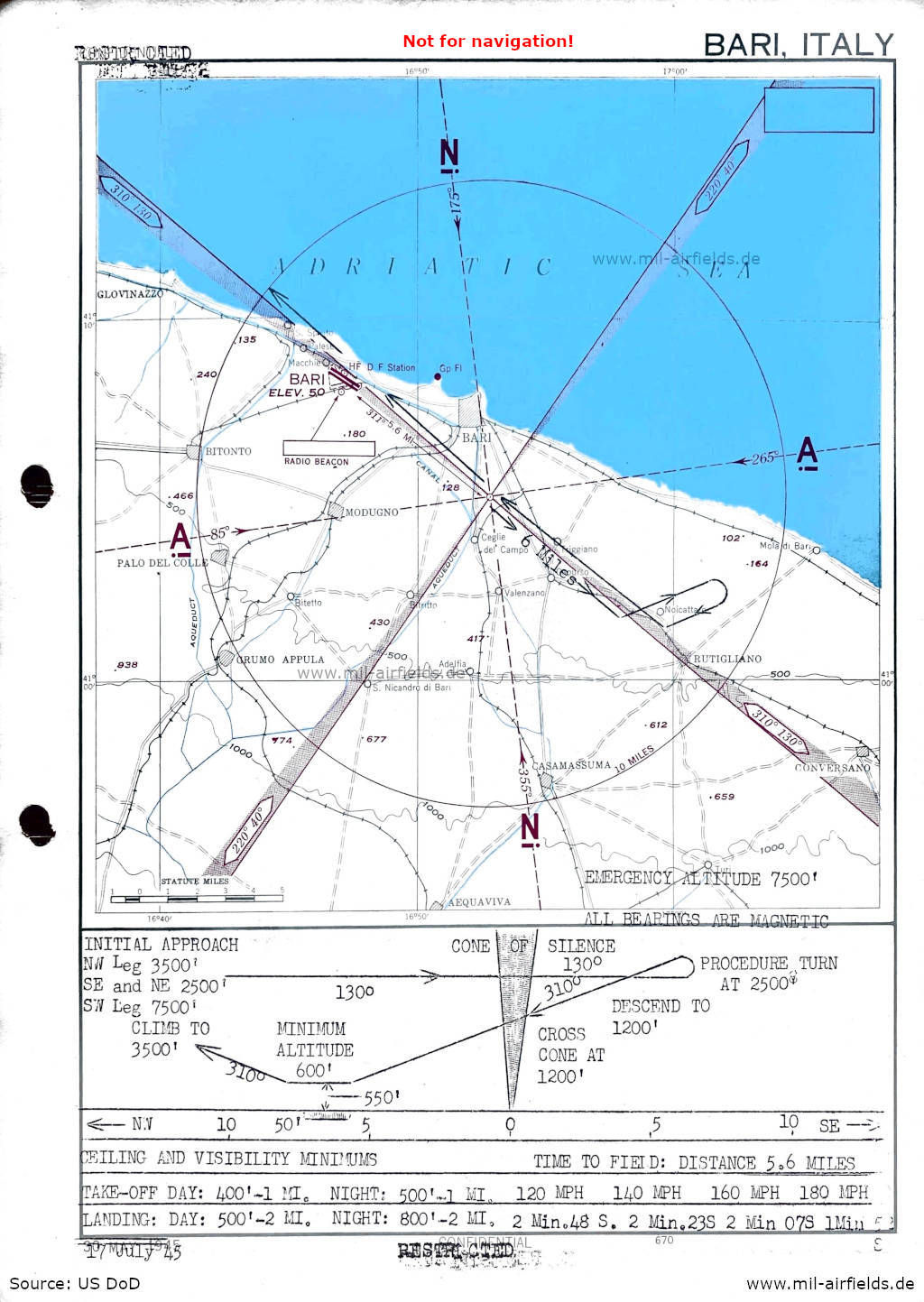
Range approach (July 1945) - The map was initially classified as "Confidential" and was then downgraded to "Restricted". (Source: US DoD)
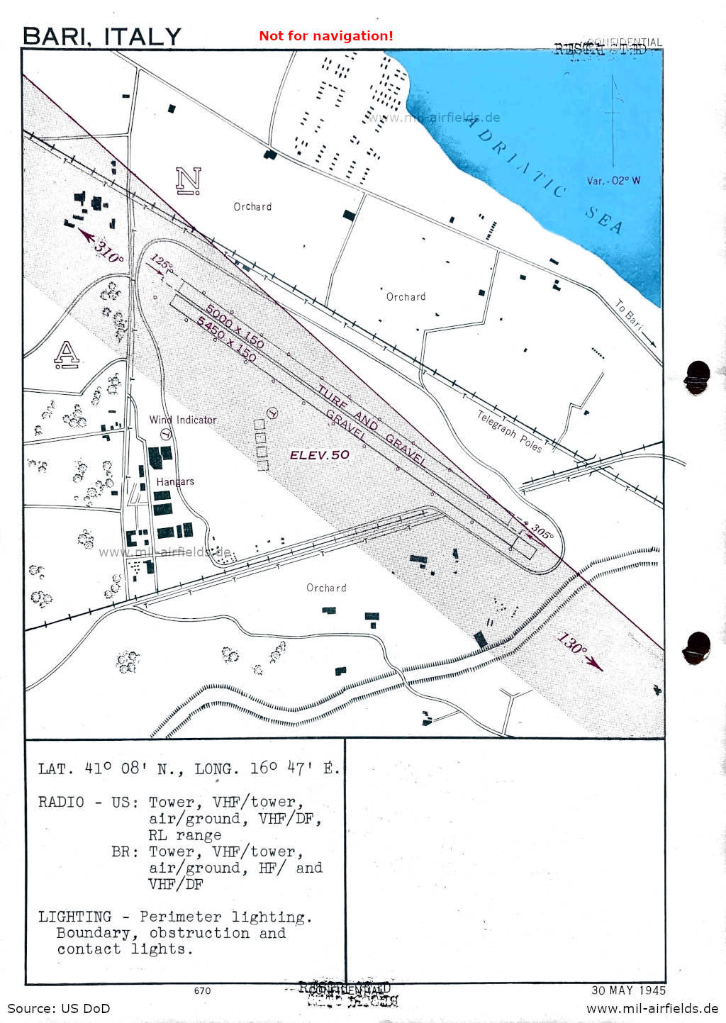
Aerodrome (May 1945) - There are two runways - 125/305: length 1661 m, width 46 m (5450 feet x 150 feet) gravel, 125/305: length 1524 m, width 46 m (5000 feet x 150 feet) turf and gravel. (Source: US DoD)
In the 1950s
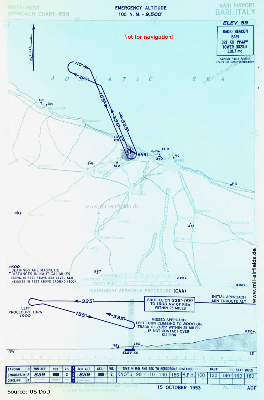
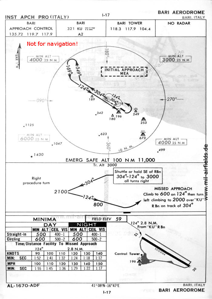
NDB approach (October 1953) - Carte di avvicinamento (Source: US DoD)
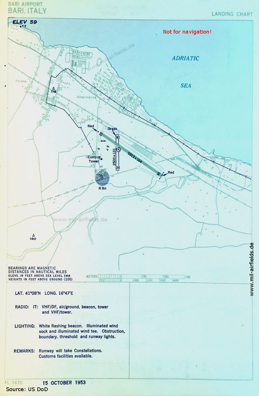
Airport map (October 1953) - Carta aerodromo - The runway lengths are given in feet. The paved runway 12/30 is 1,680 m (5,512 feet) long, the grass runway 18/36 is 762 m (2,500 feet) long. Near the threshold 12 is a writing "Bari", the control tower stands in the west of the field and in the southeast corner is the non-directional radio beacon (R Bn). (Source: US DoD)
In the 1960s
NDB approach runway 12 (October 1960) (Source: US DoD)

Satellite image from 12 September 1961 - The image was taken from a US reconnaissance satellite and was previously subject to strict secrecy. (Source: U.S. Geological Survey)
Index to the objects shown on the maps
Radio beacons / Radiofaro:
- Bari NDB KU
Air traffic control / Communications / Controllo del traffico aereo:
- Bari Approach Control, Bari Tower
Places:
- Acquaviva delle Fonti, Alberotanza, Bari, Bitetto, Bitonto, Capurso, Casamassima, Ceglie del Campo, Conversano, Giovinazzo, Grumo Appula, Mariotto, Modugno, Mola di Bari, Molfetta, Montrone (Adelfia), Noicattaro, Palese, Palo del Colle, Palombaio, Rutigliano, Sannicandro di Bari, Sovereto, Spirito, Terlizzi, Toritto, Triggiano, Turi, Valenzano
Source for all maps, if not marked otherwise: US Department of Defense (US DoD)
Recommended


Image credits are shown on the respective target page, click on the preview to open it.