Turin Caselle Airport
Aeroporto di Torino-Caselle "Sandro Pertini"
Historical approach and aerodrome charts
Aeroporto di Torino-Caselle: Carte di avvicinamento
For historical information only, do not use for navigation or aviation purposes!
| Coordinates | N451210 E0073859 (WGS84) |
| Region | Piedmont / Piemonte, Dora Riparia, Po, Sangone, Stura di Lanzo |
| Location indicator | LIMF |
In the 1960s

ILS approach runway 01 (October 1960) - There is one runway - 01/19: length 3000 m, width 60 m (9843 feet x 197 feet). (Source: US DoD)
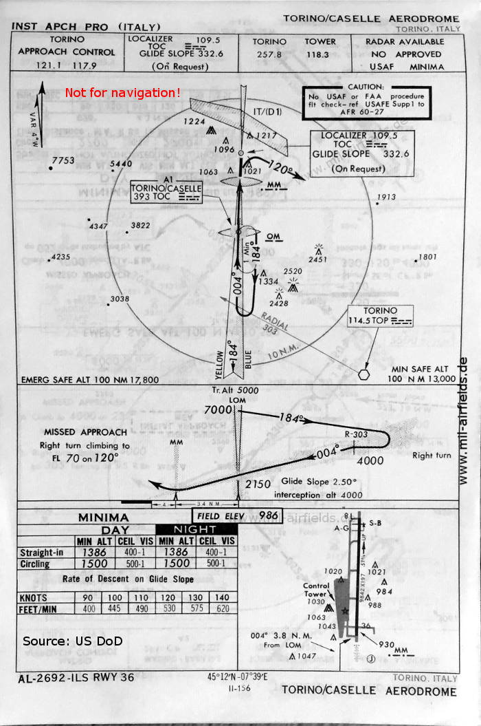
ILS approach runway 36 (May 1966) - Now the runway shown an - 18/36: length 3000 m, width 60 m (9842 feet x 197 feet) - The length is one feet shorter, compared to 1960. The parallel taxiway has been extended to the north. In addition, the identifiers of the beacons have been changed (MM / IMM → TOC) (Source: US DoD)
Index to the objects shown on the maps
Airspace / Spazio aereo:
- IT(D) 1
Radio beacons with Identifier / Radiofaro:
- Torino NDB "IMM", "TOC", VOR "TOP", Localizer "MM", "TOC", Outer Marker, Middle Marker
Air traffic control / Controllo del traffico aereo / Communications:
- Caselle Tower
- Torino Approach Control, Torino Tower
Source for all maps, if not marked otherwise: US Department of Defense (US DoD)
Recommended


Image credits are shown on the respective target page, click on the preview to open it.