Sundsvall Härnösand / Timrå Airport
Sundsvall–Härnösand flygplats
Historical approach and aerodrome charts
For historical information only, do not use for navigation or aviation purposes!
| Coordinates | N623139 E0172641 (WGS84) Google Maps |
Location Indicator: ESNN
In the 1950s
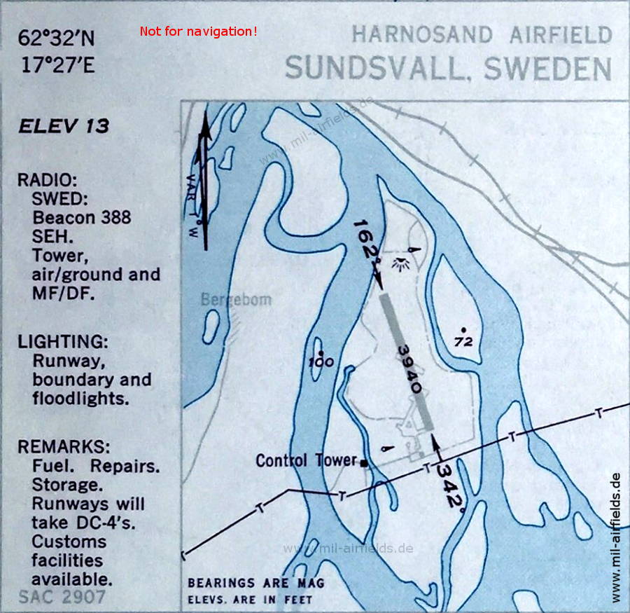
Airport (October 1950)
The runway length is indicated as 1,201 m (3,940 feet). The field is located on the island of Skeppsholmen in the mouth delta of the river Indalsälven between the arms Sörån and Norrån. Smaller arms are shown on the island, which were probably filled in later when the airport was extended. Apparently there is still no road connection to the island.
(Source: US DoD)
Source for all maps, if not marked otherwise: US Department of Defense (US DoD)
Recommended

Image credits are shown on the respective target page, click on the preview to open it.
 mil-airfields.de at Facebook