Inverness Dalcross Airport
Dalcross
Historical approach and aerodrome charts / Airfield history
For historical information only, do not use for navigation or aviation purposes!
| Coordinates | N573233 W0040251 (WGS84) Google Maps |
| Region | Scotland, Highland, Ness, Moray Firth |
| Location indicator | GGCH, EGPE |

In the 1950s
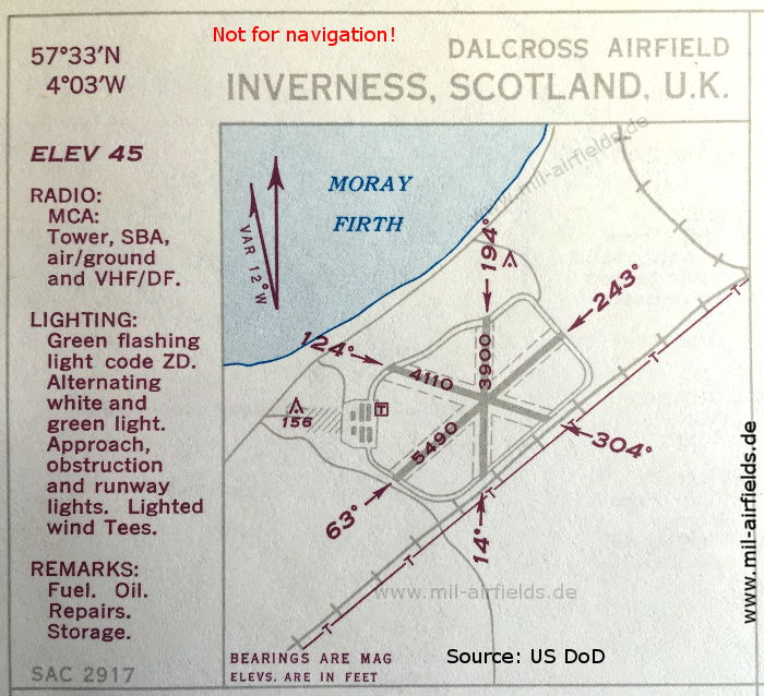
Airport (October 1950) - There are three runways - 063/243: length 1673 m (5490 feet), 124/304: length 1253 m (4110 feet), 014/194: length 1189 m (3900 feet). (Source: US DoD)
In the 1990s
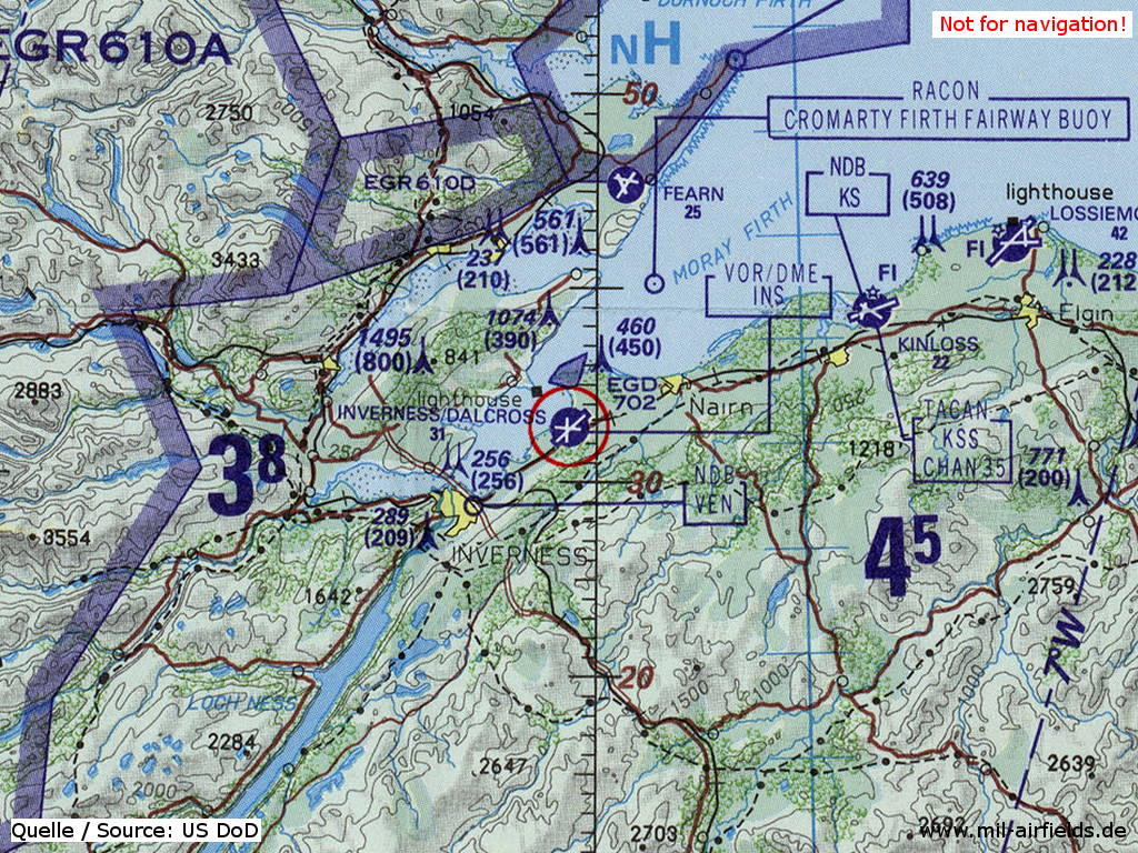
Inverness Dalcross Airport on a map of the US Department of Defense from 1993 (Source: ONC E-2 (1993), Perry-Castañeda Library Map Collection, University of Texas at Austin)
Index to the objects shown on the maps
Aerodromes:
- Fearn
- Inverness
- Kinloss
- Lossiemouth
Airspace:
- EG(D) 703
- EG(R) 610A, EG(R) 610D
Radio beacons:
- Inverness NDB "VEN", VORDME "INS"
- Kinloss NDB "KS", TACAN "KSS"
Source for all maps, if not marked otherwise: US Department of Defense (US DoD)
Recommended
Image credits are shown on the respective target page, click on the preview to open it.
 mil-airfields.de at Facebook