RAF Manston
Historical approach and aerodrome charts for free download
For historical information only, do not use for navigation or aviation purposes!
| Coordinates | N512031 E0012051 (WGS84) Google Maps |
| Location indicator | MAXM, EGUM (mil), EGMH (civ) |
| Operator | US Air Force (USAF), Royal Air Force (RAF), Kent International Airport |
In the 1950s
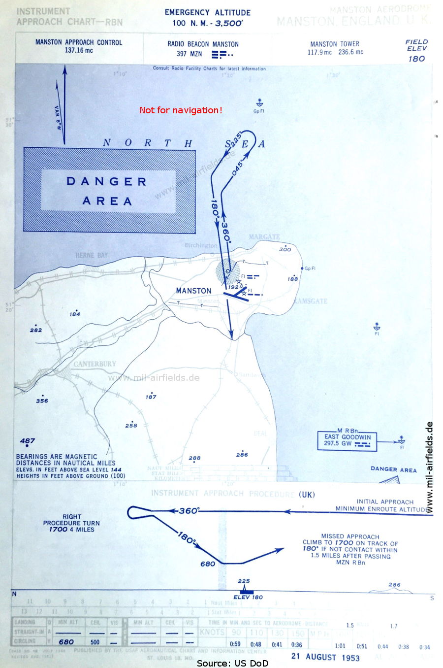
NDB approach (August 1953) (Source: US DoD)
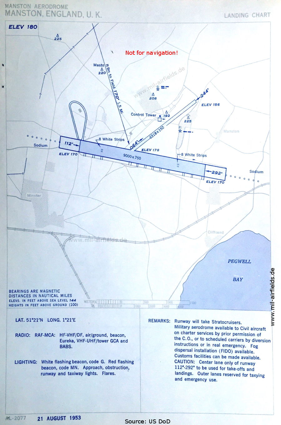
Aerodrome (August 1953) - Besides Carnaby and Woodbridge, also Manston received a long and, at 229 m (750 feet), particularly wide runway as an emergency landing field for bombers during the Second World War. (Source: US DoD)
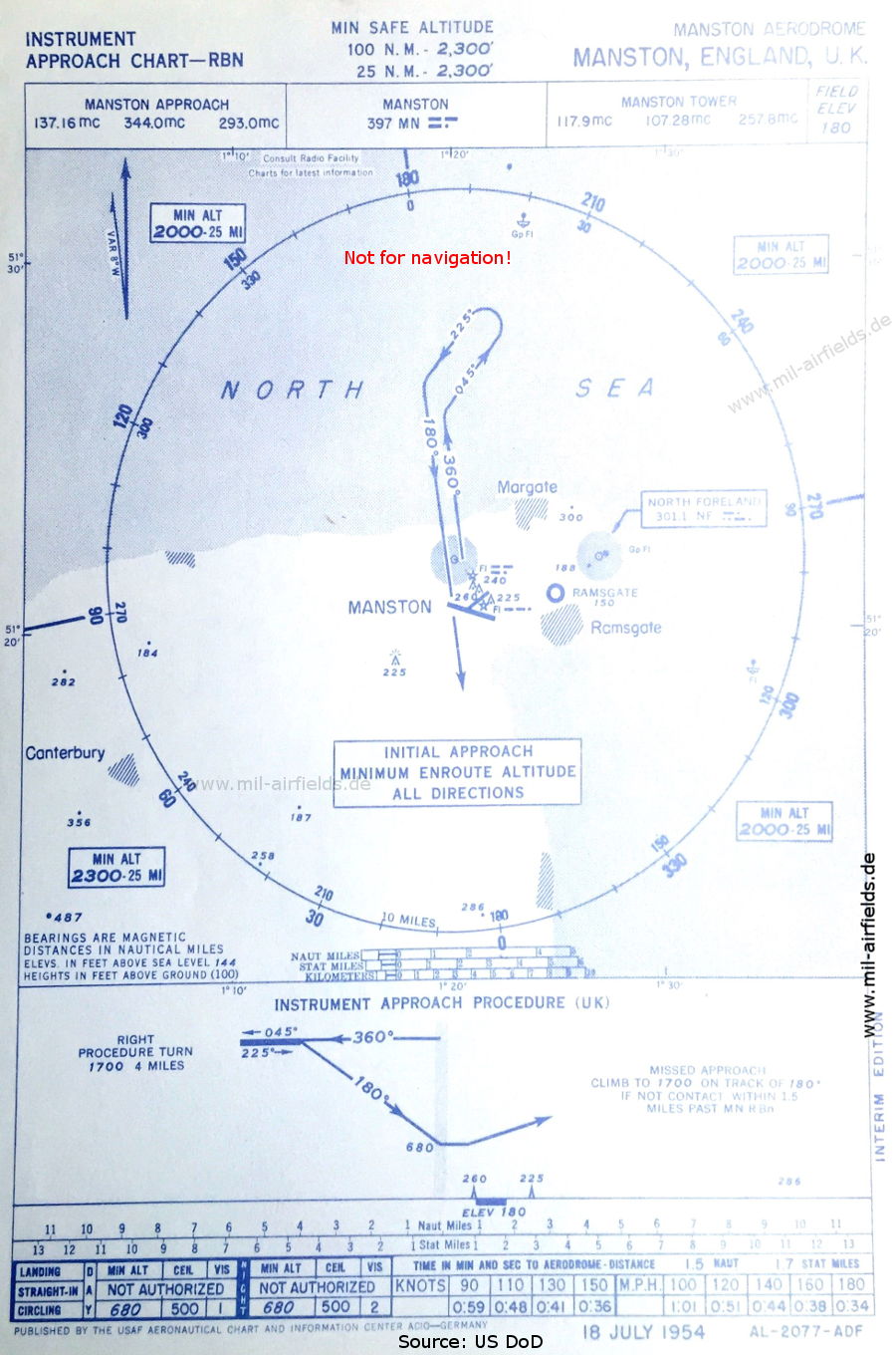
NDB approach (July 1954) - Airfield in the vicinity: Ramsgate (Source: US DoD)
Source for all maps, if not marked otherwise: US Department of Defense (US DoD)
Recommended

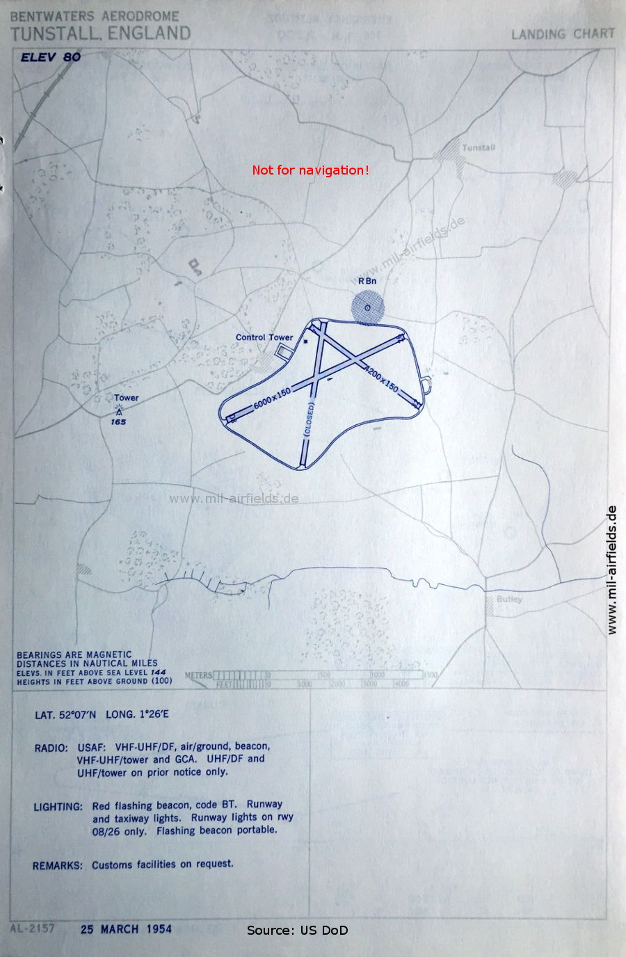

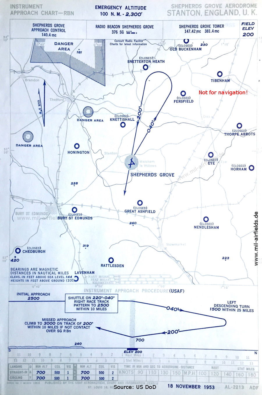
Image credits are shown on the respective target page, click on the preview to open it.
 mil-airfields.de at Facebook