RAF Northolt
Historical approach and aerodrome charts for free download
For historical information only, do not use for navigation or aviation purposes!
| Coordinates | N513310 W0002503 (WGS84) Google Maps |
| Region | London, South Ruislip, Uxbridge, Hillingdon |
| Location indicator | GACA, EGWU |
| Operator | Royal Air Force (RAF) |

In the 1950s
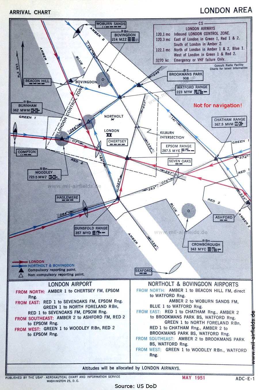
Arrival routes London (May 1951) - Shown are the routes from the airways (Amber 1, Amber 2, Blue 1, Green 1, Red 1, Red 2) to the field. (Source: US DoD)

Departure routes London (May 1951) (Source: US DoD)
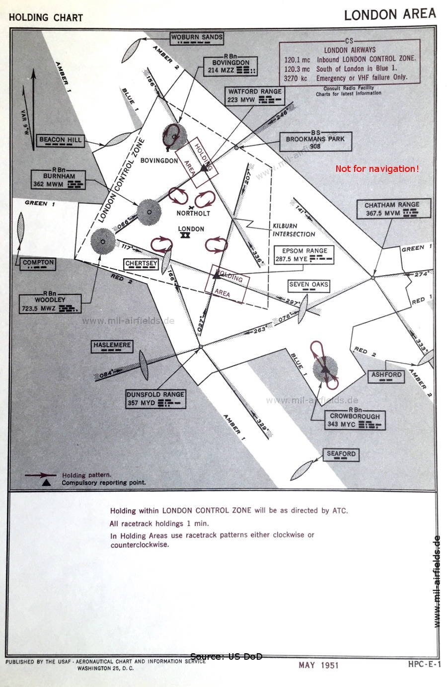
Map of the holding patterns in the area of London (May 1951) (Source: US DoD)

Approach chart (February 1952) - Airfields in the vicinity: Brooklands, Croydon, Denham, Elstree, Fairoaks, Farnborough, Hendon, Kenley, Langley, London Heathrow, Wisley. (Source: US DoD)
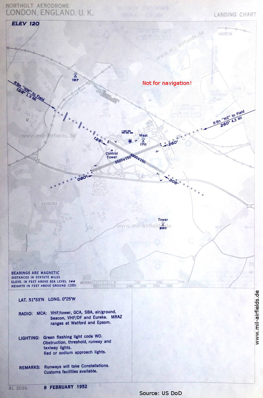
Aerodrome chart (February 1952) - Air traffic control is civilian operated. (Source: US DoD)
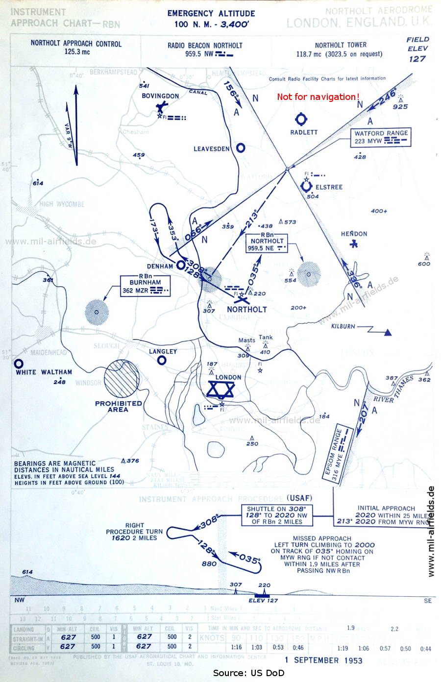
NDB approach (September 1953) (Source: US DoD)
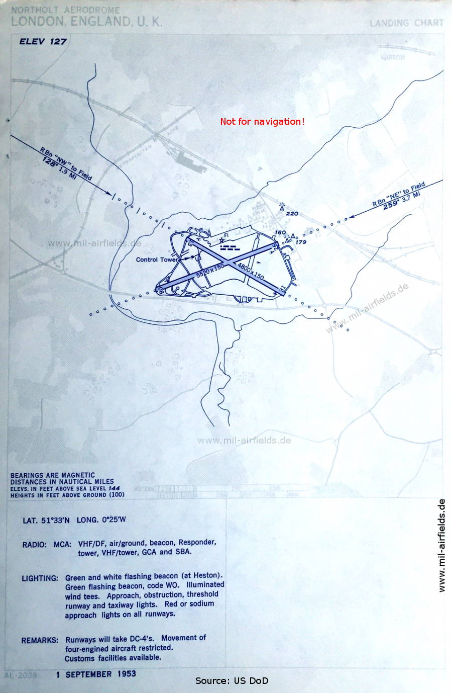
Aerodrome chart (September 1953) (Source: US DoD)
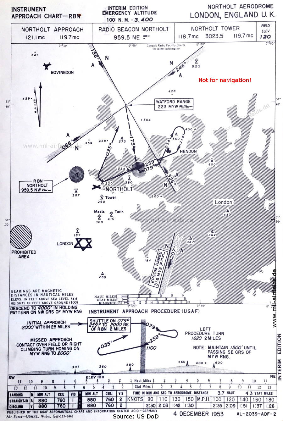
NDB approach (December 1953) - Interim edition (Source: US DoD)
Source for all maps, if not marked otherwise: US Department of Defense (US DoD)
Recommended


Image credits are shown on the respective target page, click on the preview to open it.
 mil-airfields.de at Facebook