Blackbushe Airport
RAF Blackbushe, Camberley
Historical approach and aerodrome charts / Airfield history
For historical information only, do not use for navigation or aviation purposes!
| Coordinates | N511928 W0005045 (WGS84) Google Maps |
| Region | Hampshire, Camberley |
| Location indicator | GAOA, EGLK |
In the 1950s
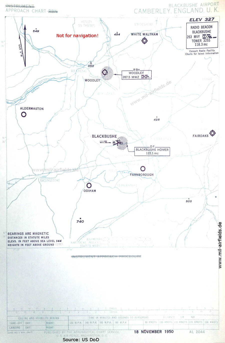
Instrument Approach Chart (November 1950) - There is no procedure shown. Airfields in the vicinity: Aldermaston, Fairoaks, Farnborough, Odiham, White Waltham, Woodley. (Source: US DoD)
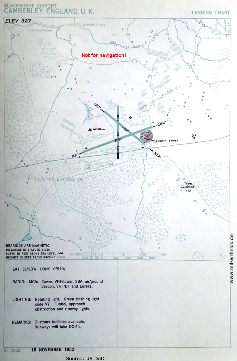
Airfield map (November 1950) - Navigation and approach aids include SBA (Standard Beam Approach) and Eureka/Rebecca radar beacon. (Source: US DoD)

NDB approach map runway 08 (July 1954) - Airfields in the vicinity: Aldermaston, Fairoaks, Farnborough, Hamstead Norris, Odiham, Langley, Lasham, White Waltham, Woodley. (Source: US DoD)
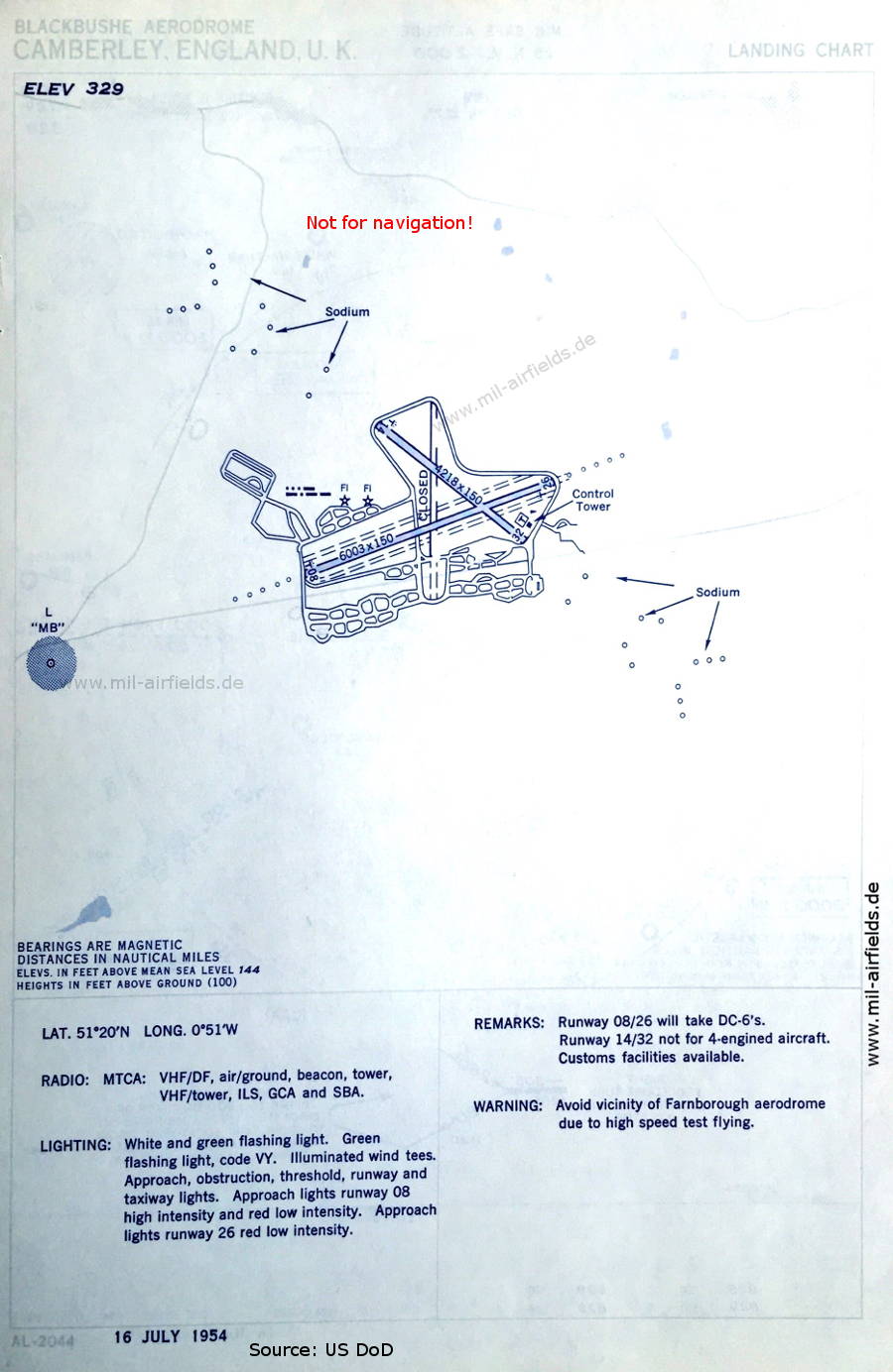
Landing chart (July 1954) (Source: US DoD)
In the 1990s
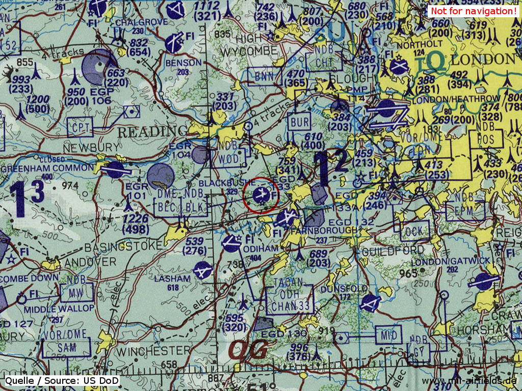
Blackbushe Airport on a map of the US Department of Defense from 1993 (Source: ONC E-2 (1993), Perry-Castañeda Library Map Collection, University of Texas at Austin)
Source for all maps, if not marked otherwise: US Department of Defense (US DoD)
Links
https://atchistory.wordpress.com/2019/09/22/blackb... - Blackbushe Procs 1959 - Instrument Approach Chart and Landing Chart
https://atchistory.wordpress.com/2019/09/22/blackb... - EGLK Blackbushe
Recommended


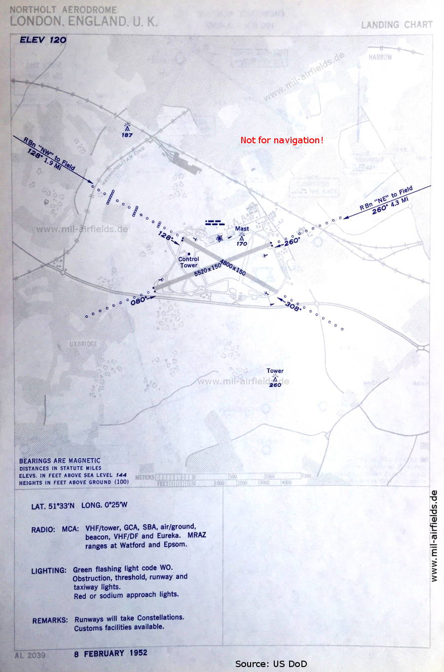
Image credits are shown on the respective target page, click on the preview to open it.
 mil-airfields.de at Facebook