For historical information only, do not use for navigation or aviation purposes!
| Coordinates | N522609 E0123525 (WGS84) Google Maps |
| Former East Germany (GDR) | District of Potsdam |
| Federal state | Brandenburg |
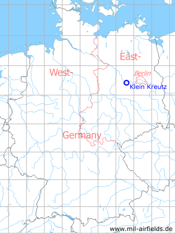
Germany during the Cold War Map
The history of the Cold War airfields: Klein Kreutz
Location of airfield
The airfield is located ca. 4 km northeast of Brandenburg/Havel center, ca. 2 km west of Klein Kreutz and ca. 3 km south of Mötzow.
During World War II
Use
Emergency landing ground since the 1930s.
Overview
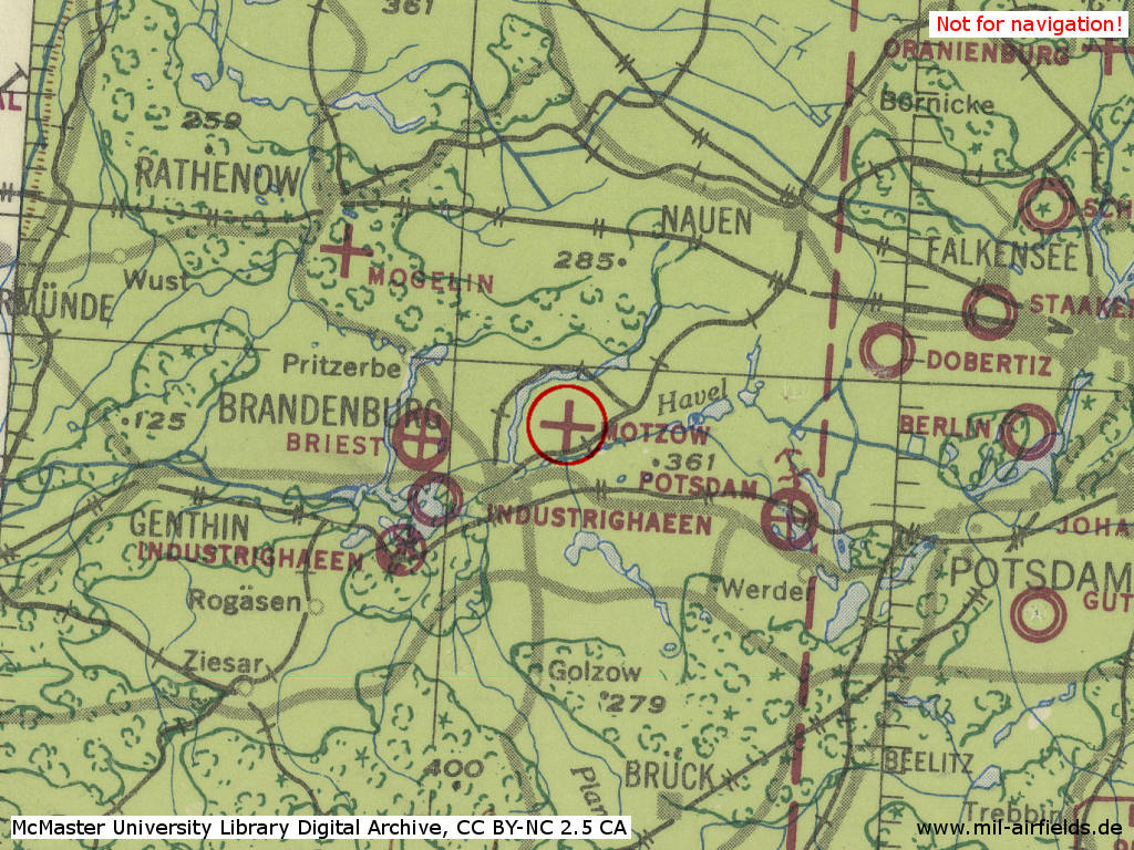
Klein Kreutz Airfield in World War II on a US map from 1943 - (McMaster University Library Digital Archive, License: Creative Commons Attribution-NonCommercial 2.5 CC BY-NC 2.5 CA /MULDA/)
During the Cold War
Use
Training field of the former East German helicopter from Brandenburg/Briest. The airfield had the number 2134. In addition, the East German helipad 6008 "GST-Bezirksausbildungszentrum Klein Kreutz" was located here.
In the 1940s
History
Reconnoitering report for the CIA from December 1949
No airfield was identified on either side of the Brandenburg (N 53&Z 23) - Moetzow (N 53/Z 24) road. No Soviet troops were quartered in Moetzow. There was no military object in the surroundings which could be seen at a distance of 2 to 2 km in good visibility.
Comment: Report is considered credible as no information on an airfield near Moetzow has been received ... A landing field, about 400 x 500 meteres, existed near Moetzow during the war.
Source: CIA
In the 1960s
Situation
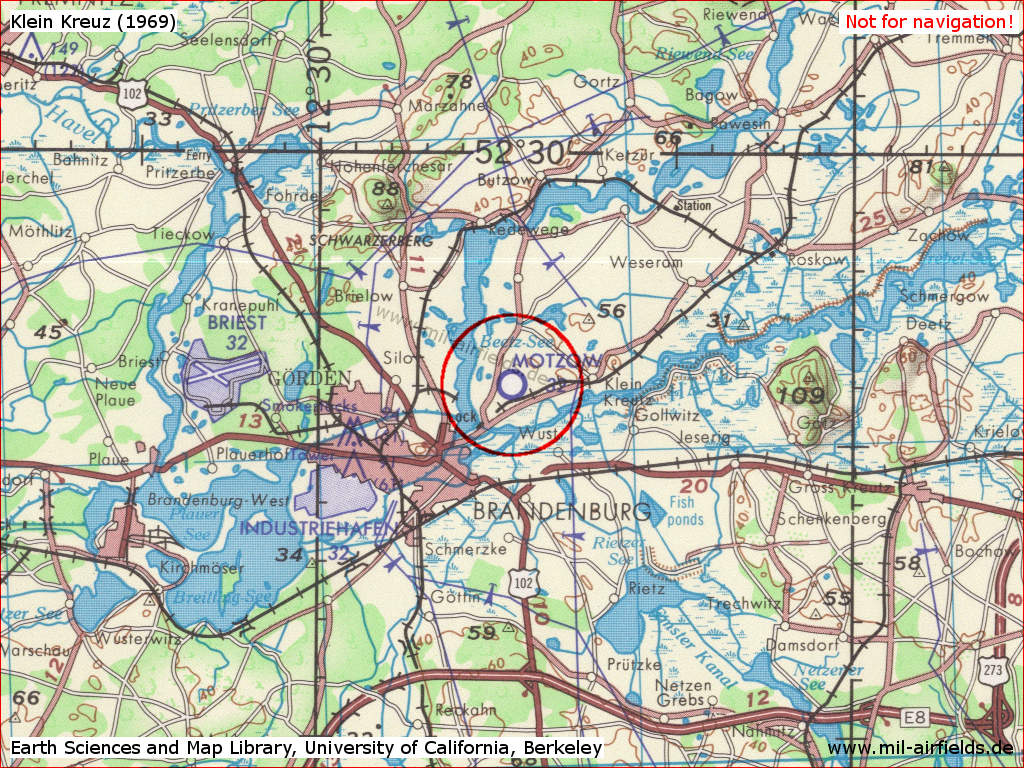
Klein Kreutz Airfield on a US map from 1969
Source: Earth Sciences and Map Library, University of California, Berkeley
In the 1970s
Overview
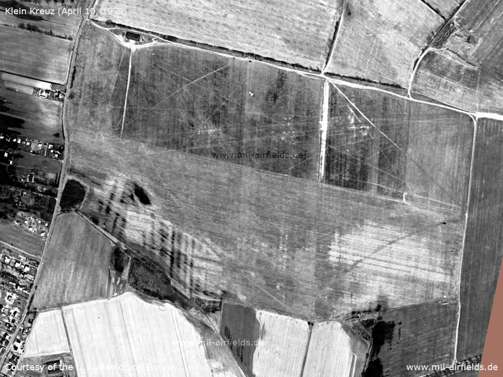
Klein Kreutz Airfield on a US satellite image from Tuesday April 10, 1979 - From the position of the sun it is late morning and there is light air traffic with 2 helicopters.
Source: U.S. Geological Survey
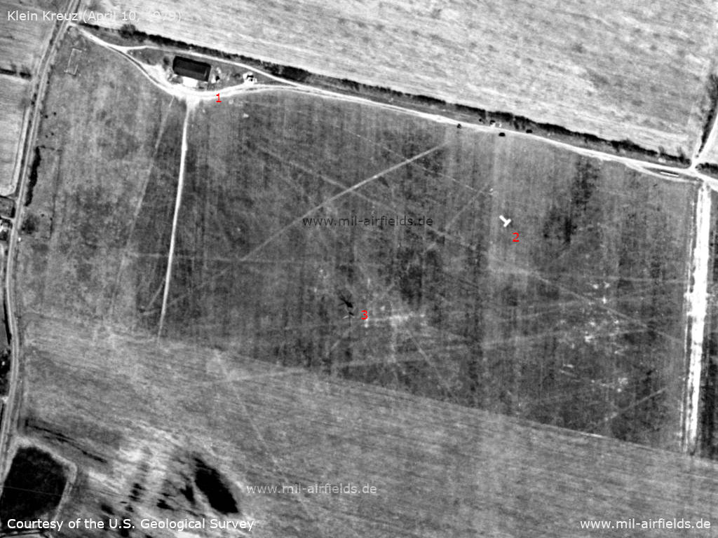
Enlargement: Western part - 1: Building, 2: Landing-T, 3: Helicopter with shadow
Source: U.S. Geological Survey
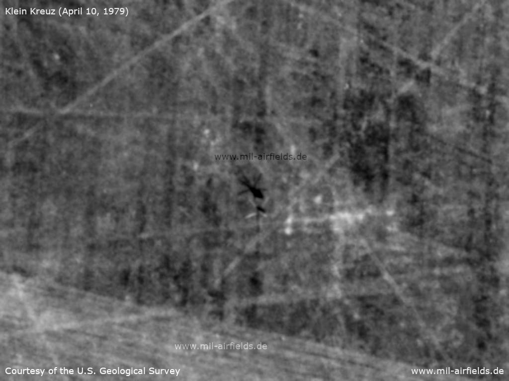
It is a 5-blade rotor, so it is probably a Mil Mi-8, probably of the East German Air Force
Source: U.S. Geological Survey
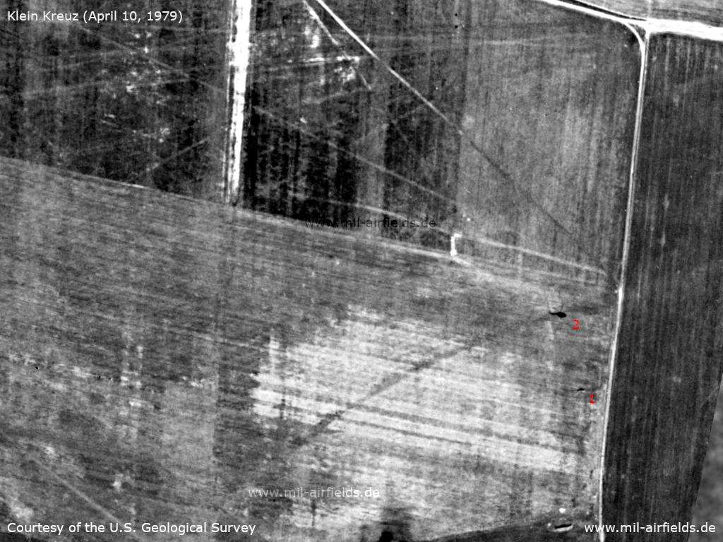
Enlargement: Eastern part - 1: Helicopter at the eastern airfield boundary, 2: Shadow
Source: U.S. Geological Survey
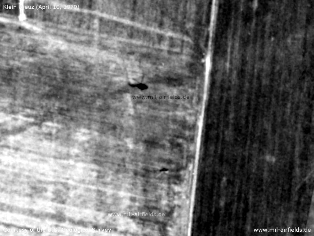
Enlargement: This also appears to be a Mi-8. - However, the helicopter appears to be flying much higher because the fuselage and shadow are farther apart.
Source: U.S. Geological Survey
In the 1980s and early 1990s
Runways
For helipad 6008:
- dimensions: 1100 m x 800 m
- main takeoff and landing direction: 270°/90°
- surface: grass,
- capacity: 12 helicopters.
- dimensions: 1100 m x 800 m
- main takeoff and landing direction: 270°/90°
- surface: grass,
- capacity: 12 helicopters.
Radio beacons
- LOM 01: 456 "KX"
- LOM 19: 456 "XK"
Radio communication
The call sign was KODEX.
Today
Use
General aviation / special airfield.
Links
- http://www.nva-flieger.de/index.php/nva-hs-plaetze... - Brandenburg-Briest airfield - with information about Klein Kreutz airfield.
Airfields in the vicinity
- 271°/9km Brandenburg: Briest Air Base
- 063°/15km Zachow: Helipad 3119 (HSLP / HLP 3119)
- 329°/19km Bamme: Agricultural Airfield
 Follow mil-airfields on Facebook