For historical information only, do not use for navigation or aviation purposes!
| Coordinates | N523013 E0140053 ca. (WGS84) Google Maps |
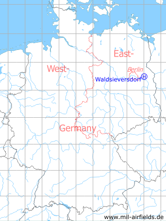
Germany during the Cold War Map
The history of the Cold War airfields: Waldsieversdorf
Location
Waldsieversdorf is located 13 km east-southeast of Strausberg.
Location of airfield
4.7 km southwest of Waldsieversdorf
Usage during the Cold War
Helipad 3004 for HQ Signals Regiment 14 (NR-14) of former East German Airforce (NVA LSK/LV).
Use today
Closed.
Runways, taxiways, aprons
Dimensions: 200 m x 200 m
Main takeoff and landing direction: 180°
Surface: overgrown sand
Capacity: 1 helicopter
Main takeoff and landing direction: 180°
Surface: overgrown sand
Capacity: 1 helicopter
Telephone
Stabsnetz S1 2434-754-88
Airspace and procedures
Usable at day during good weather conditions
Alert time: 60 minutes.
Alert time: 60 minutes.
Obstacles
None.
Airfields in the vicinity
- 119°/5km Müncheberg: Eggersdorf Airfield (Eggersdorf)
- 322°/11km Strausberg: Airfield
- 281°/13km Strausberg: Helipad 3001 (HSLP 3001)
- 157°/14km Fürstenwalde: Airfield
Categories
Military Airfields GermanyMilitary Airfields in former East GermanyHelipads of former National People's ArmyRecommended
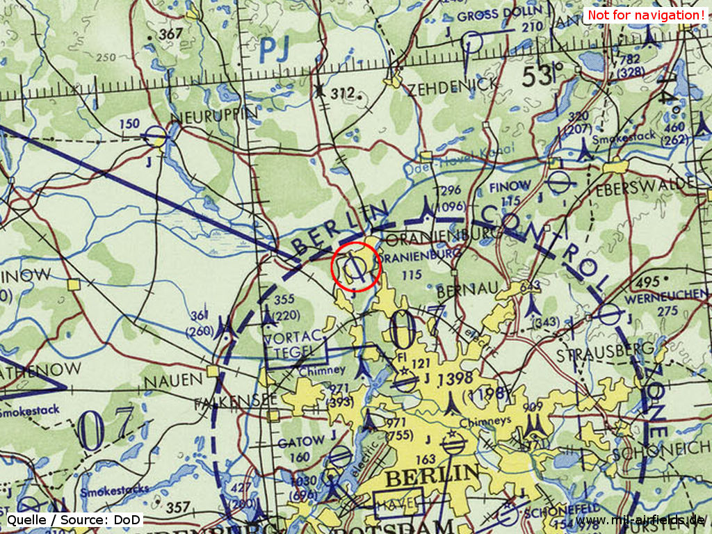
Image credits are shown on the respective target page, click on the preview to open it.
 Follow mil-airfields on Facebook