For historical information only, do not use for navigation or aviation purposes!
| Coordinates | N523129 E0134947 (WGS84) Google Maps |
| Former East Germany (GDR) | District of Frankfurt/O |
| Federal state | Brandenburg |
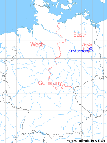
Germany during the Cold War Map
The history of the Cold War airfields: Strausberg Helipad 3001
Usage during the Cold War
Helicopter landing pad 3001 for HQ of the former East German Air Force (NVA LSK/LV).
Use today
Helipad of the Barnim Kaserne.
Runways, taxiways, aprons
1 pad 20 m x 20 m,
2 parking positions,
curface: concrete.
Capacity: 3 helicopters.
Usable without crop damage.
2 parking positions,
curface: concrete.
Capacity: 3 helicopters.
Usable without crop damage.
Communication
Stabsnetz S1 2734-3200
Airspace and procedures
Usable at day in good weather conditions.
Alert time: 60 minutes.
Alert time: 60 minutes.
Obstacles
Woods: distance 60..120 m, height: 15 m.
Airfields in the vicinity
- 043°/8km Strausberg: Airfield
- 286°/12km Hönow: Agricultural Airfield
- 101°/13km Waldsieversdorf: Helipad 3004 (HSLP / HLP 3004, Rotes Luch)
- 341°/13km Werneuchen: Air Base (Аэродром Вернейхен (ГДР))
- 299°/15km Blumberg: Agricultural Airfield
- 106°/18km Müncheberg: Eggersdorf Airfield (Eggersdorf)
- 217°/18km Berlin: Müggelheim Agricultural Airfield
- 262°/18km Berlin: Helipad 1028 (HSLP / HLP 1028)
- 032°/19km Prötzel: Helipad 3112 (HSLP / HLP 3112)
 Follow mil-airfields on Facebook