For historical information only, do not use for navigation or aviation purposes!
| Coordinates | N522848 E0140501 (WGS84) Google Maps |
| Former East Germany (GDR) | District of Frankfurt/O |
| Federal state | Brandenburg |
| Location indicator | EDCE |
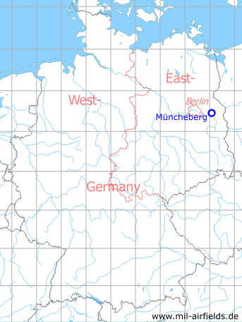
Germany during the Cold War Map
The history of the Cold War airfields: Müncheberg
During World War II
Use
Luftwaffe airfield.
During the Cold War
Use
From 1954 to 1978 the field was used by the Society for Sports and Technology (Gesellschaft für Sport und Technik, GST). From 1965/66, airfield of the East German National People's Army (NVA), initially shared with the GST, from 1978 exclusively auxiliary airfield of the NVA for Fighter Wing 8 (Jagdgeschwader 8, JG-8) and Transport Wing 44 (Transportfliegergeschwader 44, TG-44), both based at Marxwalde airfield.
In the 1950s
History
CIA report October 1950
1. Muencheberg airfield is located within a triangle formed by Muencheberg (N52/V55), Eggersdorf (N53/V34) and Schoenfelde (N53/V24), in Brandenburg. It was formerly used by the German Luftwaffe and presently servers as an auxiliary airfield for the Soviet Air Force. The field is not suitable for jet aircraft.
2. Approximately 500 Soviet Air Force personnel are stationed at Muencheberg airfield. There are no permanently stationed flying personnel.
3. The prevailing wind over the field is east-northeast to northeast. There is a grassed runway. Lanterns serve as emergency lighting for night flying.
4. There are no permanent buildings at the field. A camouflaged dispersal area for aircraft and ten new huts were being prepared in March 1950 and were due to be completed by autumn 1950. Construction was being carried out by Soviet army units stationed at the airfield.
5. There is a direction-finding device at Muencheberg.
6. Fuelling is carried out from drums or tank trucks as there are no permanent fuel tanks at the field.
7. ... one or two visiting aircraft were in the air over the field each day.
Source: /CIA RDP82-00457R006000120007-9/
CIA report from September 1958
There is a landing-ground near the village of EGGERSDORF south of MUENCHEBERG.
This landing-ground ... is used for glider training of GST members.
Four gliders are stationed at this landing-ground, together with two small single-engined aircraft used to tow the gliders.
There is one small hangar shed for the gliders. There are no installations at this airfield, no new construction, no concrete runway or other airfield equipment.
Source: /CIA RDP80T00246A044600030001-3/
In the 1960s
Overview
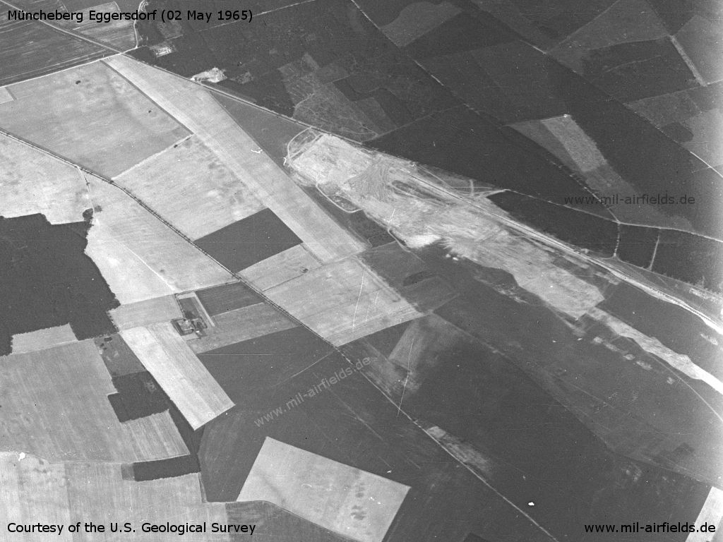
The southwestern part of Müncheberg Eggersdorf Airfield on a US satellite image from 02 May 1965 - Viewing to the west
Source: U.S. Geological Survey
In the 1970s
Overview
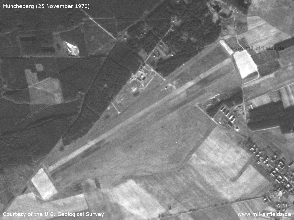
Müncheberg Eggersdorf Airfield on a US satellite image from 25 November 1970
Source: U.S. Geological Survey
In the 1980s and early 1990s
Overview
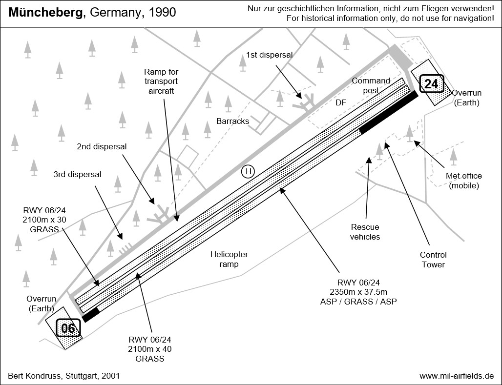
Runways
- 06/24: 2350 m x 37.5 m Asphalt/Grass/Asphalt
- 06/24: 2100 m x 30 m Grass
- 06/24: 2100 m x 40 m Grass
Radio beacons
- LOM 24: 1148 "MG"
- LMM 24: 273.5 "M"
Radio communication
The call sign was MESSING.
Telephone
Commercial: Müncheberg 405
Today
Use
General aviation.
Links
- http://www.sachsenschiene.net/bunker/flp/flp_27.ht... - Sachsenbunker
- http://www.flugplatz-eggersdorf.de/ - Verkehrslandeplatz Eggersdorf
Airfields in the vicinity
- 299°/5km Waldsieversdorf: Helipad 3004 (HSLP / HLP 3004, Rotes Luch)
- 102°/10km Heinersdorf: Helipad 3024 (HSLP / HLP 3024)
- 175°/10km Fürstenwalde: Airfield
Categories
Military Airfields GermanyMilitary Airfields in former East GermanyAir bases of former National People's ArmyRecommended
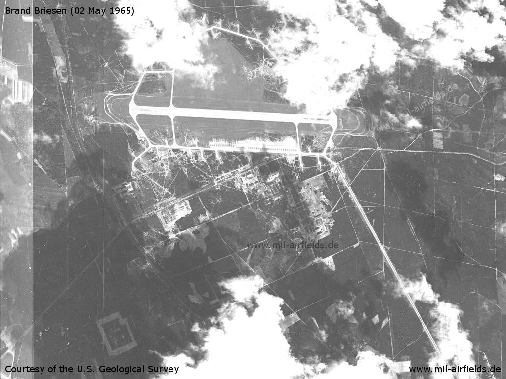
Image credits are shown on the respective target page, click on the preview to open it.
 Follow mil-airfields on Facebook