For historical information only, do not use for navigation or aviation purposes!
| Coordinates | N505158 E0070836 (WGS84) Google Maps |
| Elevation | 300 ft |
| Federal state | Nordrhein-Westfalen (North Rhine-Westphalia) |
| Location indicator | DDKB (195x), EDDK (civ), EDNK (mil), ETNK (mil) |
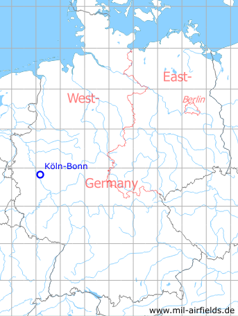
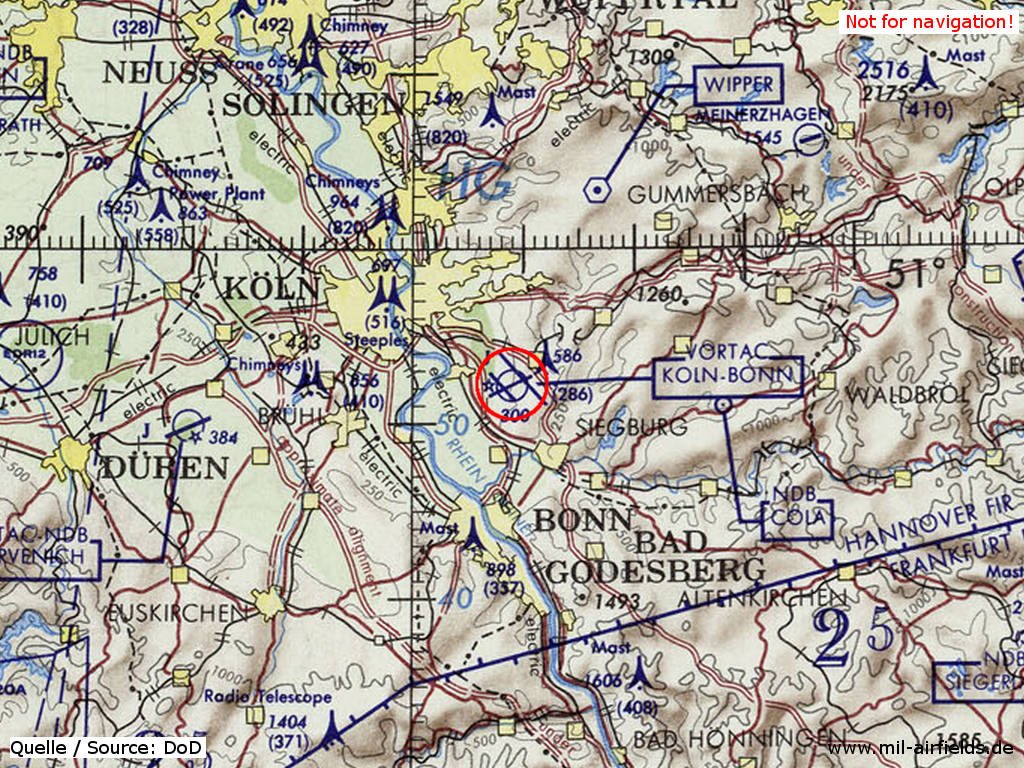
Germany during the Cold War Map
General
The airfield in the Wahner Heide southeast of Cologne was established at the end of the 1930s for the German Air Force. After the Second World War the field was used by the British Royal Air Force (RAF) under the name "Wahn". At the end of the 1950s, the RAF left the field and the Cologne-Bonn international airport came into operation. The airport has a military part, which became the base of the Flugbereitschaft (VIP flight) and which is also used today by the German Air Force.
During World War II
Use
Luftwaffe airfield.
Situation
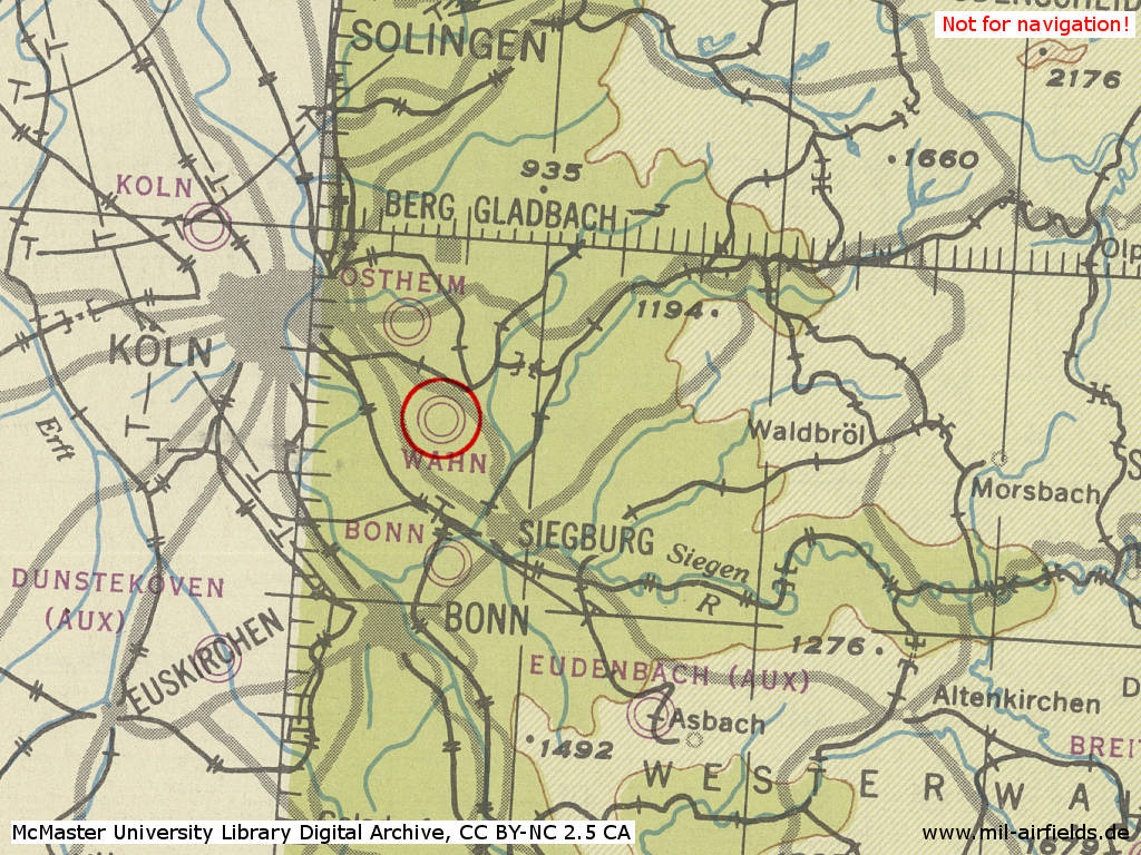
Wahn airfield in World War II on a US map from 1944 - (McMaster University Library Digital Archive, License: Creative Commons Attribution-NonCommercial 2.5 CC BY-NC 2.5 CA /MULDA/)
Overview
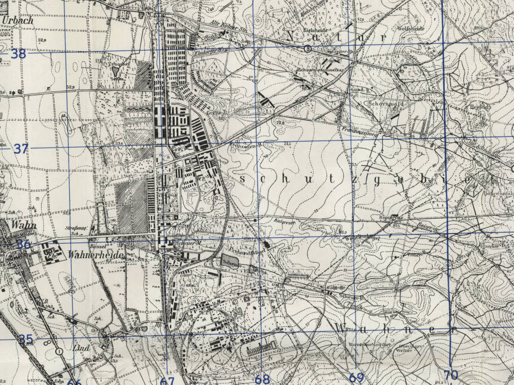
Installations of former Luftwaffe airfield Wahn on a US map from 1951 - (AMS M841 GSGS 4414, Courtesy Harold B. Lee Library, Brigham Young University /BYU/)
During the Cold War
Use
Used by RAF until 1957. Airport and German Airforce base.
In the 1940s
Situation
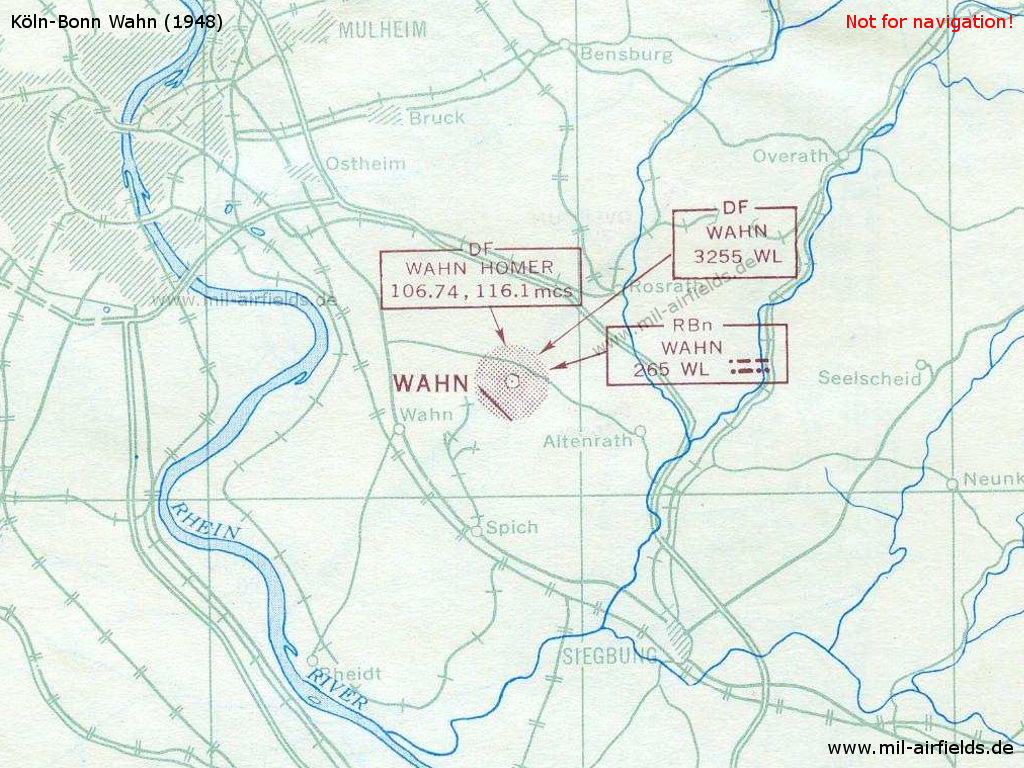
Situation 1948
Overview
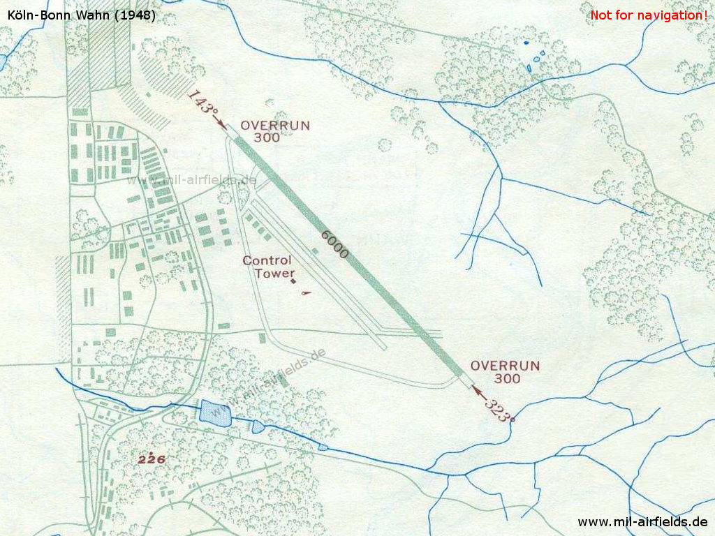
RAF Station Wahn in 1948
Runways
- 14/32: 1829 m
Radio beacons
- NDB: 265 "WL"
Radio communication
- Tower 6440, 106.74, 117.9
- Homer 106.74, 116.1
1950 - 1957
Use
Royal Air Force base - Master Aerodrome
Overview
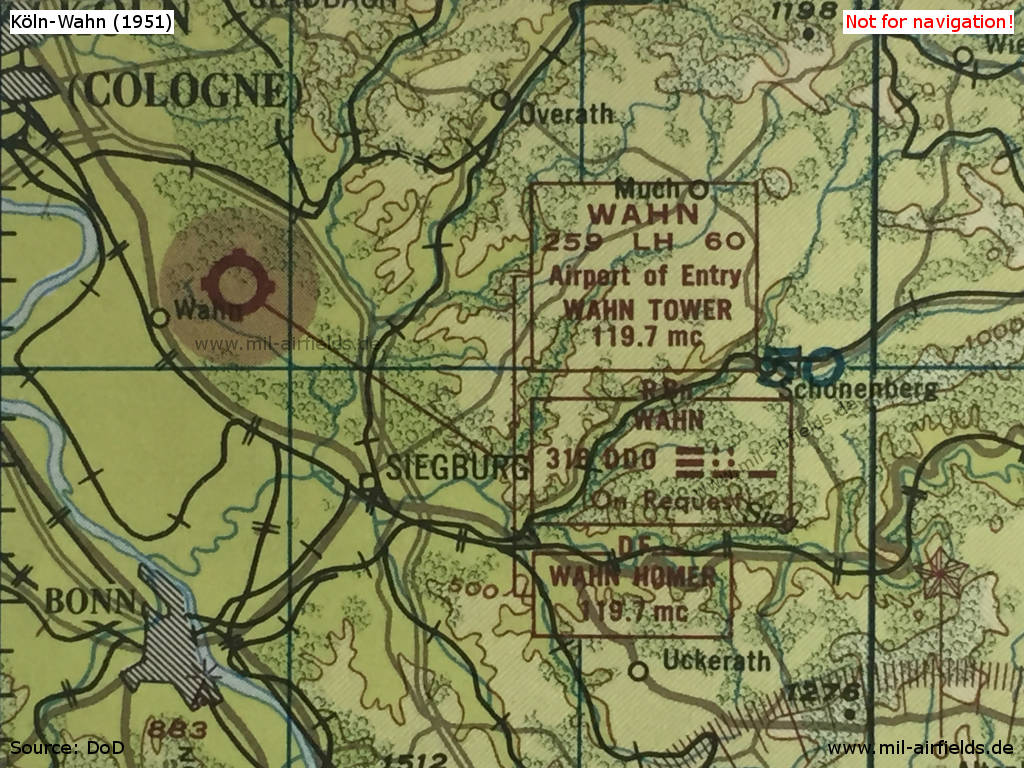
Situation 1951
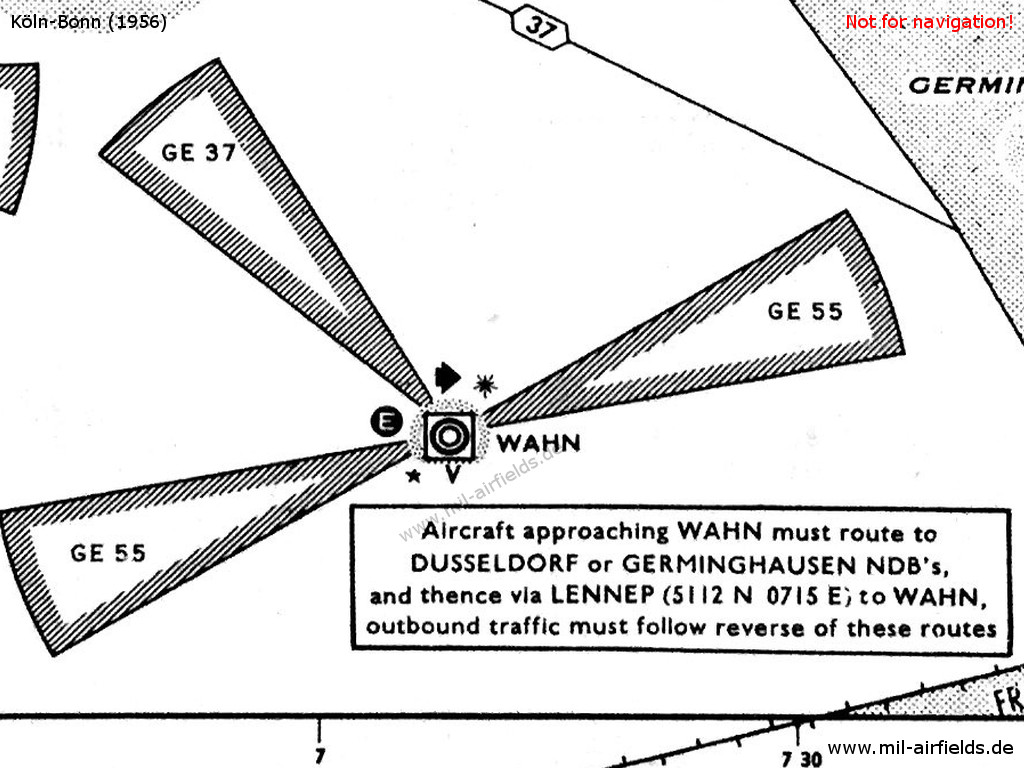
Wahn RAF base on a map from 1956 - The approach areas to the runways 07, 25 and 14 are protected by restricted areas. The white "E" in the circle symbolizes the Eureka radio beacon, used by the British at this time. The square around the airport symbol with the "V" underneath shows an VHF direction finder. The black star stands for the coded beacons which is characteristical for British airfields
Lights
Red beacon with ident "WH"
Apparently the letter combination for Wahn has been changed from WL (see above) to WH.
Radio beacons
In addition to a non-directional beacon (NDB), the field is equipped with the navigation aids Eureka (navigation) and BABS (approach), which were common for British airfields at that time.
- NDB: 294 "WH", Power 100 W
- Eureka: 213R 223T "WH"
- BABS: 233R 228T, for landing directions 07, 25, 14, 32
Radar
GCA (Ground Controlled Approach)
Radio communication
Notable is the large number of radio frequencies that have been used.
- Approach 137.16, 130.32, 117.9, 119.7, 111.42, 116.46, 114.66, 121.5, 131.58, 116.1, 117.18, 112.32, 243.0, 255.7, 257.8
- Tower 137.16, 130.32, 117.9, 119.7, 111.42, 121.5, 131.58, 116.46, 243.0, 257.8, 255.7, 237.6, 386.9, 267.2, 269.8, 291.7, 317.5, 323.8, 353.8, 362.3
- GCA 131.58, 130.32, 111.42, 118.1, 137.16, 103.32, 110.7, 100.44, 109.26, 116.46, 119.7, 121.5, 117.9, 131.76, 122.22, 140.58, 108.9, 106.02, 106.2, 108.36, 113.04, 114.84, 116.1, 117.36, 133.74, 148.86, 152.1, 386.9, 360.8, 301.1, 364.7, 237.6, 244.8, 291.7 267.2, 323.8, 327.2, 269.8, 317.5, 362.3, 344.0, 385.4, 243.0, 257.8, 255.7
- Cathode Ray VHF Direction Finder
1957 - 1959
Use
Airport of Cologne
Runways
- 14/32: 1829 m x 50 m
- 07/25: 2438 m x 46 m
Radio beacons
- : 109.1 "DLW"
- : 279.5 "LW", 250°/0.53 NM
- : 294 "DLW", 250°/3.48 NM
In the 1960s
Overview
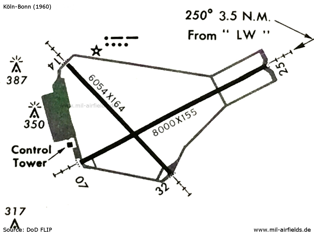
Cologne-Bonn airport in 1960 - Although the field is now under German administration, this map still shows the identification beacon with the Morse code "WH" next to the northern taxiway.
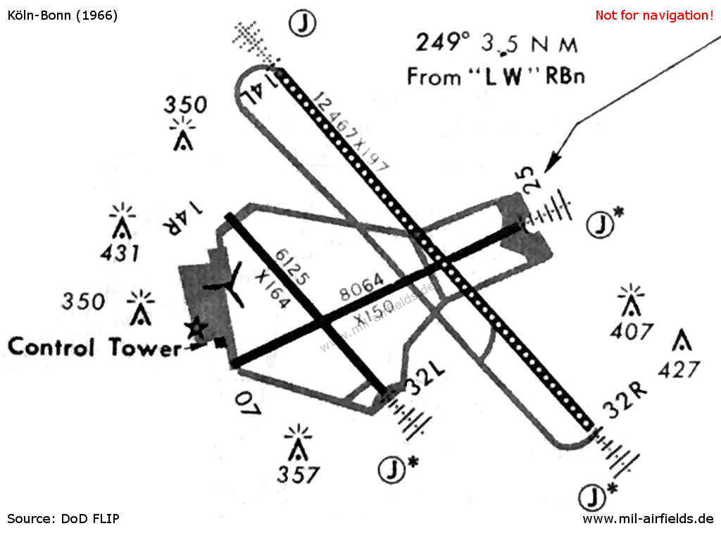
Cologne-Bonn airport in 1966 - In the meantime runway 14L/32R was put into operation, already equipped with a centerline lighting. No approach lights are shown anymore for 14R. The "propeller" at the ramp marks the helicopter landing area.
In the 1970s
Situation
Köln-Bonn Airport on a map of the US Department of Defense from 1972 - (ONC E-2 (1972), Perry-Castañeda Library Map Collection, University of Texas at Austin /PCL MC/)
Overview
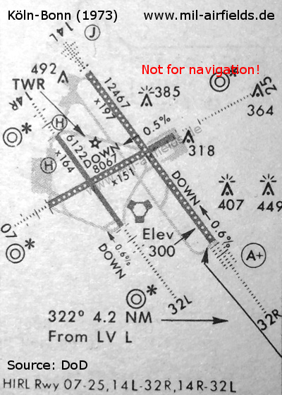
Cologne-Bonn airport in 1973 - In the meantime, the new terminal has been opened, as has a new control tower.
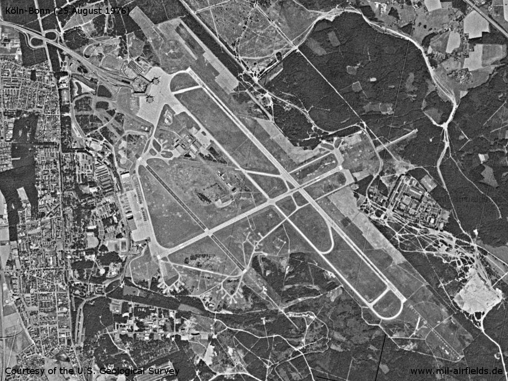
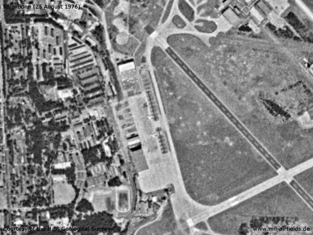
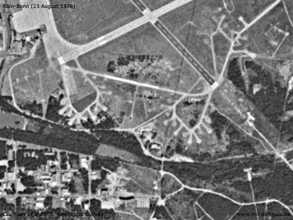
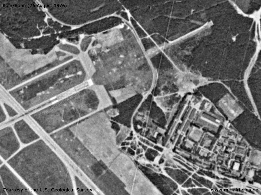
Köln-Bonn Airport on a US satellite image from 25 August 1976 - At this time, the taxiways E and A3 are still missing
Source: U.S. Geological Survey
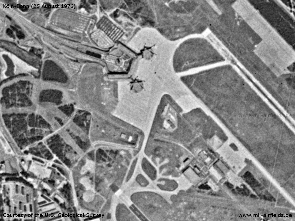
Terminal building
Source: U.S. Geological Survey
Military ramp / VIP flight
Source: U.S. Geological Survey
Parking positions
Source: U.S. Geological Survey
Runway 25
Source: U.S. Geological Survey
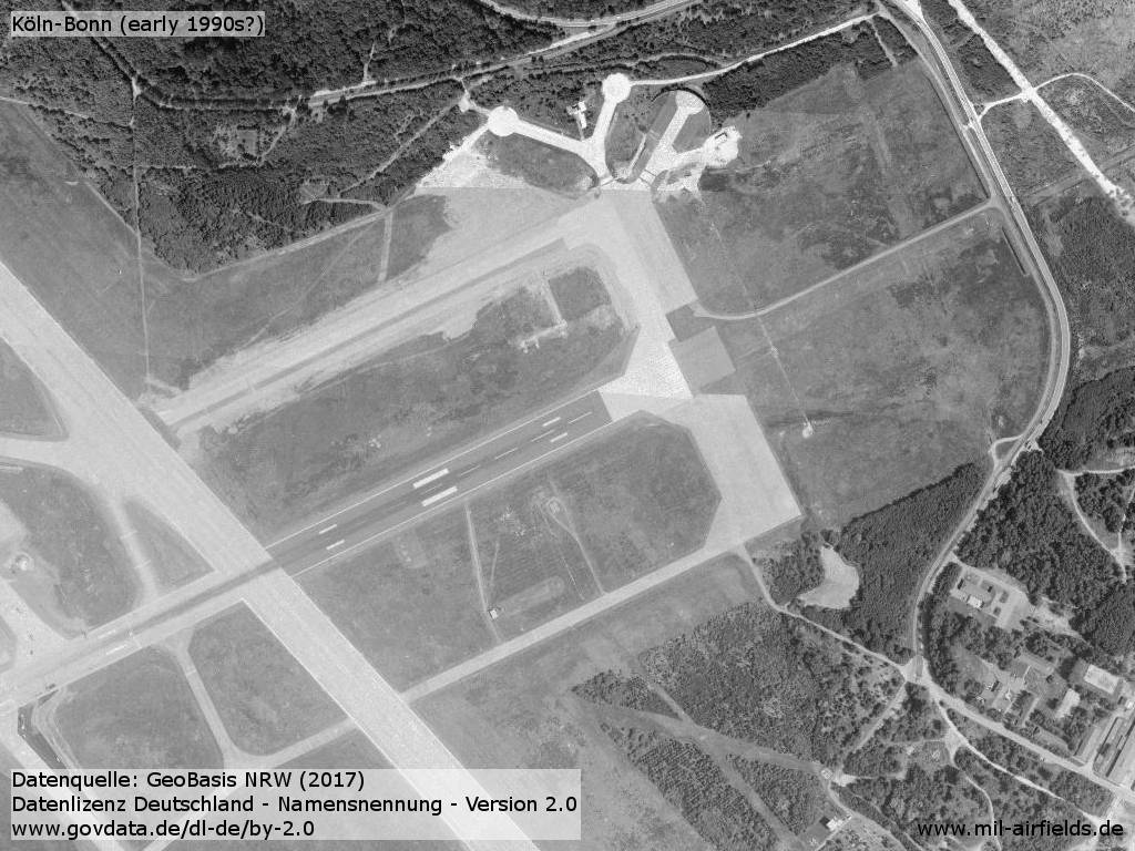
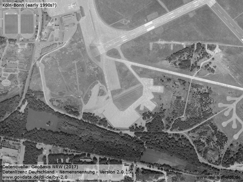
In the 1980s and early 1990s
Overview
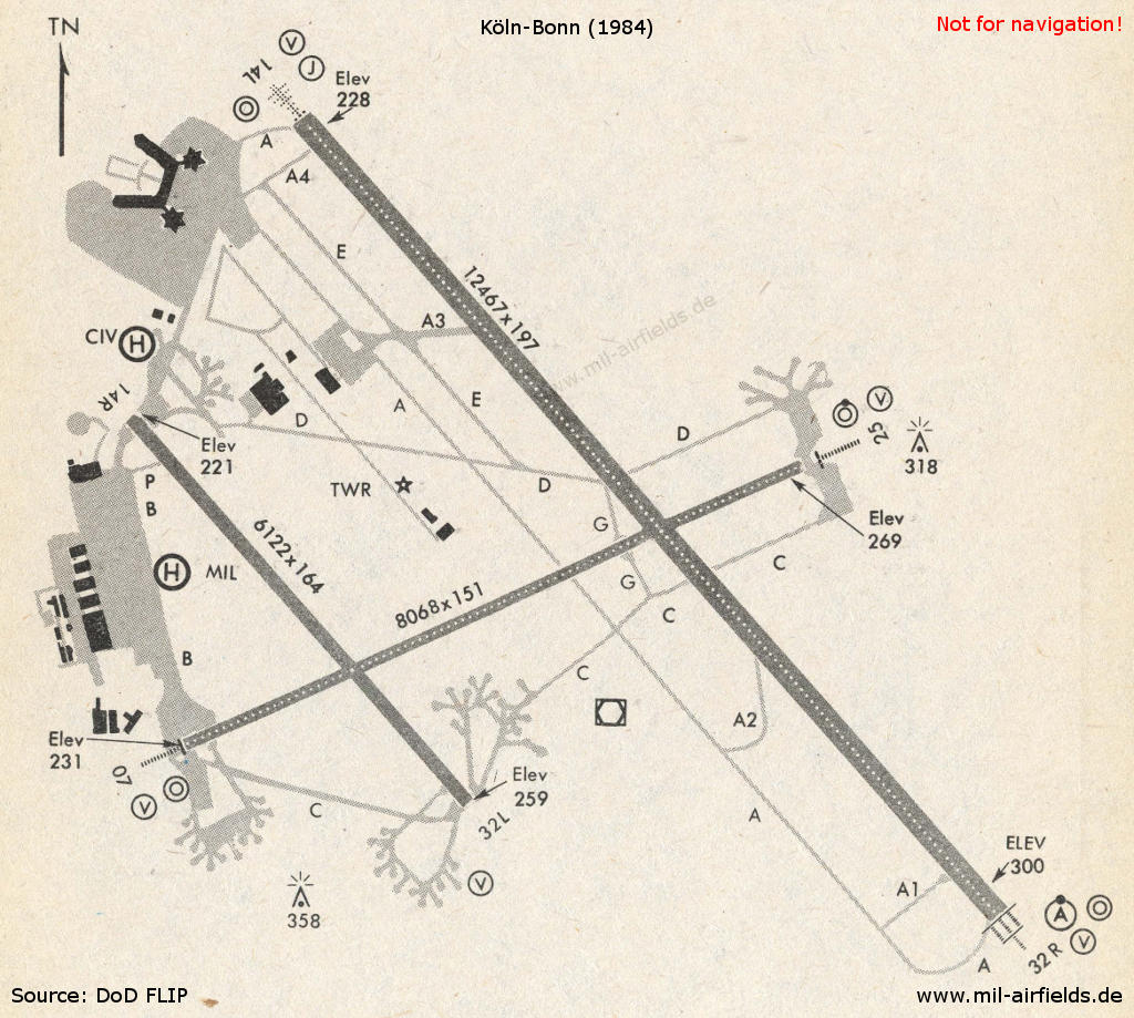
Köln-Bonn in 1984
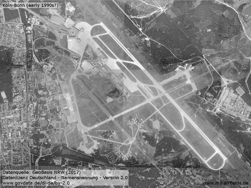
Cologne-Bonn airport in the early 1990s?
Enlargement: Beginning of runway 25 - This structure is typical for RAF airfields in Germany.
Enlargement: The hardstands at the beginning of runway 07 have been converted to larger surfaces.
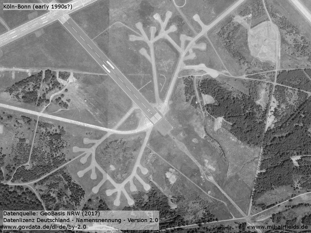
Enlargement: Hardstands at the beginning of runway 32L - These structures are also typical for RAF airfields in Germany.
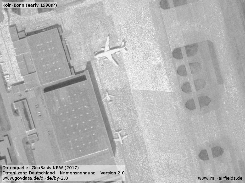
Enlargement: Airbus, Jetstar and VFW-614 of Flugbereitschaft?
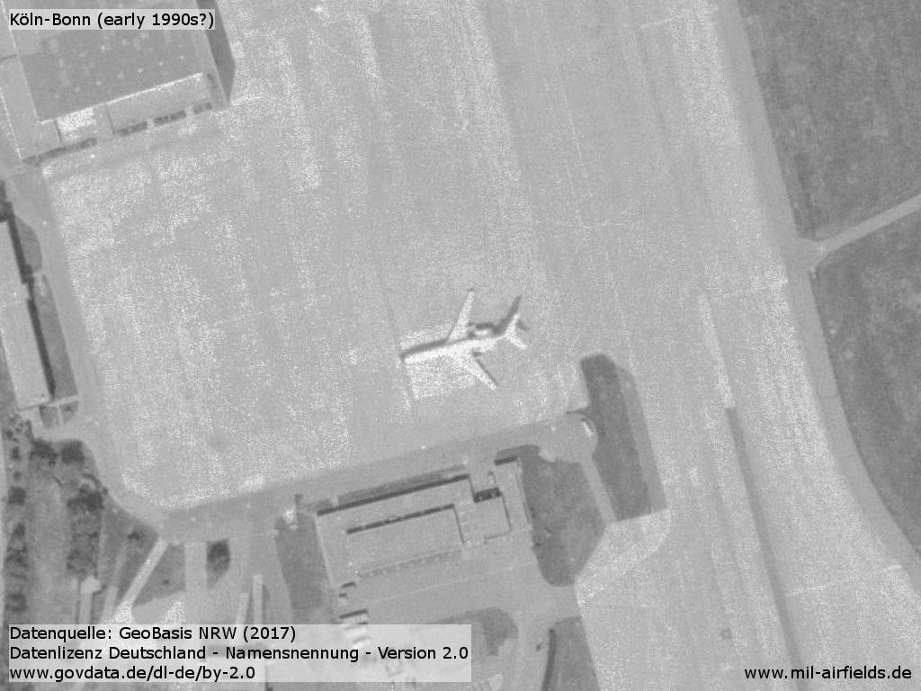
Enlargement: A Tu-134 of Flugbereitschaft?
Runways
Data for the year 1990:
- 07/25: 2459 m x 45 m Concrete
- 14L/32R: 3815 m x 60 m Concrete
- 14R/32L: 1863 m x 45 m Concrete
Today
Overview
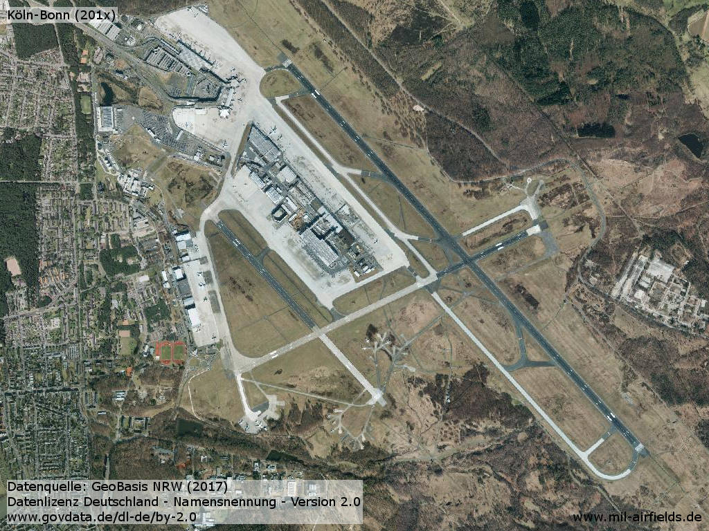
Aerial picture 2015/2016
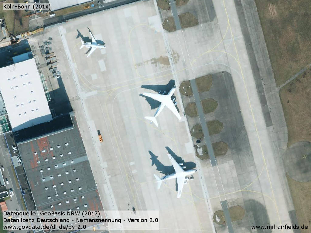
Transport aircraft on the military ramp
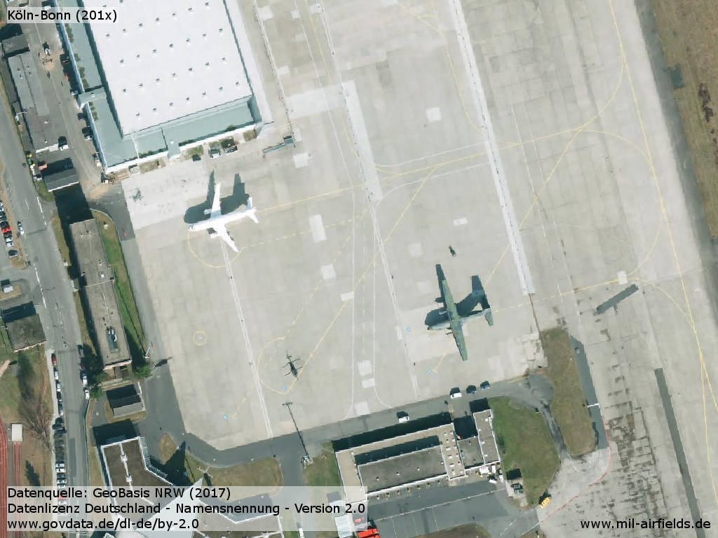
Airbus, Transall and helicopter
Links
Image sources:
- https://www.geoportal.nrw/ - Geoportal NRW
- http://www.airport-cgn.de/ - Airport Köln-Bonn
Bibliography
- Ries, Karl; Dierich, Wolfgang: "Fliegerhorste und Einsatzhäfen der Luftwaffe" Motorbuch Verlag Stuttgart, 1993
Airfields in the vicinity
Categories
Military Airfields GermanyMilitary Airfields in former West GermanyGerman Air Force Air BasesRoyal Air Force (RAF) Bases in GermanyRecommended
Image credits are shown on the respective target page, click on the preview to open it.
 Follow mil-airfields on Facebook