For historical information only, do not use for navigation or aviation purposes!
| Coordinates | N495120 E0073619 (WGS84) Google Maps |
| Elevation | 1299 ft |
| Federal state | Rheinland-Pfalz (Rhineland-Palatinate) |
| Location indicator | EDSP |
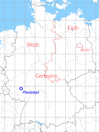
Germany during the Cold War Map
The history of the Cold War airfields: Pferdsfeld
During World War II
Use
Luftwaffe airfield.
During the Cold War
Use
Luftwaffe airbase.
In the 1960s
Situation
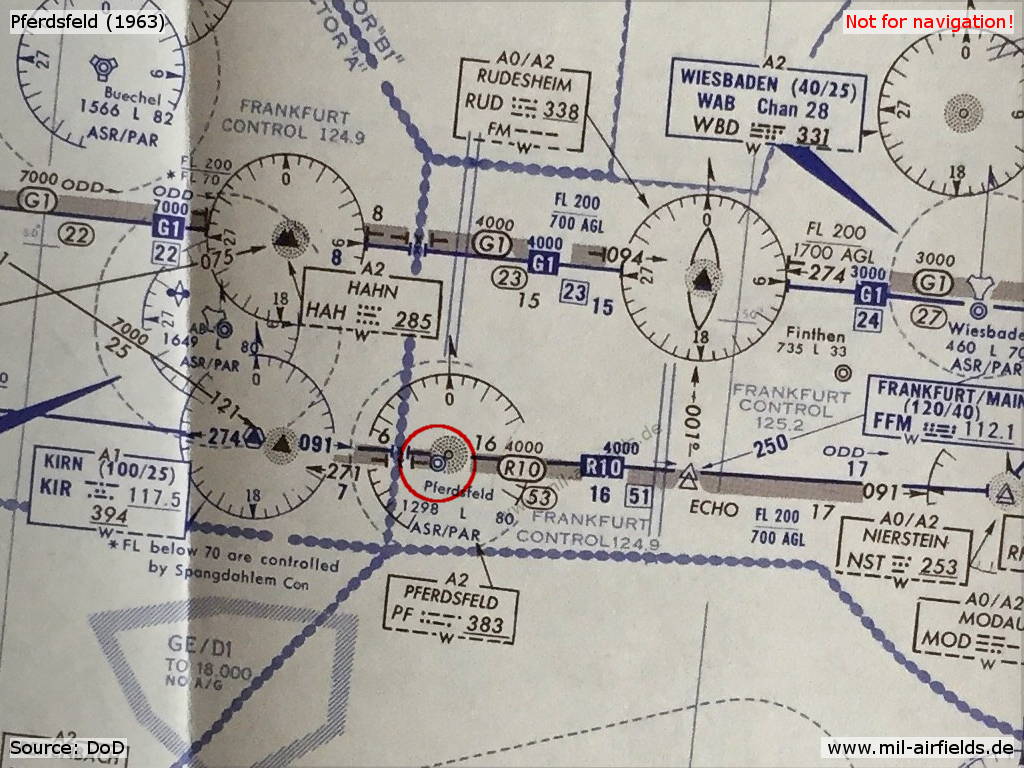
Pferdsfeld Airfield on a map from 1963 - At this time, no TACAN navigation system was installed at Pferdsfeld yet.
In the 1970s
Situation
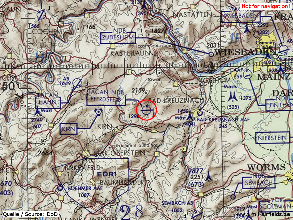
Pferdsfeld Air Base on a map of the US Department of Defense from 1972 - (ONC E-2 (1972), Perry-Castañeda Library Map Collection, University of Texas at Austin /PCL MC/)
Overview
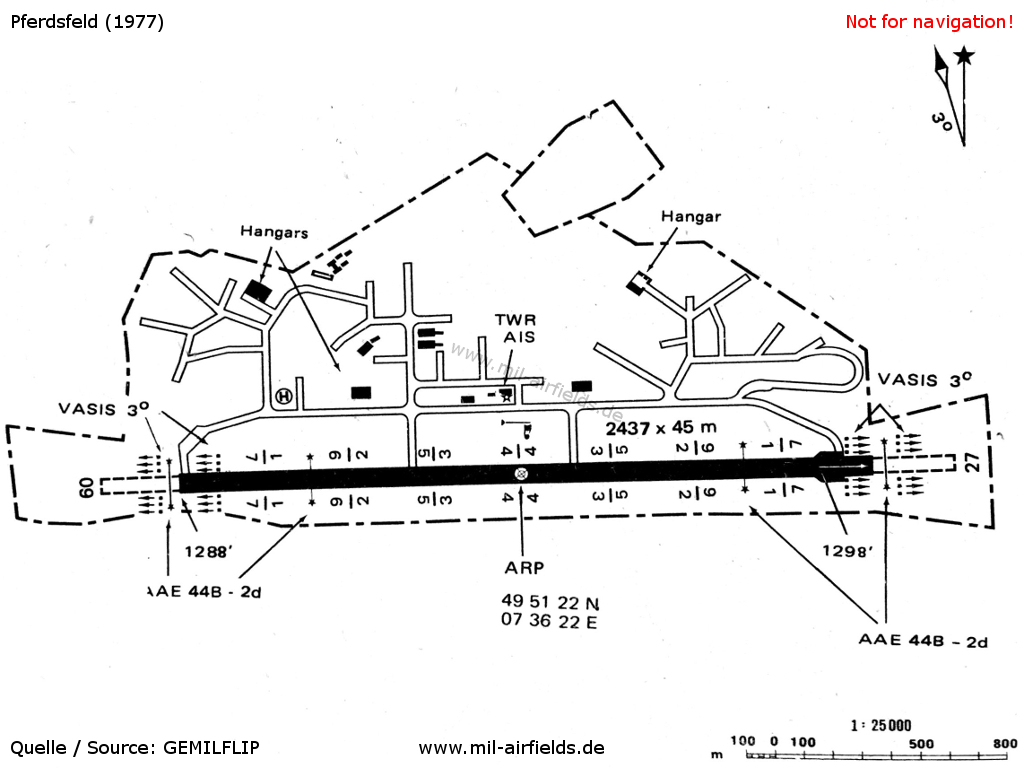
Pferdsfeld Air Base on a map from 1977
Radio beacons
Data for the year 1971:
- NDB: 394 "PFF", at field
- TACAN: CH98 "PFF", at field
Today
Use
Closed.
Situation
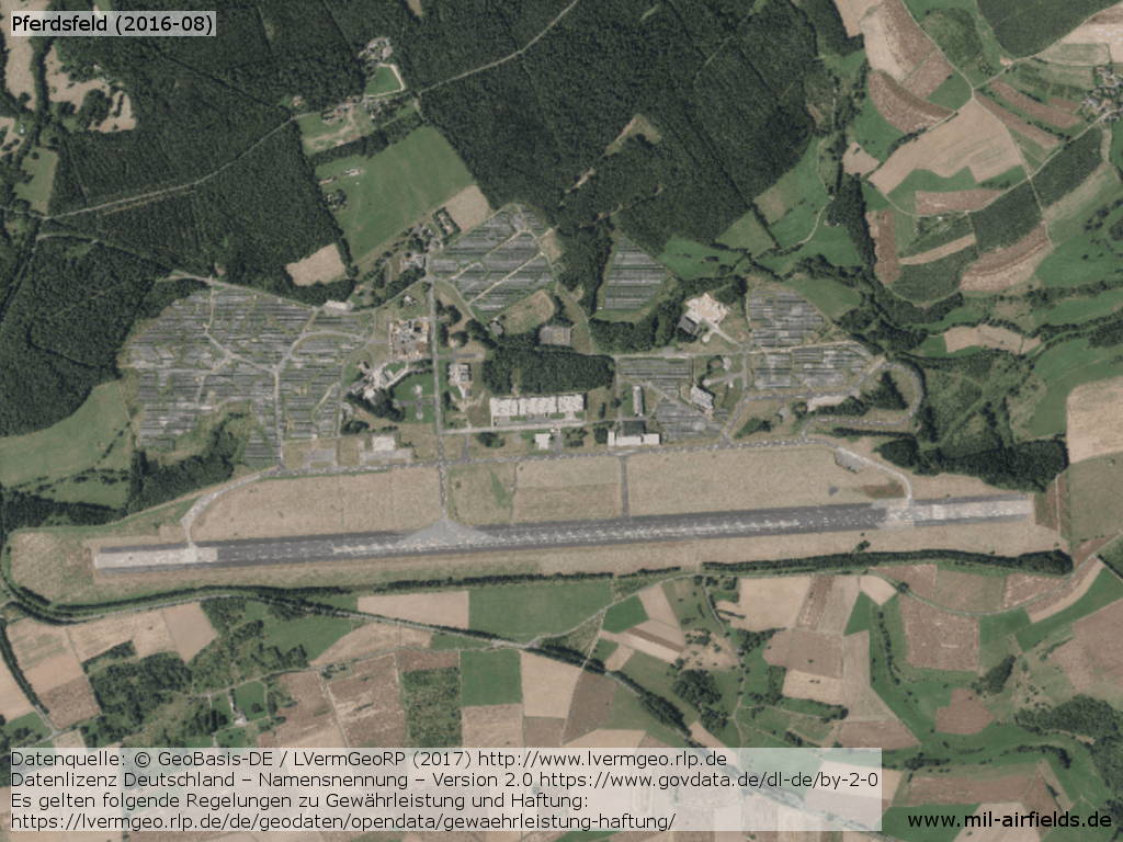
Aerial picture from August 2016 - Large parts of the former airfield are covered with solar panels.
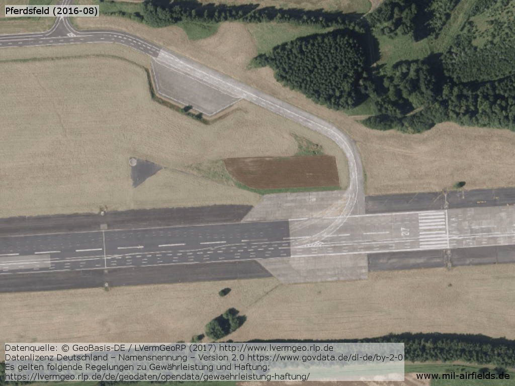
Eastern end with threshold runway 27
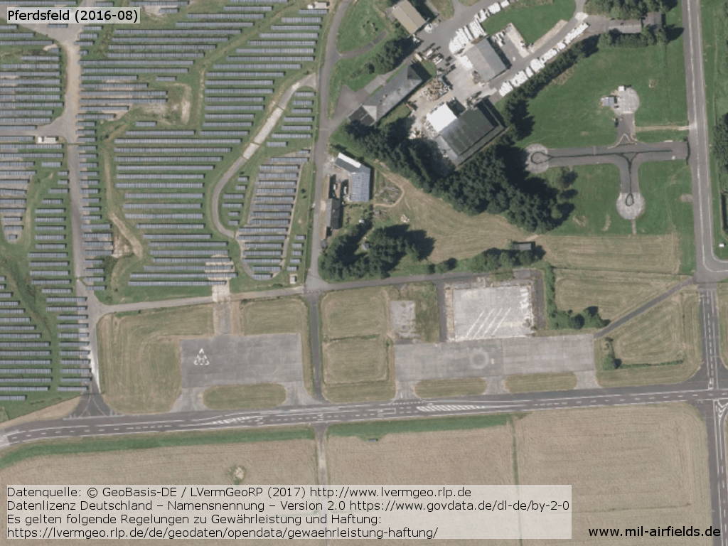
Former helipad, solar energy modules
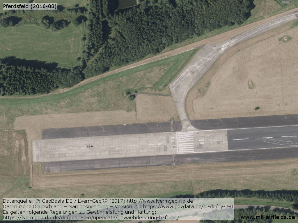
Western end with threshold runway 09
Links
- http://rgebhard.de/seite215.htm - German Air Force Base - Pferdsfeld / Germany Pictures
Sources
- http://www.lvermgeo.rlp.de - Geoportal Rhein-Pfalz
Videos
- https://www.youtube.com/watch?v=5qujsoJrAWQ - Projekt Pferdsfeld
- https://www.youtube.com/watch?v=xpcE5kRaUi0 - Pferdsfeld Air Base Tour 2011
Airfields in the vicinity
- 092°/20km Bad Kreuznach: Army Airfield AAF
- 086°/25km Sprendlingen: Highway Strip (Notlandeplatz)
- 293°/27km Hahn: Air Base (Hahn Air Base)
Categories
Military Airfields GermanyMilitary Airfields in former West GermanyGerman Air Force Air BasesRecommended
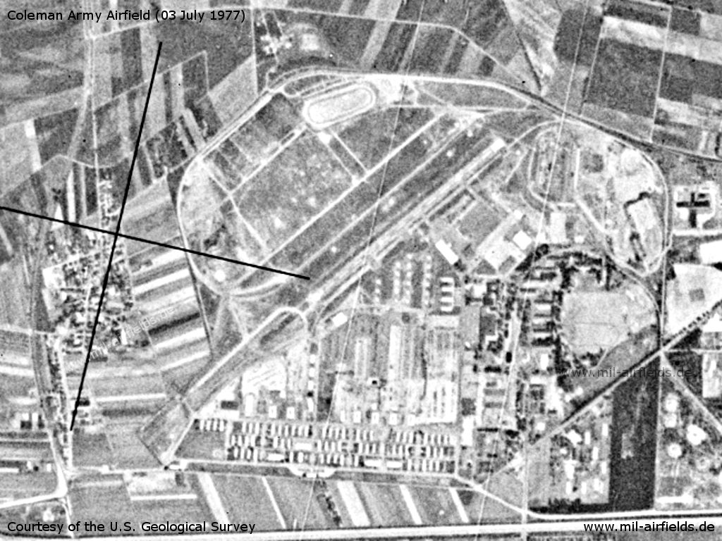
Image credits are shown on the respective target page, click on the preview to open it.
 Follow mil-airfields on Facebook