Hahn: Air Base
For historical information only, do not use for navigation or aviation purposes!
| Coordinates | N495652 E0071547 (WGS84) Google Maps |
| Elevation | 1649 ft |
| Location indicator | EDAH (1990), EDFH (2000) |
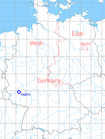
Germany during the Cold War Map
During the Cold War
Use
US Air Force base.
Units
50th Tactical Fighter Wing:
1971: 50th TFW: 10th TFS (F-4D), 496th TFS (F-4E)
1975: 50th TFW: 10th TFS (F-4D/E), 496th TFS (F-4E) (1975)
1980: 50th TFW: 10th, 313th, 496th TFS (F-4E)
1985: 50th TFW: 10th, 313th, 496th TFS (F-16A/B/C/D) (1985)
1990: 50th TFW: 10th, 313th, 496th TFS (F-16C/D) (1985)
In the 1950s
Situation
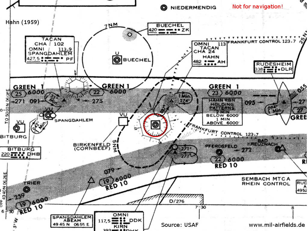
Hahn Air Base on a map from 1959 - Besides a non-directional beacon (NDB) and a TACAN, the field has also a VOR - here shown as "OMNI"
In the 1960s
Situation
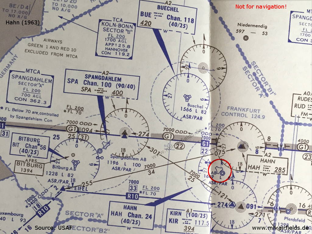
Hahn Air Base on a map from 1963 - Compared to 1959, the VOR has disappeared again.
In the 1970s
Situation
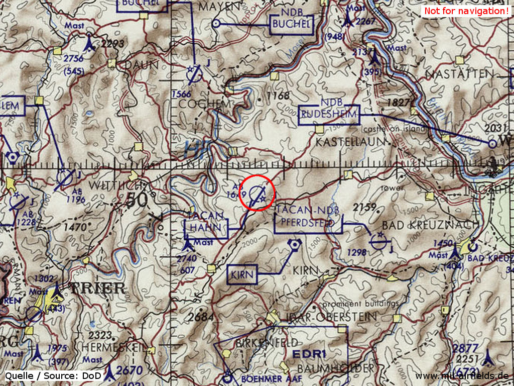
Hahn Air Base on a map of the US Department of Defense from 1972
Source: ONC E-2 (1972), Perry-Castañeda Library Map Collection, University of Texas at Austin>
Images
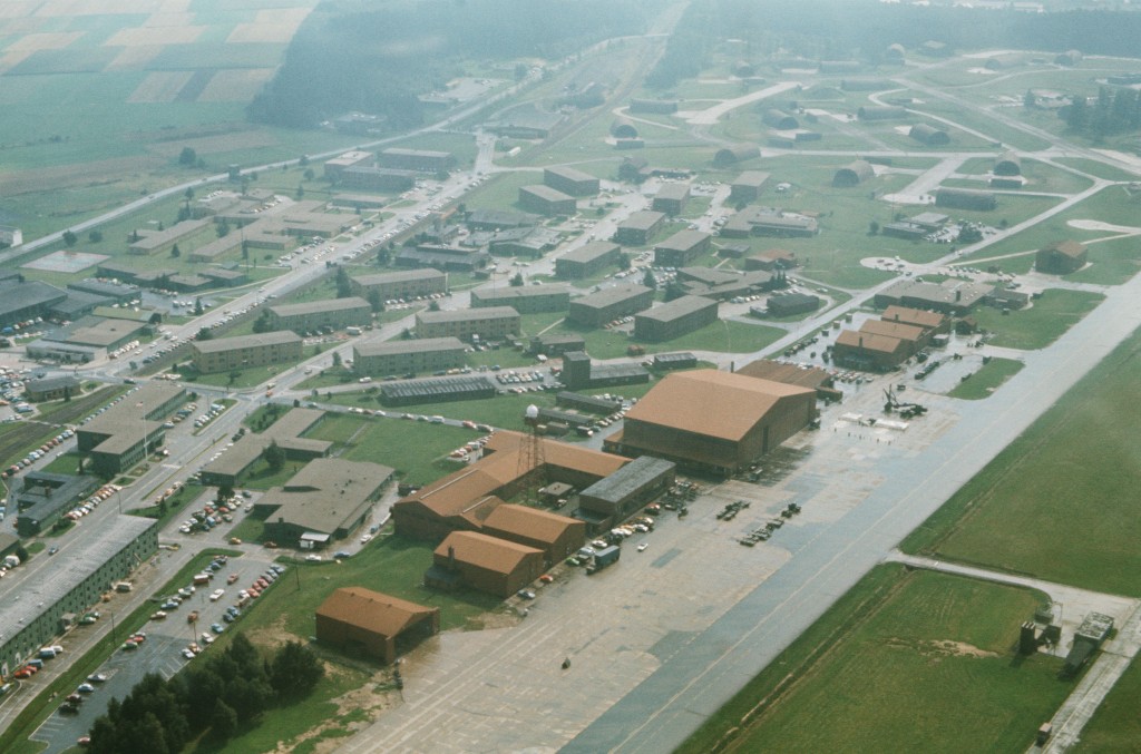
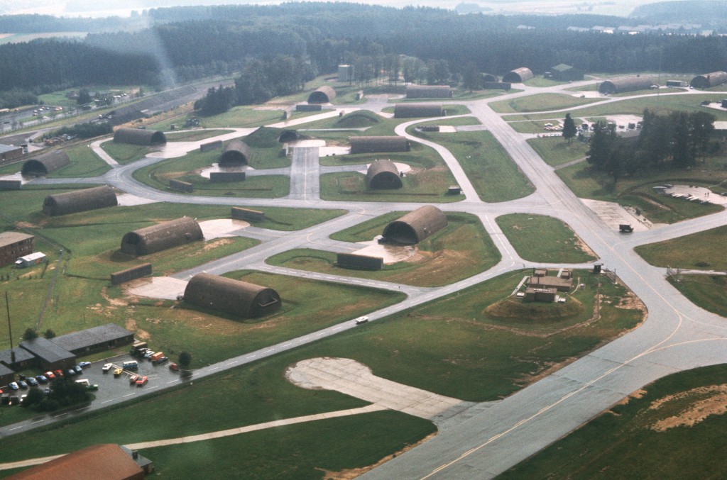
Aerial pictures 1977
Aerial views of the base prior to completion of Project Tonedown, in which aircraft taxiways and runways will be camouflaged according to US Air Force Europe specifications.
Source: DoD, Scene Camera Operator: MSGT Ralph E. Kelly
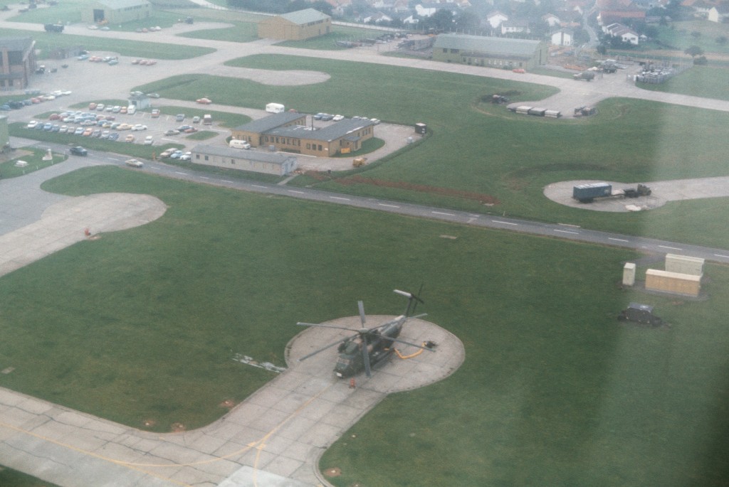
Exercise SALTY ROOSTER April 1978
Source: DoD, Scene Camera Operator: SSGT Emmett Lewis Jr.
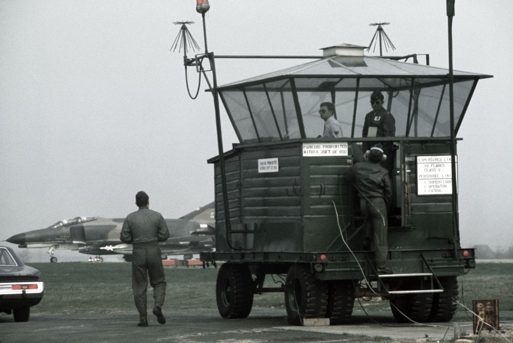
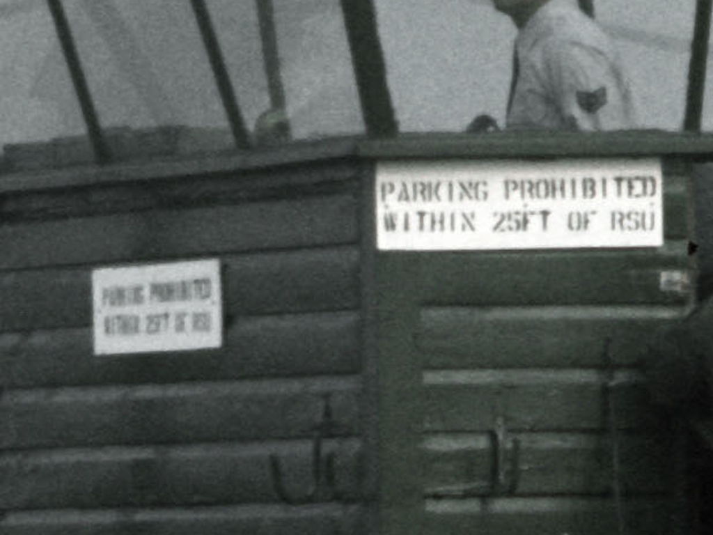
Ground Surveillance Unit (GSU)
Enlargement
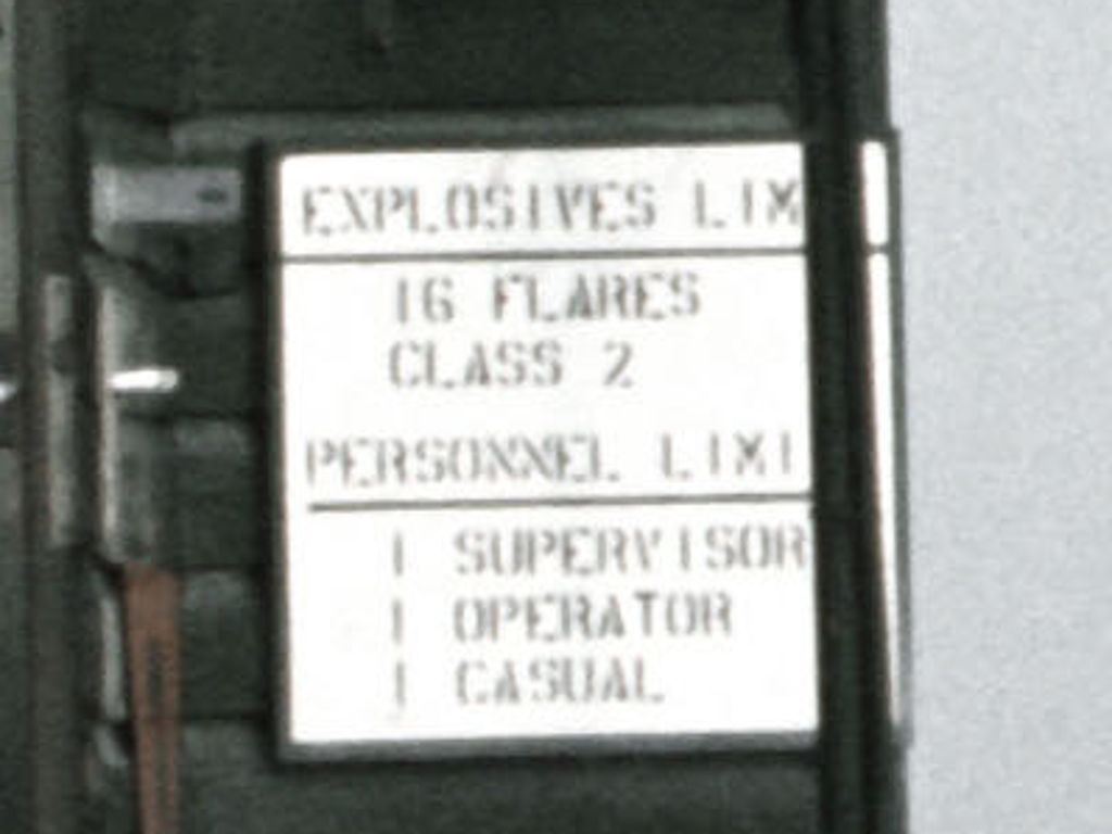
Enlargement
In the 1980s and early 1990s
Overview
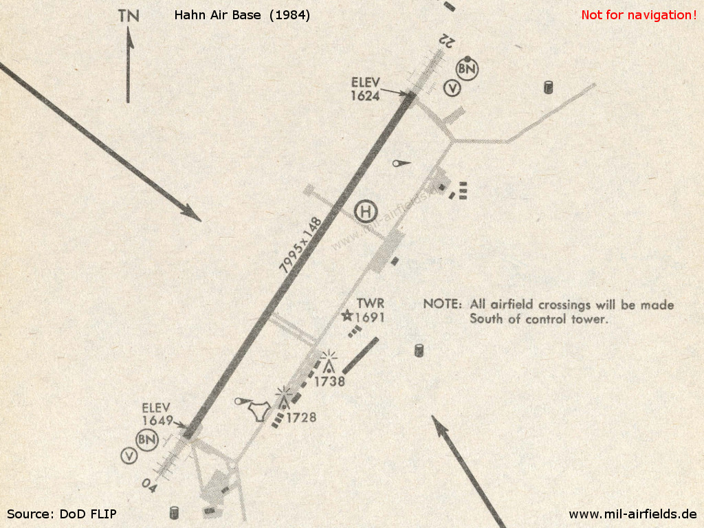
Hahn in 1984
Runways
Data for the year 1990:
- 03/21: 2437 m x 45 m Asphalt
Radio beacons
Data for the year 1990:
- ILS
- TACAN: CH24 "HAH", at field
Radar
ASR, PAR (1990)
Installations
Railway siding from Büchenbeuren.
Images
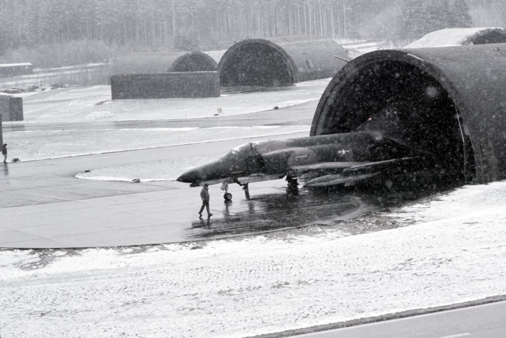
November 1980: Exercise SALTY MACE
SALTY MACE was an exercise about chemical warfare.
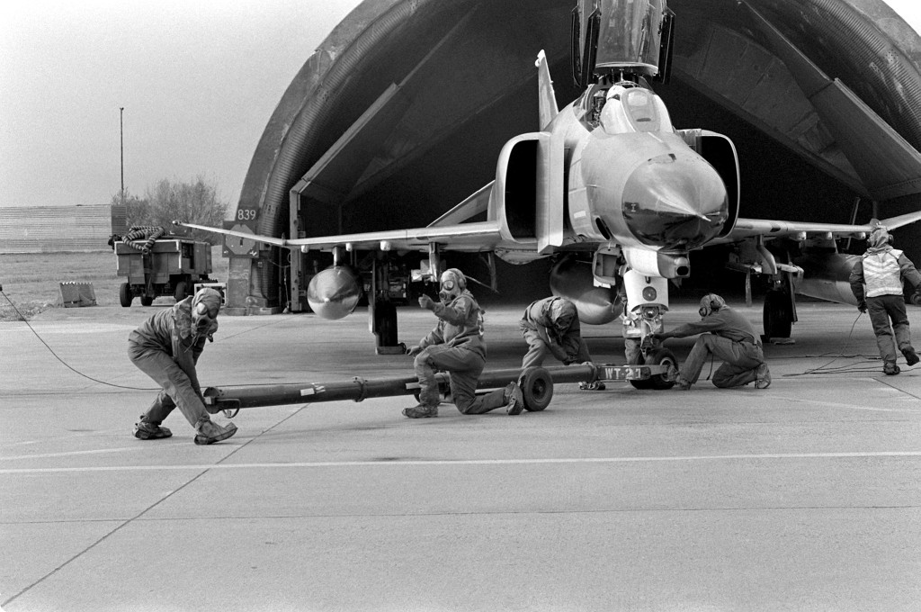
A ground crew in chemical warfare gear connects a tug to an F-4 Phantom II fighter aircraft before flight - Source: DoD, Scene Camera Operator: SSGT Mary Andrews
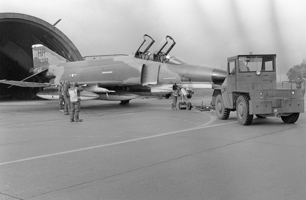
Preparation for flight - Source: DoD, Scene Camera Operator: SSGT Mary Andrews
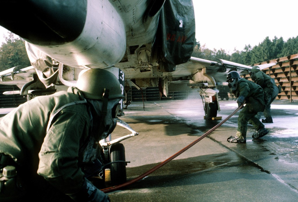
A disaster preparedness team of the 50th Civil Engineering Squadron performs decontamination maintenance on an F-4E Phantom II aircraft. - Source: DoD, Scene Camera Operator: SSGT James R. Pearson
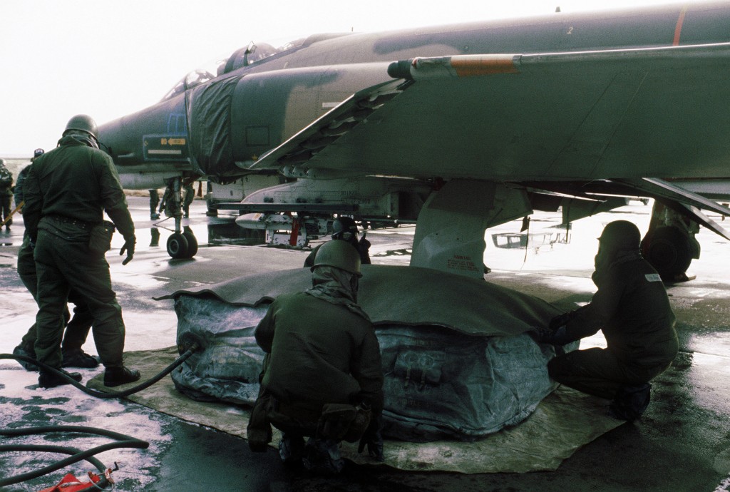
Members of the 50th Civil Engineering Squadron repair a simulated flat tire of an F-4E Phantom II aircraft - Source: DoD, Scene Camera Operator: SSGT James R. Pearson
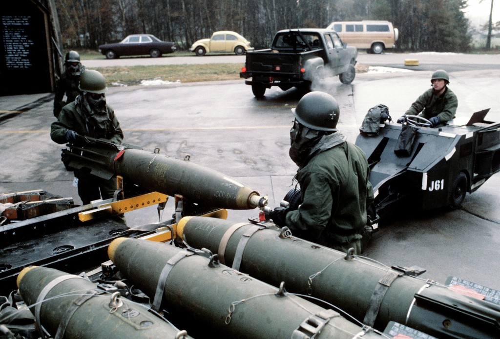
A member of the 50th Munitions Maintenance Squadron checks out Mark 82 Snake-Eye bombs - Source: DoD, Scene Camera Operator: SSGT James R. Pearson
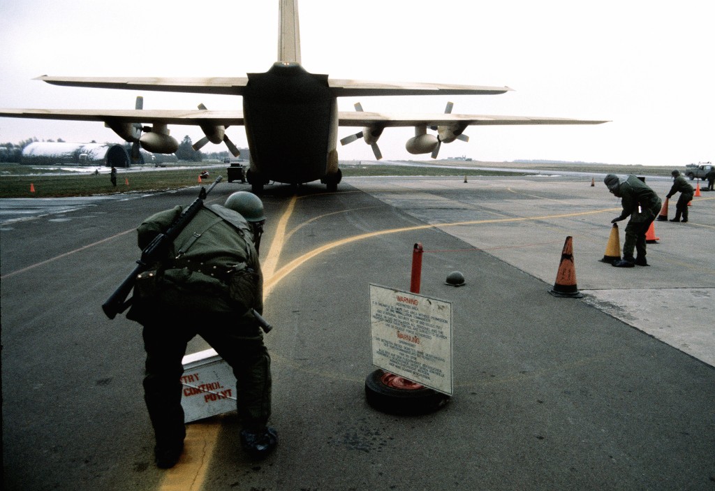
Offloading of a simulated nuclear cargo from a C-130 Hercules from the 37th Tactical Airlift Squadron - Source: DoD, Scene Camera Operator: TSGT Charles Gentry
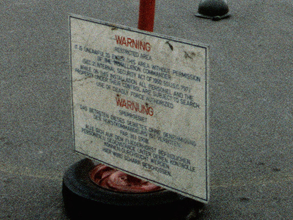
Enlargement: Sign restricted area
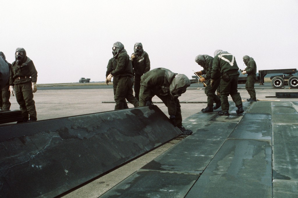
Members of the 50th Civil Engineering Squadron repair a simulated bomb crater - Source: DoD, Scene Camera Operator: SSGT James R. Pearson
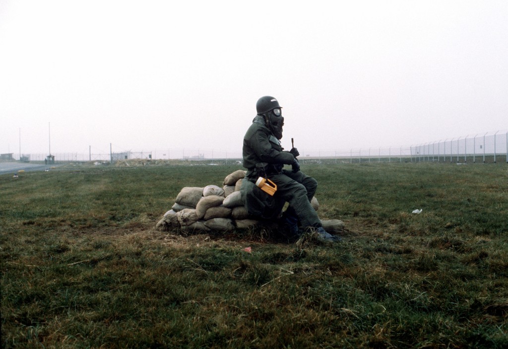
A member of the 50th Security Police Squadron dressed in chemical warfare gear stands guard around the perimeter at Hahn Air Base - Source: DoD, Scene Camera Operator: SSGT James R. Pearson
More pictures from 1980s
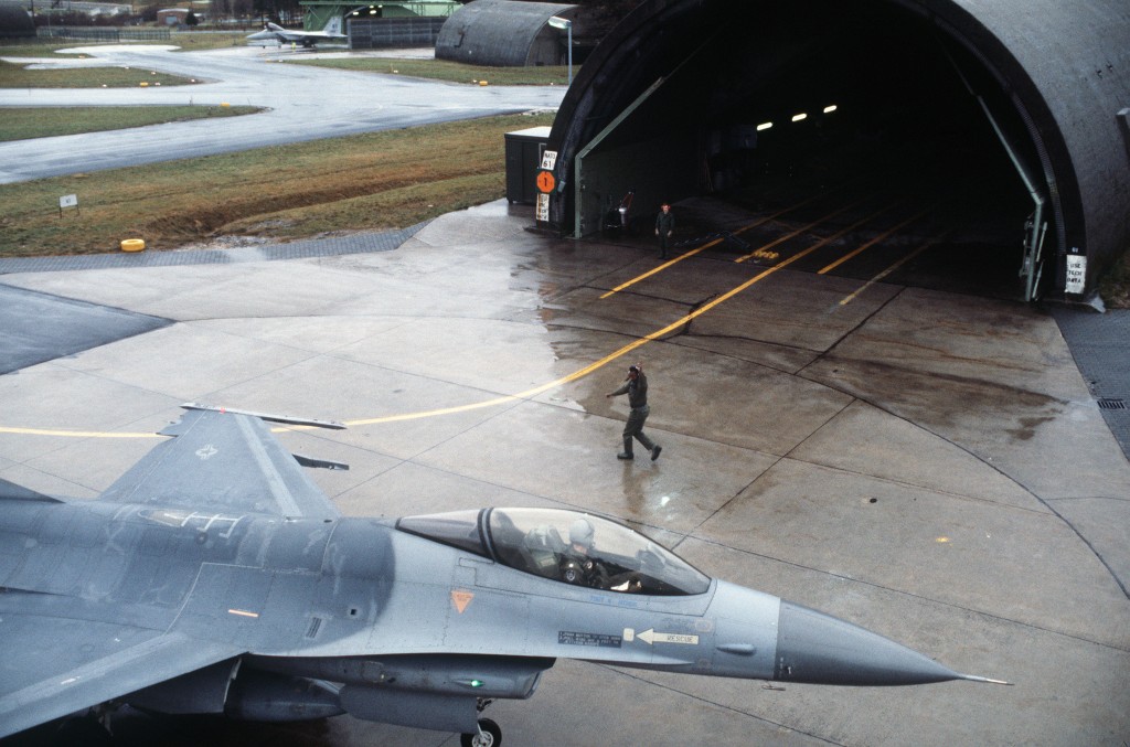
Final checks are made on an F-16 Fighting Falcon aircraft from the 50th Tactical Fighter Wing, before it is maneuvered back into a hangar (1982) - Source: DoD, Scene Camera Operator: AIC T. Vickmark
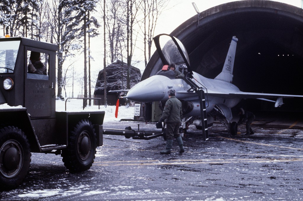
An F-16A Fighting Falcon aircraft of the 50th TFW is guided into a hangar after flying a support mission for the exercise REFORGER '86 - Source: DoD, Scene Camera Operator: MSGT Patrick Nugent
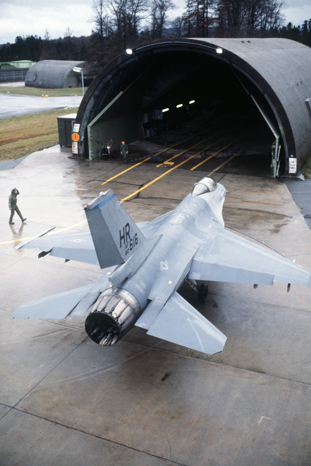
Source: DoD, Scene Camera Operator: MSGT Patrick Nugent
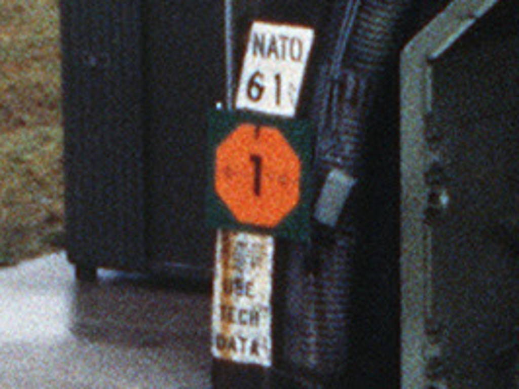
Enlargement: USE TECH DATA
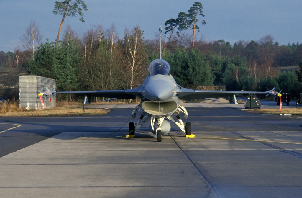
An F-16 Fighting Falcon aircraft, armed with AIM-9 Sidewinder missiles at Hahn (1987) - Source: DoD, Scene Camera Operator: Sgt David S. Nolan
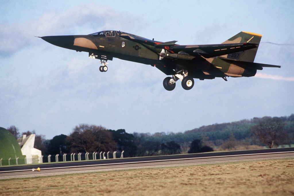
An F-111F from the 493rd Tactical Fighter Squadron takes off for a mission during the exercise REFORGER '86 - Source: DoD, Scene Camera Operator: Sgt David S. Nolan
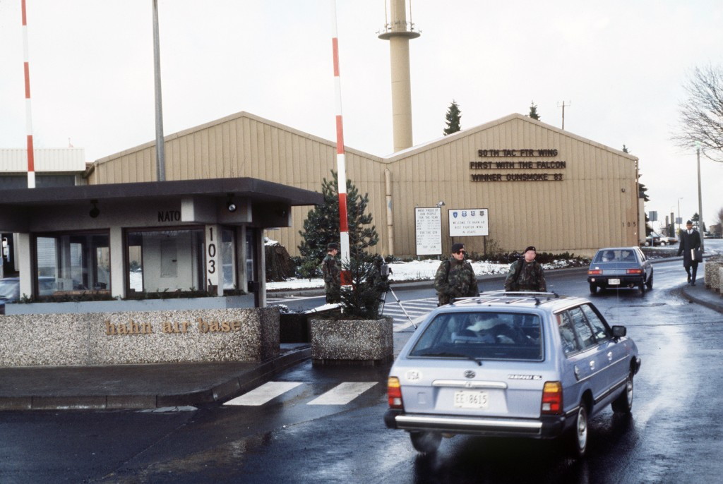
The front gate entrance to the base, 1986 - Source: DoD, Scene Camera Operator: MSGT Patrick Nugent
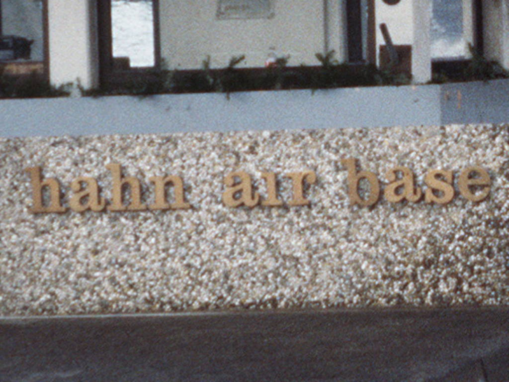
Enlargement - Hahn Air Base
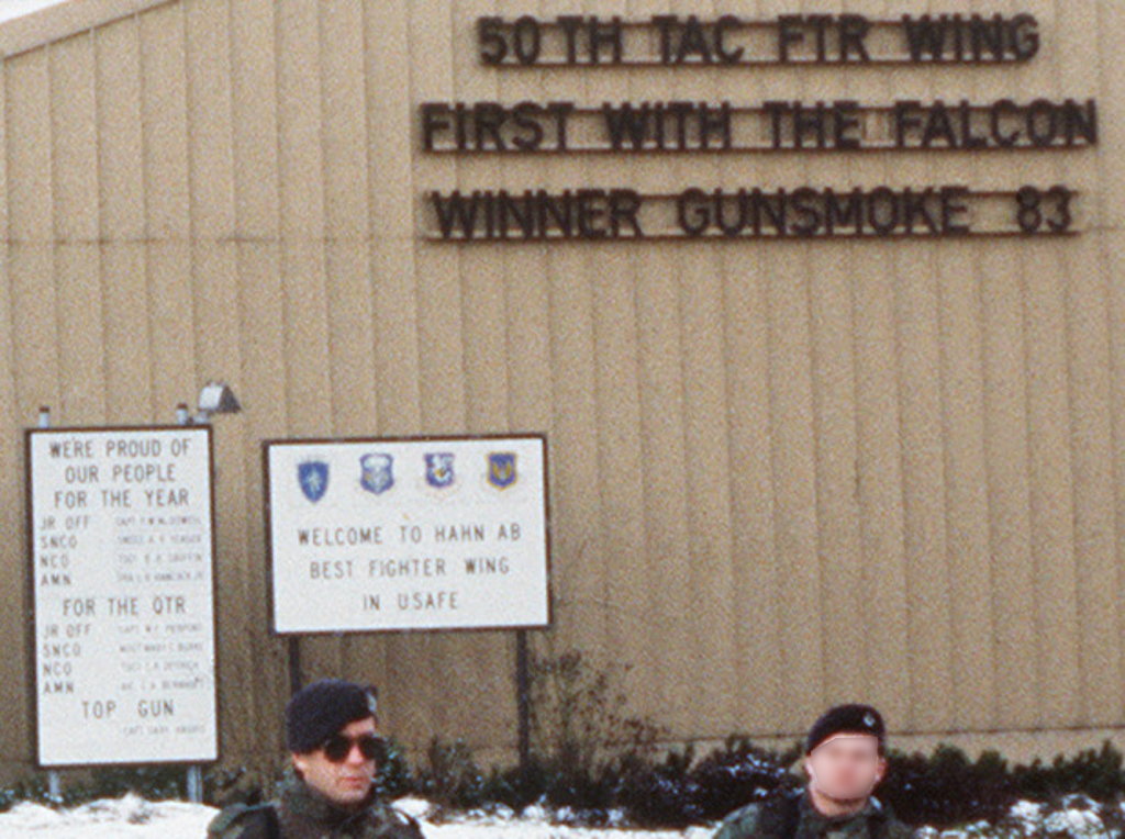
Enlargement - Welcome to Hahn AB - Best Fighter Wing in USAFE
Today
Use
Regional airport.
Overview
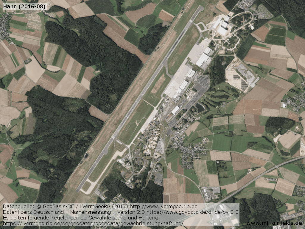
Aerial view from August 2016
Approach and aerodrome maps
The development of Hahn Air Base over the years can also be seen from historical maps. Here is a collection of approach and airport maps from the 1950s and 1960s:
Approach maps + aerodrome maps Hahn Air Base
Approach maps + aerodrome maps Hahn Air Base
Links
- http://www.hahn-airport.de/ - Hahn Airport
Sources
- https://www.archives.gov/ - National Archives
- http://www.lvermgeo.rlp.de/ - Geoportal Rhein-Pfalz
Airfields in the vicinity
- 113°/27km Pferdsfeld: Air Base (Eckweiler)
- 331°/29km Büchel: Air Base
- 175°/33km Baumholder: Army Airfield AAF (Army Airfield AAF)
- 255°/35km Trier: Föhren Airfield
Categories
Military Airfields GermanyMilitary Airfields in former West GermanyAir Bases of the United States Air Force (USAF) in GermanyRecommended
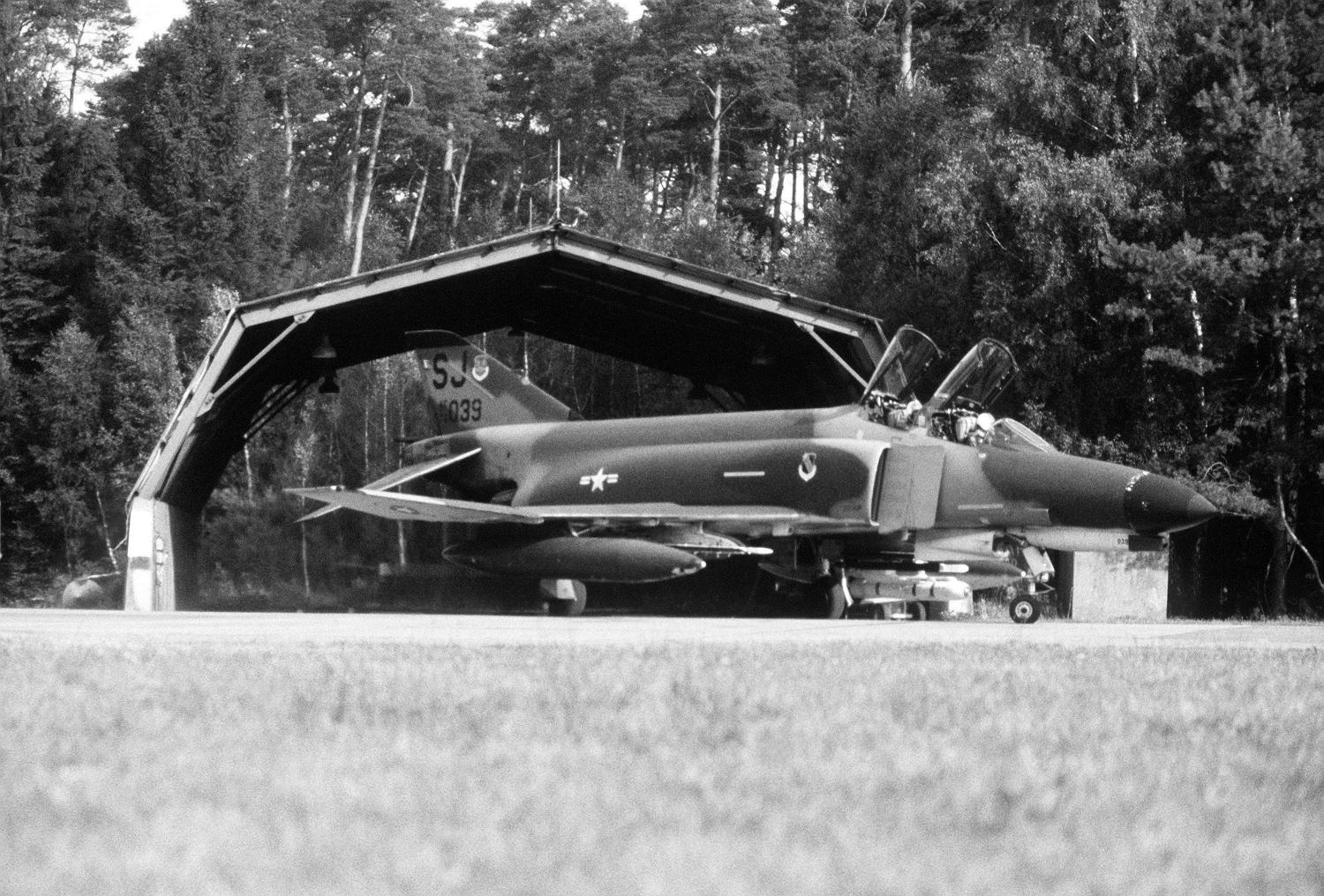
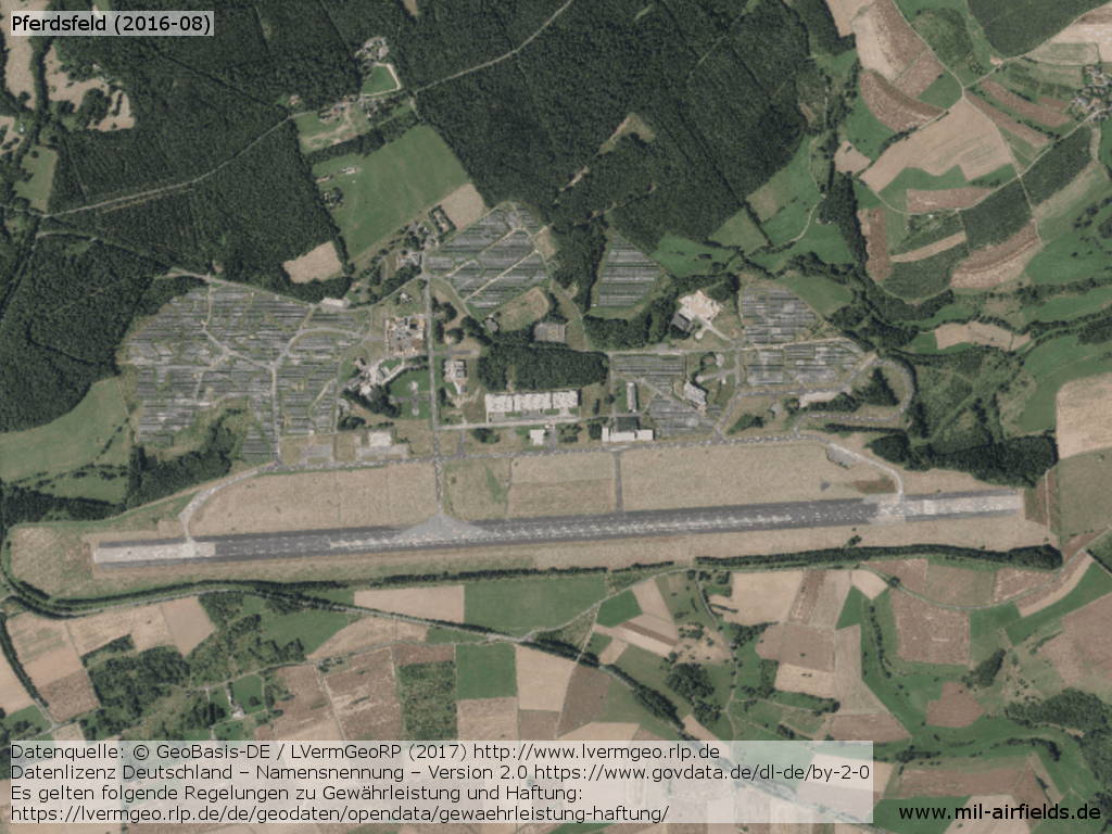
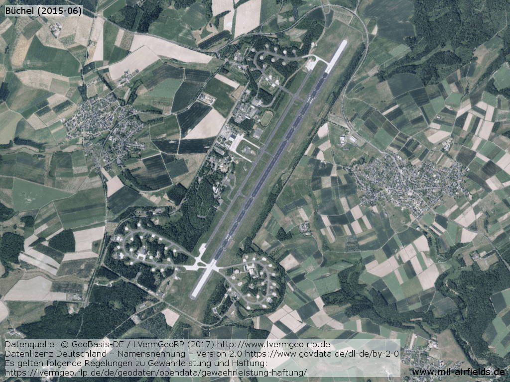
Image credits are shown on the respective target page, click on the preview to open it.
 Follow mil-airfields on Facebook