For historical information only, do not use for navigation or aviation purposes!
| Coordinates | N520236 E0042225 (WGS84) Google Maps |
| Elevation | -6 ft |
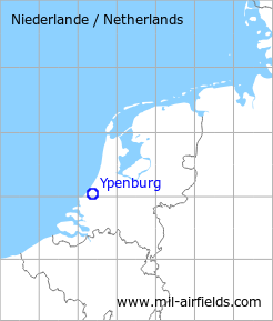
| Region | Zuid-Holland |
| Location indicator | EHYB |
The history of the Cold War airfields: Ypenburg
Use
Royal Netherlands Air Force (Koninklijke Luchtmacht, KLu) base
During World War II
Situation
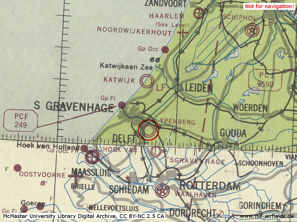
Ypenburg Air Base in World War II on a US map from 1943
Source: McMaster University Library Digital Archive, License: Creative Commons Attribution-NonCommercial 2.5 CC BY-NC 2.5 CA
During the 1950s
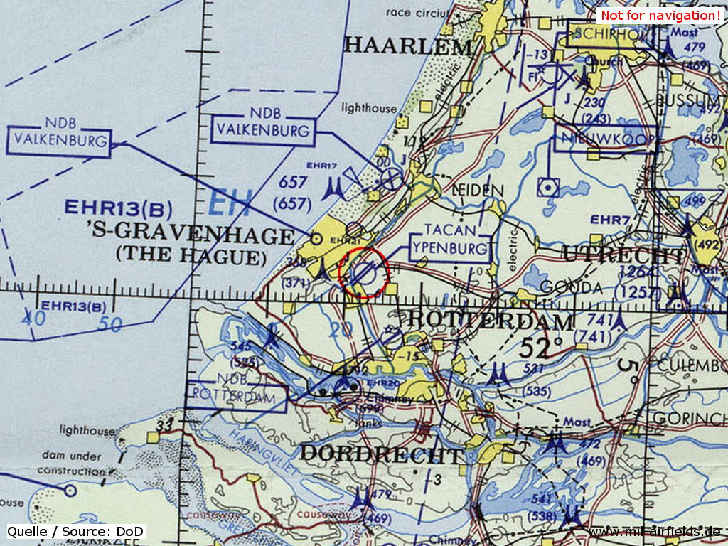
Situation
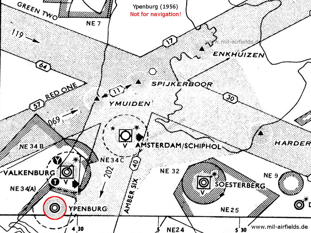
Ypenburg with surrounding airways and restricted areas in 1956
Radio beacons
- NDB: 376 "PEY"
Radio communication
- Tower 117.9, 257.8, 111.42, 121.5, 262.9, 100.26
During the 1960s
Overview
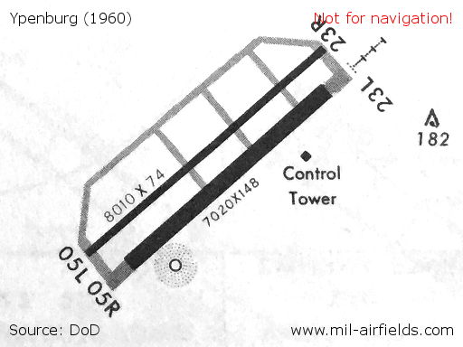
Runways and taxiways on a map from 1960
Source: DoD
Runways
- 05L/23R: 2441 m x 23 m
- 05R/23L: 2140 m x 45 m
Lights
Identification beacon with ident YP at the northwestern side of the field,
Approach lights runway 23L
Approach lights runway 23L
Radio beacons
- NDB: 376 "YBR", at field, in the southwestern corner
Radar
ASR, PAR
Radio communication
- Ypenburg Approach Control 362.3, 136.35, 117.9
- Ypenburg Tower 357.1, 257.8, 117.9
In the 1970s
Situation
Ypenburg Air Base on a map of the US Department of Defense from 1972
Source: ONC E-2 (1972), Perry-Castañeda Library Map Collection, University of Texas at Austin
Overview
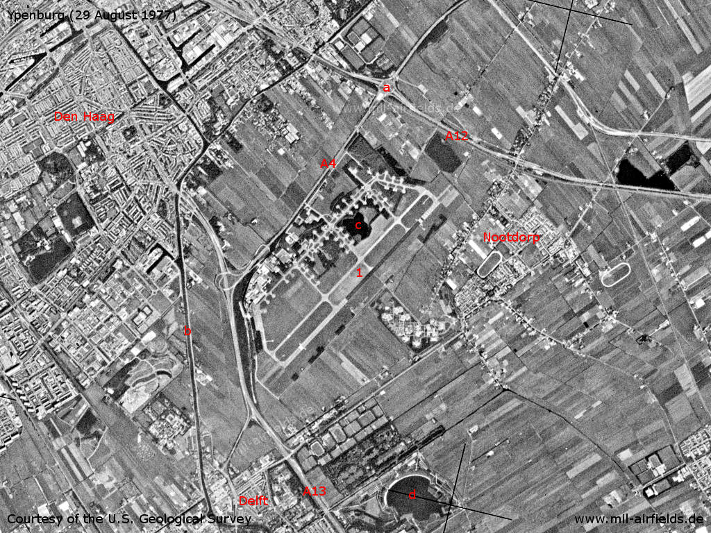
Ypenburg and surroundings on a US satellite image from 29 August 1977 - 1: Airfield. Motorways A4, A12 und A13. a: Knooppunt Prins Clausplein interchange; b: Delftsche Vliet canal; c: Lake Bosplas (at the airfield); d: Lake Grote Plas. Places: Delft, Den Haag, Nootdorp.
Source: U.S. Geological Survey
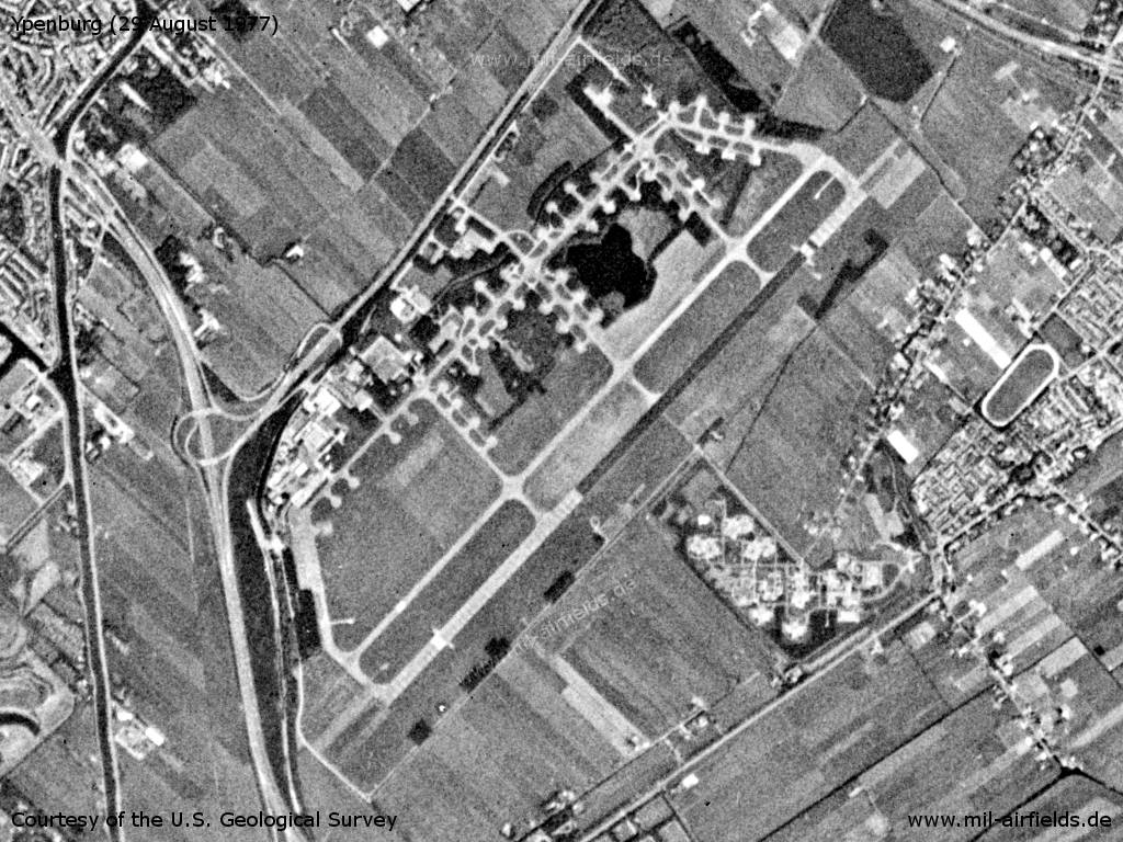
Ypenburg Air Base
Source: U.S. Geological Survey
In the 1980s
Runways
- 05L/23R: 2442 m Concrete
- 05R/23L: 2442 m Concrete
Radio beacons
- TACAN: CH 49 "YBR", at field
Radio communication
- Approach 122.1, 341.8, 362.3
- GCA 123.3, 226.7, 260.1, 122.1, 280.4, 344.0, 385.4
- Tower 122.1, 257.8, 337.3
Telephone
(070) 469335
In the early 1990s
Runways
The previous two parallel runways have been reduced to only one.
- 05/23: 2440 m Asphalt/Concrete
Radio beacons
- TACAN: CH 49, at field
Radio communication
- Rotterdam Approach 127.025, 230.5, 362.3, 119.7
- Final 399.35, 385.4, 257.5, 123.3, 122.1
- Tower 122.1, 308.55, 257.8
Telephone
(015) 146441
Airspace and procedures
The airfield may only be used by special arrangement to the Ministry of Defence in the Hague in exceptional circumstances.
Today
Use
Closed. The area was used to build a housing area and an industrial estate. At the northwestern corner, the former control tower is preserved.
Links
- http://home.deds.nl/%7Evliegveldypenburg/index.htm - Vliegveld Ypenburg - Van sportvliegveld tot vliegbasis The former airfield with many pictures.
- https://www.jetphotos.com/airport/Ypenburg+Air+Bas... - Pictures of stored Starfighters in Ypenburg 1987
Airfields in the vicinity
Categories
Air Bases NetherlandsRecommended
Image credits are shown on the respective target page, click on the preview to open it.
 Follow mil-airfields on Facebook